1. City of Lompoc

    1. City of Lompoc

    0

    ,

    Cancel

    Open app

    Search

    City of Lompoc

    3.6 (11 reviews)

    City of Lompoc Photos

    More like City of Lompoc

    Recommended Reviews - City of Lompoc

    Your trust is our priority, so businesses can't pay to alter or remove their reviews. Learn more about reviews.
    Yelp app icon
    Browse more easily on the app
    Review Feed Illustration

    Reviews With Photos

    Linda H.

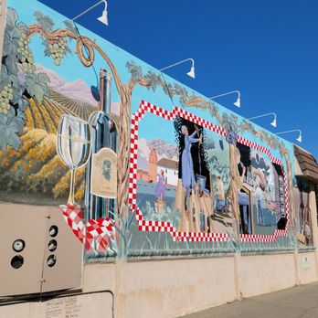
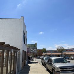
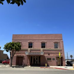
    Small town on the central coast of California. The saying is that you never go to Lompoc, you go through it. It is off the beaten path, off of the 101 freeway. A side trip worth visiting. If you've seen the movie Sideways, it's all about the area. Lompoc is doing a nice job of cleaning up the area and making updates. New businesses are coming in. I grew up in this town and many of my my family and friends are here from many years ago. Love the murals on Southside. People are friendly. Surf Beach is very close.

    Nijole T.

    While this is one of the more affordable places to live in CA, there is good reason why. There is absolutely NOTHING to do here, the highlights would be Walmart or Albertsons, 99 cent store or Marshall's. Very few good restaurants or opportunity for kids or families. I only stayed here for a week on business, but there is nothing here I could say is worth coming back for.

    Beautiful flower fields
    Melissa N.

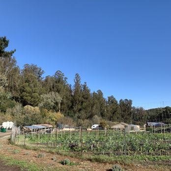
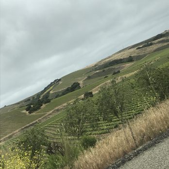
    It's kind of a sleepy town yet it offers a lot of little goodies. There are a bunch of wineries, vineyards, flower fields and even sky diving. There's not much to do during the night but during the day you can visit the mission or just drive through and see all the agriculture.

    See all

    2 years ago

    Helpful 10
    Thanks 3
    Love this 5
    Oh no 0
    Photo of Patti R.
    17
    91
    13

    19 hours ago

    Helpful 0
    Thanks 0
    Love this 0
    Oh no 0

    5 years ago

    Helpful 1
    Thanks 0
    Love this 0
    Oh no 0
    Photo of Linda H.
    317
    1095
    5408

    7 years ago

    Helpful 2
    Thanks 0
    Love this 4
    Oh no 0

    9 years ago

    Helpful 12
    Thanks 0
    Love this 12
    Oh no 0

    8 years ago

    Helpful 1
    Thanks 0
    Love this 1
    Oh no 0

    6 years ago

    Helpful 0
    Thanks 0
    Love this 1
    Oh no 0
    Photo of D D.
    146
    324
    59

    12 years ago

    Helpful 5
    Thanks 0
    Love this 6
    Oh no 0

    14 years ago

    Helpful 2
    Thanks 0
    Love this 3
    Oh no 0
    Photo of Clint H.
    2
    57
    200

    11 years ago

    Helpful 1
    Thanks 0
    Love this 0
    Oh no 0
    Photo of San D.
    14
    18
    0

    7 years ago

    Helpful 1
    Thanks 0
    Love this 1
    Oh no 0

    Ask the Community - City of Lompoc

    Verify this business for free

    Get access to customer & competitor insights.

    Verify this business

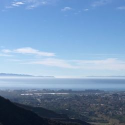
    Kissing Point Scenic Viewpoint - View over Goleta with the lesser seen Santa Rosa Island (right) and Santa Cruz Island (left)

    Kissing Point Scenic Viewpoint

    5.0(2 reviews)
    61.3 km

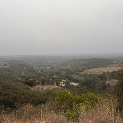
    Given it being Valentine's Day Eve, it seems quite appropriate to review a Santa Barbara gem. The…read morelocals--particularly UCSB students--know it as "Kissing Point." You don't need to use your imagination why: Simply venture here at sunrise/sunset and you'll be macking with whomever is closest to you due to the natural romance in the Californian air. It also helps that the temperature is sometimes +10* warmer since it is in the mountains. ;) History: Kissing Point is about a third of the way up (or three-quarters of the way down depending on your route) Old San Marcos Road. This was the original stagecoach route to cross over the mountains prior to the current San Marcos Pass/Route 154 between 1861 and 1901. There are a few weathered historical markers along the way but anyone will easily be impressed by the hard work put into carving out the road. How to get here?: The easiest route to reach Kissing Point is by exiting off the 101 Freeway at Patterson Rd and going toward the mountains, turn right on Cathedral Oaks, then turn left when you've reached San Marcos Rd. Kissing Point consists of only two unmarked dirt pull-offs (one now with bollards due to erosion). There is also a third and fourth pull-off much further up hill but with very limited space. What do I see?: The views are from the Santa Ynez Foothills down into Santa Barbara and Goleta Valley with easy landmarks being the Santa Barbara Airport, University of California Santa Barbara (UCSB), Old Town Goleta, the Pacific Ocean's Santa Barbara Channel, and almost all of the Channel Islands in the distance on a clear day (from north to south: San Miguel, Santa Rosa, Santa Cruz--the most obviously, and Anacapa Islands). I am spoiled to have this scenic drive only minutes from my house since it offers not only some of the best aerial views (ie particularly from Kissing Point) but also a backroad option to access Route 154 that goes over the Santa Ynez Mountains toward popular destinations including Lake Cachuma, Santa Ynez Valley Wine Country, and Solvang. A few tips: - I have included the precise location on the Yelp map, in addition to GPS coordinates, in the Quick Tips. - Check out my video of the drive down this twisty road with views for days: https://www.yelp.com/user_local_photos?select_video=OgU4LsTKlJ7Eqyh60KKdcA&userid=4DyMRBKrokax6d8LCI3GAw. - People love to drive extremely fast up and down (including myself). Be cautious of mountain bikers and motorcycles, particularly around the two hairpin U-turns toward the top. - As the signs heed, put on your headlights during the night AND day. - Please clean up after yourself. Unfortunately there is plenty of trash and glass bottles left behind. Don't be this person.

    Was a fun roadtrip got there a bit late and it was cloudy unfortunately but it was still a…read morebeautiful sight and relaxing to sit and view with your significant other

    Photos
    Kissing Point Scenic Viewpoint
    Kissing Point Scenic Viewpoint - Gorgeous views of all of Santa Barbara and Goleta with the Channel Islands in the distance

    Gorgeous views of all of Santa Barbara and Goleta with the Channel Islands in the distance

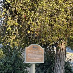
    Kissing Point Scenic Viewpoint - One of several historic markers along the route

    See all

    One of several historic markers along the route

    City of Solvang - The Clique

    City of Solvang

    4.1(394 reviews)
    27.6 km

    Want to visit a town that is proud of their danish heritage? Come to Solvang…read more Like how Bruges, Belgium is big on chocolate shops, here bakeries are everywhere with loads of tourist souvenir shops. There are free public parking lots. Ice cream, trolley rides and a miniature Little Mermaid statue are here. A few wine tasting rooms, restaurants and lodgings are visible.

    GETTING HERE: Head…read moreNorth on the 101 and at the city of Buellton you'll navigate to the 246 East. REVIEW: ^^^^^^^ Once again, Yelp is not keeping the photos. There are several photos. I have attached that are visible on the.com but are not visible on the app. Oh, how I love Solvang! As a kid, I would come up here once a year and walk around and buy a piece of fudge for the drive home. As an adult, I cannot believe the amazing history that is held in this city! First and foremost, the Mission Santa Ines is a MUST see and do. Beyond that, the streets have historical-looking buildings and shops that will take you straight to Denmark: shopping, bakeries, restaurants, wine tasting experiences, etc. etc. It's an incredible environment to immerse yourself in that is a great way to take a quick "staycation" if you're in Santa Barbara, Ventura, or even Los Angeles Counties. Via a quick search on the G train, the city of Solvang was founded in 1911. Also see: https://solvangusa.com/ There is so much to do and see in Solvang! Check it out and be sure to get a piece of Solvang fudge! Enjoy!

    Photos
    City of Solvang - Welcome to SOLVANG (Denmark). #windmill #bnw

    Welcome to SOLVANG (Denmark). #windmill #bnw

    City of Solvang - Founded in 19th century.

    Founded in 19th century.

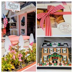
    City of Solvang - The Solvang Bakery

    See all

    The Solvang Bakery

    Pismo Beach Pier - Pismo Pier

    Pismo Beach Pier

    4.3(234 reviews)
    57.0 km

    Pier is beautiful and flooring is stable af…read more Beach is Clorox clean. I swear!!! Visitors, locals, and staff really keep this beach clean. I didn't see any trash except in the trash can where it belongs. Weather was nice and cool. Locals are friendly and nice. We had a few of them give my ex gf and me some unsolicited conversations that made us smile. We had another local offer to take pictures of my ex gf and me with her phone. So nice. Wish folks were this nice and friendly in Los Angeles County . Male and female restrooms were clean when we needed them. Lots of places to eat and shop. Most are pricey. If you want souvenirs, definitely go to the outlets, a mile away from the beach. Biggest issue with beach (and any other beach) is available free public parking. We actually got lucky to find a nice spot while a person was leaving.

    After grabbing some award winning Clam Chowder at Splash Cafe, we decided to walk around the Pismo…read moreBeach Pier before getting back on the road to Solvang. We walked around the outer part where they have a huge stand up Pismo Beach photo op, plus a nice public restroom and even a little playground near the pier which I think is a nice touch! Our daughter loved playing on it! The Pismo Beach Pier is about 1,200 feet and it was nice to stretch our legs and enjoy the ocean breeze. Lots of benches and concrete tables to sit at and relax - it was fun watching the surfers catch some waves. They allow you to fish off the pier as long as you don't cast off of it. They also have signs that tells you what kind of fish you might catch as well as information on the different birds in the area. The pier and beach were also nice and clean - I didn't see any trash! My family and I are already talking about coming back in the Fall and renting one of the hotel rooms that overlook the ocean. It was a much needed fresh air break away from the busy city! We can't wait to come back!

    Photos
    Pismo Beach Pier - Playground

    Playground

    Pismo Beach Pier - Pismo Beach Pier

    Pismo Beach Pier

    Pismo Beach Pier - Your typical sign shot but had to do it!

    See all

    Your typical sign shot but had to do it!

    Guadalupe City

    Guadalupe City

    4.0(3 reviews)
    37.3 km

    Mission La Purisima was established in this area in 1787. Guadalupe California was incorporated as…read morea city in May 1946. The tight cluster of buildings is surrounded by agricultural land. I love walking through downtown and seeing the historic buildings. The Dunes Center is my favorite museum in town and has an excellent exhibit on the dunes. https://www.hungryones.com/2023/09/dunes-center-2/ El Padrecito's Ice Cream Shop has refreshing treats. https://www.hungryones.com/2023/09/el-padrecitos/ They are making good progress on restoring the movie theatre. Should open later this year. Maggie loves eating at 2 Brother's pizza. https://www.hungryones.com/2018/07/the-brothers-guadalupe/ The drive to Guadalupe City winds through various farms and there are roadside stands where you can buy produce. When I was a kid there were many of them in San Diego but now they are hard to find. I noticed one stand was selling mango, watermelon, and cantaloupe. I stopped and was given a sample of watermelon and cantaloupe. Watermelon was sweet and juicy with a firm texture. It was bursting with sweet watermelon flavor and one of the best tasting watermelons I've ever had. I bought one for $10 and it was huge and delicious just like the sample. Cantaloupe was firm, juicy, and full of delicious flavor. I love buying from roadside stands as you typically get perfectly ripe produce. I'm not a fan of grocery stores as fruit is picked before it's ripe and left to ripen at the store and it doesn't taste that good. In San Diego multi-level housing and office buildings are replacing the old neighborhoods. Visiting Guadalupe it's refreshing viewing the original buildings. There is a sense of time standing still. I wish I could have seen this town when it was new. "I am going to look at the stars. They are so far away, and their light takes so long to reach us. All we ever see of stars are their old photographs." Alan Moore - The Watchmen

    This little town has a very interesting history & makes a nice stop on Hwy #1…read more I am adding this Yelp basic entry for now quoting the net: From Dunes Center: "Our mission is to promote the conservation and restoration of the Guadalupe-Nipomo Dunes ecosystem through education, research, and the support of cooperative stewardship."... http://dunescenter.org/visit-the-dunes/dunes-center/exhibits-and-activities-research/the-lost-city-of-demille/ "The Lost City of Demille, In 1923, pioneer filmmaker Cecil. B. DeMille built the largest set in movie history in the dunes near Guadalupe, CA, for his silent (and early Technicolor) epic, The Ten Commandments. It was called "The City of the Pharaoh." After filming was complete, DeMille ordered that the entire set be dismantled... and secretly buried in the dunes. And there it lay, forgotten, for the next 60 years and it still sits there, buried in the sand, known as the "Lost City of Cecil B. DeMille." From Wikipedia: History: "The first European land exploration of Alta California, the Spanish Portolà expedition, camped near today's Guadalupe on September 1, 1769. Franciscan missionary and expedition member Juan Crespi noted in his diary that they found "a very large lake". The lake has since mostly filled in, leaving a low-lying plain traversed by the Santa Maria River and several tributaries.[9] When Mission La Purisima was established in 1787, the area became part of the mission's pasture land. In 1840, following secularization of the mission, the area became part of the Rancho Guadalupe land grant. Rancho Guadalupe was settled by pioneers of many unique backgrounds, such as European, Chinese, Filipino, Japanese, and Mexican. The small town was incorporated as the city of Guadalupe on May 19, 1946. The city name honors Our Lady of Guadalupe, the title given to the Virgin Mary."..... Geography: "West of town, both in Santa Barbara County and north in adjacent San Luis Obispo County, is the Guadalupe-Nipomo Dunes, a large region of dune habitat along the Pacific Ocean shore. Filmmakers have used this region as a setting for several films, including Cecil B. DeMille's 1923 Ten Commandments and in 1998 The Odd Couple II. Scenes from Pirates of the Caribbean: At World's End and Hidalgo have also been filmed here. The Guadalupe-Nipomo Dunes Center serves as the education and research facility for the natural area." Parks & Recreation: "There is a beach near Guadalupe at the end of Main St. that is part of the Guadalupe-Nipomo Dunes. Oso Flaco Lake in Nipomo (San Luis Obispo County) is also a part of this dunes complex and is a few miles north of Guadalupe; it features a boardwalk that goes over the lake and leads to the beach." Even more history that still lives on can be found at: http://californiajapantowns.org/guadalupe.html " Guadalupe Located nine miles west of Santa Maria on historic Highway 1 in Santa Barbara County is the small town of Guadalupe with a dramatic Nikkei history. Gradually replacing the Chinese in the sugar beet fields, the Japanese labor force grew to nearly 600 with the expansion of the Union Sugar Mill Company of Betteravia in the early 1900s. By the 1910s, a cooperative, renamed the Guadalupe Japanese Association, supporting Japanese farm operations, included branches in Santa Maria, Oceano, Pismo and San Luis Obispo; and the Japantowns of Santa Maria and Guadalupe became commercial centers...... From the early 1900s, the Masatani family operated a store at Main Street, selling clothing and groceries, with produce stands on the sidewalk to attract the customers, but often tempting the neighborhood children to grab a snack and run..... Although Mr. Masatani never returned to Guadalupe after WW II, his son Harry continued the family business by opening Masatani Market at its current location on Main Street. Today, third generation Steve Masatani runs the business, while Harry remains the consummate guide for Guadalupe's Japantown history."

    Photos
    Guadalupe City - Nearby farm fields

    Nearby farm fields

    Guadalupe City - Our Lady of Guadalupe

    Our Lady of Guadalupe

    Guadalupe City

    See all

    City of Lompoc - localflavor - Updated July 2026
    Loading...
    Loading...
    Loading...