Cancel

    Open app

    Search

    Coastal Island Adventures

    5.0 (1 review)
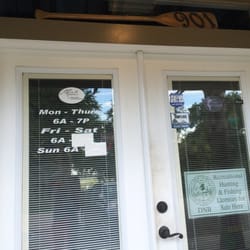
    Closed 9:00 am - 5:00 pm

    Coastal Island Adventures Photos

    More like Coastal Island Adventures

    Recommended Reviews - Coastal Island Adventures

    Your trust is our priority, so businesses can't pay to alter or remove their reviews. Learn more about reviews.
    Yelp app icon
    Browse more easily on the app
    Review Feed Illustration

    8 years ago

    Helpful 0
    Thanks 0
    Love this 0
    Oh no 0

    Ask the Community - Coastal Island Adventures

    Verify this business for free

    Get access to customer & competitor insights.

    Verify this business

    DeVaul Henderson Lake Loop

    DeVaul Henderson Lake Loop

    5.0
    (3 reviews)
    10.6 mi

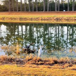
    Little One and I have been cooped up in the house because she has been sick, so I took her out to…read moreget some fresh air. The DeVaul Henderson Lake Loop (DHLL) seemed to be the best bet due to length of the trail. When you are on Hwy 144 and you get to the roundabout, turn in on Veterans Memorial Parkway, where the Bryan County Administrative Complex is. The trail is located right next to it. You can't miss it. Parking - You can pretty much park anywhere on the grass along Veterans Memorial Parkway. I like to park toward the other end, by the elementary school, where you see the 4 wooden posts. Trail Description - From the 4 wooden posts, down to the paved path, the ground is dirt and a mix of sand and pine needles, and not paved, but that distance is minimal. It is surround by tall trees. Once you get down to the paved part, the signs indicate that it's a 0.5 mile loop. This loop has 3 different connection points to other parts of DeVaul Henderson Recreation Park (to soccer fields and restrooms) and I believe to the side of the Bryan County Administrative Complex. The connection points are located on the opposite side of Veterans Memorial Parkway. There are park benches all around the lake, as well as flotation devices in case someone gets in and needs some saving. There was a unique bench (kind of like one of those stone benches you see in gardens) and it had a sign "The Murphy Bench" that was placed there in memory of an infant boy. How tragic, but so touching. Difficulty Level - Easy for all ages. It is stroller and wheelchair friendly too, but might experience some bumpiness when going down that first small stretch to the paved path. Beware - There are signs that say "Beware of Wildlife". I am assuming they mean alligators, because that is what they always seem to warn you about around these parts, but we did not personally see any. But do we ever really see them when they are around? Unless they decide to come out of the water. However, we did see a lot of ducks swimming in the lake, as well as a beautiful white one just sitting on the side in the grass. This is a great place to run, walk, speed walk, scoot (my Little One took her scooter) and I saw some people fishing too. It's a great pit stop if you happen to be in the area. You can fill up on gas at the Shell Station and stretch those legs before you go on the next leg of your trip. Get outside, People!

    This lake loop is 1/2 mile. The path is paved and stroller friendly. It also connects to other…read morepaved pathways leading past the soccer fields, baseball fields, softball fields, dog park and finally into the Green Creek trails. There are restrooms available.

    Photos
    03/22/2021
    03/22/2021
    One of few benches along the trail.
    One of few benches along the trail.
    Two little visitors

    See all

    Two little visitors
    Lazaretto Creek Park Fishing Pier

    Lazaretto Creek Park Fishing Pier

    4.3
    (3 reviews)
    32.0 mi

    Lazaretto Creek Park Fishing Pier is located right outside of Tybee Island and is about a…read moretwenty-minute drive from downtown Savannah. I think that due to the distance from Savannah, this pier does not get a lot of usage compared to others in the area. The pier side of the creek also contains a boat ramp about a one-half mile from the pier, with the pier situated at the end of the road. There are no public facilities or running water at the pier, with two portable restrooms the only structures located there. While fishing, there are great views of the Lazaretto Creek Bridge. Visible on the other side of the creek are several fishing and charter boats, jet skiers, kayakers and several restaurants. In between catching fish, activity from these businesses is more than enough to keep you occupied while enjoying the picturesque views. It is never too busy at the pier, with weekend traffic consisting of about ten people. Consider Lazaretto Fishing Pier if you desire a peaceful and scenic fishing experience.

    Excellent fishing pier with a awesome view of Lazaretto Creek as it goes under the Highway 80…read morebridge out to the ocean. Across the creek is the Loco Moco Bar and North Island Kayak & Canoe Rentals (also jet skis). Great location to watch the sun raise or just good ol' fashion fish'n. Also has two porta potties in the parking area. No running water at this location.

    Photos
    Your public facilites. Located near the parking area.
    Your public facilites. Located near the parking area.
    View from the fishing pier.
    View from the fishing pier.
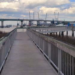
    Fishing pier with Lazaretto Creek Bridge in the background.

    See all

    Fishing pier with Lazaretto Creek Bridge in the background.
    Sterling Creek Park

    Sterling Creek Park

    4.3
    (6 reviews)
    12.0 mi

    A great place to unwind! Beautiful lake & trails! Please mark trails & have a map of the area!read more

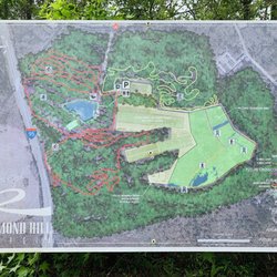
    Sterling Creek Park (SCP) is tucked away in the very back of a neighborhood called Sterling Creek…read morePlantation in Richmond Hill. You'll see signs to the park from Harris Trail Road when you turn in to the neighborhood. Keep going straight through the neighborhood until you get to the entrance to the park. SCP is the most unusual park that I have come across in this area, reason being that it shares space with the Police training grounds and gun range, as well as an active water treatment plant. See what I mean? That being said, I'll take trails and green space anywhere I can get it! - Background Info - There isn't too much info on this park online, but from what I could find, it seems that the city of Richmond Hill purchased this property back in 2012 with the intention of converting it into a park and the plan is to include running trails, nature trails, mountain bike paths, a fishing pond, restrooms, parking and camping. The property is about 187 acres of forests, wetlands, ponds, and grassland habitats. The most recent article I found was dated January of this year (2019) and it looks like they celebrated the opening of Phase 2 with a Relay Race. - Parking - Once you drive past the park entrance, just go straight until you get to a white-ish building. It looks like it's had better days and definitely does not look brand new. This building also has the restrooms (we didn't use them, so I don't know for sure, but the male/female signs are outside the doors) and the big space around it that seems to be the parking. - What we did - The Little One and I set out for a quick adventure, as we had to get back for her sister's event at school. We parked the car by the restrooms and behind it, you will see a large sign (the map of the park) and a trash can in the distance, by the woods, and that is where the beginning of the trail is. Now, keep in mind, don't go in the woods just yet right there, just walk alongside the fence of the water treatment plant, to the right. You will come to a dead end and there will be a well worn path into the woods which will be the only part in the forest). The path in the woods isn't very long and the day we went, it must have rained heavily there because part of the road was super muddy and there were tons of truck tracks. Once you get out of the woods and into the clearing, there is another well worn path/road that runs along the fence again of the water treatment plant. Walk down and keep walking down and don't lost hope, because you will finally get to the wetlands and ponds area. This area has more signs. I think we did parts of the yellow line and parts of the blue line (refer to pic). There is also a Youtube video that gives you a quick aerial view of the park to give you a general idea of what it is like. - My thoughts - The park is secluded, especially it being inside a neighborhood. I don't even think many of the residents of RH know about it. We saw one person along the trail, but at the same time, it was the weekday also. I read the article of the Relay Race that they held by the lake, after we walked the trail, and looking at the photos and videos posted online, I am still confused as to which lake they were running around, because it does not look anything close to the lakes and ponds we saw. I am going back to explore more when we have more time. All in all, the area is a bit confusing and I think they just need more signs at the beginning of the trail almost all the way until you pass the fencing of the water treatment plant. The presence of the water treatment plant gives you this sense that you shouldn't be there. The lake and ponds areas were my favorite part and they are clearly marked in that area, probably because it's the newest phase. I will update this review once I find the lake in the article!

    Photos
    Restrooms.
    Restrooms.
    Part of the trail in the forest. Just before you get out in the clearing, Super muddy there that day.
    Part of the trail in the forest. Just before you get out in the clearing, Super muddy there that day.
    Sterling Creek Park

    See all

    Coastal Island Adventures - rafting - Updated August 2026
    Loading...
    Loading...
    Loading...