Cay Creek Wetlands Interpretive Center Photos


More like Cay Creek Wetlands Interpretive Center
Recommended Reviews - Cay Creek Wetlands Interpretive Center
Start your review...


Reviews With Photos


So beautiful but scary as hell , I seen a 6+ ft snake at the end of the trail wrapped around the walking bridge .. I've never ran so fast


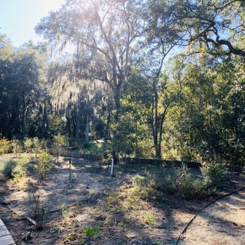
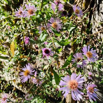
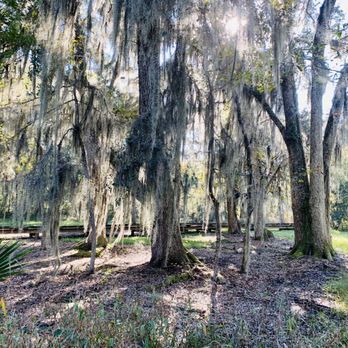
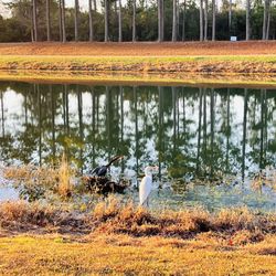
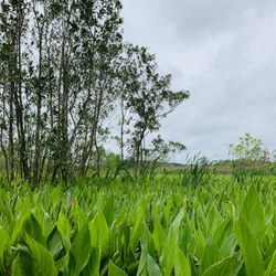
Cay Creek Wetlands Interpretive Center (CCWIC) is located in Midway, off exit 76 on I-95. According to one of the info boards, the site of CCWIC was bought by the City of Midway to provide its citizens, as well as visitors, a green space to enjoy and to learn about the unique environment in our coastal area. I'm always on the lookout for nature spaces to bring my kids, so when a friend had mentioned this place that she had heard, I, of course, immediately did some research and went to check it out this weekend with my kids. The unique thing about this space is that this is where you can see the wetlands transition to a salt water marsh. - Parking - Private lot. You'll clearly see a wooden sign from Charlie Butler Road and a metal gate that bears its name. It states on the website, open daily from 9 am to dusk, so plan accordingly. You'll drive straight down a short dirt path and will arrive at the parking area. - Admission - FREE, Baby! - History - The area used to be a plantation which, back then, used to be called Salter's Creek, owned by Raymond Cay. Rice and other food crops were grown on a smaller scale then. Pine trees were abundant in the area and eventually, with the booming paper industry, paper companies bought large pieces of pine lands, including Cay Creek. In 1996, the City of Midway bought the property. - Trail Description - There is only one path with no off shoot trails, about 0.7 miles round trip. An elevated boardwalk has been built the entire way. It's very well maintained, with built-in benches and trash cans with their own built-in nooks for your convenience throughout the trail. There is also a 15-ft tower about halfway through the trail that provides a great bird's eye view and great for bird watchers. When you get to the end of the trail, there is also a bigger deck with benches built in on either side and you can see the transition of the two types of water flow. Lots of birds and animals can be found here, but my kids and I probably scared them all away. Haha. - Heads Up - You will find modern and recent info boards in color, throughout the trail that talks about the different flora and fauna and how they have adapted to this environment. There are QR codes at the bottom of the boards that you can scan to read more about it, but I tried scanning the code on the first board and it came up as an error so I didn't bother scanning the others. Given the proximity of this trail to I-95, this would be a great place to stop and have a quick snack and to stretch your legs as there is a picnic table in the parking area. However, there are no bathrooms on site, so you might want to stop at the gas station down the road for that. This is such a great gift by the city of Midway and anyone passing through or live in the area, should take advantage. It was a great place for a small afternoon adventure and get some fresh air and teach my kids about the unique environmental conditions in this area. Get outside! read more



6 years ago
What a cool little spot off the beaten path. In a short walk on their boardwalk we saw an indigo snake, an alligator, lots of birds and insects, crabs, and very interesting plants. Worth spending 30+ minutes on read more


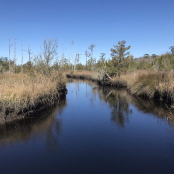
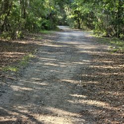
We have walked this short trail twice now, but I really like it. It's very pretty, super easy, and not too far out! It's very easy to find, it has some parking available, and it's just a clear back there and back. Good for kids! They also have a bird watching tower that's about 15 ft up. read more




5 years ago
So beautiful but scary as hell , I seen a 6+ ft snake at the end of the trail wrapped around the walking bridge .. I've never ran so fast read more


7 years ago
Wonderful place to visit and take a nice walk with the family. A very tranquil and nature walk close to home. read more


More info about Cay Creek Wetlands Interpretive Center
189 Charlie Butler Rd
Midway, GA 31320
Directions
(912) 884-3344
Call Now
Hours
Outdoor Amenities























Cay Creek Wetlands Interpretive Center - hiking - Updated August 2026
Best of Midway
People found Cay Creek Wetlands Interpretive Center by searching for…
Trending Searches in Midway, GA
Antiques near Cay Creek Wetlands Interpretive Center
Barbershop For Men near Cay Creek Wetlands Interpretive Center
Boardwalk near Cay Creek Wetlands Interpretive Center
Boat Launch near Cay Creek Wetlands Interpretive Center
Consignment Shops near Cay Creek Wetlands Interpretive Center
Dog Friendly Beaches near Cay Creek Wetlands Interpretive Center
Dog Friendly Things To Do near Cay Creek Wetlands Interpretive Center
Ear Piercing near Cay Creek Wetlands Interpretive Center
Eyebrow Threading near Cay Creek Wetlands Interpretive Center
Fishing Spots near Cay Creek Wetlands Interpretive Center
Kids Haircut near Cay Creek Wetlands Interpretive Center
Lakes near Cay Creek Wetlands Interpretive Center
Mini Golf near Cay Creek Wetlands Interpretive Center
Parks near Cay Creek Wetlands Interpretive Center
Pedicure near Cay Creek Wetlands Interpretive Center
Permanent Makeup near Cay Creek Wetlands Interpretive Center
Picnic Areas near Cay Creek Wetlands Interpretive Center
Places To Walk At Night near Cay Creek Wetlands Interpretive Center
Playgrounds near Cay Creek Wetlands Interpretive Center
Preschools near Cay Creek Wetlands Interpretive Center
Public Beaches near Cay Creek Wetlands Interpretive Center
Public Golf Courses near Cay Creek Wetlands Interpretive Center
Public Pools near Cay Creek Wetlands Interpretive Center
Scenic Night View near Cay Creek Wetlands Interpretive Center
Shopping Malls near Cay Creek Wetlands Interpretive Center
Sunrise View near Cay Creek Wetlands Interpretive Center
Swimming Holes near Cay Creek Wetlands Interpretive Center
Tennis Courts near Cay Creek Wetlands Interpretive Center
Things To Do With Kids near Cay Creek Wetlands Interpretive Center
Trading Card Shops near Cay Creek Wetlands Interpretive Center
Used Furniture Stores near Cay Creek Wetlands Interpretive Center
Browse Articles
Browse Nearby
BEST of Midway, Georgia Things to Do near Cay Creek Wetlands Interpretive Center
BEST of Midway, Georgia Parks near Cay Creek Wetlands Interpretive Center
BEST of Midway, Georgia Restaurants near Cay Creek Wetlands Interpretive Center
BEST of Midway, Georgia Coffee near Cay Creek Wetlands Interpretive Center
BEST of Midway, Georgia Walking Trails near Cay Creek Wetlands Interpretive Center
BEST of Midway, Georgia Campgrounds near Cay Creek Wetlands Interpretive Center
BEST of Midway, Georgia Taxis near Cay Creek Wetlands Interpretive Center
BEST of Midway, Georgia Breakfast near Cay Creek Wetlands Interpretive Center
Browse Brands
Related Searches in Midway, GA
Affordable Kayak Rental Services in Midway, Georgia
Best Dog Hiking Trails Around Midway, Georgia
Best Fishing Locations and Guides in Midway, Georgia
Best Nature Trails for Hiking in Midway, Georgia
Best Off Leash Dog Parks in Midway, Georgia
Best Parks for Parties and Events in Midway, Georgia
Best Places for Horseback Riding in Midway, Georgia
Best Sightseeing Experiences Available in Midway, Georgia
Best Water Parks for Kids in Midway, Georgia
Check Out Great Playgrounds in Midway, Georgia
Check Out Off Road Trails in Midway, Georgia
Discover Baseball Fields Around Midway, Georgia
Discover Beautiful Garden Spots in Midway, Georgia
Discover Dog Friendly Trails to Explore in Midway, Georgia
Discover Free Parking Options in Midway, Georgia
Discover Fun Activities to Do in Midway, Georgia
Discover Popular Bike Trails in Midway, Georgia
Discover Scenic Mountain Bike Trails Near Midway, Georgia
Discover Soccer Fields in Midway, Georgia Near You
Discover Top Nature Parks to Visit in Midway, Georgia
Discover Top State Parks to Visit in Midway, Georgia
Discover a Hiking Trail in Midway, Georgia
Discover the Best Beaches in Midway, Georgia
Discover the Best Night Hike Trails in Midway, Georgia
Dog-Friendly Hikes With Dogs in Midway, Georgia
Enjoy Camping Adventures Around Midway, Georgia
Enjoy Exciting Mountain Biking Adventures in Midway, Georgia
Enjoy Kayaking Adventures in Midway, Georgia
Enjoy Off Leash Dog Hikes in Midway, Georgia
Enjoy Tent Camping Spots Around Midway, Georgia
Enjoy the Best Picnic Spots and Ideas in Midway, Georgia
Enjoy the Best Walking Trails in Midway, Georgia
Explore Beautiful Parks and Green Spaces in Midway, Georgia
Explore Easy Hikes Perfect for All in Midway, Georgia
Explore Family-Friendly Zoos and Wildlife in Midway, Georgia
Explore Free Picnic Areas Around Midway, Georgia
Explore Fun Activities to Do in Midway, Georgia
Explore Parks With Pull Up Bars in Midway, Georgia
Explore Picnic Parks Near Midway, Georgia
Explore Popular Campgrounds Near Midway, Georgia
Explore Popular Picnic Areas Around Midway, Georgia
Explore Popular RV Parks Around Midway, Georgia
Explore Popular State Park Destinations in Midway, Georgia
Explore Scenic Lakes to Visit in Midway, Georgia
Explore Top Dog Parks in Midway, Georgia Near You
Explore Top Trampoline Parks in Midway, Georgia
Explore Top Water Parks in Midway, Georgia Today
Explore the Best Beach Spots in Midway, Georgia


