
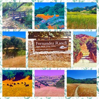
Fernandez Ranch Photos


You might also consider


More like Fernandez Ranch
Recommended Reviews - Fernandez Ranch
Start your review...


Reviews With Photos


I forgot I've been to Fernandez Ranch almost 11yrs ago. Went Sat 4/3/21 I drove from Fremont which is 45miles away, traffic was ok until Hwy 80 where there was an accident earlier, so took more than 45 min. Free parking and there is an Overflow lot if there are too many cars. 1 vault toilet had tp and trash can inside. No drinking water there so bring your own. We went to the Windmill Trail there is an old windmill that works, then we went Pinole Valley Watershed where u need a permit to hike in (friend has a permit). After a long day hiking in the Watershed area I felt a bit more energy. I thought 3 more miles would be easy, but we had already done like 11 miles. Still we did those 3 extra miles. Woodrat Trail was short, but Whipsnake Trail was super long and went up with many switchbacks, then did Black Phoebe Trail that's ADA approved (good for wheelchair). We saw a Coyote, lots of cows, lots of turkeys, and birds.


Fernandez Ranch what a gem! Great hiking trails not too strenuous, but challenging at times. Views of rolling hills, wildlife birds of prey, rabbits, coyotes. We just love coming here. Until today Our car was broken into along with several other cars. Nothing was taken because there was nothing to take. Resulting in two broken windows. These are mobile thieving jerks trying to make a fast buck.


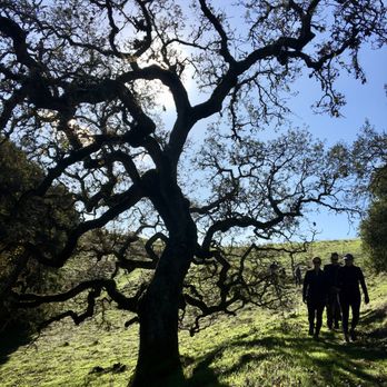
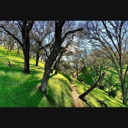
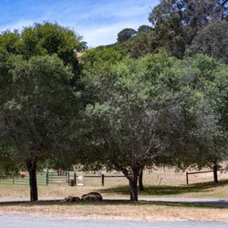
There was something in the air that night The stars were bright, Fernandez... I may have been humming this slightly modified Abba tune during part of our group hike here, even though it was in the daytime. We hit the December weather just right - cool and crisp; and we were treated to blue skies, gorgeous oaks and rolling, open hills. Like most of the exposed East bay hikes, the cooler months are the best time to go here. (Per my East Bay hiking contact, the summer can be fairly brutal at this location). And if you are feeling boviniferous, you're in luck. There is still a working dairy farm on the property, so quite a few cows can be seen munching grass in some sections of the park. And where there are cows, there are also patties, so we did have to stay vigilant for 'land mines' along the trail. Our group completed a 7-mile loop, breaking for lunch at a lone hill at the end of the vista trail. This perch provided 360 degree views and showed us that civilization actually wasn't too far in some directions; but the park layout and semi-clandestine entrance had made it feel like it was our own private, secluded hiking area. Note: It's easy to miss the turnoff on Christie road, off Rte 4. It is just after the Franklin Canyon golf course and just before the train track overpass; and the last half mile is a narrow and sketchy passage that can barely be classified as 'paved'. Dan's Hiking Spot Checklist: -- Parking: small gravel lot, in good shape -- Bathrooms: pit toilet at parking lot -- Potable water: No -- Maps provided: No (but available online) -- Highlights: Lack of crowds; remote feel; nice views


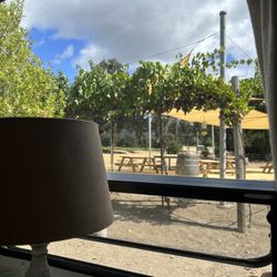
One of my favorite hiking trails! Beautiful trails that are well maintained during the year. I'm always amazed by how underused this space is... You can easily get a 5k done by sticking to the large loop. Great for hill work as well! Recently I've noticed that they are working on adding a cover over the picnic tables which will make it more comfortable during the summer months for picnic outings. Great for some communing with nature time...


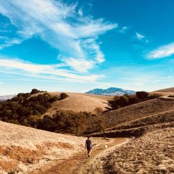
It was good to find a new trail, at least new for me since it's been open to the public since 2010. As part of the John Muir Land Trust (and not East Bay Regional Parks), the trail is just south of Highway 4 between Hercules and Martinez, definitely an isolated area of grassy hills with the added challenge of Highway 4 speed demons who believe the speed limit doesn't apply to them. Heading east, I had to slow down to take a minor exit onto Christie Road. The trailhead is only 0.7 miles down a paved road, though the parking lot itself is on gravel. There's a restroom and a suspension bridge they built as the starting point of the hike. I followed the Windmill Trail and failed to see the windmill. I did see the old dairy farm and a herd of cows who had little interest in my presence. The trail climbs a bit to a locked gate protecting the Pinole Valley Watershed. That was my cue to follow the woodsy Woodrat Trail and then the Whipsnake Trail for the elevated views. Luckily I didn't run into either woodrats nor whipsnakes, but I did see young deer jumping in a large meadow next to the concluding Black Phoebe Trail. The entire loop was less than four miles but still a reasonable workout if you need the steps RELATED - Up for a hike? Here's a collection of trails I've walked and reviewed: https://bit.ly/2OrC8nU read more

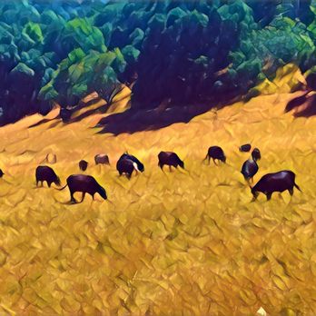

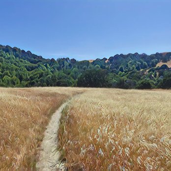

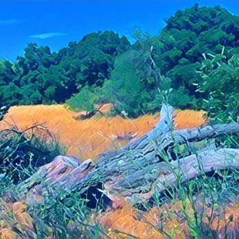


I am not a local around here but my in-laws are. I needed to find a nice decent trail to hike in for my weekend hikes. I did the 'Black Phoebe to a Windmill Trail' loop which was only four miles and around 680ft. Make sure to go clock wise on the loop. I would consider this an easy trail; zigzag trails to higher elevation so it's good for beginners and kids. On 'AllTrails' app they considered this a moderate trail. Plenty of shade for those hot summers. Nice loose dirt but not good once winter hits and it rains. Some horse poops, some cows and their poops and was dry when we hiked. This place has a good amount of private car parking and a place to have a day picnic. There is no garbage cans or water access so bring your own. There is two other longer trails in this ranch so I will be back when I get a chance. Definitely, a nice trail to come to for a nice hike. [62/100] read more


I went to Fernandez Ranch. I enjoyed Fernandez Ranch. And I sighed with some sadness, because such a remote spot like this, likely with no street address, no way will this be on Yelp, and I wasn't sure if it could be put onto Yelp (is this Hercules or Martinez?). Well, guess what: someone put it on Yelp. Oh well, married men are accustomed to always being wrong, or at least hearing that from their wives. The John Muir Land Trust preserves don't get as much attention as the East Bay Regional Parks. And they're intentionally undeveloped. So you need to really make an effort to reach them, and don't plan on doing anything but exploring the natural world. Fernandez Ranch is easier to reach than others, and is more developed than the others, but is still mostly left as it has been for 100 years. It has a parking lot and restrooms, but beyond that, it's romping over fire roads and narrow trails. Grasslands. Hills. Cows. Patches of oak forest. Views of the East Bay. Cows. Leftover infrastructure from when this was a ranch. Cows. Cow patties. Watch your step. So far, Fernandez Ranch sounds like a lot of other preserves in this area. And it is similar to the others. But because it's remote, more undeveloped, and lesser known, you're more likely to have more solitude here. Which means no rush to get the perfect photo, study old growth, imagine this lifestyle during the 1920s, or contemplate the meaning of life (hint: five letters, starts with a J). Enjoy yourself. read more


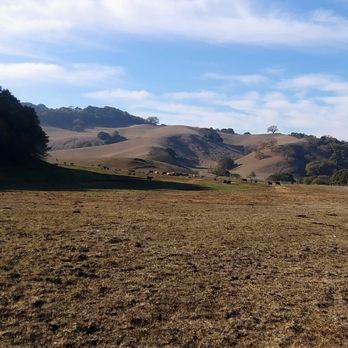


I forgot I've been to Fernandez Ranch almost 11yrs ago. Went Sat 4/3/21 I drove from Fremont which is 45miles away, traffic was ok until Hwy 80 where there was an accident earlier, so took more than 45 min. Free parking and there is an Overflow lot if there are too many cars. 1 vault toilet had tp and trash can inside. No drinking water there so bring your own. We went to the Windmill Trail there is an old windmill that works, then we went Pinole Valley Watershed where u need a permit to hike in (friend has a permit). After a long day hiking in the Watershed area I felt a bit more energy. I thought 3 more miles would be easy, but we had already done like 11 miles. Still we did those 3 extra miles. Woodrat Trail was short, but Whipsnake Trail was super long and went up with many switchbacks, then did Black Phoebe Trail that's ADA approved (good for wheelchair). We saw a Coyote, lots of cows, lots of turkeys, and birds. read more




5 years ago
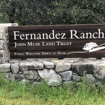
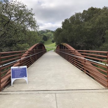
Fernandez Ranch what a gem! Great hiking trails not too strenuous, but challenging at times. Views of rolling hills, wildlife birds of prey, rabbits, coyotes. We just love coming here. Until today Our car was broken into along with several other cars. Nothing was taken because there was nothing to take. Resulting in two broken windows. These are mobile thieving jerks trying to make a fast buck. read more


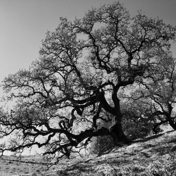
There was something in the air that night The stars were bright, Fernandez... I may have been humming this slightly modified Abba tune during part of our group hike here, even though it was in the daytime. We hit the December weather just right - cool and crisp; and we were treated to blue skies, gorgeous oaks and rolling, open hills. Like most of the exposed East bay hikes, the cooler months are the best time to go here. (Per my East Bay hiking contact, the summer can be fairly brutal at this location). And if you are feeling boviniferous, you're in luck. There is still a working dairy farm on the property, so quite a few cows can be seen munching grass in some sections of the park. And where there are cows, there are also patties, so we did have to stay vigilant for 'land mines' along the trail. Our group completed a 7-mile loop, breaking for lunch at a lone hill at the end of the vista trail. This perch provided 360 degree views and showed us that civilization actually wasn't too far in some directions; but the park layout and semi-clandestine entrance had made it feel like it was our own private, secluded hiking area. Note: It's easy to miss the turnoff on Christie road, off Rte 4. It is just after the Franklin Canyon golf course and just before the train track overpass; and the last half mile is a narrow and sketchy passage that can barely be classified as 'paved'. Dan's Hiking Spot Checklist: -- Parking: small gravel lot, in good shape -- Bathrooms: pit toilet at parking lot -- Potable water: No -- Maps provided: No (but available online) -- Highlights: Lack of crowds; remote feel; nice views read more




12 years ago
One of my favorite hiking trails! Beautiful trails that are well maintained during the year. I'm always amazed by how underused this space is... You can easily get a 5k done by sticking to the large loop. Great for hill work as well! Recently I've noticed that they are working on adding a cover over the picnic tables which will make it more comfortable during the summer months for picnic outings. Great for some communing with nature time... read more


16 years ago

9 years ago

10 years ago

13 years ago


12 years ago

13 years ago
More info about Fernandez Ranch
Ask the Community - Fernandez Ranch
Is the parking area closed due to COVID-19?
It was open when I was there this week
Review Highlights - Fernandez Ranch
You might also consider



















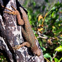


Fernandez Ranch - hiking - Updated September 2026
Best of Martinez
People found Fernandez Ranch by searching for…
Walking Trails in Martinez, CA
Things to Do With Kids in Martinez, CA
Dog Friendly Hiking Trails in Martinez, CA
Beautiful Views in Martinez, CA
Secluded Spots in Martinez, CA
Running Trails in Martinez, CA
Park & Forests in Martinez, CA
Tourist Attractions in Martinez, CA
Parks for Kids in Martinez, CA
Regional Parks in Martinez, CA
Trending Searches in Martinez, CA
Apple Orchards near Fernandez Ranch
Apple Picking near Fernandez Ranch
Barbershop near Fernandez Ranch
Bike Shop near Fernandez Ranch
Cliff Jumping near Fernandez Ranch
Consignment Shops near Fernandez Ranch
Cruising Spots near Fernandez Ranch
Dog Friendly Things To Do near Fernandez Ranch
Estheticians near Fernandez Ranch
Eyebrow Threading near Fernandez Ranch
Eyelash Extensions near Fernandez Ranch
Furniture Stores near Fernandez Ranch
Kids Birthday Party near Fernandez Ranch
Makeup Artists near Fernandez Ranch
Mattresses near Fernandez Ranch
Outdoor Activities near Fernandez Ranch
Picnic Areas near Fernandez Ranch
Public Shower near Fernandez Ranch
River Swimming near Fernandez Ranch
Rock Quarry near Fernandez Ranch
Scenic Overlook near Fernandez Ranch
Sunrise View near Fernandez Ranch
Teeth Whitening near Fernandez Ranch
Browse Articles
Browse Nearby
Browse Brands
Related Searches in Martinez, CA
Best Dog Hiking Trails Around Martinez, California
Best Fishing Locations and Guides in Martinez, California
Best Nature Trails for Hiking in Martinez, California
Best Places for Horseback Riding in Martinez, California
Best Sightseeing Experiences Available in Martinez, California
Check Out Off Road Trails in Martinez, California
Discover Dog Friendly Trails to Explore in Martinez, California
Discover Easy Hiking Trails Near Martinez, California
Discover Kid Friendly Hiking Trails in Martinez, California
Discover Popular Bike Trails in Martinez, California
Discover Scenic Mountain Bike Trails Near Martinez, California
Discover Walking Parks in Martinez, California Near You
Discover a Hiking Trail in Martinez, California
Discover the Best Night Hike Trails in Martinez, California
Dog-Friendly Hikes With Dogs in Martinez, California
Enjoy Camping Adventures Around Martinez, California
Enjoy Kayaking Adventures in Martinez, California
Enjoy Off Leash Dog Hikes in Martinez, California
Enjoy Scenic Places to Walk in Martinez, California
Enjoy a Beautiful Waterfall Hike in Martinez, California
Enjoy the Best Walking Path in Martinez, California
Enjoy the Best Walking Trails in Martinez, California
Explore Beautiful Parks and Green Spaces in Martinez, California
Explore Easy Hikes Perfect for All in Martinez, California
Explore Fun Activities to Do in Martinez, California
Explore Popular Campgrounds Near Martinez, California
Explore Popular Dog Walking Trails in Martinez, California
Explore Top Dog Parks in Martinez, California Near You
Explore Top Water Parks in Martinez, California Today
Explore the Best Beach Spots in Martinez, California
Family Friendly Hiking With Kids in Martinez, California
Find Beautiful Views in Martinez, California
Find Cozy Camping Cabins in Martinez, California
Find Top Dog Friendly Parks to Visit in Martinez, California
Find the Best Parks for Picnics in Martinez, California
Hiking Trails With Waterfalls in Martinez, California
Off Leash Dog Hiking Trails in Martinez, California
Popular Outdoor Activities to Try in Martinez, California
Popular Picnic Spots to Visit in Martinez, California
Popular Waterfall Hiking Trails in Martinez, California
Safe River Swimming Areas in Martinez, California
Safe and Fun Parks for Kids in Martinez, California
Top Hiking Trails to Explore in Martinez, California
Top Playgrounds for Kids to Enjoy in Martinez, California
Top Running Trails to Explore in Martinez, California
Top Swimming Lakes to Enjoy in Martinez, California
Top Swimming Spots and Pools in Martinez, California


