1. Jung Ranch Trail

    1. Jung Ranch Trail

    0

    San Simeon, CA

    Cancel

    Open app

    Search

    Jung Ranch Trail

    3.5 (2 reviews)

    Jung Ranch Trail Photos

    You might also consider

    Recommended Reviews - Jung Ranch Trail

    Your trust is our priority, so businesses can't pay to alter or remove their reviews. Learn more about reviews.
    Yelp app icon
    Browse more easily on the app
    Review Feed Illustration

    9 years ago

    Helpful 8
    Thanks 0
    Love this 3
    Oh no 0

    8 years ago

    Helpful 1
    Thanks 0
    Love this 2
    Oh no 0

    Verify this business for free

    People searched for Hiking 229 times last month within 15 miles of this business.

    Verify this business

    San Simeon Creek Trail

    San Simeon Creek Trail

    4.5
    (6 reviews)
    1.5 mi

    A nice trail that's part nature walk, part moderate hike. The distance ranges from 3.5 - 3.8 miles…read moreit's a loop trail that goes around Sam Simeon State park/Campground. If you're staying at the camp ground you can easily get to the trail by following the park map. If you're not visiting the campsite there is a pullout area across the campground entrance on the other side near the beach where you can walk the trail under PCH. Coming from the beach trail around the loop you'll get around 450 feet of elevation gain, the trail is pretty simple to follow but if you're looking for direction to follow online there is a map on All Trails under "San Simeon trail to Washburn Campground Loop"

    The first .5 mile has a wooden path but don't try to do the full loop! The trial is quite overgrown…read moreand poison ivy is all along it. There was a small sign that indicated a part of the trail was under maintenance but once on the trail there's little direction other than small signs that tell about the trail. With no warning, suddenly you're in a very overgrown part that continues onto a broken bridge. By the point we got here we assumed we were more than halfway and didn't wanna risk more poison ivy which he had hardly gotten past. I'm glad we chose to continue because after getting past the broken bridge which was blocked off at the end (not the end we had come on) it was open, far less poison ivy and we made it to a road intended for vehicles to grt to the campground I think? It had some beautiful parts but not the sort of thing to bring kids out ages. Very narrow path for most of it!

    Photos
    Walk way from the campground goes under PCH right to the beach.
    Walk way from the campground goes under PCH right to the beach.
    The trail head right next to the path that leads to the beach. This trail goes around Washburn campground.
    The trail head right next to the path that leads to the beach. This trail goes around Washburn campground.
    Watch out for the bugs.

    See all

    Watch out for the bugs.
    Hiking Trails at San Simeon Bay

    Hiking Trails at San Simeon Bay

    4.2
    (6 reviews)
    3.6 mi

    2020 review (8/21/2020) - The is the best family-friendly trail in the area. They've done extensive…read morecleanup since my last visit and many of the downed trees have been removed. It's mostly flat and the only risk to small kids are the Cliffs. The yelp address is misleading (this is not located in Pittsburgh). To get here you must park in the Hearst Memorial Beach parking lot. Walk down to the beach and walk north about 200 yards. Look for the trail that goes up to the cliff area ( just past the Hearst Winery Barn).. Many people just hike to the San Simeon point and the benches. BUT I highly recommend you continue your adventure through the tall tree path all the way to the cove with a sea cave. There are several openings along the tree trail that give exclusive and private views of the coastline. - When you start this hike keep a look out on the right hand side for a very short path that leads to a huge climbing tree.. The kids will love playing on that.. - The farther you go the fewer people you will see.

    I read about this area via a SLO county travel site:…read morehttps://highway1discoveryroute.com/activities/hiking-san-simeon-ragged-point/ where it's also referred as the San Simeon Point Trail. Access to these trails are from William Randolph Hearst State Beach. Gates to the park open at 8 a.m. and there's no fee to enter. The trail is about 2 miles round trip and can be accessed if you walk along the beach (on the right side of the pier if you're facing it. You'll see a trail that leads up to the bluff, about 1/2 way down the beach. Once along the bluffs, you'll wind through the trees and catch views of the beach and pier. Not too far in, there are a few fallen trees and the path, at first seems to have disappeared-it hasn't. Look to the right and there's a small opening in the fence that allows day hikers to continue on (it's marked private property with allowance for passage of day use hikers.) It's a quiet trail that's partially shaded and very quiet. For a short while I was a bit unnerved being alone but soon enough I came across some locals walking their dogs. The hike out to the point is the big payoff and plan to spend a little while admiring the views, including a small cove to the north. It was the perfect short morning adventure and definitely a less known gem in the area.

    Photos
    View from top of trail
    View from top of trail
    Pelicans
    Pelicans
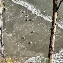
    Ducks!

    See all

    Ducks!
    Limekiln State Park

    Limekiln State Park

    4.4
    (143 reviews)
    34.7 mi

    I fell I love with this beach many years ago. The drive here is INCREDIBLE! I literally have dreams…read moreabout driving under the bridge! You go under to get to this secluded beach off of Hwy 1. I had no idea that you could choose between 3 different campsites until I decided I HAD to be under the moonlight at the beach on 2.22.22 at 2:22 pm. And the views are BREATH TAKING from the beach campsite. They were also freezing, windy, and WET in February! And all of the trails were closed when we visited due to the fire, but it was like a little slice of Heaven to disconnect and spend 2 nights off the grid with great folks. The rangers who serve this place are BEYOND friendly, and they do an awesome job of keeping the bathrooms clean. I believe they were cleaned 3 times a day. And the campsites were so self contained, you really had no idea there were up to 29 sites there. Camping on the beach meant you heard the crash of waves all night long. It was so very peaceful! And while the view looked almost warm, there was NOTHING warm about being there in February. But if you had a camper, and the right gear, the rain and wind would be worth it just to burn that image eternally into your mind! I hope I can snag this location during the warmer months. I'm just in love with everything about LimeKiln.

    This review is for the Limekiln campground. We camped at…read moresite #17. The Redwood campground (sites #17-#29) is basically a big dirt parking lot divided into tiny "campsites." There's a creek running behind the big dirt parking lot and lots of big trees on the perimeter of the big dirt parking lot. But there's no trees or plants in the tiny "campsites." So forget hanging a hammock or having any sense of privacy. We could barely fit a 6-person tent in site #17. The creek was pretty. The bathrooms were decent and have flush toilets. Our campsite was, at most, a 2-minute walk to the ocean, which was pretty cool.

    Photos
    Limekiln State Park
    Limekiln State Park
    Flocks of birds and otters hang out just offshore

    See all

    Flocks of birds and otters hang out just offshore
    Ragged Point Scenic View

    Ragged Point Scenic View

    4.9
    (10 reviews)
    15.8 mi

    Thanks to Yelp pal Hannah S.'s review, I had bookmarked this spot as a place to stop when we were…read morein the area. The views are indeed scenic! We grabbed some coffee at the shop located here and then took a stroll behind the stores to savor the cool breezes, the trees, and the lovely sights of the Pacific Ocean. There's actually a trail, too, but we didn't venture down it as we were pressed for time. This is worth a stop to bask in the beautiful seascape.

    Lovely scenic stop along the PCH as you make your way up from Cambria towards Big Sur. There's a…read morerestaurant, gas station, great coffee shop, bathrooms, art work, some hiking and view points, and an inn all at this little stop area. I walked all the way to the back where there's a lovely overlook with expansive Pacific Ocean views all along the cliffs and out as far as the eye can see! I even saw a sea otter hanging out with a sea gull - playing around in the waves together haha!! I think the gull was chasing him and gobbling up the otter's leftovers lol. There's another hiking trail on site down to the black sands of Young Creek Beach - but it's a super steep hike down a 400 foot cliff and I wasn't feeling it lol! But there are lots of nice seating areas overlooking the trail, beaches and cliffs so it's still very enjoyable. I grabbed a coffee and some dessert at the coffee shop instead which I can highly recommend!! It was fantastic and the staff were wonderful (see my review for Ragged Point Coffee Shop & Bakery). At the time of my visit, it was about as far as you could go up the PCH to Big Sur bc the road further up is washed out but they're working on it. Still a great little spot to explore - lots of parking and great views. I'd definitely consider staying at the inn next time!

    Photos
    My coffee from the cute coffee shop - was fabulous!
    My coffee from the cute coffee shop - was fabulous!
    Nice seating areas with incredible views!
    Nice seating areas with incredible views!
    Got a latte to sip while we savored the scene

    See all

    Got a latte to sip while we savored the scene
    Big Falls Trail

    Big Falls Trail

    5.0
    (2 reviews)
    42.9 mi

    As of Oct 17, 2020 this place is still temporarily closed due to the El Dorado fire…read more The road leading to the trailhead may close seasonally. Please DO NOT park in undesignated spots as you are likely to get towed. Adventure Pass or National Parks Pass is required for entry. Due to many search and rescue situations in the past, hikers may not venture past the waterfall at the end of this route. There is a large parking lot at the trailhead with BOTH free and PAID parking. The gravel lot to the left is free. The lined spots require a day pass which you can purchase at the general store a few miles down the road. Making it to the very top requires a little scrambling and rock climbing, but its doable. So many places to relax and enjoy nature. Overnight camping is no longer allowed, but if you want to hang out for the day and set up a little picnic there are spots and bathrooms. Upper Big Falls is currently closed until 5/21/21 due to public safety. The closure is from the observation deck up to the waterfalls itself. Do not hike or climb past the observation deck. Forest Adventure Pass Daily Pass--Costs: $5 per dayForest Adventure Pass Annual Pass--Costs: $30 Annually Forest headquarters 602 So. Tippecanoe Ave San Bernardino Ca 92408 Tel no (909) 382 2682 (800)735 2922

    We decided to come here for a hike, we drove like 50 minutes from AG. The rode goes up a mountain…read morethen descents towards a series of creek passings (about 18). Luckily we took a pick up truck because the creek water level in some of them were about 3ft deep. No 4x4 is needed but definitely helps, car height is more important. When we actually got to the end of the road we went on a hike crossing a couple more creeks. When just about made it to the falls it was tough to get down if your a inexperienced hiker or kid. You have to climb down with a rope, pretty sketchy.. We just decide to hang out at one of the creeks we crossed by foot, very tranquil.

    Photos
    Entrance
    Entrance
    Big Falls Trail
    Big Falls Trail

    See all

    Salmon Creek Trail

    Salmon Creek Trail

    4.5
    (2 reviews)
    36.9 mi

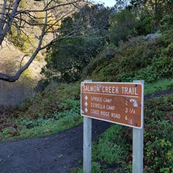
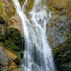
    The Salmon Creek Trail and Waterfall is one of the funner places to take the family along Highway 1…read morein lower Monterey County. This trail is located about 3.5 miles north of the Ragged Point Inn along the middle of large bend in the road. There's a pull-off just north of the trailhead. You have to walk across the bridge to get to the actually trail. After a short walk down the trail you will come to a fork in the road. Follow the arrow to the "Balls".. It used to say Falls but someone changed it to "Balls"... This is a review of the Waterfall Trail that is a split off from the Salmon Creek Trail. The waterfall is less than a quarter mile so most families can make it to the waterfall. Those seeking to access the actual water pool will have to do some hiking over slippery rocks and cold rushing water. That's not advisable unless you're a crafty hiker. Your reward is to stand below, or even behind a 120-foot waterfall. The best pictures have to be earned the hard way on this hike. There's also a cave in this same area. Tips - The rocks here are slippery!! If you want to get to the base of the waterfall I recommend water shoes or just using you bare feet. - Check out the tunnel and graffiti under the bridge.. The trail is just off area where you park, don't cross the bridge, rather just walk down the tiny trail to the base of the bridge ( see my picture).

    Short hike from the turn out. Definitely a good pit stop on the drive to big sur. The trail can be…read morea little bit confusing when you're trying to get to the upper falls. Will definitely have to climb some rocks but worth it. We didn't climb to the upper falls because there was quite a few people.

    Photos
    Secret tunnel under highway
    Secret tunnel under highway
    Salmon Creek Trail
    Salmon creek waterfall

    See all

    Salmon creek waterfall

    Jung Ranch Trail - hiking - Updated July 2026

    Loading...
    Loading...
    Loading...