LMU Hiking Trail Photos


You might also consider


More like LMU Hiking Trail
Recommended Reviews - LMU Hiking Trail
Start your review...


Reviews With Photos
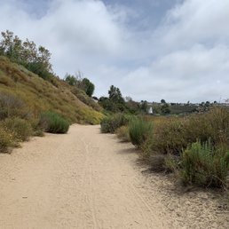

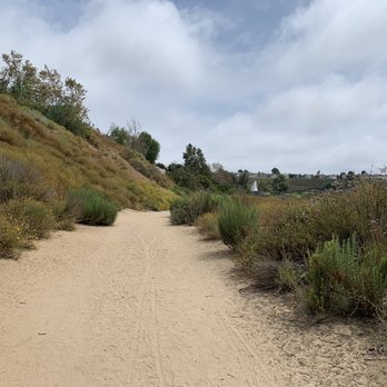
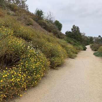
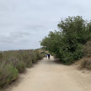
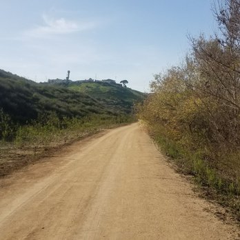
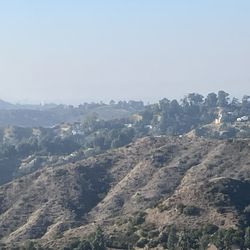
The LMU Hiking Trail, also known as Westchester Fire Road, is good for city hiking when you can't get out of LA, and may enjoy getting a taste of the outdoors along this partially paved road crosses the bluff below Loyola Marymount University and is a level approximately 2 miles from point to point. The trail is very flat and easy, dog friendly, and certain trails are closed as habitat for wildlife, so please follow the sign and don't enter.


The trail was easy to find because the security helped me LOL The trail was simply beautiful! Dogs are allowed but they have to stay leash! Which makes sense bc there's a lot of wild life and it would be easy to fir them to get hurt. There's a nearby dog park if your interested! I would definitely go back because I enjoyed this workout! It was easy enough for even children to enjoy or ride bikes! 3 miles both ways and took me almost 2 hours.


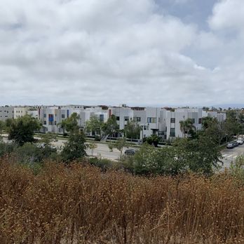
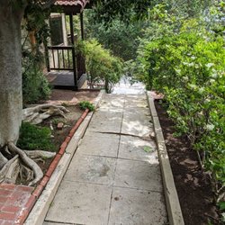
This trail seems to have more names to it. Call it whatever you like, it's all paradise as far as I'm concerned!! Since I don't really run, I'm a long distance walker/hiker. This trail is almost mostly flat, so if your looking for inclines, Baldwin Hills Scenic Overlook is probably the closest in the area. For the rest of the people that frequent it, mostly runners, dogs walking their owners, couples, some bikes (although I don't know what the rule is on bikes, but every biker I've seen was very considerate) and I've even seen a large family strolling through here (although I think the park would have been more fun for both baby in stroller & little one that was roaming around looking to play - it had just rained a couple days ago & muddy). With that said, its appealing to all that know of it, besides the students and nearby residents. You can tailor your run/walk to longer distance by walking up Bluff Trail Road to the park and/or Ballona Wetlands trail. It's a nice alternative to Ballona Creek bike path (a lot safer too). We measured it would be just a about 4 miles - or little under round trip. There is parking off to the side of the entrance to the University. People have been the most respectful and pet owners are mostly responsible, although we were puzzled as to why we kept seeing filled doggy poop bags throughout the trail - no trash cans were seen (one huge dumpster in the middle), but did notice some large lawn bags hung up on the trees throughout - maybe that's what they are for? But definitely a clean environment with no litter - what, no Litter in Southern California? Shhhhhhh!!! We mustn't let the others find out or they might just start creeping over and ruin it. Seriously, I hope not! I love how peaceful it was. Safe too. I did see security patrolling through there. You've also got nice panoramic views of Silicon Beach - Youtube Space, Google, IMAX Headquarters, etc, most of the new residential living complexes throughout Playa Vista, the park, farmers market on Saturdays, parts of Ballona Wetlands, the newer homes, and pockets of hidden tiny creeks throughout. To elaborate further, you can see the Hollywood sign from there, Santa Monica mountains, the tall high rises from Wilshire blvd & Beverly Hills, planes taking off from nearby LAX/Westchester, parts of Marina Del Rey, and higher you will be able to see some ocean views as well. Whew!! Skies the limit baby! And the sounds of nature is priceless! As is the birdwatching, we saw a beautiful common egret (white heron). I'm not a big bird watcher, as a friend of mine, but I do love looking and taking photos of. The trail is composed of concrete, dirt, soft woodchip/pellets throughout - all spread out and not in same area. It's definitely not hard on your knees. It's very popular with folks that run and dogs. But not crowded (sshhhhh! I didn't say that). No bathrooms, but if need be, walk down to the park on Bluff Creek - however it won't help if your too far in distance and there are no openings from the trail except beginning and end. Did I miss anything? There are more reviews if you look up LMU running trail and Westchester Fire Road trail. Enjoy!


Second time here and I loved it more than the first time we came. Perhaps the nice weather had something to do with it. Whatever it is, the whole family had a great time hiking, especially our two furry kids. It's definitely a place to bring your furry ones.
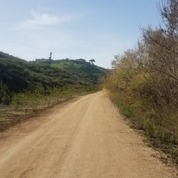

Love to find trails in LA that are good, clean, tranquil, and safe. I Yelped this trail and needed one as I was in Westchester and wanted to be out and see something besides the beach walk path. This is a nice 4 mile loop trail. Easy going, and great for people who do not mind dogs off leash. The upper trail is just that, and the bottom trail is near the stream and you get more bird songs and sights of ducks and ducklings, and those lizards of course! The address sends you to LMU, and I went on a Sunday and was directed to park in the structure and that was FREE. The trail seems safe for day use and would recommend for anyone who can walk on lightly even ground and very mild incline. Check it out for an easy going jog or walk, as it is not crowded. Folks on the trail are friendly, and is a sight to see how excited the dogs get when they greet their own species!


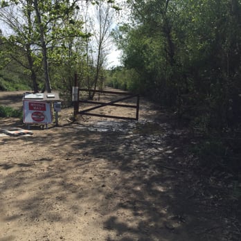
LMU Hiking trail is a great place to get a level dirt trail hike in any day of the week. It's mostly well kept and most people stick to the rules while on it. It's the people that don't follow the rules that had me knock a star off this review. The Pros: When the upper and lower trails are open, you can choose to do a tree shaded walk/run or a mostly sunny one on the upper. The paths are wide, and are mostly dirt surface. From the upper trail you can also take in some nice views of LAs west side. You can even ride your bike here. I believe the entire loop is just under 5 miles. Maybe more like 4 miles and some change. The Cons: People who don't think the rules apply to them. Especially the dog owners. I AM A DOG OWNER! I LEASH AND CLEAN UP AFTER MY DOG because it's what the posted rules ask me to do. Also the lower trail is closed for habitat rehabilitation. But alas this doesn't stop exceptional people that go through the fence. Not sure what the penalty or fine is but I would hope it's enough of a sting to discourage this behavior. Overall: It's a wonderful place to get your steps in and tune out. Afternoon or early mornings are great for spotting wild life like rabbits, cranes and or coyotes. Be safe and see you on the trail. Please bring your dog on a leash too! read more

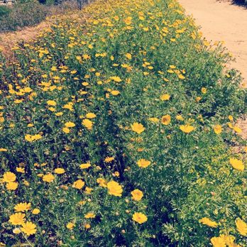


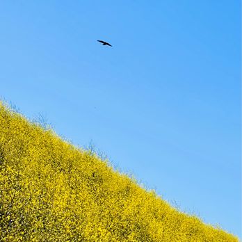



Great hike that is pretty flat. Trail is wide. Lots of parking nearby. It's not the cleanest since there is a lot of mulch and leaves. Some parts smell a bit like sewage. I only give it 3 stars because there are way too many off leash dogs and not all the owners will recall the dogs back. This isn't a dog park. I don't want my leashed dog to be greeted by your off leash dog. Please be respectful and leash your dogs (it's the law). read more


2 years ago

The LMU Hiking Trail, also known as Westchester Fire Road, is good for city hiking when you can't get out of LA, and may enjoy getting a taste of the outdoors along this partially paved road crosses the bluff below Loyola Marymount University and is a level approximately 2 miles from point to point. The trail is very flat and easy, dog friendly, and certain trails are closed as habitat for wildlife, so please follow the sign and don't enter. read more





3 years ago

6 years ago
The trail was easy to find because the security helped me LOL The trail was simply beautiful! Dogs are allowed but they have to stay leash! Which makes sense bc there's a lot of wild life and it would be easy to fir them to get hurt. There's a nearby dog park if your interested! I would definitely go back because I enjoyed this workout! It was easy enough for even children to enjoy or ride bikes! 3 miles both ways and took me almost 2 hours. read more


3 years ago

3 years ago

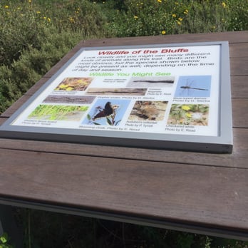
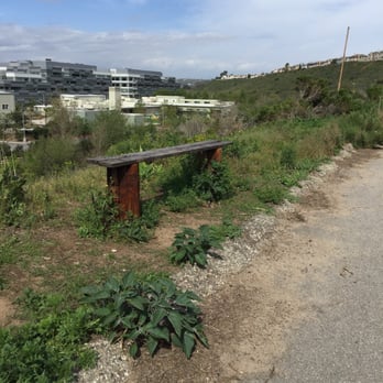
This trail seems to have more names to it. Call it whatever you like, it's all paradise as far as I'm concerned!! Since I don't really run, I'm a long distance walker/hiker. This trail is almost mostly flat, so if your looking for inclines, Baldwin Hills Scenic Overlook is probably the closest in the area. For the rest of the people that frequent it, mostly runners, dogs walking their owners, couples, some bikes (although I don't know what the rule is on bikes, but every biker I've seen was very considerate) and I've even seen a large family strolling through here (although I think the park would have been more fun for both baby in stroller & little one that was roaming around looking to play - it had just rained a couple days ago & muddy). With that said, its appealing to all that know of it, besides the students and nearby residents. You can tailor your run/walk to longer distance by walking up Bluff Trail Road to the park and/or Ballona Wetlands trail. It's a nice alternative to Ballona Creek bike path (a lot safer too). We measured it would be just a about 4 miles - or little under round trip. There is parking off to the side of the entrance to the University. People have been the most respectful and pet owners are mostly responsible, although we were puzzled as to why we kept seeing filled doggy poop bags throughout the trail - no trash cans were seen (one huge dumpster in the middle), but did notice some large lawn bags hung up on the trees throughout - maybe that's what they are for? But definitely a clean environment with no litter - what, no Litter in Southern California? Shhhhhhh!!! We mustn't let the others find out or they might just start creeping over and ruin it. Seriously, I hope not! I love how peaceful it was. Safe too. I did see security patrolling through there. You've also got nice panoramic views of Silicon Beach - Youtube Space, Google, IMAX Headquarters, etc, most of the new residential living complexes throughout Playa Vista, the park, farmers market on Saturdays, parts of Ballona Wetlands, the newer homes, and pockets of hidden tiny creeks throughout. To elaborate further, you can see the Hollywood sign from there, Santa Monica mountains, the tall high rises from Wilshire blvd & Beverly Hills, planes taking off from nearby LAX/Westchester, parts of Marina Del Rey, and higher you will be able to see some ocean views as well. Whew!! Skies the limit baby! And the sounds of nature is priceless! As is the birdwatching, we saw a beautiful common egret (white heron). I'm not a big bird watcher, as a friend of mine, but I do love looking and taking photos of. The trail is composed of concrete, dirt, soft woodchip/pellets throughout - all spread out and not in same area. It's definitely not hard on your knees. It's very popular with folks that run and dogs. But not crowded (sshhhhh! I didn't say that). No bathrooms, but if need be, walk down to the park on Bluff Creek - however it won't help if your too far in distance and there are no openings from the trail except beginning and end. Did I miss anything? There are more reviews if you look up LMU running trail and Westchester Fire Road trail. Enjoy! read more




6 years ago

5 years ago

6 years ago

6 years ago

Second time here and I loved it more than the first time we came. Perhaps the nice weather had something to do with it. Whatever it is, the whole family had a great time hiking, especially our two furry kids. It's definitely a place to bring your furry ones. read more


9 years ago
Love to find trails in LA that are good, clean, tranquil, and safe. I Yelped this trail and needed one as I was in Westchester and wanted to be out and see something besides the beach walk path. This is a nice 4 mile loop trail. Easy going, and great for people who do not mind dogs off leash. The upper trail is just that, and the bottom trail is near the stream and you get more bird songs and sights of ducks and ducklings, and those lizards of course! The address sends you to LMU, and I went on a Sunday and was directed to park in the structure and that was FREE. The trail seems safe for day use and would recommend for anyone who can walk on lightly even ground and very mild incline. Check it out for an easy going jog or walk, as it is not crowded. Folks on the trail are friendly, and is a sight to see how excited the dogs get when they greet their own species! read more


6 years ago

7 years ago
This trail is perfect for mornings I want to get a solid run in with my dog. It's conveniently located in the Playa Vista area. There's street parking available. If you've never been to the area it may be hard to find the start of the trail but you'll probably see people going up the path on Bluff Creek. The trail goes all the way to Lincoln and is a solid distance. Lots of people bring their dogs and most of the ones I've come across are off leash - please don't do this as animals are unpredictable and this is not an off leash trail. read more


8 years ago
5 years ago

8 years ago

Short and sweet. 2 miles long and almost in a straight path. You want more? head across the street (Lincoln) and hike the marsh as well.You also have the other small trails you can tack on next to the youtube facilities. read more


9 years ago

9 years ago

9 years ago

11 years ago
More info about LMU Hiking Trail
7299 Loyola Marymount University Dr
Los Angeles, CA 90045
Playa Vista
Directions
Hours
Indoor Amenities
Outdoor Amenities
Ask the Community - LMU Hiking Trail
Review Highlights - LMU Hiking Trail
You might also consider















Why does Yelp recommend reviews?
1 review that is not currently recommended
The reviews below are not factored into the business's overall star rating.
7 years ago
LMU Hiking Trail - hiking - Updated September 2026
Best of Los Angeles
People found LMU Hiking Trail by searching for…
Hiking Trails in Los Angeles, CA
Dog Friendly Beaches in Los Angeles, CA
Walking Trails in Los Angeles, CA
Running Trails in Los Angeles, CA
Places to Walk in Los Angeles, CA
Things to Do in Los Angeles, CA
Beautiful Views in Los Angeles, CA
Scenic View in Los Angeles, CA
Dog Friendly Hiking Trails in Los Angeles, CA
Watch Sunset in Los Angeles, CA
Shaded Hike in Los Angeles, CA
Stroller Friendly Hikes in Los Angeles, CA
Stroller Walk in Los Angeles, CA
Scenic Spots in Los Angeles, CA
Off Leash Dog Hikes in Los Angeles, CA
Lookout Points in Los Angeles, CA
Places to Take Pictures in Los Angeles, CA
Free Parking in Los Angeles, CA
Trending Searches in Los Angeles, CA
Apple Orchards near LMU Hiking Trail
Apple Picking near LMU Hiking Trail
Barbershop near LMU Hiking Trail
Bike Shop near LMU Hiking Trail
Cliff Jumping near LMU Hiking Trail
Cruising Spots near LMU Hiking Trail
Dog Friendly Things To Do near LMU Hiking Trail
Estheticians near LMU Hiking Trail
Eyelash Extensions near LMU Hiking Trail
Furniture Stores near LMU Hiking Trail
Hiking Trails With Waterfalls near LMU Hiking Trail
Kids Birthday Party near LMU Hiking Trail
Lakes & Ponds near LMU Hiking Trail
Makeup Artists near LMU Hiking Trail
Mattresses near LMU Hiking Trail
Off Road Trails near LMU Hiking Trail
Picnic Areas near LMU Hiking Trail
Places To Take Pictures near LMU Hiking Trail
Private Schools near LMU Hiking Trail
Public Shower near LMU Hiking Trail
Rock Quarry near LMU Hiking Trail
Scenic Night View near LMU Hiking Trail
Scenic Overlook near LMU Hiking Trail
Sugaring near LMU Hiking Trail
Sunrise View near LMU Hiking Trail
Browse Articles
Browse Nearby
BEST of Los Angeles, California Coffee near LMU Hiking Trail
BEST of Los Angeles, California Things to Do near LMU Hiking Trail
BEST of Los Angeles, California Restaurants near LMU Hiking Trail
BEST of Los Angeles, California Parks near LMU Hiking Trail
BEST of Los Angeles, California Walking Trails near LMU Hiking Trail
BEST of Los Angeles, California Breakfast near LMU Hiking Trail
BEST of Los Angeles, California Campgrounds near LMU Hiking Trail
BEST of Los Angeles, California Sightseeing near LMU Hiking Trail
BEST of Los Angeles, California Airport near LMU Hiking Trail
Browse Brands
Related Searches in Los Angeles, CA
Best Dog Hiking Trails Around Los Angeles, California
Best Fishing Locations and Guides in Los Angeles, California
Best Nature Trails for Hiking in Los Angeles, California
Best Places for Horseback Riding in Los Angeles, California
Check Out Off Road Trails in Los Angeles, California
Discover Dog Friendly Trails to Explore in Los Angeles, California
Discover Easy Hiking Trails Near Los Angeles, California
Discover Kid Friendly Hiking Trails in Los Angeles, California
Discover Popular Bike Trails in Los Angeles, California
Discover Scenic Mountain Bike Trails Near Los Angeles, California
Discover Walking Parks in Los Angeles, California Near You
Discover a Hiking Trail in Los Angeles, California
Discover the Best Night Hike Trails in Los Angeles, California
Dog-Friendly Hikes With Dogs in Los Angeles, California
Enjoy Camping Adventures Around Los Angeles, California
Enjoy Kayaking Adventures in Los Angeles, California
Enjoy Off Leash Dog Hikes in Los Angeles, California
Enjoy Scenic Places to Walk in Los Angeles, California
Enjoy Tent Camping Spots Around Los Angeles, California
Enjoy a Beautiful Waterfall Hike in Los Angeles, California
Enjoy the Best Walking Path in Los Angeles, California
Enjoy the Best Walking Trails in Los Angeles, California
Explore Beautiful Parks and Green Spaces in Los Angeles, California
Explore Easy Hikes Perfect for All in Los Angeles, California
Explore Fun Activities to Do in Los Angeles, California
Explore Popular Campgrounds Near Los Angeles, California
Explore Popular Dog Walking Trails in Los Angeles, California
Explore Top Dog Parks in Los Angeles, California Near You
Explore the Best Beach Spots in Los Angeles, California
Family Friendly Hiking With Kids in Los Angeles, California
Find Parks and Recreation Activities in Los Angeles, California
Find Top Dog Friendly Parks to Visit in Los Angeles, California
Find Top-Rated Waterfalls in Los Angeles, California Now
Find the Best Parks for Picnics in Los Angeles, California
Hiking Trails With Waterfalls in Los Angeles, California
Off Leash Dog Hiking Trails in Los Angeles, California
Popular Outdoor Activities to Try in Los Angeles, California
Popular Picnic Spots to Visit in Los Angeles, California
Popular Waterfall Hiking Trails in Los Angeles, California
Safe River Swimming Areas in Los Angeles, California
Safe and Fun Parks for Kids in Los Angeles, California
Top Hiking Trails to Explore in Los Angeles, California
Top Playgrounds for Kids to Enjoy in Los Angeles, California
Top Running Trails to Explore in Los Angeles, California
Top Swimming Lakes to Enjoy in Los Angeles, California
Top Swimming Spots and Pools in Los Angeles, California
Top-Rated Camping Sites in Los Angeles, California
Walk Dog Friendly Hiking Trails in Los Angeles, California
Walk the Best Paved Walking Trails in Los Angeles, California


