
Mount Lewis Via Dawson Saddle Photos


You might also consider


More like Mount Lewis Via Dawson Saddle
Recommended Reviews - Mount Lewis Via Dawson Saddle
Start your review...


Reviews With Photos


Lewis Falls is do hidden not even Yelp can find it. Lewis Falls was a Beautiful hidden gem to discover. The trail is hard to find, so here is s review to help you enjoy this Hike. Once you pass ColdBrook Camp look for what looks like a Water Tower on the left side of the road around mile Marker 34. There is plenty of parking here. You can try to park closer at a Turnout up ahead. There are no signs as previous reviewers mentioned. Not sure if it was run over or destroyed. So just look for the Mile Markers if you pass marker 34.87 you went one marker to far. The trail will be on the Right Side of the street. You'll see the Water Drains under the road. That is where the Trail begins. The actual walking Trail gets lost on the Hike so keep your eyes open. It's small and narrow. Toward the last 1/4 mile where you think it ends. That is where the fun begins. You'll need to climb over rocks, over fallen trees, under logs, and through the creek. You'll want to give up wondering if you will find the Falls. Even when you see where the Trail actually ends keep walking. The Fall is on the left side of the trial ending which you can't see til you're literally in front of it. This hidden Gem has pretty much no Graffiti and no trash. Let's keep it that way. Things you need or recommended: -Adventure Pass required -Long Pants, the trail in raw and rough and you'll be going through debree. I got my legs pretty scrapped up. -Bring gloves to help get over rocks or logs -Hiking Stick is useful to test areas when you walk through water and mud -Bring extra Shoes. You're feet will get wet Enjoy your Hike


6 years ago
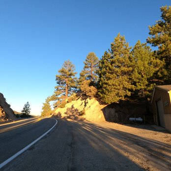
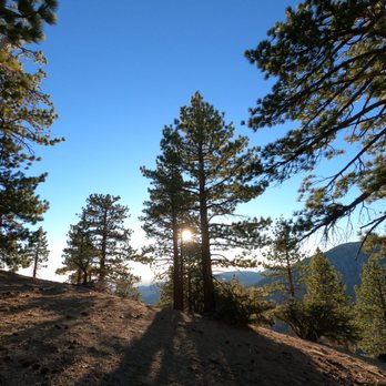
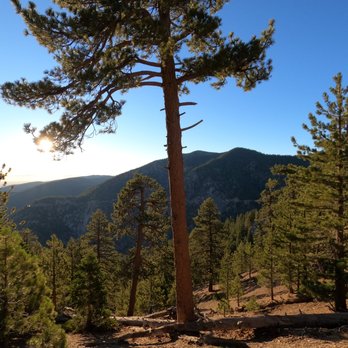
The review here is for Mount Lewis, not Lewis Falls. You will park at Dawson Saddle area. Display your adventure pass. There is no restroom in the area. At Dawson Saddle, you will see a brown building, to the left of the building there is a small trail going up to Mount Lewis. It's a short hike but steep like less than a mile, the trail is one way in and back out. It's still a nice little hike which I combined this with Throop Peak and Mount Hawkins. The view on top is covered with trees, but still there are spots of good views all around. A nice place to be alone and not in a crowd with other hikers. Just head back down when you're done, the trail head to Throop Peak or if you have energy to Mount Baden-Powell, is on the other side of the road. As always, pack accordingly to the weather and have fun. read more





9 years ago

9 years ago
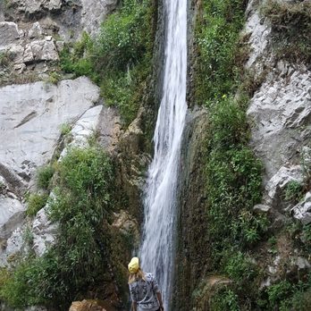
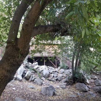
Nestled on the side of the road without any signage this trail is secluded and quiet. Perfect for anyone trying to find solitude. Pay attention to your right hand side for a trail entrance right after you pass the watertower. You can park there and do a walk up or find a decent open shoulder nearby. Make sure to have an adventure pass in the forest. Trail is only .8 miles in and out. You're sitting at 4,200 elevation with only a 350ft gain through the hike. It's easy with some areas where you might scramble and cross the creek. Nothing to be scared of... Except for the bugs. Jesus christ the bugs!!! I tried not to inhale any of them but they were all so desperate to die inside me, trying to find any orifice in! Accidentally had an early protein filled breakfast by swallowing 3 of them. Aside from my face, which was being prodded at the entire time, my exposed hands were subjected to multiple bites despite having a repellent on. I would hate to see what would have happened had I rolled up my sleeves. I was only here for half an hour too. The insects swarm closer to the water but you're not really safe from them anywhere. It's a humid area so it's the perfect breeding ground for these mother fucks. Bring good repellent, maybe a handkerchief and prayers for defense. Despite being so short there were plenty of points of interests. A couple of cabins, demolished buildings, a scary outdoor toilet and many small cascades on the way up. The waterfall yielded a great flow for this time of year. Such a great payoff for a short hike! read more




10 years ago
Lewis Falls is do hidden not even Yelp can find it. Lewis Falls was a Beautiful hidden gem to discover. The trail is hard to find, so here is s review to help you enjoy this Hike. Once you pass ColdBrook Camp look for what looks like a Water Tower on the left side of the road around mile Marker 34. There is plenty of parking here. You can try to park closer at a Turnout up ahead. There are no signs as previous reviewers mentioned. Not sure if it was run over or destroyed. So just look for the Mile Markers if you pass marker 34.87 you went one marker to far. The trail will be on the Right Side of the street. You'll see the Water Drains under the road. That is where the Trail begins. The actual walking Trail gets lost on the Hike so keep your eyes open. It's small and narrow. Toward the last 1/4 mile where you think it ends. That is where the fun begins. You'll need to climb over rocks, over fallen trees, under logs, and through the creek. You'll want to give up wondering if you will find the Falls. Even when you see where the Trail actually ends keep walking. The Fall is on the left side of the trial ending which you can't see til you're literally in front of it. This hidden Gem has pretty much no Graffiti and no trash. Let's keep it that way. Things you need or recommended: -Adventure Pass required -Long Pants, the trail in raw and rough and you'll be going through debree. I got my legs pretty scrapped up. -Bring gloves to help get over rocks or logs -Hiking Stick is useful to test areas when you walk through water and mud -Bring extra Shoes. You're feet will get wet Enjoy your Hike read more




10 years ago
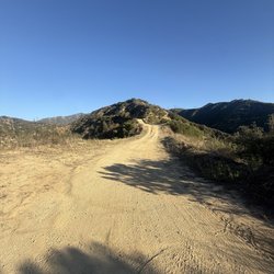
Mount Lewis- Short But Steep and Sweet Hike A small, narrow use trail can be found to the west of a forest service building next to the parking area of Dawson Saddle. The elevation gain is roughly 500 feet, and is very steep. The summit is forested, but you can still see some great views of the Angeles High Country. The hike is roughly 1 mile round trip. For such a short hike, it packs a great workout. read more
More info about Mount Lewis Via Dawson Saddle
Dawson Saddle Trl
Angeles National Forest
Azusa, CA 91702
Directions
Hours
Outdoor Amenities
You might also consider

















Mount Lewis Via Dawson Saddle - hiking - Updated September 2026
Best of Azusa
People found Mount Lewis Via Dawson Saddle by searching for…
Trending Searches in Azusa, CA
Apple Orchards near Mount Lewis Via Dawson Saddle
Apple Picking near Mount Lewis Via Dawson Saddle
Barbershop near Mount Lewis Via Dawson Saddle
Bike Shop near Mount Lewis Via Dawson Saddle
Blowout near Mount Lewis Via Dawson Saddle
Casinos near Mount Lewis Via Dawson Saddle
Cliff Jumping near Mount Lewis Via Dawson Saddle
Consignment Shops near Mount Lewis Via Dawson Saddle
Cruising Spots near Mount Lewis Via Dawson Saddle
Dog Friendly Things To Do near Mount Lewis Via Dawson Saddle
Estheticians near Mount Lewis Via Dawson Saddle
Eyelash Extensions near Mount Lewis Via Dawson Saddle
Furniture Stores near Mount Lewis Via Dawson Saddle
Hiking Trails With Waterfalls near Mount Lewis Via Dawson Saddle
Kids Birthday Party near Mount Lewis Via Dawson Saddle
Lookout Points near Mount Lewis Via Dawson Saddle
Makeup Artists near Mount Lewis Via Dawson Saddle
Mattresses near Mount Lewis Via Dawson Saddle
Parks near Mount Lewis Via Dawson Saddle
Picnic Areas near Mount Lewis Via Dawson Saddle
Places To Take Pictures near Mount Lewis Via Dawson Saddle
Public Shower near Mount Lewis Via Dawson Saddle
Rock Quarry near Mount Lewis Via Dawson Saddle
Scenic Night View near Mount Lewis Via Dawson Saddle
Scenic Overlook near Mount Lewis Via Dawson Saddle
Sugaring near Mount Lewis Via Dawson Saddle
Sunrise View near Mount Lewis Via Dawson Saddle
Swimming Holes near Mount Lewis Via Dawson Saddle
Browse Articles
Browse Nearby
Browse Brands
Related Searches in Azusa, CA
Best Dog Hiking Trails Around Azusa, California
Best Fishing Locations and Guides in Azusa, California
Best Nature Trails for Hiking in Azusa, California
Best Places for Horseback Riding in Azusa, California
Check Out Off Road Trails in Azusa, California
Discover Dog Friendly Trails to Explore in Azusa, California
Discover Easy Hiking Trails Near Azusa, California
Discover Kid Friendly Hiking Trails in Azusa, California
Discover Popular Bike Trails in Azusa, California
Discover Scenic Mountain Bike Trails Near Azusa, California
Discover Walking Parks in Azusa, California Near You
Discover a Hiking Trail in Azusa, California
Discover the Best Night Hike Trails in Azusa, California
Dog-Friendly Hikes With Dogs in Azusa, California
Enjoy Camping Adventures Around Azusa, California
Enjoy Kayaking Adventures in Azusa, California
Enjoy Off Leash Dog Hikes in Azusa, California
Enjoy Scenic Places to Walk in Azusa, California
Enjoy Tent Camping Spots Around Azusa, California
Enjoy a Beautiful Waterfall Hike in Azusa, California
Enjoy the Best Walking Path in Azusa, California
Enjoy the Best Walking Trails in Azusa, California
Explore Beautiful Parks and Green Spaces in Azusa, California
Explore Easy Hikes Perfect for All in Azusa, California
Explore Fun Activities to Do in Azusa, California
Explore Popular Campgrounds Near Azusa, California
Explore Popular Dog Walking Trails in Azusa, California
Explore Top Dog Parks in Azusa, California Near You
Family Friendly Hiking With Kids in Azusa, California
Find Beautiful Views in Azusa, California
Find Parks and Recreation Activities in Azusa, California
Find Top Dog Friendly Parks to Visit in Azusa, California
Find Top-Rated Waterfalls in Azusa, California Now
Find the Best Parks for Picnics in Azusa, California
Hiking Trails With Waterfalls in Azusa, California
Off Leash Dog Hiking Trails in Azusa, California
Popular Outdoor Activities to Try in Azusa, California
Popular Picnic Spots to Visit in Azusa, California
Popular Waterfall Hiking Trails in Azusa, California
Safe River Swimming Areas in Azusa, California
Safe and Fun Parks for Kids in Azusa, California
Top Hiking Trails to Explore in Azusa, California
Top Playgrounds for Kids to Enjoy in Azusa, California
Top Running Trails to Explore in Azusa, California
Top Swimming Lakes to Enjoy in Azusa, California
Top Swimming Spots and Pools in Azusa, California
Top-Rated Camping Sites in Azusa, California


