1. Old Youth Camp Loop

    1. Old Youth Camp Loop

    0

    Burbank, CA

    Cancel

    Open app

    Search

    Old Youth Camp Loop

    5.0 (2 reviews)

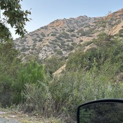
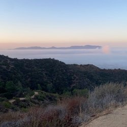
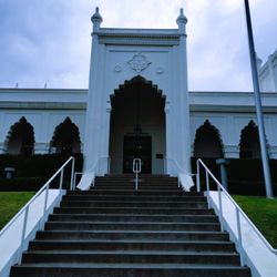
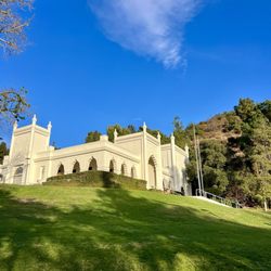
    Old Youth Camp Loop Photos

    You might also consider

    Recommended Reviews - Old Youth Camp Loop

    Your trust is our priority, so businesses can't pay to alter or remove their reviews. Learn more about reviews.
    Yelp app icon
    Browse more easily on the app
    Review Feed Illustration

    5 years ago

    Helpful 4
    Thanks 0
    Love this 3
    Oh no 0

    9 years ago

    Helpful 7
    Thanks 1
    Love this 4
    Oh no 0

    You might also consider

    Verify this business for free

    People searched for Hiking 11,615 times last month within 15 miles of this business.

    Verify this business

    Switzer Falls - USDA Forest Service

    Switzer Falls - USDA Forest Service

    4.4(294 reviews)
    9.9 mi

    Perfect hike for a hot day…read more I love waterfall hikes and listening to the sound of calm, running water. The added challenge on these hikes is the multiple stream crossings. I brought some hiking poles which helped with balance and probing for loose rocks and logs. If you want to get parking in the lower lot, it's best to come before 8AM. We found parking in the second lot. An Adventure Pass or Day Pass is required. Parking is enforced. A car received a ticket for being in a No Parking zone. The start of the trail is nicely shaded. The second half is a hilly, narrow, sun exposed path which routes back into the canyon toward the Lower Switzer Falls. I'm glad they had fencing on some narrow and steep parts of the trail. We encountered an active rattlesnake which headed down the mountain, so be on the lookout. Overall, the hike takes about 3 hours for 5.5 miles. The additional hike back up to the parking lot was about 1/4 of a mile. Note: if you need to use the restroom, it's best to bring your own toilet paper and to go before you start your hike. It was kind of smelly, but if you gotta go... you gotta go.

    This was my first real hike, and it was great! It was a bit confusing to get there but there were…read moreplenty of people around to help out. The water is ice cold and you need water shoes to comfortably walk around in the water. Be careful not to slip on the algae covered rocks! Still wonderful

    Photos
    Switzer Falls - USDA Forest Service - Lower Switzer Fall

    Lower Switzer Fall

    Switzer Falls - USDA Forest Service
    Switzer Falls - USDA Forest Service - The grand prize, Switzer falls.

    See all

    The grand prize, Switzer falls.

    Skyline Trail - Gorgeous!

    Skyline Trail

    4.0(3 reviews)
    1.5 mi

    SHUTTLE AWAY!!…read more Continuing the Conditioning Hike Series of reviews. Several months ago, me and The Crew were headed to the backcountry on a strenuous backpacking trip. To prepare, I wanted to do some conditioning hikes to decrease my chances of having to be airlifted out. This was one of the trails I did several times prior to the trip. Back when I was a wee hiker, The Crew planned a shuttle hike. What the heck is a shuttle hike?!?!?! STATS: Distance: 6.5 miles Time: 2.5-3 hours Elevation Gain: 1700 ft. Rating: Intermediate, not for beginners Trail: Fire Road, Non-maintained Fire Road and Single Track w/very little shade. Just northeast of Griffith Park lie the Verdugo Mountains. Like Griffith Park, there are a freakton of trails, some are maintained and well-traveled, some are not. Like the trails at Griffith Park, the trails in the Verdugo's are not all that shaded, and it gets super hot haulin yourself up an ascent to capture a 180+ view of the city below, not to mention, watch as planes arrive and depart Bob Hope Airport, as the sun sets. If the air is clear enough, you can see the sun dipping itself into the ocean as its glow illuminates on the water. Fast forward years of hiking with The Crew, I learned quickly and almost the hard way what a shuttle hike entailed. I also learned that I'm not the only one who goes through this growing pain. Anywhoo, while hikes are up and back, or in and out, or point A to point A, where the starting and ending points are the same, a shuttle hike is a one-way hike and takes a more planning and organizing than a one-way hike. Everyone meets with their cars at the ending point, hikers pile into as few cars as possible, and carpool to the starting point/trailhead. The route mapped out should lead hikers back to the initial meeting point and drive those whose cars parked at the trailhead are carpooled back. Most often, The Crew does shuttle, or loop likes, one-way is typically on backpacking trips. The Skyline trail is in the Verdugo's, and just as every trail, can be one-way, however, The Crew makes it a car shuttle hike. So we left some cars at our initial meeting point, in this case, Brand Park. A short ride down the street and around the bend, to a residential area is where we began our hike. The track is overgrown and a bit challenging in a few spots, but rewards hikers with some outstanding scenes of the Burbank and Glendale areas, and a nice steady incline, great for conditioning. The trail back down to our cars is the rutted firebreak that connects Beaudry to the library and can be a bit dangerous, but there are other, safer trails that lead back to the Brand Park, should you choose to do a car shuttle. Otherwise, y'all can return the same way you came, and make it a one-way hike. DISCLAIMER: Hiking is not something that can be taken lightly. It can be life-threatening as you see and hear on the news, people die or get lost all time. Please, if you are going to hike, never go alone and prepare for the worst, hope for the best. Remember when going for a hike, no matter how short you think it may be, always be prepared. Carry at least two liters of water for every five miles (more if the weather is warm), protein bar, nuts, and electrolytes. Wear sturdy lug sole shoes and protective clothing. Some areas the weather can change quicker than a firefighter can put on his gear. It is also very important, always always always let a family member or friend know where you are going and when you expect to be back. Lastly, have fun when you hike it up.

    Start on Via Montana, east of Country Club Drive. The trailhead is to the right of a blue portable…read moretoilet in a vacant lot. Head through the yellow gate and the rest is fairly obvious. It is 5.1-miles roundtrip with a 1600-foot elevation gain from the trailhead to the Verdugo Mountainway on the crest of the mountain range. It is 8.4-miles roundtrip with a 1900-foot elevation change from the trailhead to Verdugo Peak, the highest point on the range. For the biggest experience, try a loop of Skyline Trail to Verdugo Peak and back down Wildwood Canyon which can be done in 8.8 miles with a 2200-foot change. The trail mostly runs on the northern side of the ridge. There is some shade from the ridge, but that land mass also lessens the view of Burbank. Views are mostly of the canyon with shots of Glendale. Of course, reaching the top has a view of most of Los Angeles. Compared to Stough Canyon, Wildwood Canyon, and Brand Park, this is the least busy of the trailheads that go into the Verdugo Mountains from Burbank. Wear long pants to protect the legs. Although the trail is clear, it's not heavily maintained. Parking is on a city street around condos.

    Photos
    Skyline Trail
    Skyline Trail - Choose your route on Skyline Trail

    Choose your route on Skyline Trail

    Skyline Trail - View from Skyline Trail of the sun dipping into the ocean for the night.

    See all

    View from Skyline Trail of the sun dipping into the ocean for the night.

    Secret Stairs - Tamarac Dr. to Glenullen Dr.

    Secret Stairs

    4.3(37 reviews)
    8.9 mi

    My second time doing the stairs here is how I found them…read more Number of stairs- 9 Sycamore Glen to Redwood Dr.-this staircase is not in Fleming's Secret Stairs book, Walk #1, though they could have easily been part of the route. 60 steps Elmwood Dr. to Redwood Dr. 98 steps Redwood Dr. to Tamarac Dr. 81 steps up then 19 steps down Tamarac Dr. to Glenullen Dr. 86 steps Glenullen Dr. to Cherry Dr. 99 steps Cheviotdale Pl. to Capinero Dr. 44 steps La Loma to Cheviotdale Pl. 54 steps Cheviotdale Pl. to Cherry Dr. 43 steps La Loma to Evergreen-this staircase... Hope it helps It's around two miles.

    I decided to give the Secret Stairs a visit after a tip from Yelp! There is just something charming…read moreabout a neighborhood network of stairs. The stairs serves well as an easy hike or an exercise spot for those who love stair climbing. One thing I did not expect is that the stairs go up and down. Rather than take you higher and higher, some of the stairs just takes you across hills which for me is disappointing. Also, I did not find the houses along the trail particularly scenic. They are probably nice for Pasadena but definitely a far cry from what you see in nearby Arcadia, San Marino, La Canada, etc. Overall, I consider the Secret Stairs a local attraction. It's a worth a visit if you live less than 20 minutes away and its a fun neighborhood novelty but it's definitely not worth your time if you don't live in the area. Parking: I parked on the street on Elmwood which is the beginning of the trail, but I don't highly recommend it. It's not a particularly well maintained street and it is super narrow and steep without proper curbs/sidewalks. There is also a sign that says 'Tow Away on Red Flag Days'. Refer to the affixes picture. If I returned, I would either park on the street prior to Elmwood or just skip to a different segment.

    Photos
    Secret Stairs - Start on. Elmwood Dr. to Redwood Dr.

    Start on. Elmwood Dr. to Redwood Dr.

    Secret Stairs - Map if you want to do 2.7 miles.

    Map if you want to do 2.7 miles.

    Secret Stairs - Redwood Dr. to Tamarac Dr.

    See all

    Redwood Dr. to Tamarac Dr.

    Lake Hollywood Reservoir - These leaves  on the ground.. eucalyptus discovery and they smell so nice

    Lake Hollywood Reservoir

    4.5(285 reviews)
    6.4 miHollywood Hills

    Hollywood Reservoir is one of my favorite places to walk in LA. . My friends and I usually complete…read morethe entire loop, and every visit is relaxing and enjoyable. One of the biggest advantages is the convenient parking area right at the trailhead. There are also restrooms along the route, making longer walks much more comfortable The scenery keeps bringing me back. The trail offers beautiful views of the reservoir, the surrounding hills, Southern California landscapes, elegant homes, and one of the clearest views of the Hollywood Sign. Wildlife is another reason I enjoy coming here. On a typical walk, I spot squirrels, rabbits, deer, a variety of birds, and sometimes even coyotes or opossums. It's a reminder that nature is still thriving in the middle of LA I also like turning my walks into a small history lesson. Listening to podcasts about William Mulholland while walking around the reservoir adds another layer to the experience and helps you appreciate how important this place has been to the city's history. Whether you're looking for exercise, fresh air, quiet conversation with friends or simply a peaceful place to clear your mind, this trail offers all of it

    My friend and I were looking for a hiking trail. Being a L.A. native I haven't hiked this trail,…read moreever. It's been on my list forever and why I haven't been here is beyond me. I put it in my gps and found parking pretty easily. As we got off I noticed we can do the reservoir trail, which is flat gravel, and goes around the lake or we can hike up the mountains to the Hollywood sign. Being that it's summer we decided to do the flat trail that was surrounded by shade. As soon as we walked in my friend haven't noticed but I saw a deer really close to us. We sat in silenced for a while, it was beautiful. Since there is a fence around the reservoir I'm sure most animal will be on the other side, where the trees and mountains are. So it's not close enough where you can touch it. The walk is a 3 mile loop, very beautiful!!!! I mean we were in absolutely aw of the nature, trees, lake, wild life, just everything. Also I think it was very nice that it was my first time exploring. I definitely can't wait to come back again.

    Photos
    Lake Hollywood Reservoir - Get your run in!  Discipline equals habits... habits equal character

    Get your run in! Discipline equals habits... habits equal character

    Lake Hollywood Reservoir
    Lake Hollywood Reservoir

    See all

    Trail Canyon Falls

    Trail Canyon Falls

    4.4(123 reviews)
    7.9 mi

    BEWARE! CAR BREAK-INS! DO NOT leave valuables in the car!!…read moreMy car got broken into today, 31 May 2026 around 12-2pm. After the hike, I noticed the lock on my car door handle fell off and immediately sensed something wrong and checked my bag. They took hundreds of dollars in cash and all of my credit/debit cards. I have to take my car into the auto shop to get fixed as well. I was not aware of this trailhead being notorious for car break-ins. I was actually trying to hike Condor Peak Trailhead but couldn't find it and ended up at Trail Canyon. I had absolutely no cell signal so I couldn't even do a quick Google search on this trailhead. My first time going into a hike blind and I got robbed. I'm guessing the thieves camp out near the parking and scope out their victims. I parked right in front of the start of the trailhead. I will NOT be returning to this hike. Be careful, stay vigilant.

    This hike was interesting, but for me it was definitely more difficult and a lot more dangerous…read morethan I expected. The first part of the trail, down to the creek and along the creek, was not too hard and actually pretty enjoyable. Crossing the creek several times was fun, and there were some nice shaded areas along the way. We also saw a California newt, which was really interesting -- but please do not touch them. Later, when we finally had internet again, we read that their skin produces a toxin, so it's best to admire them from a safe distance. The harder part starts after you climb above the creek. From there, the trail leading toward the waterfall becomes narrow and slippery, and on the right side there are steep drop-offs almost the entire way. The final descent to the waterfall was the biggest challenge for me. You have to go down along the rock with a rope for support, but honestly it did not look safe at all, so we decided not to go all the way down to the base of the waterfall. I would not bring children on this hike. Also, be prepared that the round trip can take around 3.5 hours depending on your pace. A few helpful things to know: * parking was along the road * there are no restrooms * tickets/permits need to be purchased in advance in a different place * internet service was very poor, so it's better to download your map ahead of time * there were not many people, which was nice The waterfall was full and rushing, and the views were beautiful, but personally I would not do this hike a second time.

    Photos
    Trail Canyon Falls
    Trail Canyon Falls
    Trail Canyon Falls

    See all

    Old Youth Camp Loop - hiking - Updated September 2026

    Loading...
    Loading...
    Loading...