Stough Canyon Nature Center Photos


You might also consider


More like Stough Canyon Nature Center
Recommended Reviews - Stough Canyon Nature Center
Start your review...


Reviews With Photos


This is a moderate-advanced hike. You definitely want shoes that grip or hiking boots; dirt path with a good amount of rocks. Small parking lot but there's street parking a little further down the hill.


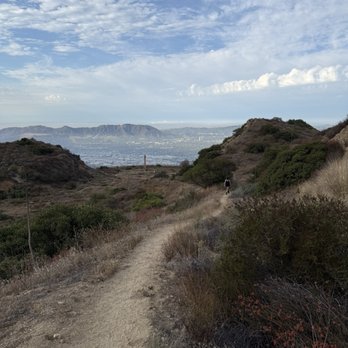
Truly a nice hike but not good for someone who is experiencing back pain or someone who cannot handle elevation. I came here around 7am after dropping off my sister's husband at the Burbank airport on a Saturday. My boyfriend was experiencing some back pain prior to the hike and I just brushed it off and told him to just walk it off. This hike is not meant for someone to "walk off pain" because there is so much incline. With incline, there is also decline which really destroys your already fragile body because you are walking at a consistent unfamiliar forward angle. The hike itself isn't too long and you can turn back whenever you want. It does loop around and it took us around an hour and a half to get down. The best thing is there are restrooms that are open early next to the nature center (even though the nature center opens at 9am). Plenty of street parking right with a bit of a walk then there is also actual parking at a lot which wasn't open when we got there at 7am (so it probably opens at 8am? Maybe). Overall, great hike, great views, and I would love to come back again!


This is a moderate trail where you can bring children or the elderly since it's not too difficult to get to the BUR airport overlook. The parking is free but there aren't too many spaces but we've never have had trouble finding a spot. If you love plane spotting then you will enjoy the overlook and see the flights take off and land.


It was a beautiful warm day, perfect for a bike ride! I rode my mountain bike from Vicory and Buena Vista up past DeBELL Golf Course . I rode my bike up to Strough Canyon Nature Center. After checking out the beautiful facility, I continued up the nature trail that starts there by the parking lot. The trail starts out with a gradual incline, then starts getting steeper as you go through the switch backs. I made it up to the first stop at the Half mile point. There is a bench there and a great view of DeBELL Golf Course. It was my first attempt to make it to the top. So I decided that would be a good first ride up the trail.


This hike is NO joke (especially the initial starting portion which is a bit of a climb) but it's a beautiful and well-maintained trail (all dirt). The trailhead has a nice restroom and a decent parking lot. The views of Burbank are unmatched at the top and there are some picnic tables to sit at to enjoy a snack or meal. I would definitely recommend this hike to others and I don't think you need a whole bunch of hiking experience to do this one. It's more of a decent walk on dirt with incline at a very points.


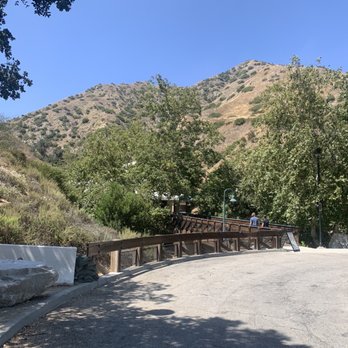
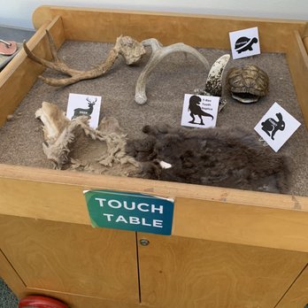
Stough Canyon Nature Center is a nice little getaway spot located just 15 minutes away from Hollywood Burbank Airport. It is also happened to be an entrance of the Stough Canyon Loop (2.4-mile loop trail). [Hours]: Sunday from 12 PM to 5 PM, Tuesday to Saturday from 9 AM to 5 PM, and closes on Monday. [Parking]: There's a small designated parking lot and there were empty of spot when I got here on Sunday. [Activities]: The center offers docent led hikes such as Moonlight Hikes and Wild Creatures Walk. Other activities include Woodcarving Workshop, Story Owl Hour, and other recreational classes. [What's inside]: You will get to see western hognose snake, a touch table of tortoise shell/rabbit fur/t-rex tooth replica/deer fur, and information displays. I did not have any cellular reception, but luckily the center offers free Wi-Fi. The staff was friendly and I had a friendly & quick chat too. A great stop to check out for 15 - 30 minutes. P.S. - Restroom is available just outside of the center. P.P.S. - There's a short & hidden trail called Shane Colin Proffitt Trail and it's a nice 5-minute walk. The entrance is located right next to the center (just off the parking lot) and the trail loops back to the driveway entrance of the Stough Canyon Nature Center.


Beautiful, clean and with lots of parking available. Come during the week if you can. The trails are less crowded and you can enjoy it all to yourself.


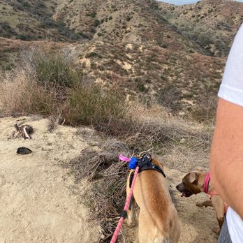
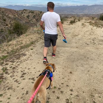
Been hiking here twice now, both times with my husband and our doggies. The first time we went up close to the top - not doing the full loop as I think its a 6+ mile loop. We went back down but took a narrower path that was a bit scary. This time we went back down the wider path - this was a nice 3 mile hike. I like this place because - one, there's a restroom there, two, if you can get there around 10am, it's not super crowded, three - the views are amazing, and lastly - it is dog friendly - dog bowl at the restroom area. There is a parking lot but we usually just find parking on the street right before.
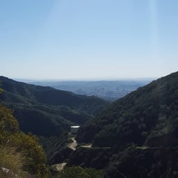

This is one of those reviews that almost pains me to write. Why? Simply because I don't want people to find out about this spot. I am VERY anti-social when it comes to hiking. Not only do I take it seriously in terms of exercise but it is also when I meditate and reflect so I don't like to hike with others and that includes not liking other people on the trails. I am not a Runyan Canyon "be seen" sort of gal. All of my secret hiking spots always get discovered after a few years and I am pushed away. Hopefully, that won't happen here as, Stough Canyon is MINE. Stough Canyon is located in the Verdugo Mountains and has a sort of nondescript entrance past a golf course. There is an actual small nature center building which I can't speak on because I haven't been inside (I have seen children attending birthday parties here so I think it can be rented out). The hike and trails themselves are probably my favorite in the Valley due to the mixture of the scenery/views and the energy in the mountain. Laurel Canyon on the Valley side has odd vibes and has become "stuffy" but you won't find that at Stough Canyon. Stough Canyon is best described as an intermediate hike. There is an immediate incline of 2000 feet and all the trails continue upwards past that. There really aren't that many flat portions. The trails are wide but very rocky: this is the type of hike NOT good for children/strollers/dogs because there are loose rocks everywhere. You will be transported into imagining what life was like when California was discovered. Make sure to wear proper supportive shoes or you will hurt your ankles and gets sediment into your shoes. Not to mention, there is little shade aside from the natural shading from trees and sides of the canyon. Therefore, this isn't as "easy" as some reviews state but perfect for hiking aficionados such as myself. Lovely views hit you instantly with a nice look during the first incline at downtown LA. Once you bypass this and hit the first fork; left takes you to the Old Youth Camp outlook which has a tree and picnic table and the most amazing views of the entire Valley. Are you a plane lover? You are right above the Burbank Airport and can just sit and watch planes take off or gaze at downtown LA. In fact, in the far distance (a bit difficult to see because of our lovely smog); you can even see the ocean! You can see the barges and boats! This is definitely the spot for all of you trendy folk who like taking photos in yoga poses with a great view in the background. Making a right at the fork is the more common path. You will get all up in the Verdugo Mountains like girls at a Bachlorette Party on Channing Tatum. This trail is rockier but also has a more lush scenery and with really neat rocks (you can collect and find awesome river rock/gems perfect for collecting or jewelry making). The wonderful thing about these trails are that there are so many options. Aside from the main trails, there are many offshoots which mountain bikers zoom past on. I have spent 2 hours at once at Stough taking a 12 mile hike and there are still more paths to explore! It is amazing and SO perfect without all the kids and unleashed dogs you find on other "hikes" (those are called "walks", people. You aren't hiking!). There are snakes, lizards, and coyotes so be careful with that especially those who hike at night for the views. The major downfall? Parking. The parking lot is very small so you usually have to park along the road leading up to the canyon so basically you are already hiking up before you even begin the hike! Annoying. I could rave about Stough Canyon all day. But I won't because it is my spot and I don't want it bombarded. Long story short though, this is an intermediate hike with great views and a very natural, rocky setting. Definitely the best in the East Valley. Now go away!


What a gem of a nature center in Burbank. Driving up to the parking lot, the roads are well maintained and the layout is orderly. Restrooms are clean, and they have toilets and sinks. The start of the running/hiking trail head is easily located as well. The only negative is that cell reception is very spotty and difficult to access, even at the parking lot. parking - free lot
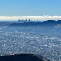

Great hikes for beginners and moderate-types alike. Plenty of parking and road-side parking in case the lot is full.
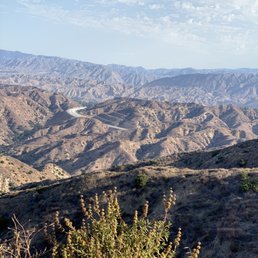

I have been hiking this trail a few times, and today I made it to the tower. I was feeling very accomplished especially hiking up from Stough Cyn to the Vital Link and going down and out at Wildwood Cyn. Brutal, I made many rest stops as I felt my knees are giving up. I took nice photos & videos. Not sure when or if I will do this again. Glad I did though.


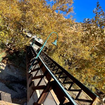
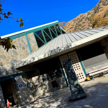

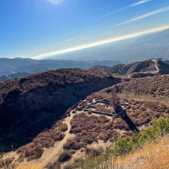


We Burbankers don't like to brag, but we've got a cozy nature center right past the golf course. Hold on to your purses and backpacks, as some live animals live inside and can be brought out for petting purposes. Who pets a snake? Some do. Easy free parking right outside the nature center with lots of interactive displays inside. There's also an outdoor theatre area for presentations and plenty of space for the summer kids' camp. Burbank's hiking trail starts right outside the front door and is now accessible to all with Burbank's new all-terrain hiking wheelchairs, available at no charge with a reservation. Best kept secret? Sparkling clean bathrooms inside. read more

We hiked to Verdugo Peak, so many pretty workers along the trail and at the peak. The fork where you take to Verdugo Peak, you'll find the tree of life and tower as well. For the avid hiker this is a moderate trail, slow steady incline all the way. Very nice view of the valley when the marine layer clears up. The tree of life has a swing on it, nice spot to enjoy the view. Good warm hike for me. read more


1 year ago
This is a moderate-advanced hike. You definitely want shoes that grip or hiking boots; dirt path with a good amount of rocks. Small parking lot but there's street parking a little further down the hill. read more

Truly a nice hike but not good for someone who is experiencing back pain or someone who cannot handle elevation. I came here around 7am after dropping off my sister's husband at the Burbank airport on a Saturday. My boyfriend was experiencing some back pain prior to the hike and I just brushed it off and told him to just walk it off. This hike is not meant for someone to "walk off pain" because there is so much incline. With incline, there is also decline which really destroys your already fragile body because you are walking at a consistent unfamiliar forward angle. The hike itself isn't too long and you can turn back whenever you want. It does loop around and it took us around an hour and a half to get down. The best thing is there are restrooms that are open early next to the nature center (even though the nature center opens at 9am). Plenty of street parking right with a bit of a walk then there is also actual parking at a lot which wasn't open when we got there at 7am (so it probably opens at 8am? Maybe). Overall, great hike, great views, and I would love to come back again! read more



1 year ago
This is a moderate trail where you can bring children or the elderly since it's not too difficult to get to the BUR airport overlook. The parking is free but there aren't too many spaces but we've never have had trouble finding a spot. If you love plane spotting then you will enjoy the overlook and see the flights take off and land. read more

1 year ago
It was a beautiful warm day, perfect for a bike ride! I rode my mountain bike from Vicory and Buena Vista up past DeBELL Golf Course . I rode my bike up to Strough Canyon Nature Center. After checking out the beautiful facility, I continued up the nature trail that starts there by the parking lot. The trail starts out with a gradual incline, then starts getting steeper as you go through the switch backs. I made it up to the first stop at the Half mile point. There is a bench there and a great view of DeBELL Golf Course. It was my first attempt to make it to the top. So I decided that would be a good first ride up the trail. read more


This hike is NO joke (especially the initial starting portion which is a bit of a climb) but it's a beautiful and well-maintained trail (all dirt). The trailhead has a nice restroom and a decent parking lot. The views of Burbank are unmatched at the top and there are some picnic tables to sit at to enjoy a snack or meal. I would definitely recommend this hike to others and I don't think you need a whole bunch of hiking experience to do this one. It's more of a decent walk on dirt with incline at a very points. read more
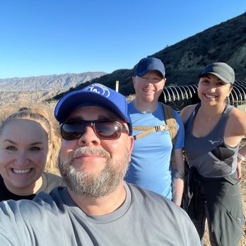


Stough Canyon Nature Center is a nice little getaway spot located just 15 minutes away from Hollywood Burbank Airport. It is also happened to be an entrance of the Stough Canyon Loop (2.4-mile loop trail). [Hours]: Sunday from 12 PM to 5 PM, Tuesday to Saturday from 9 AM to 5 PM, and closes on Monday. [Parking]: There's a small designated parking lot and there were empty of spot when I got here on Sunday. [Activities]: The center offers docent led hikes such as Moonlight Hikes and Wild Creatures Walk. Other activities include Woodcarving Workshop, Story Owl Hour, and other recreational classes. [What's inside]: You will get to see western hognose snake, a touch table of tortoise shell/rabbit fur/t-rex tooth replica/deer fur, and information displays. I did not have any cellular reception, but luckily the center offers free Wi-Fi. The staff was friendly and I had a friendly & quick chat too. A great stop to check out for 15 - 30 minutes. P.S. - Restroom is available just outside of the center. P.P.S. - There's a short & hidden trail called Shane Colin Proffitt Trail and it's a nice 5-minute walk. The entrance is located right next to the center (just off the parking lot) and the trail loops back to the driveway entrance of the Stough Canyon Nature Center. read more





3 years ago
Beautiful, clean and with lots of parking available. Come during the week if you can. The trails are less crowded and you can enjoy it all to yourself. read more


Been hiking here twice now, both times with my husband and our doggies. The first time we went up close to the top - not doing the full loop as I think its a 6+ mile loop. We went back down but took a narrower path that was a bit scary. This time we went back down the wider path - this was a nice 3 mile hike. I like this place because - one, there's a restroom there, two, if you can get there around 10am, it's not super crowded, three - the views are amazing, and lastly - it is dog friendly - dog bowl at the restroom area. There is a parking lot but we usually just find parking on the street right before. read more



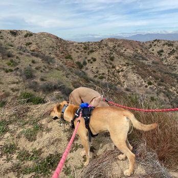


11 years ago
This is one of those reviews that almost pains me to write. Why? Simply because I don't want people to find out about this spot. I am VERY anti-social when it comes to hiking. Not only do I take it seriously in terms of exercise but it is also when I meditate and reflect so I don't like to hike with others and that includes not liking other people on the trails. I am not a Runyan Canyon "be seen" sort of gal. All of my secret hiking spots always get discovered after a few years and I am pushed away. Hopefully, that won't happen here as, Stough Canyon is MINE. Stough Canyon is located in the Verdugo Mountains and has a sort of nondescript entrance past a golf course. There is an actual small nature center building which I can't speak on because I haven't been inside (I have seen children attending birthday parties here so I think it can be rented out). The hike and trails themselves are probably my favorite in the Valley due to the mixture of the scenery/views and the energy in the mountain. Laurel Canyon on the Valley side has odd vibes and has become "stuffy" but you won't find that at Stough Canyon. Stough Canyon is best described as an intermediate hike. There is an immediate incline of 2000 feet and all the trails continue upwards past that. There really aren't that many flat portions. The trails are wide but very rocky: this is the type of hike NOT good for children/strollers/dogs because there are loose rocks everywhere. You will be transported into imagining what life was like when California was discovered. Make sure to wear proper supportive shoes or you will hurt your ankles and gets sediment into your shoes. Not to mention, there is little shade aside from the natural shading from trees and sides of the canyon. Therefore, this isn't as "easy" as some reviews state but perfect for hiking aficionados such as myself. Lovely views hit you instantly with a nice look during the first incline at downtown LA. Once you bypass this and hit the first fork; left takes you to the Old Youth Camp outlook which has a tree and picnic table and the most amazing views of the entire Valley. Are you a plane lover? You are right above the Burbank Airport and can just sit and watch planes take off or gaze at downtown LA. In fact, in the far distance (a bit difficult to see because of our lovely smog); you can even see the ocean! You can see the barges and boats! This is definitely the spot for all of you trendy folk who like taking photos in yoga poses with a great view in the background. Making a right at the fork is the more common path. You will get all up in the Verdugo Mountains like girls at a Bachlorette Party on Channing Tatum. This trail is rockier but also has a more lush scenery and with really neat rocks (you can collect and find awesome river rock/gems perfect for collecting or jewelry making). The wonderful thing about these trails are that there are so many options. Aside from the main trails, there are many offshoots which mountain bikers zoom past on. I have spent 2 hours at once at Stough taking a 12 mile hike and there are still more paths to explore! It is amazing and SO perfect without all the kids and unleashed dogs you find on other "hikes" (those are called "walks", people. You aren't hiking!). There are snakes, lizards, and coyotes so be careful with that especially those who hike at night for the views. The major downfall? Parking. The parking lot is very small so you usually have to park along the road leading up to the canyon so basically you are already hiking up before you even begin the hike! Annoying. I could rave about Stough Canyon all day. But I won't because it is my spot and I don't want it bombarded. Long story short though, this is an intermediate hike with great views and a very natural, rocky setting. Definitely the best in the East Valley. Now go away! read more
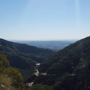
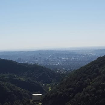
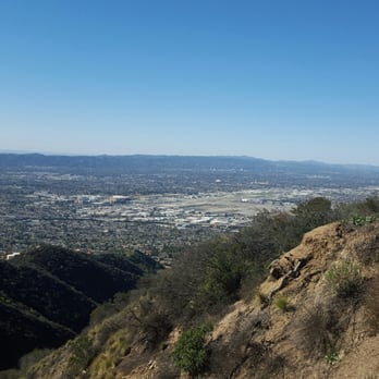


8 years ago
What a gem of a nature center in Burbank. Driving up to the parking lot, the roads are well maintained and the layout is orderly. Restrooms are clean, and they have toilets and sinks. The start of the running/hiking trail head is easily located as well. The only negative is that cell reception is very spotty and difficult to access, even at the parking lot. parking - free lot read more


5 years ago
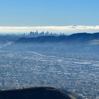
Great hikes for beginners and moderate-types alike. Plenty of parking and road-side parking in case the lot is full. read more

5 years ago
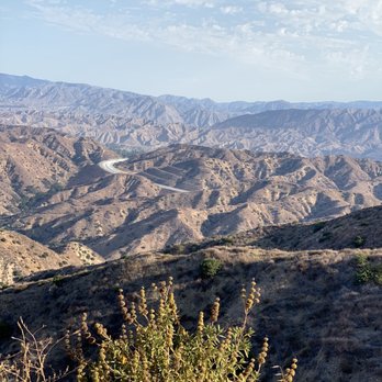
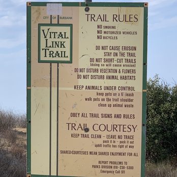
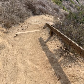
I have been hiking this trail a few times, and today I made it to the tower. I was feeling very accomplished especially hiking up from Stough Cyn to the Vital Link and going down and out at Wildwood Cyn. Brutal, I made many rest stops as I felt my knees are giving up. I took nice photos & videos. Not sure when or if I will do this again. Glad I did though. read more



5 years ago

6 years ago
Took me a bit to update this but, I finally made it to the radio tower about a month ago. It was worth it and breathtaking up there. The tree of life was beautiful as well, what an amazing experience it was! read more


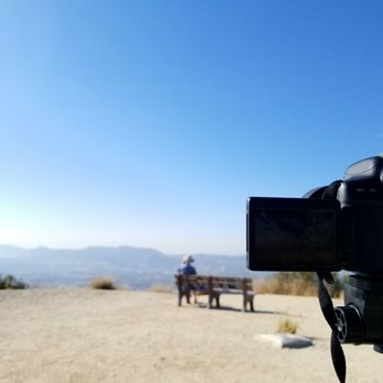

I love this hike! I attempt it three times, the first time I found out about it, I came but back out because i was afraid sun was setting and not being familiar w the hike I got scared lol! Second attempt went w my friend. We gave up after 1.5 miles because the sun was setting and it was getting late and we didn't know how much further until we make it to the chair. My third attempt, I went at 6:30am in the morning. I wanted to quit so bad because I had work at 10am n needed time to get down and get ready for work. But I decided to keep pushing. And I made it to the chair!!! To get to the chair, you follow the sign to the radio tower. I thought that I had a very long way to go because I thought the chair was at the radio tower!! But it's NOT!! Just Follow the sign, once you see the 2 mile marker you are only 5-10 mins from reaching the chair!! So worth it! Took me 1 hour 30 min less to get up and 35-40 min to get down . I ran half way down . read more
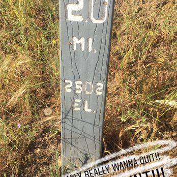


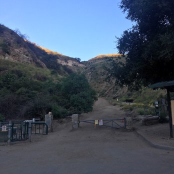


A liiiiiittle steep, but definitely doable. Stough Canyon's hiking area is open until 10pm and the Nature Center is open until 5pm everyday. There is a parking lot right at the head of the trail. If you're driving past a golf course, keep going-- you're on the right path. Because the Nature Center closes at 5pm, so do the restrooms! My friend and I got there around 6pm to get to "The View". It's 0.6 miles there, so 1.2 miles round trip-- just follow the signs to "The View". There are two benches there and a panoramic view of Los Angeles. There are other paths, but we were only interested with the view point. Stopped to take photos a few times.. we were in an out in less than an hour. read more


7 years ago
One of my all time favorite hiking spots, wide fire road and beautiful view by the table vista, I never get tired of hiking here as every day feels like a brand new day, I just saw the posting on Facebook that they just reopened after the repairs done Make sure you lock up and take valuable with you as I and some others have had incidences where cars were broken into, now they have signs for it Here is the announcement for reopening from Facebook page https://www.facebook.com/821536967898358/posts/2272221152829925?sfns=mo read more


8 years ago
This is my favorite hiking trail - not too intimidating for first-time hikers but challenging enough for seasoned ones. It is easy to get to, just a 5-min drive up Walnut from the Burbank Mall. Parking is always easy and there are restrooms at the parking area. The first few meters going up (about 15 to 20mins) still gets my heart rate up even after coming here for three years. After that it's easy breezy! The first time we did this trail it took us four hours as we took so many breaks but now I get to visit once a week and the whole going up and down takes 1.25 hours. We have seen several deers on the trail and a couple of snakes and sometimes a whole flock of black crows. People normally just hike but you see bikers every now and then. Love this place and it's never crowded! read more


8 years ago
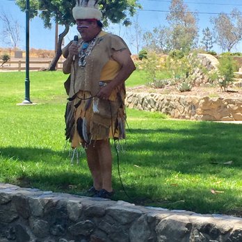
I forced myself up the canyon for the Halloween Haunted Maze. The parking and entrance was by the Starlight Bowl. I found parking. I saw the food trucks. There were police on duty... And my cellphone had no reception. The moon wasn't shining and other lights were sporadic. It was packed: couples on dates, single people, teen/college groups, families, city workers/volunteers. Ten-minutes from parking lot to entrance was scare enough for me. I can say it was a well planned event. And people that did the maze enjoyed it. I couldn't handle being there alone... So I went to the grocery store. Lolz. read more




8 years ago
Great hike! Constant uphill with nice and steady incline. Definitely come early or later in the day because there is no shade at all. So be careful if you decide to do it during a hot day!! **warning** as you go higher, you will run into fire ants(a lot!) . Be extra careful if you're bringing pets. Also once you notice fire ants, try not to stand in one place too long since that will allow the ants to crawl on to you!! You don't want to get bit once you're that high up because it will make it that much harder to get back. Other than no shade and lots of fire ants, this hike is a great work out!! read more


7 years ago
Nice hikes, no very crowded and well kept. Very recommend in cool seasons. There are not trees to look for shade in the summer though. Great views southeast of The Valley. read more


I discovered this place thanks to yelpers and it may have the best views in this part of Los Angeles. The trails are wide and easy. I have often looked at those Burbank mountains (Verdugo mountains) but never knew they were so great for hiking until recently. They have their own parking lot (free) and a nature center with nice, actual restrooms attached. Dogs are definitely allowed all over the park but they must be on-leash. This is especially important because this is one trail where mountain bikers come down fast and furious. My dog is a herding breed, so this is a call for her to chase, which is actually pretty dangerous for both the bikers and my pup. Because of this, she's on a harness if we hike here. However, it feels very safe, it's very open and like I said before, amazing scenery. Also, there are a lot of side trails and these are full of the random giant chair, or concrete picnic table, or remains of an old house, so it's a good area to explore if you start early. I haven't checked out the nature center (yet) but they seem cool, the only thing I wish they had were more garbage cans because I spend my return hike picking up everyone's plastic and dropping them in the only can on the lot. Also, go early in the morning not mid-day unless it's late fall, early spring or winter: it can get very hot here. read more


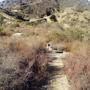


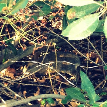
Stough Canyon Nature Center is amazing! I discovered it by accident when I was looking for the Castaways (turned up the wrong street, thank goodness). This past weekend my mom, brother and I decided to brave up the mountain and so glad we did. It was a beautiful Sunday afternoon, warm with a slight breeze here and there. The mountain is rather steep so I realized just how out of shape I really am (and it's bad). The first five minutes I was huffing and puffing but the burn from both the hike and sun felt great. It only took us about 15 minutes to get to the first scenic viewpoint and with my mom's Garmin watch it was able to tell us the distance, I think it was less than half a mile. We ended up hiking for the next 2 hours and got in over 3miles, we sat down to admire the view a few times. It was absolutely beautiful and breath taking (the hike and views). I'm in love with this place and can't wait to hike back up and have it kick my butt. Enjoy! *Parking isn't too bad, I was able to find a spot at 2pm on a Sunday afternoon. - I saw quite a few people bike it O__O WOW!!!! That is all I can say, I was slightly dying just walking up it, I couldn't imagine biking the sucker. KUDOS to you mountain bikers and your killer legs. -I also saw a few kids on this hike. A little girl who must have been 6 or 7 years old put me to shame. She was just walking and chatting along as if she was on the sidewalk instead of a the mountian side. If she could do it, anyone can :] read more
![Stough Canyon Nature Center - First viewpoint :] - Hiking Near Me - Burbank, California](https://s3-media0.fl.yelpcdn.com/bphoto/CWgfvZeQaAhRmMD8KbwK9A/348s.jpg "Stough Canyon Nature Center - First viewpoint :] - Hiking Near Me - Burbank, California")

11 years ago
BEWARE THERE ARE COYOTES HERE!!!! If you don't want your small dog bring eaten like Jessica Simpsons dog...you should carry them!!! I saw a pack of coyotes (around 5 or 6) starting at the golf course. I had two chihuahuas with me and it scared me!! While hiking a nice man warned me the coyotes come to the trails closer to the night fall. He even told me he's heard coyotes eating small dogs when they were by the foot of their owners, while on a leash. Anyways, the hike is past the golf course straight ahead. It's medium difficultly. At first there's a bit of an incline but it gets easier. Not leisurely and not too difficult. I really enjoyed this hike. We hiked for about an hour. It's clean, you get a nice view of the city and there's a bathroom. I will defiantly be back here again :) read more


13 years ago
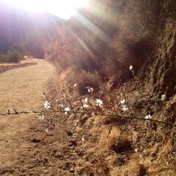
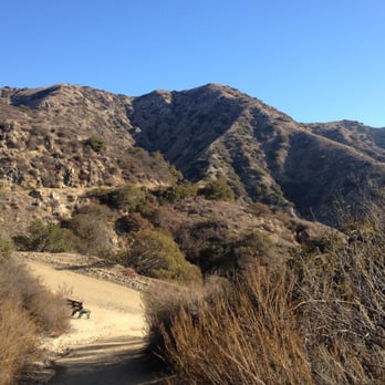
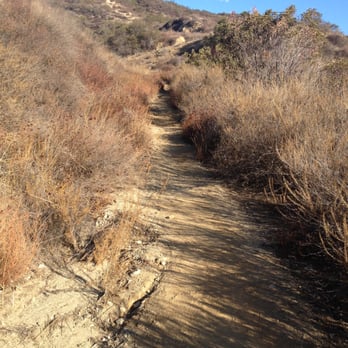
What?! Why haven't I written about this place yet?! I come here often, because it's such a gem! The views are exquisite! Be on the lookout for deer, rabbits, lizards, and birds too! They have a variety of paths that are easy to navigate. All the trails I've been on are just right, not too steep, not insanely difficult, but challenging enough for an excellent workout. If you make your way here before 8am, you can park right outside of the parking lot, no problem. Also after 9am it does get busier, but it's never horribly crowded. Plus some of the main paths are wide so even with more people, you're not going to feel like you're going to go over the side of the mountain trying to make room for others. Come prepared for exercise, fun and beauty here! read more




11 years ago
Great steep hike in the heart of the Burbank mountains. You would never know it existed if you didn't look for it though. It boasts some beautiful views which include Burbank, Glendale, SFV, and Dtla. If you go in the evening you can get some amazing sunset pics that shine off of the building in downtown. There are also many trails to pick from which connect at certain spots. read more


13 years ago
Page 1 of 3
More info about Stough Canyon Nature Center
2300 Walnut Ave
Burbank, CA 91501
Directions
(818) 238-5440
Call Now
Hours
Outdoor Amenities
Ask the Community - Stough Canyon Nature Center
Is this hike okay for a 4 year old and 9 year old?
It's a pretty tuff trail the best thing to do is try it before taking them. Unless there up for a challenge after the heat goes down.
Review Highlights - Stough Canyon Nature Center
You might also consider




























Why does Yelp recommend reviews?
5 reviews that are not currently recommended
The reviews below are not factored into the business's overall star rating.

6 years ago

11 years ago

12 years ago

5 years ago

10 years ago
Stough Canyon Nature Center - hiking - Updated September 2026
Best of Burbank
People found Stough Canyon Nature Center by searching for…
Trending Searches in Burbank, CA
Apple Orchards near Stough Canyon Nature Center
Apple Picking near Stough Canyon Nature Center
Archery near Stough Canyon Nature Center
Barbershop near Stough Canyon Nature Center
Baseball Fields near Stough Canyon Nature Center
Beautiful Views near Stough Canyon Nature Center
Bird Sanctuary near Stough Canyon Nature Center
Blow Dry Bar near Stough Canyon Nature Center
Consignment Shops near Stough Canyon Nature Center
Corn Maze near Stough Canyon Nature Center
Dog Friendly Things To Do near Stough Canyon Nature Center
Dog Parks near Stough Canyon Nature Center
Dog Swimming near Stough Canyon Nature Center
Eyelash Extensions near Stough Canyon Nature Center
Formal Wear near Stough Canyon Nature Center
Hiking Trails near Stough Canyon Nature Center
Kids Birthday Party near Stough Canyon Nature Center
Makeup Artists near Stough Canyon Nature Center
Mens Suits near Stough Canyon Nature Center
Off Road Trails near Stough Canyon Nature Center
Parks near Stough Canyon Nature Center
Photo Spots near Stough Canyon Nature Center
Picnic Areas near Stough Canyon Nature Center
Places To Take Pictures near Stough Canyon Nature Center
Playgrounds near Stough Canyon Nature Center
Private Schools near Stough Canyon Nature Center
Public Running Track near Stough Canyon Nature Center
Public Shower near Stough Canyon Nature Center
Pumpkin Patches near Stough Canyon Nature Center
River Swimming near Stough Canyon Nature Center
Rock Quarry near Stough Canyon Nature Center
Scenic Night View near Stough Canyon Nature Center
Scenic Overlook near Stough Canyon Nature Center
Sunrise View near Stough Canyon Nature Center
Browse Nearby
BEST of Burbank, California Coffee near Stough Canyon Nature Center
BEST of Burbank, California Restaurants near Stough Canyon Nature Center
BEST of Burbank, California Things to Do near Stough Canyon Nature Center
BEST of Burbank, California Breakfast near Stough Canyon Nature Center
BEST of Burbank, California Walking Trails near Stough Canyon Nature Center
BEST of Burbank, California Parks near Stough Canyon Nature Center
BEST of Burbank, California Campgrounds near Stough Canyon Nature Center
BEST of Burbank, California Airport near Stough Canyon Nature Center
BEST of Burbank, California Motel near Stough Canyon Nature Center
Browse Brands
Related Searches in Burbank, CA
Best Camp Locations and Facilities in Burbank, California
Best Day Camps for Children in Burbank, California
Best Dog Hiking Trails Around Burbank, California
Best Fishing Locations and Guides in Burbank, California
Best Gymnastics for Kids Activities in Burbank, California
Best Kids Camps Available in Burbank, California
Best Montessori Preschools Available in Burbank, California
Best Nature Trails for Hiking in Burbank, California
Best Off Leash Dog Parks in Burbank, California
Best Parks for Parties and Events in Burbank, California
Best Places for Horseback Riding in Burbank, California
Best Summer Camps for Kids Located in Burbank, California
Best Water Parks for Kids in Burbank, California
Check Out Great Playgrounds in Burbank, California
Check Out Off Road Trails in Burbank, California
Daycares With Cameras for Peace of Mind in Burbank, California
Discover Baseball Fields Around Burbank, California
Discover Dog Friendly Trails to Explore in Burbank, California
Discover Easy Hiking Trails Near Burbank, California
Discover Fun Toddler Parks in Burbank, California for Your Little One
Discover Kid Friendly Hiking Trails in Burbank, California
Discover Lakes & Ponds to Explore in Burbank, California
Discover Popular Bike Trails in Burbank, California
Discover Scenic Mountain Bike Trails Near Burbank, California
Discover Soccer Fields in Burbank, California Near You
Discover Top Nature Parks to Visit in Burbank, California
Discover Top State Parks to Visit in Burbank, California
Discover Walking Parks in Burbank, California Near You
Discover a Hiking Trail in Burbank, California
Discover the Best Kids Park Spots in Burbank, California
Discover the Best Night Hike Trails in Burbank, California
Dog-Friendly Hikes With Dogs in Burbank, California
Enjoy Camping Adventures Around Burbank, California
Enjoy Kayaking Adventures in Burbank, California
Enjoy Off Leash Dog Hikes in Burbank, California
Enjoy Scenic Places to Walk in Burbank, California
Enjoy a Beautiful Waterfall Hike in Burbank, California
Enjoy the Best Picnic Spots and Ideas in Burbank, California
Enjoy the Best Walking Path in Burbank, California
Enjoy the Best Walking Trails in Burbank, California
Explore After School Programs Available in Burbank, California
Explore Beautiful Parks and Green Spaces in Burbank, California
Explore Easy Hikes Perfect for All in Burbank, California
Explore Free Kids Activities Near Burbank, California
Explore Free Picnic Areas Around Burbank, California
Explore Free Preschools Near Burbank, California
Explore Fun Activities to Do in Burbank, California


