
Sage Ranch Park Photos


You might also consider


More like Sage Ranch Park
Recommended Reviews - Sage Ranch Park
Start your review...


Reviews With Photos


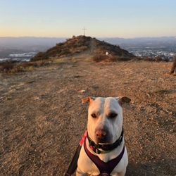
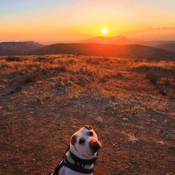
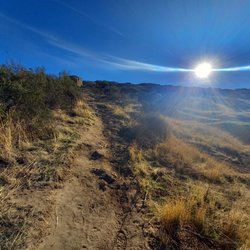
When you need to recharge, this is the place to go, especially if you live near here. The loop is great way to get in some exercise and remind yourself that not everything is on your phone. All you need to do is look up... and look around. Check out my pics!


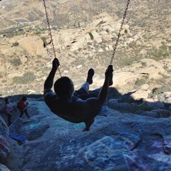
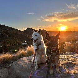
Best thing about this park is that it's empty. That's the most surprising thing too. So many people have yelped good things about it and every time I go, there might be 2 or 3 other people or couples there at the most. We bring the dogs and climb the rocks and frolic through the grass and weeds. The dogs love it. There's even a camp site looking area with parking stalls for all. They even have a little amphitheater type seating area. https://fbcdn-sphotos-f-a.akamaihd.net/hphotos-ak-xfp1/t1.0-9/10303450_10152451026815259_49549126336655434_n.jpg

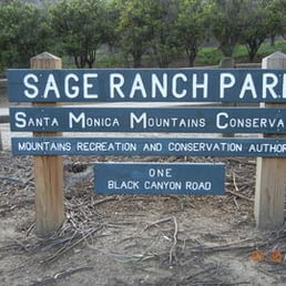

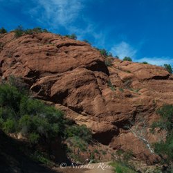
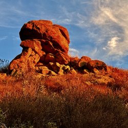
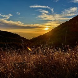
BACKGROUND: Located high in the northwestern Simi Hills between the San Fernando and Simi Valleys at the Los Angeles-Ventura county line, 625-acre Sage Ranch Park provides some of the most beautiful and easily accessible trails in the area. Park features include massive sandstone rock formations, expansive views, ample parking, an outdoor amphitheater with views of the spectacular outcroppings, picnic tables, restrooms and drinking fountains. Situated in a critical cross-mountain wildlife corridor, the park is rich with fragrant coastal sage scrub, chaparral, native grasses, oak woodlands, and wildflower meadows. Avocado and orange groves - remnants of the site's ranching history - remain. The southwest region of the park contains a significant riparian area replete with oaks, sycamores, walnuts, and ferns. Springtime at Sage Ranch brings running springs and lush grass to the park - a brilliant contrast to the tawny sandstone rock outcroppings. STATS: Distance: 2.6 mile loop trail Elevation Gain: Less than 500 ft. depending what you do More of a stroll Snakes on trail Poison Oak grows freely Ten campground sites Tent camping only Available by advance reservation for organized groups OUR ROUTE: Sage Ranch is where The Crew has celebrated their anniversary for the past several years. We don't really take any type of route, we tend to just roam around the ranch and climb some rocks to work up and appetite for our potluck dinner ending the evening with a really bad movie and sleepover. Sage Ranch is quaint place to get away from everything and just relax. There are no difficult trails or routes, but plenty to see and do. As you can see the sunsets are always amazing. But watch out there are snakes and poison oak throughout the area. DISCLAIMER: Hiking is not something that can be taken lightly. It can be life-threatening as you see and hear on the news, people die or get lost all time. Please, if you are going to hike, never go alone and prepare for the worst, hope for the best. Remember when going for a hike, no matter how short you think it may be, always be prepared. Carry at least two liters of water for every five miles (more if the weather is warm), protein bar, nuts, and electrolytes. Wear sturdy lug sole shoes and protective clothing. Some areas the weather can change quicker than a fireman can put on his gear. It is also very important, always always always let a family member or friend know where you are going and when you expect to be back. Lastly, have fun when you hike it up.


Huge park which is great for hiking. Helped my daughter plant her first oak tree. Sky Valley Volunteers are helping plant trees in the park.


Took this hike yesterday for the first time and absolutely loved it! There's so much to see here, massive rock outcroppings to climb, green fields of grass and stunning wildflowers. We did take the detour and unlike other reviewers, we didn't find it difficult at all and I am not a rock star athlete by any means. Perhaps it's because the trail has dried out now, so it's not as slippery going up and down the inclines as it may have been a few weeks back. He detour has some steep inclines but no, more difficult than other hikes in the area.


Sage Ranch Park is not named after the plant which is abundant here. It is named for the rancher who raised cattle here from the mid 1940's until the mid 1980's. You can either park down the hill by the entrance, or drive up the hill toward the campground and park there like I did and pay an honor system of $5.00. You can also drive up there just to have a picnic and enjoy the view. We walked down toward the oak covered campground and pick up the trail head adjacent to campsite #7 (trail loop). The trail meanders through the Chatsworth formation sandstone whose tilted structure is evidence of the Simi Hills rapid uplift. The northern portion of the loop provides nice views of the east end of Simi Valley. The many sandstone boulders provide a means of avoiding the heavy chaparral growth to gain access to the scenic views. There's a fairly well hidden picnic table on the south side of the loop trail that would make a nice place for a picnic on a sunny day. (34.23725°N 118.68080°W). The trail shoots between a sandstone formation and a stand of Eucalyptus. A normally dry creek runs just south of the trees. I would recommend this hike to anyone looking for an easy (close to the city) hike. RATTLESNAKE WARNING: be careful if you bring dogs or children there are a lot of rattlesnakes here. We stumbled upon a Southern Pacific rattlesnake and heard lots of shaking in the brush by the trail. I would wear tall hiking boots and loose pants. I gave this place a lower review because the amount of snake activity. It freaks me out so it makes my experience less enjoyable. If you go in cooler months and are not intimidated by rattlesnakes you most likely would give this place a higher review. I do however recommend a drive up to the top picnic area just to take in the view.


What a great little hidden gem! We hiked in winter, so no signs of rattlesnakes, but I can certainly understand why you may see a lot of them in warmer seasons, there are tons of rocks for them to sun. A few things to note going up to the park: 1.) You cannot bike or jog to the site, there are multiple signs prohibiting this, it could be dangerous. 2.) It is a STEEP incline on the car ride up from the main road, this makes some people very nervous, if you're one of them, you may want to skip this. 3.) When you pull in, the first parking lot is free, if you head up through the second gate on the right, the parking is $5 at the Iron Ranger. 4.) There are (2) portable toilets, one in the paid parking lot and one in the campground. 5.) The paid parking lot has two trail entrances, one on the left, and one on the right, I recommend taking the trailhead on the right, as getting onto the loop is much more straightforward. 6.) If you take the trailhead on the left, find campsite #7 to the entrance of the loop trail. When you get to the loop trail sign at the fork in the road, go left, going right just takes you straight back to the parking lot. 7.) There are picnic tables, so bring a lunch/dinner or snack! We really enjoyed our hike, it was not particularly strenuous (but we are avid hikers). Newbies may struggle a bit, but it should still be "doable" for most people. It is not designed to be wheelchair accessible or stroller accessible. My husband and I are BIG fans of Valley history, and he has wanted to get a good view of the Santa Susana Field Lab for a long time, so he was REALLY excited to see it. If you are a history buff too, a simple Google search will shock and amaze you, and you'll want to get right back out on the trail to check it out too. Happy hiking!


What a great morning out. I love it here we took lots of photographs. Easy hike some great views. Pack a lunch and some water and off you go. Don't forget to pay your $5.00 fee when you park. Enjoy


8 years ago
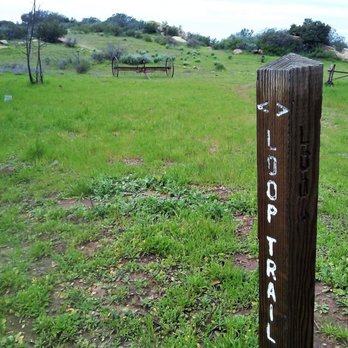
Anyone who describes this as an "entry level hike" has a really different idea than me of what "entry level" is. It ISN'T having to slide down a hill on my butt because the trail is so steep and muddy there's simply no other safe way to descend. It ISN'T having segments of the trail so close to the edge of a steep embankment -- and so slanted -- that you have to get down on your hands and knees to get through, hoping you don't slide off anyway because of the mud. Now granted, I'm talking about the DETOUR segment of the trail here. As others have pointed out, the first part of the hike, till you get to the detour, isn't too bad, and of course there are wonderful views all the way along. If the full, original trail ever reopens, or they create a better, safer detour, I'd happily add more stars to my review. However, if you're not an athlete and/or a daredevil, my recommendation is (1) take a really sturdy hiking pole and (2) turn around and go back as soon as you spot that "Loop Trail Detour" sign! Trust me - it's a sign from God!! read more


7 years ago
When you need to recharge, this is the place to go, especially if you live near here. The loop is great way to get in some exercise and remind yourself that not everything is on your phone. All you need to do is look up... and look around. Check out my pics! read more


12 years ago
Best thing about this park is that it's empty. That's the most surprising thing too. So many people have yelped good things about it and every time I go, there might be 2 or 3 other people or couples there at the most. We bring the dogs and climb the rocks and frolic through the grass and weeds. The dogs love it. There's even a camp site looking area with parking stalls for all. They even have a little amphitheater type seating area. https://fbcdn-sphotos-f-a.akamaihd.net/hphotos-ak-xfp1/t1.0-9/10303450_10152451026815259_49549126336655434_n.jpg read more



4 years ago
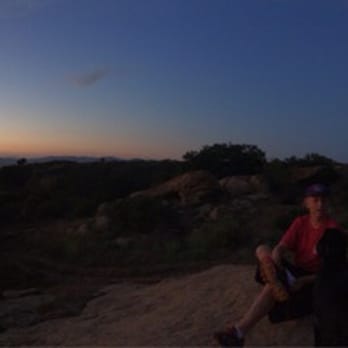
Great 2 mile loop. Can be changing at the end with the hills. Fun to see the backside of the plant read more


12 years ago
BACKGROUND: Located high in the northwestern Simi Hills between the San Fernando and Simi Valleys at the Los Angeles-Ventura county line, 625-acre Sage Ranch Park provides some of the most beautiful and easily accessible trails in the area. Park features include massive sandstone rock formations, expansive views, ample parking, an outdoor amphitheater with views of the spectacular outcroppings, picnic tables, restrooms and drinking fountains. Situated in a critical cross-mountain wildlife corridor, the park is rich with fragrant coastal sage scrub, chaparral, native grasses, oak woodlands, and wildflower meadows. Avocado and orange groves - remnants of the site's ranching history - remain. The southwest region of the park contains a significant riparian area replete with oaks, sycamores, walnuts, and ferns. Springtime at Sage Ranch brings running springs and lush grass to the park - a brilliant contrast to the tawny sandstone rock outcroppings. STATS: Distance: 2.6 mile loop trail Elevation Gain: Less than 500 ft. depending what you do More of a stroll Snakes on trail Poison Oak grows freely Ten campground sites Tent camping only Available by advance reservation for organized groups OUR ROUTE: Sage Ranch is where The Crew has celebrated their anniversary for the past several years. We don't really take any type of route, we tend to just roam around the ranch and climb some rocks to work up and appetite for our potluck dinner ending the evening with a really bad movie and sleepover. Sage Ranch is quaint place to get away from everything and just relax. There are no difficult trails or routes, but plenty to see and do. As you can see the sunsets are always amazing. But watch out there are snakes and poison oak throughout the area. DISCLAIMER: Hiking is not something that can be taken lightly. It can be life-threatening as you see and hear on the news, people die or get lost all time. Please, if you are going to hike, never go alone and prepare for the worst, hope for the best. Remember when going for a hike, no matter how short you think it may be, always be prepared. Carry at least two liters of water for every five miles (more if the weather is warm), protein bar, nuts, and electrolytes. Wear sturdy lug sole shoes and protective clothing. Some areas the weather can change quicker than a fireman can put on his gear. It is also very important, always always always let a family member or friend know where you are going and when you expect to be back. Lastly, have fun when you hike it up. read more


7 years ago
Huge park which is great for hiking. Helped my daughter plant her first oak tree. Sky Valley Volunteers are helping plant trees in the park. read more


7 years ago
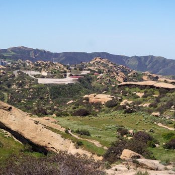
Took this hike yesterday for the first time and absolutely loved it! There's so much to see here, massive rock outcroppings to climb, green fields of grass and stunning wildflowers. We did take the detour and unlike other reviewers, we didn't find it difficult at all and I am not a rock star athlete by any means. Perhaps it's because the trail has dried out now, so it's not as slippery going up and down the inclines as it may have been a few weeks back. He detour has some steep inclines but no, more difficult than other hikes in the area. read more




8 years ago

8 years ago

7 years ago

16 years ago
Sage Ranch Park is not named after the plant which is abundant here. It is named for the rancher who raised cattle here from the mid 1940's until the mid 1980's. You can either park down the hill by the entrance, or drive up the hill toward the campground and park there like I did and pay an honor system of $5.00. You can also drive up there just to have a picnic and enjoy the view. We walked down toward the oak covered campground and pick up the trail head adjacent to campsite #7 (trail loop). The trail meanders through the Chatsworth formation sandstone whose tilted structure is evidence of the Simi Hills rapid uplift. The northern portion of the loop provides nice views of the east end of Simi Valley. The many sandstone boulders provide a means of avoiding the heavy chaparral growth to gain access to the scenic views. There's a fairly well hidden picnic table on the south side of the loop trail that would make a nice place for a picnic on a sunny day. (34.23725°N 118.68080°W). The trail shoots between a sandstone formation and a stand of Eucalyptus. A normally dry creek runs just south of the trees. I would recommend this hike to anyone looking for an easy (close to the city) hike. RATTLESNAKE WARNING: be careful if you bring dogs or children there are a lot of rattlesnakes here. We stumbled upon a Southern Pacific rattlesnake and heard lots of shaking in the brush by the trail. I would wear tall hiking boots and loose pants. I gave this place a lower review because the amount of snake activity. It freaks me out so it makes my experience less enjoyable. If you go in cooler months and are not intimidated by rattlesnakes you most likely would give this place a higher review. I do however recommend a drive up to the top picnic area just to take in the view. read more


7 years ago

10 years ago
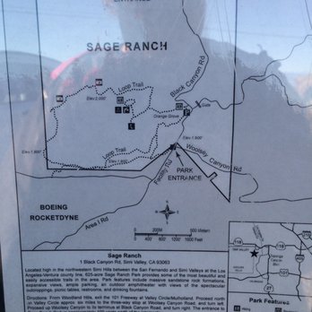
What a great little hidden gem! We hiked in winter, so no signs of rattlesnakes, but I can certainly understand why you may see a lot of them in warmer seasons, there are tons of rocks for them to sun. A few things to note going up to the park: 1.) You cannot bike or jog to the site, there are multiple signs prohibiting this, it could be dangerous. 2.) It is a STEEP incline on the car ride up from the main road, this makes some people very nervous, if you're one of them, you may want to skip this. 3.) When you pull in, the first parking lot is free, if you head up through the second gate on the right, the parking is $5 at the Iron Ranger. 4.) There are (2) portable toilets, one in the paid parking lot and one in the campground. 5.) The paid parking lot has two trail entrances, one on the left, and one on the right, I recommend taking the trailhead on the right, as getting onto the loop is much more straightforward. 6.) If you take the trailhead on the left, find campsite #7 to the entrance of the loop trail. When you get to the loop trail sign at the fork in the road, go left, going right just takes you straight back to the parking lot. 7.) There are picnic tables, so bring a lunch/dinner or snack! We really enjoyed our hike, it was not particularly strenuous (but we are avid hikers). Newbies may struggle a bit, but it should still be "doable" for most people. It is not designed to be wheelchair accessible or stroller accessible. My husband and I are BIG fans of Valley history, and he has wanted to get a good view of the Santa Susana Field Lab for a long time, so he was REALLY excited to see it. If you are a history buff too, a simple Google search will shock and amaze you, and you'll want to get right back out on the trail to check it out too. Happy hiking! read more




12 years ago


15 years ago
What a great morning out. I love it here we took lots of photographs. Easy hike some great views. Pack a lunch and some water and off you go. Don't forget to pay your $5.00 fee when you park. Enjoy read more


13 years ago
Really beautiful park. When we went, the campground looked like a ghost town, but it was a fun experience frolicking about the brush and rocks. read more

6 years ago

13 years ago
9 years ago

10 years ago

14 years ago

10 years ago

11 years ago

10 years ago
More info about Sage Ranch Park
Ask the Community - Sage Ranch Park
Review Highlights - Sage Ranch Park
You might also consider














Why does Yelp recommend reviews?
5 reviews that are not currently recommended
The reviews below are not factored into the business's overall star rating.
2 years ago
3 years ago
13 years ago
13 years ago
4 years ago
Sage Ranch Park - hiking - Updated September 2026
Best of Simi Valley
People found Sage Ranch Park by searching for…
Places to Take Pictures in Simi Valley, CA
Scenic View in Simi Valley, CA
Scenic Drive in Simi Valley, CA
Beautiful Views in Simi Valley, CA
Watch Sunset in Simi Valley, CA
Photo Spots in Simi Valley, CA
Hiking Trails in Simi Valley, CA
Campgrounds in Simi Valley, CA
Scenic Overlook in Simi Valley, CA
Fishing Spots in Simi Valley, CA
Sunset View in Simi Valley, CA
Picnic Areas in Simi Valley, CA
Ghost Towns in Simi Valley, CA
Orange Groves in Simi Valley, CA
Secluded Spots in Simi Valley, CA
Parks With Pull Up Bars in Simi Valley, CA
Beach Camping in Simi Valley, CA
Tent Camping in Simi Valley, CA
River Swimming in Simi Valley, CA
Flower Field in Simi Valley, CA
Trending Searches in Simi Valley, CA
Barbershop For Men near Sage Ranch Park
Bike Shop near Sage Ranch Park
Bird Sanctuary near Sage Ranch Park
Boardwalk near Sage Ranch Park
Cliff Jumping near Sage Ranch Park
Consignment Shops near Sage Ranch Park
Cruising Spots near Sage Ranch Park
Dog Friendly Beaches near Sage Ranch Park
Dog Friendly Things To Do near Sage Ranch Park
Ear Piercing near Sage Ranch Park
Eyebrow Threading near Sage Ranch Park
Fishing Spots near Sage Ranch Park
Flower Fields near Sage Ranch Park
Hair Braiding near Sage Ranch Park
Kids Haircut near Sage Ranch Park
Lookout Points near Sage Ranch Park
Picnic Areas near Sage Ranch Park
Playgrounds near Sage Ranch Park
Preschools near Sage Ranch Park
Private Schools near Sage Ranch Park
Public Golf Courses near Sage Ranch Park
Public Running Track near Sage Ranch Park
Public Tennis Courts near Sage Ranch Park
Rock Quarry near Sage Ranch Park
Scenic Night View near Sage Ranch Park
Scenic Overlook near Sage Ranch Park
Sunrise View near Sage Ranch Park
Swimming Holes near Sage Ranch Park
Things To Do Alone near Sage Ranch Park
Trading Card Shops near Sage Ranch Park
Used Furniture Stores near Sage Ranch Park
Browse Nearby
BEST of Simi Valley, California Restaurants near Sage Ranch Park
BEST of Simi Valley, California Coffee near Sage Ranch Park
BEST of Simi Valley, California Things to Do near Sage Ranch Park
BEST of Simi Valley, California Parks near Sage Ranch Park
BEST of Simi Valley, California Breakfast near Sage Ranch Park
BEST of Simi Valley, California Lakes near Sage Ranch Park
BEST of Simi Valley, California Campgrounds near Sage Ranch Park
Browse Brands
Related Searches in Simi Valley, CA
Best Dog Hiking Trails Around Simi Valley, California
Best Fishing Locations and Guides in Simi Valley, California
Best Nature Trails for Hiking in Simi Valley, California
Best Off Leash Dog Parks in Simi Valley, California
Best Parks for Parties and Events in Simi Valley, California
Best Places for Horseback Riding in Simi Valley, California
Best Water Parks for Kids in Simi Valley, California
Check Out Great Playgrounds in Simi Valley, California
Check Out Off Road Trails in Simi Valley, California
Discover Baseball Fields Around Simi Valley, California
Discover Dog Friendly Trails to Explore in Simi Valley, California
Discover Easy Hiking Trails Near Simi Valley, California
Discover Fun Toddler Parks in Simi Valley, California for Your Little One
Discover Kid Friendly Hiking Trails in Simi Valley, California
Discover Lakes & Ponds to Explore in Simi Valley, California
Discover Popular Bike Trails in Simi Valley, California
Discover Scenic Mountain Bike Trails Near Simi Valley, California
Discover Soccer Fields in Simi Valley, California Near You
Discover Top Nature Parks to Visit in Simi Valley, California
Discover Top State Parks to Visit in Simi Valley, California
Discover Walking Parks in Simi Valley, California Near You
Discover a Hiking Trail in Simi Valley, California
Discover the Best Beaches in Simi Valley, California
Discover the Best Kids Park Spots in Simi Valley, California
Discover the Best Night Hike Trails in Simi Valley, California
Dog-Friendly Hikes With Dogs in Simi Valley, California
Enjoy Camping Adventures Around Simi Valley, California
Enjoy Kayaking Adventures in Simi Valley, California
Enjoy Off Leash Dog Hikes in Simi Valley, California
Enjoy Scenic Places to Walk in Simi Valley, California
Enjoy Tent Camping Spots Around Simi Valley, California
Enjoy a Beautiful Waterfall Hike in Simi Valley, California
Enjoy the Best Picnic Spots and Ideas in Simi Valley, California
Enjoy the Best Walking Path in Simi Valley, California
Enjoy the Best Walking Trails in Simi Valley, California
Explore Beautiful Parks and Green Spaces in Simi Valley, California
Explore Easy Hikes Perfect for All in Simi Valley, California
Explore Free Picnic Areas Around Simi Valley, California
Explore Fun Activities to Do in Simi Valley, California
Explore Parks With Pull Up Bars in Simi Valley, California
Explore Picnic Parks Near Simi Valley, California
Explore Popular Campgrounds Near Simi Valley, California
Explore Popular Kids Parks Throughout Simi Valley, California
Explore Popular Picnic Areas Around Simi Valley, California
Explore Popular RV Parks Around Simi Valley, California
Explore Scenic Lakes to Visit in Simi Valley, California
Explore Top Dog Parks in Simi Valley, California Near You


