Three Creeks Trail Photos


You might also consider


More like Three Creeks Trail
Recommended Reviews - Three Creeks Trail
Start your review...


Reviews With Photos

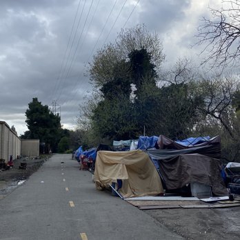
unfortunately the trail has turned into a homeless encampment. It's shocking to see how many encampments are in the creek and alongside the trail. the trail is unusable to residents. So sad how much money was spent on this trail and it is not being maintained. There is a clear law that prohibits encampments along trails and 100 feet of trails.


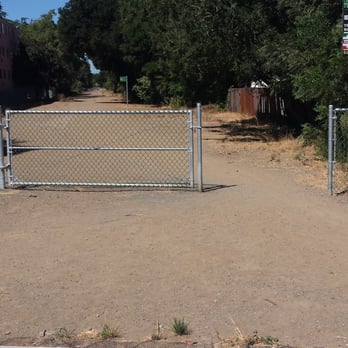
I'm going to preface this review with a quick history lesson on this trail since it is relatively new and a lot of people may not be familiar with it. History- This trail is basically the old UPR tracks that ran through the Central San José/Willow Glen area for years; they originally wanted to call the trail "The Willow Glen Spur" after the railine, but settled on the "Three Creeks" moniker because the trail crosses over three existing trails (Guadalupe River, Coyote Creek, and Los Gatos Creek). The railroad line hasn't ran since 2000 and the tracks were subsequently removed around 2004. After many years of debate, planning and land acquisition the City -in conjunction with other government entities (i.e., The County, SCVWD, Santa Clara County Open Space Preserve and the State of CA)- the trail finally opened on an "interim" basis sometime this year (2013). Currently only the western span of this trail is open which begins at end of Lonus St by the Los Gatos Creek Trail and ends at the cul-de-sac of Falcon Pl which is where the trail will cross the Guadalupe River. The eastern span is still in the design/discussion phase and no date has been announced when that will be open. Review- As I stated earlier in the history portion -You were paying attention weren't you?- 3-Creeks crosses over existing trails and this alignment causes it to be a very useful trail. Unfortunately, it only seems to be useful to the much vaunted Local Outdoor Enthusiasts (LOE). My co-workers and I jokingly refer to it as the "Hobo Highway" because that's the only people we've ever seen use it. It's essentially a quick way to get from Downtown to the Ranch Town Recycling center on Lincoln Ave. Granted I've never tried it on a weekend but I know one thing about Silicon Valley residents and it's that they love their trails; good trails are always busy even during the work week. Go to Los Alamitos Creek Trail or Los Gatos Creek Trail - #1 & #2, respectively, in my book - and you'll always find them hustling and bustling with activity; no matter what the day or time. This trail is a veritable Ghost Town except for the LOE cruising up and down. I know this isn't a final product -thus the "interim" status- but it really leaves something to be desired. A majority of the trail is compacted dirt and not paved A/C like the better trails are. Dirt is OK, I suppose, but no one like kicking up dust and running on jagged rocks except for teenagers and people on BMX bikes; two things I am not. Plus there's a lot of safety concerns that need addressing like a lack of crosswalks at all the major street crossings (e.g., Bird Ave,Willow St, Coe Ave, & Minnesota Ave) and, my personal favorite, the northwesterly section of the trail that ends at Lonus St leads you right into a dead end and a scary-looking LOE encampment at the Los Gatos Creek Trailhead. Not good. Some poor old lady's gonna decide to go for a walk one day, to see where it goes, and end up in a potentially bad situation. I feel bad bashing an unfinished product, but it is technically open and I feel the need to inform and educate; I'm silly like that. I will gladly update my review once the whole thing is up and open for business but until such time I will stick with the LAC and the LGC for all my trail needs.

2 years ago
This is a good bike trail. For the most part there are no blind spots where you cannot see people walking or jogging. This makes it easy as long as cyclists can let these people know if your coming up behind th read more

I am surprised by the 3.5 ratings. It is great to have an urban trail where you can go for a nice bike ride or walk in the middle of all the concrete we are surrounded by. Keep in mind that parking is limited to street parking, there is no shade and you are crossing city streets to stay on the trail...still this is a blessing! Make sure you stop by the gushing creek (at least now) under the bridge and stop to read the signs that have information on the history of the area and the trail. read more


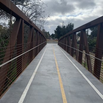


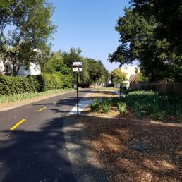
3-Star average? Really? What do you expect from an urban walkway? We just discovered this trail and stopped by with the dog (Zoey) to check it out for about an hour walk. We did not walk the entire thing, so we will check out the rest of it again another time. The former railroad is a fine place to walk, run, rollerblade, or ride your bike. And it is dog-friendly. Since it goes through residential neighborhoods, there are plenty of places to enter/leave the trail. For a paved multi-use walkway in Willow Glen, it is actually quite nice and pleasant. There are a few benches, dog poop bags, and garbage cans, but not much else. If you find it wanting, perhaps you expect too much. I can say that Zoey certainly enjoyed it! read more


3 years ago
unfortunately the trail has turned into a homeless encampment. It's shocking to see how many encampments are in the creek and alongside the trail. the trail is unusable to residents. So sad how much money was spent on this trail and it is not being maintained. There is a clear law that prohibits encampments along trails and 100 feet of trails. read more
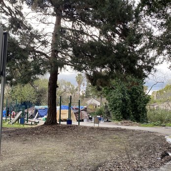


I'm going to preface this review with a quick history lesson on this trail since it is relatively new and a lot of people may not be familiar with it. History- This trail is basically the old UPR tracks that ran through the Central San José/Willow Glen area for years; they originally wanted to call the trail "The Willow Glen Spur" after the railine, but settled on the "Three Creeks" moniker because the trail crosses over three existing trails (Guadalupe River, Coyote Creek, and Los Gatos Creek). The railroad line hasn't ran since 2000 and the tracks were subsequently removed around 2004. After many years of debate, planning and land acquisition the City -in conjunction with other government entities (i.e., The County, SCVWD, Santa Clara County Open Space Preserve and the State of CA)- the trail finally opened on an "interim" basis sometime this year (2013). Currently only the western span of this trail is open which begins at end of Lonus St by the Los Gatos Creek Trail and ends at the cul-de-sac of Falcon Pl which is where the trail will cross the Guadalupe River. The eastern span is still in the design/discussion phase and no date has been announced when that will be open. Review- As I stated earlier in the history portion -You were paying attention weren't you?- 3-Creeks crosses over existing trails and this alignment causes it to be a very useful trail. Unfortunately, it only seems to be useful to the much vaunted Local Outdoor Enthusiasts (LOE). My co-workers and I jokingly refer to it as the "Hobo Highway" because that's the only people we've ever seen use it. It's essentially a quick way to get from Downtown to the Ranch Town Recycling center on Lincoln Ave. Granted I've never tried it on a weekend but I know one thing about Silicon Valley residents and it's that they love their trails; good trails are always busy even during the work week. Go to Los Alamitos Creek Trail or Los Gatos Creek Trail - #1 & #2, respectively, in my book - and you'll always find them hustling and bustling with activity; no matter what the day or time. This trail is a veritable Ghost Town except for the LOE cruising up and down. I know this isn't a final product -thus the "interim" status- but it really leaves something to be desired. A majority of the trail is compacted dirt and not paved A/C like the better trails are. Dirt is OK, I suppose, but no one like kicking up dust and running on jagged rocks except for teenagers and people on BMX bikes; two things I am not. Plus there's a lot of safety concerns that need addressing like a lack of crosswalks at all the major street crossings (e.g., Bird Ave,Willow St, Coe Ave, & Minnesota Ave) and, my personal favorite, the northwesterly section of the trail that ends at Lonus St leads you right into a dead end and a scary-looking LOE encampment at the Los Gatos Creek Trailhead. Not good. Some poor old lady's gonna decide to go for a walk one day, to see where it goes, and end up in a potentially bad situation. I feel bad bashing an unfinished product, but it is technically open and I feel the need to inform and educate; I'm silly like that. I will gladly update my review once the whole thing is up and open for business but until such time I will stick with the LAC and the LGC for all my trail needs. read more




8 years ago
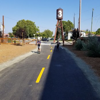
Trail grand opening is August 25th 2018! Looking good and fun for walkers as well as wheels. read more



4 years ago

13 years ago

8 years ago


8 years ago

8 years ago
More info about Three Creeks Trail
Ask the Community - Three Creeks Trail
You might also consider







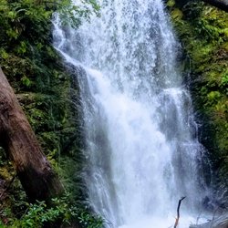




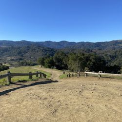


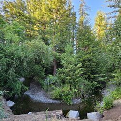
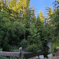
Three Creeks Trail - hiking - Updated September 2026
Best of San Jose
People found Three Creeks Trail by searching for…
Abandoned Places in San Jose, CA
Running Trails in San Jose, CA
Walking Trails in San Jose, CA
Dog Friendly Hiking Trails in San Jose, CA
Walking Groups in San Jose, CA
Hikes With Dogs in San Jose, CA
Waterfalls and Swimming Holes in San Jose, CA
Scenic Places to Walk in San Jose, CA
Mountain Biking in San Jose, CA
Nature Preserve in San Jose, CA
Trending Searches in San Jose, CA
Apple Orchards near Three Creeks Trail
Apple Picking near Three Creeks Trail
Archery near Three Creeks Trail
Barbershop near Three Creeks Trail
Blow Dry Bar near Three Creeks Trail
Cliff Jumping near Three Creeks Trail
Consignment Shops near Three Creeks Trail
Corn Maze near Three Creeks Trail
Dog Friendly Things To Do near Three Creeks Trail
Dog Swimming near Three Creeks Trail
Eyelash Extensions near Three Creeks Trail
Formal Wear near Three Creeks Trail
Hiking Trails near Three Creeks Trail
Kids Birthday Party near Three Creeks Trail
Makeup Artists near Three Creeks Trail
Mens Suits near Three Creeks Trail
Off Road Trails near Three Creeks Trail
Photo Spots near Three Creeks Trail
Picnic Areas near Three Creeks Trail
Places To Take Pictures near Three Creeks Trail
Private Schools near Three Creeks Trail
Public Shower near Three Creeks Trail
Pumpkin Patches near Three Creeks Trail
Rock Quarry near Three Creeks Trail
Scenic Night View near Three Creeks Trail
Scenic Overlook near Three Creeks Trail
Browse Articles
Browse Nearby
BEST of San Jose, California Coffee near Three Creeks Trail
BEST of San Jose, California Restaurants near Three Creeks Trail
BEST of San Jose, California Things to Do near Three Creeks Trail
BEST of San Jose, California Breakfast near Three Creeks Trail
BEST of San Jose, California Walking Trails near Three Creeks Trail
BEST of San Jose, California Parks near Three Creeks Trail
BEST of San Jose, California Caves near Three Creeks Trail
BEST of San Jose, California Campgrounds near Three Creeks Trail
BEST of San Jose, California Sightseeing near Three Creeks Trail
Browse Brands
Related Searches in San Jose, CA
Affordable Kayak Rental Services in San Jose, California
Best Dog Hiking Trails Around San Jose, California
Best Fishing Locations and Guides in San Jose, California
Best Nature Trails for Hiking in San Jose, California
Best Places for Horseback Riding in San Jose, California
Check Out Off Road Trails in San Jose, California
Discover Dog Friendly Trails to Explore in San Jose, California
Discover Easy Hiking Trails Near San Jose, California
Discover Kid Friendly Hiking Trails in San Jose, California
Discover Popular Bike Trails in San Jose, California
Discover Scenic Mountain Bike Trails Near San Jose, California
Discover Walking Parks in San Jose, California Near You
Discover a Hiking Trail in San Jose, California
Discover the Best Night Hike Trails in San Jose, California
Dog-Friendly Hikes With Dogs in San Jose, California
Enjoy Camping Adventures Around San Jose, California
Enjoy Kayaking Adventures in San Jose, California
Enjoy Off Leash Dog Hikes in San Jose, California
Enjoy Scenic Places to Walk in San Jose, California
Enjoy Tent Camping Spots Around San Jose, California
Enjoy a Beautiful Waterfall Hike in San Jose, California
Enjoy the Best Walking Path in San Jose, California
Enjoy the Best Walking Trails in San Jose, California
Explore Beautiful Parks and Green Spaces in San Jose, California
Explore Easy Hikes Perfect for All in San Jose, California
Explore Fun Activities to Do in San Jose, California
Explore Popular Campgrounds Near San Jose, California
Explore Popular Dog Walking Trails in San Jose, California
Explore Top Dog Parks in San Jose, California Near You
Explore the Best Beach Spots in San Jose, California
Family Friendly Hiking With Kids in San Jose, California
Find Parks and Recreation Activities in San Jose, California
Find Top Dog Friendly Parks to Visit in San Jose, California
Find Top-Rated Waterfalls in San Jose, California Now
Find the Best Parks for Picnics in San Jose, California
Hiking Trails With Waterfalls in San Jose, California
Off Leash Dog Hiking Trails in San Jose, California
Popular Outdoor Activities to Try in San Jose, California
Popular Picnic Spots to Visit in San Jose, California
Popular Waterfall Hiking Trails in San Jose, California
Safe River Swimming Areas in San Jose, California
Safe and Fun Parks for Kids in San Jose, California
Top Hiking Trails to Explore in San Jose, California
Top Playgrounds for Kids to Enjoy in San Jose, California
Top Running Trails to Explore in San Jose, California
Top Swimming Lakes to Enjoy in San Jose, California
Top Swimming Spots and Pools in San Jose, California
Top-Rated Camping Sites in San Jose, California


