Coyote Creek Trail Photos


You might also consider


More like Coyote Creek Trail
Recommended Reviews - Coyote Creek Trail
Start your review...


Reviews With Photos


Found a new local bike trail that was nice! We started near Bernal Rd and rode south to Morgan Hill. There's a small parking lot where you can park. The parking was free and is on dirt. The ride from there was about 9 miles one way to Morgan Hill. There isn't too much shade on the trail but the weather was in the low 60s so it wasn't too hot and the sun wasn't harsh. It was not crowded at all! It's a pretty flat road and easy to ride on. The creek is along the trail most the way. We saw some horses in the fields and ducks in the water. On the way back, it was a bit windy which made it a tiny little bit more challenging but the breeze felt good!
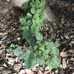

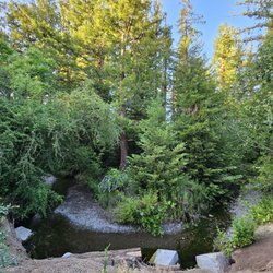
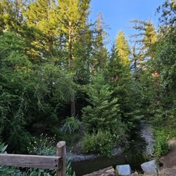
There are tons of sumac plants right next to the trails as soon as you walk near the bridge. It is highly poisonous and leaves you covered in blisters if you aren't able to wipe it off throughly enough within the first hour of contact. I went back to the site to take photos so I could warn others of this danger since my predicament is so bad. I have the reaction from the sumac plant on my hand, legs, ankles and feet. It spreads when you take off your pants and that's why I have it on my feet as well. There are also tons of mosquitos, I was taking photos for about 5 minutes and have more than 5 mosquito bites on my arms and back. I would not recommend this park to anyone other than my worst enemy.


Awesome trail! This is a great place for a ride, it's mostly flat and you spend a lot of the time in the shade. Its about 18 miles long if you go all the way to Morgan Hill but the combined elevation gain over the distance is only about 250 feet. Along the ride you pass a golf course, a driving range, a skate park, a lake that allows fishing, picnic spots with BBQ's, a velodrome, a water skiing park, several playgrounds for kids, the sliver creek athletic club, it's a virtual tour of all the fun stuff to do in the valley while doing the most fun thing you could be doing in the valley! How's that for a run on sentence! The path is nicely paved and striped down the center and you get a large variety of folks enjoying it for the day. There are serious cyclists that are going for their best time that will likely fly by you from time to time as well as Sunday riders. There are families walking their dogs, there are little people on tricycles, and there are old folks watching the birds. There is a little something for everyone on this trail. The trail also has markers every 1/2 mile that serve as motivational as well and informational tools to help you though your ride. The front has the distance one way and the back has the distance the other way. These don't exist for the whole ride though and for some reason they do not start at the trail head so they can be confusing. I come out to do this ride a few times a year and I love it every time. I recommend packing a lunch and plenty of water and just go for it!. You might not make the whole ride but go as long as you feel, it is worth the effort! This is an awesome resource for fun lovers!


A part of this trail goes behind Verona at the crescent village. I often take that part till Tasman. It is always peaceful, calm and the best part is so near to my house. The recent rains have filled up the creeks and there are more ducks and geese. The creek has become lush and green. read more


The Coyote Creek Trail by itself is great but avoid this entrance! There was no parking or signs on how to get to the trail. We parked in a residential area and then walked around until we found the way to get on the trail. The area is filthy and run over with garbage. I empathize with the homeless and it's not a statement about them but from a hiking and safety perspective, please find a different location. read more


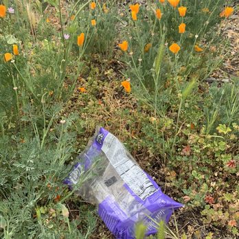


Found a new local bike trail that was nice! We started near Bernal Rd and rode south to Morgan Hill. There's a small parking lot where you can park. The parking was free and is on dirt. The ride from there was about 9 miles one way to Morgan Hill. There isn't too much shade on the trail but the weather was in the low 60s so it wasn't too hot and the sun wasn't harsh. It was not crowded at all! It's a pretty flat road and easy to ride on. The creek is along the trail most the way. We saw some horses in the fields and ducks in the water. On the way back, it was a bit windy which made it a tiny little bit more challenging but the breeze felt good! read more


7 years ago
There are tons of sumac plants right next to the trails as soon as you walk near the bridge. It is highly poisonous and leaves you covered in blisters if you aren't able to wipe it off throughly enough within the first hour of contact. I went back to the site to take photos so I could warn others of this danger since my predicament is so bad. I have the reaction from the sumac plant on my hand, legs, ankles and feet. It spreads when you take off your pants and that's why I have it on my feet as well. There are also tons of mosquitos, I was taking photos for about 5 minutes and have more than 5 mosquito bites on my arms and back. I would not recommend this park to anyone other than my worst enemy. read more
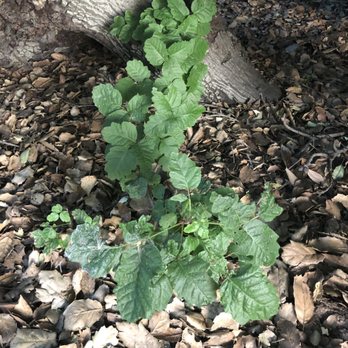


Awesome trail! This is a great place for a ride, it's mostly flat and you spend a lot of the time in the shade. Its about 18 miles long if you go all the way to Morgan Hill but the combined elevation gain over the distance is only about 250 feet. Along the ride you pass a golf course, a driving range, a skate park, a lake that allows fishing, picnic spots with BBQ's, a velodrome, a water skiing park, several playgrounds for kids, the sliver creek athletic club, it's a virtual tour of all the fun stuff to do in the valley while doing the most fun thing you could be doing in the valley! How's that for a run on sentence! The path is nicely paved and striped down the center and you get a large variety of folks enjoying it for the day. There are serious cyclists that are going for their best time that will likely fly by you from time to time as well as Sunday riders. There are families walking their dogs, there are little people on tricycles, and there are old folks watching the birds. There is a little something for everyone on this trail. The trail also has markers every 1/2 mile that serve as motivational as well and informational tools to help you though your ride. The front has the distance one way and the back has the distance the other way. These don't exist for the whole ride though and for some reason they do not start at the trail head so they can be confusing. I come out to do this ride a few times a year and I love it every time. I recommend packing a lunch and plenty of water and just go for it!. You might not make the whole ride but go as long as you feel, it is worth the effort! This is an awesome resource for fun lovers! read more


Quite trail entrance, about 11.75!miles from the start of the trail! Located behind the softball/baseball fields, this trail can take you as far south as Morgan Hill. You'll pass by a skate park and other parks in San Jose! I prefer cycling on this path, but just walked the pup here and was very quite. Free parking here and bathrooms/water fountains located by the baseball/softball fields. On weekends it can get tough to find parking! Weekdays are easy peasy! The only downside to this trail is that there are transient encampments along the river!!! read more




More info about Coyote Creek Trail
Tully Rd
San Jose, CA 95122
East San Jose
Directions
Hours
Outdoor Amenities

Ask the Community - Coyote Creek Trail
You might also consider














Why does Yelp recommend reviews?
2 reviews that are not currently recommended
The reviews below are not factored into the business's overall star rating.

3 years ago

3 years ago
Coyote Creek Trail - hiking - Updated September 2026
Best of San Jose
People found Coyote Creek Trail by searching for…
Trending Searches in San Jose, CA
Apple Orchards near Coyote Creek Trail
Apple Picking near Coyote Creek Trail
Barbershop near Coyote Creek Trail
Bike Shop near Coyote Creek Trail
Casinos near Coyote Creek Trail
Cliff Jumping near Coyote Creek Trail
Consignment Shops near Coyote Creek Trail
Cruising Spots near Coyote Creek Trail
Dog Friendly Things To Do near Coyote Creek Trail
Estheticians near Coyote Creek Trail
Eyebrow Threading near Coyote Creek Trail
Eyelash Extensions near Coyote Creek Trail
Furniture Stores near Coyote Creek Trail
Hiking Trails With Waterfalls near Coyote Creek Trail
Kids Birthday Party near Coyote Creek Trail
Lakes & Ponds near Coyote Creek Trail
Makeup Artists near Coyote Creek Trail
Middle Schools & High Schools near Coyote Creek Trail
Off Road Trails near Coyote Creek Trail
Picnic Areas near Coyote Creek Trail
Places To Take Pictures near Coyote Creek Trail
Public Shower near Coyote Creek Trail
Rock Quarry near Coyote Creek Trail
Scenic Night View near Coyote Creek Trail
Scenic Overlook near Coyote Creek Trail
Sunrise View near Coyote Creek Trail
Swimming Holes near Coyote Creek Trail
Browse Articles
Browse Nearby
BEST of San Jose, California Coffee near Coyote Creek Trail
BEST of San Jose, California Restaurants near Coyote Creek Trail
BEST of San Jose, California Things to Do near Coyote Creek Trail
BEST of San Jose, California Breakfast near Coyote Creek Trail
BEST of San Jose, California Walking Trails near Coyote Creek Trail
BEST of San Jose, California Parks near Coyote Creek Trail
BEST of San Jose, California Campgrounds near Coyote Creek Trail
BEST of San Jose, California Sightseeing near Coyote Creek Trail
BEST of San Jose, California Glamping near Coyote Creek Trail
Browse Brands
Related Searches in San Jose, CA
Affordable Kayak Rental Services in San Jose, California
Best Dog Hiking Trails Around San Jose, California
Best Fishing Locations and Guides in San Jose, California
Best Nature Trails for Hiking in San Jose, California
Best Places for Horseback Riding in San Jose, California
Check Out Off Road Trails in San Jose, California
Discover Dog Friendly Trails to Explore in San Jose, California
Discover Easy Hiking Trails Near San Jose, California
Discover Kid Friendly Hiking Trails in San Jose, California
Discover Popular Bike Trails in San Jose, California
Discover Scenic Mountain Bike Trails Near San Jose, California
Discover Walking Parks in San Jose, California Near You
Discover a Hiking Trail in San Jose, California
Discover the Best Night Hike Trails in San Jose, California
Dog-Friendly Hikes With Dogs in San Jose, California
Enjoy Camping Adventures Around San Jose, California
Enjoy Kayaking Adventures in San Jose, California
Enjoy Off Leash Dog Hikes in San Jose, California
Enjoy Scenic Places to Walk in San Jose, California
Enjoy Tent Camping Spots Around San Jose, California
Enjoy a Beautiful Waterfall Hike in San Jose, California
Enjoy the Best Walking Path in San Jose, California
Enjoy the Best Walking Trails in San Jose, California
Explore Beautiful Parks and Green Spaces in San Jose, California
Explore Easy Hikes Perfect for All in San Jose, California
Explore Fun Activities to Do in San Jose, California
Explore Popular Campgrounds Near San Jose, California
Explore Popular Dog Walking Trails in San Jose, California
Explore Top Dog Parks in San Jose, California Near You
Explore the Best Beach Spots in San Jose, California
Family Friendly Hiking With Kids in San Jose, California
Find Parks and Recreation Activities in San Jose, California
Find Top Dog Friendly Parks to Visit in San Jose, California
Find Top-Rated Waterfalls in San Jose, California Now
Find the Best Parks for Picnics in San Jose, California
Hiking Trails With Waterfalls in San Jose, California
Off Leash Dog Hiking Trails in San Jose, California
Popular Outdoor Activities to Try in San Jose, California
Popular Picnic Spots to Visit in San Jose, California
Popular Waterfall Hiking Trails in San Jose, California
Safe River Swimming Areas in San Jose, California
Safe and Fun Parks for Kids in San Jose, California
Top Hiking Trails to Explore in San Jose, California
Top Playgrounds for Kids to Enjoy in San Jose, California
Top Running Trails to Explore in San Jose, California
Top Swimming Lakes to Enjoy in San Jose, California
Top Swimming Spots and Pools in San Jose, California
Top-Rated Camping Sites in San Jose, California


