Cancel

    Open app

    Search

    Trout Zone Anglers

    5.0 (1 review)
    Closed 9:00 am - 5:00 pm

    Trout Zone Anglers Photos
    More like Trout Zone Anglers

    Recommended Reviews - Trout Zone Anglers

    Your trust is our priority, so businesses can't pay to alter or remove their reviews. Learn more about reviews.
    Yelp app icon
    Browse more easily on the app
    Review Feed Illustration

    8 years ago

    Helpful 0
    Thanks 0
    Love this 0
    Oh no 0

    Ask the Community - Trout Zone Anglers

    Verify this business for free

    Get access to customer & competitor insights.

    Verify this business

    Cummins Falls State Park

    Cummins Falls State Park

    4.4
    (111 reviews)
    59.1 km

    You need a permit to walk all the way down to the falls and it is a very challenging hike. They…read morelimit the amount sold so it does sell out. The gorge does flood so def watch the safetyvide. we wouldn't have made it without out hiking poles. It was my first time using them but theybare game changer for hills and uneven terrain. We had to cross a river ... not creek. Climbing over rocks and boulders. River rocks are sooo slippery. Shoes should have good tread. This was challenging and truthful doubt I'd do it again. Water was cold. But falls are beautiful.

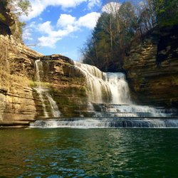
    Cummins Falls State Park is located 10 miles north of the town of Cookeville, in Central Tennessee…read more Can you go swimming at Cummins Falls??? Of course you can! It's a 1 mile hike down to the bottom of a gorge to reach a swimming hole Travel and Leisure Magazine rates...as one of the "10 Best in the United States"! It's $7 to gain access to the gorge. You can purchase passes online ahead of time at tnstateparks.com. Or, you can buy passes inside the Visitor Center the day of, but they allot only 200 tickets per day so depending upon the time of year, passes can sell out quickly especially during peak summers. Now...there is a waterfall overlook to check out but I think it'd be more worthwhile to get to Cummins Falls ASAP before the crowds arrive and you can always visit the lookout on the return trip back up towards the trailhead. Once you reach the river area, it's 6/10th's of a mile remaining until you arrive at the falls. Also, make sure to hang towards the left while hiking beside the river and (imo) it's imperative to be wearing water shoes as the creek is filled with sharp rocks and water levels reaching shin high. While hiking to Cummins Falls, you really get a sense for being in the heart of nature. I enjoyed the setting. Approaching the falls, it's 75 feet of cascading waters flowing down the cliffside and ideal for swimming. Best of all, visitors can climb the rocks and explore at their leisure making for an adventurous experience. Of course, it's a rite of passage to finish the experience in style by going swimming. The park opens at 8am. I'd suggest arriving as early as possible before it gets busy. The park closes at 6pm but there's a clearly stated sign that visitors must exit the gorge area by 5pm. One extra note...lifeguards are on duty at Cummins Falls throughout the day. When returning back up towards the trailhead, now head over to the lookout platform getting to admire Cummins Falls from high above. It makes for a photogenic perspective and is a clear reminder of why the great outdoors can be so special. Right nearby Cummins Falls SP are more local waterfalls to check out including...Fall Creek Falls, Burgess Falls, Ozone Falls, Virgin Falls, Piney Falls and Stinging Fork Falls, just to name a few.

    Photos
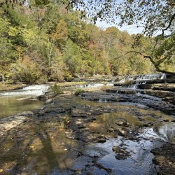
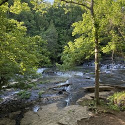
    Another small falls on the walk
    Another small falls on the walk
    This is Cummins Falls State Park located 10 miles outside Cookeville, Tennessee. It's a terrific park for swimming in the great outdoors.
    This is Cummins Falls State Park located 10 miles outside Cookeville, Tennessee. It's a terrific park for swimming in the great outdoors.
    Cummins Falls State Park

    See all

    Fall Creek Falls State Park

    Fall Creek Falls State Park

    4.4
    (158 reviews)
    43.4 km

    Pictures do not do this campground justice! This is an absolutely beautiful campground that has…read moreplenty of shade trees, and spacious camp spaces. The bathhouses are clean and well maintained, and there is so much to do in the area! Despite there being a lot of kids, this campground is relatively quiet and very relaxing! The roads are well maintained, the grounds are just beautiful (I know I keep saying that). This is one of my top 5 favorite campgrounds EVER!!

    I'll make it short & sweet. July 15, 2026, I called Reservations (can't remember the name of the…read moregirl who took my reservations, although I wrote it down somewhere but when I hear it, I'll know it) & booked the dates of July 18th, Saturday, to July 21st, Tuesday of 2026; B65 was the location. I explained to the female that I had trouble with self-reservation online & I couldn't see the rest of the information in the dropdown box whenever I clicked, what looked like a location was available or as I understood it to be available. She took my reservation, REPEATED IT BACK to me correctly (in between putting me on hold about 2 or 3 times) and then gave me the price. I paid for it and she sent the email confirmation. I looked at the email and saw the date I called, the time & "18th - 21st." Cool. That Saturday morning of July 18th, I drove over 9 hours (got lost a little bit because of highway construction and GPS) but made it there. Went to the office lobby, gave my name & the campground location. "Brandy" is what the front desk girl asked me as my name. "No..." I responded and repeated my name. Well, long story short, she said Brandy had my spot, I was offered another location, I took it, showed her my confirmation and saw that the reservation girl had listed me as "Tuesday, August 18, 2026 arrival" and departure "Friday, August 21, 2026." I told the young lady at the desk of the conversation of my reservation and stated that although I didn't notice the month and days were incorrect, the reservationist spoke it correctly, so that's what I saw. The part that really got me, she said I had to pay $17.00 extra to go to the new location. I refused. I have worked in hospitality for years and I know how it works. I told her I wasn't upset with her but I shouldn't have to pay for their mistake. I asked for a refund. Then I drove another 10 or so hours back home (because of traffic & getting lost trying to leave Spencer, TN). I'm just now leaving this review because I tried to forget what happened but each time someone asked me, who hadn't seen me since I returned, how my vacation went, as I replay the scenario, my emotional feelings of frustration, some anger & the memory of how exhausted I was, returns. I slept for 2 days because I had missed so much sleep just driving to TN then immediately returning home. Will I ever return to this campground? I doubt it. NO, I shall not. No one even apologized to me. All I heard was, "That'll be $17.00." My response, "17.00 for what? I'm paying?" Nooooo, I believe I'm done. Thanks for reading.

    Photos
    Fall Creek Falls State Park
    Fall Creek Falls State Park
    Fall Creek Falls State Park
    The water falls behind  me was beautiful  love how cool it was in 86 degree weather

    See all

    The water falls behind me was beautiful love how cool it was in 86 degree weather
    Burgess Falls State Park

    Burgess Falls State Park

    4.8
    (82 reviews)
    47.7 km

    This was a beautiful park. The falls were spectacular. The hike was an easy one and didn't take…read morelong to get to the falls outlook. I'm almost 63 and had no problem. The trail to the bottom was closed unfortunately.

    This is Burgess Falls, another state park located in Central Tennessee sitting 12 miles northwest…read moreof the town of Sparta, TN. There's a 3/4 of a mile out and back hike called the River Trail that leads to 4 different waterfall lookout points comprising Burgess Falls SP. Waterfall #1 - The Cascades. Sort of the introduction area to the park. Waterfall #2 - First Falls. A quick glance at a 30 foot high waterfall section. But nothing special, imo. When Continuing on the trail, you'll cross over a wooden bridge and follow up a staircase. Now at... Waterfall #3 - Middle Falls... Middle Falls is 80 feet high and partially obstructed by trees and branches having grown over time. *Side Note*.... I wish park services would do some forest cutting for everyone to enjoy clearer views of the park's waterfalls. Entrance right now is free. I'd suggest charging a small fee and using that money to pay for some grooming. A lot of the observation points can't be fully appreciated. Just me venting a little, lol. Waterfall #4 - Burgess Falls... Burgess falls is the centerpiece highlight of the park. Standing at 136 feet from top to bottom, Burgess Falls can absolutely be dramatic, but still natural excess forest maturation disrupts full visibility of the falls. I did read that kayaking at the bottom of Burgess Falls is the most interactive way to come face to face with this statuesque waterfall. You can rent kayaks at Cane Hollow Recreation Area, located at the end of Cane Hollow Road. It's about 10 minutes from Burgess Falls. You can end the River Trail hike at the Top of Burgess for a panoramic overlook of the rugged gorge the falls splash down into from high above. It's another quick stop and go area before returning back towards the trailhead. Overall, Burgess Falls was a muted experience for me, but still has potential to be a rewarding visit if park authorities can maintain the inevitable growing forest hindrances that negate special moments at the waterfall overlooks.

    Photos
    Lower falls
    Lower falls
    Burgess Falls State Park
    Burgess Falls State Park

    See all

    Obed Wild and Scenic River

    Obed Wild and Scenic River

    4.3
    (7 reviews)
    42.3 km

    This place is a hidden gem. I highly recommend stopping by at the very least to do the Lily Bluff…read moreOverlook. It's not strenous and the rewards of the views after a short walk are well worth it. I visited when it was raining and so it wasn't the best view, but it was still gorgeous. I also went on the Obed River Point Trail (3.6-mile out-and-back). You have to cross some streams using rocks, and there's also a wood bridge. The trail has a hidden arch rock to your right as you approach the end of the trail, but it's small and there's a reason why they don't mark it as it's not dramatic haha. Towards the end of the trail there's a lot of small social off shoot trails, but the main trail is wider than the others. Near the end of the trail there's a marker and then an end point marker. Neat trail!

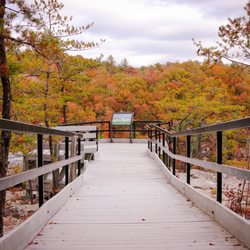
    An absolutely stunning nature space with a great many wild features to look forward to. They have…read moretrails and adventures for everyone so that everyone is able to enjoy the splendor that is Obed. Lily Bluff Overlook itself has multiple access trails. For those needing a mostly flat path with maintained gravel surface, try the upper parking lot trailhead. It is easily recognized by the huge Obed sign at the parking lot entrance. For a more uphill and challenging experience, take one of the trailheads from either of the bridge parking areas below the bluff. Pictures: 1) Lily Bluff Overlook platform -- an extensive platform to make access safe and manageable for everyone while also protecting the natural elements of the bluff. 2) The view from Lily Bluff Overlook 3) The hike up -- this picture shows the start of the trail up to Lily Bluff from the bridge parking area. The hike is all uphill with stone and wooden stairs, and roots. It is a beautiful, fun, and enjoyable hike.

    Photos
    Lily Bluff Overlook
    Lily Bluff Overlook
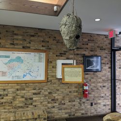
    Visitor center exhibit - wasp nest
    Visitor center exhibit - wasp nest
    Lily Bluff Overlook

    See all

    Lily Bluff Overlook

    Trout Zone Anglers - fishing - Updated August 2026
    Loading...
    Loading...
    Loading...