Cancel

    Open app

    Search

    Tumey Hills

    5.0 (2 reviews)
    Open Open 24 hours

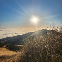
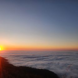
    Tumey Hills Photos

    You might also consider

    Recommended Reviews - Tumey Hills

    Your trust is our priority, so businesses can't pay to alter or remove their reviews. Learn more about reviews.
    Yelp app icon
    Browse more easily on the app
    Review Feed Illustration
    Photo of Julie L.
    1397
    1322
    7049

    7 years ago

    Helpful 11
    Thanks 0
    Love this 10
    Oh no 0

    12 years ago

    Helpful 5
    Thanks 0
    Love this 0
    Oh no 0

    Verify this business for free

    Get access to customer & competitor insights.

    Verify this business

    Pinnacles National Park

    Pinnacles National Park

    4.5
    (449 reviews)
    23.1 mi

    A beautiful CA national park. We did 2 short hikes in one day…read more The pinnacle rocks and the caves are SO cool! Parking was really easy for the trails we wanted to access. National Park pass is required.

    This was such a fun park. A little out of the way but way worth the trip!…read more A small fee to enter. It's worth it because it goes to take care of upkeep and in the summer, there's a lot of people so this little bit helps. You will want to have a flashlight on hand to go through the caves here as there are long spots you are in the dark climbing up and down stairs or down or up through boulders. Headlamps are best but a flashlight will work too. I started out day 1 on one side and had so much fun hiking through the park and crawling through the rock caves. I spent a little time talking to the Park Rangers to find the best place for me to hike that wasn't too long. Reaching the top of the mountain and walking back down with the amazing views, all the Turkey Vultures and other birds and wildlife was spectacular. The trails, though not necessarily well marked which way is which were well traveled so you knew you weren't going to get lost going off trail. The second day I hit the other side of the park to do Bear Gulch Caves. Excellent cave! Parking at the foot is limited even about 1/4 mile down next to info shop and restrooms is limited so be patient. You may have to park further down as summer comes. This is the only bathroom but very well maintained. There is water running down through this cave and when you reach the top, there a tight squeeze through the rocks and then an amazing payoff with the reservoir. Great spot to watch the birds, Dragon Flies, walk around some of the reservoir before hiking back out down along the very well traveled path past rock climbers to the parking lot again. I highly recommend this fantastic park not just for the excellent caves but for all the good hiking trails. There is some camping and even a pool further down towards the entrance on one side. The Rangers here are full of knowledge and very friendly and professional. Excellent experience!!

    Photos
    West Pinnacles National Park
    West Pinnacles National Park
    West Pinnacles National Park
    West Pinnacles National Park
    West Pinnacles National Park

    See all

    West Pinnacles National Park
    Pacheco State Park

    Pacheco State Park

    3.9
    (18 reviews)
    39.9 mi

    For those headed to Rte 5 from the South Bay, you've likely passed Pacheco State Park on Hwy 152…read morebefore descending to the San Luis Reservoir. (But don't blink, or you'll miss the exit). Despite the unassuming entrance, it's a surprisingly large and beautiful park. Like a lot of hikes in the Diablo range, your experience will depend much on the season. Summer here is to be avoided, unless you are a heat-freak (or masochist). Fall and winter are much better, but still brown with a capital B. Spring, however, is the time to see sprouting trees and hills bathed in green. I went here with hiking buddy M in early March, and conditions were absolutely ideal. Some wildflowers were already out; and we spotted munching elk on an adjacent hillside (They scattered quickly.) The weather was sunny, windy, and in the 60s. Just gorgeous. (Photos added). Trail junctions were well-marked, but some trails were so faint they sometimes faded into pasture. (For those who want to hike on anything but primary fire roads, a navigation device is recommended.) We had excellent trail maps on our phones, so we were able to explore some more remote trails. Note: Being next to Henry Coe State Park, I had thought to call this a "mini Coe" but that's not accurate. It feels a little less wild and is windier (a wind farm borders the eastern side). Believe it or not, my biggest issue with the park was in leaving. To get back to the Bay Area - and starting from a dead stop - we had to cross two lanes of busy, eastbound traffic on Hwy 152 while also merging with two lanes of 70 mph traffic heading the other way. Patience pants were required, size XL. Hiking Spot Checklist: -- Parking: Self-register lot (paid) after entering gate, but there's also free parking 0.1 mi away (outside the gate) -- Bathrooms: Pit toilets at main entrance -- Potable water provided: No (bring plenty, especially in summer) -- Maps provided: Yes (but not very good); bring good maps on your phone -- Highlights: Unspoiled oak woodland and expansive views

    Without GPS you would be completely lost hiking these trails. At least 40% of the trails are…read morebeautifully overgrown with wildflowers. There are at least a dozen places to make a wrong turn, but as long as you're not in a hurry, the wrong turn will likely leave you to a steep beautiful hillside. I did this hike on a beautifully sunny and cool April 1st. On a blazing hot day I think it would be miserable unless you have a good hat and plenty of water. Almost zero cover. April 1st 2023, the wildflowers were amazing. So many wildflowers that you couldn't find the trail. Check out my GPS track for this trail and you'll see how chaotic it got. But all the time it was amazing and beautiful.

    Photos
    Pacheco State Park
    Spring flowers
    Spring flowers
    Pacheco State Park

    See all

    High Peaks Trail

    High Peaks Trail

    4.8
    (6 reviews)
    20.9 mi

    Absolutely amazing trail that I've done twice in 100° weather. The views are great, and the trail…read moreis well groomed. But, oh my god, it is straight uphill. With extreme heat I literally thought I was going to die. Do it in the winter.

    one of the many, many wonderful trails at pinnacles nat'l park. from the apex, you can see almost…read morethe entire park on a clear day, the beautiful balconies, ridges, forestry and wildlife that belongs to pinnacles. you can access this trail from: +west side: chaparral trailhead parking lot, 1.8mi hike to western trailhead of high peaks +east side: old pinnacles trailhead, 1.3mi hike to eastern trailhead of high peaks +east/south side: bear gulch parking lot, 0.5mi to southern trailhead of high peaks we chose to start from the east side, hike the old pinnacles trail to balconies, break at the chaparral trailhead for lunch, then return east via the high peaks trail. this was a TOUGH climb up, especially since it was only a little after noon, the sun was strong, and we'd already hiked 4+ miles from the east. many breaks were taken, call it "photo pace" hiking, and after some time, we finally reached the western side of the high peaks trail...more climbing awaited us, as did awesome views of this treasured park. there were many switchbacks, each turn offering a different view, so of course, i had to pause each time to snap a pic! there are no restrooms, water fountains, or other amenities here. due to the time of day we were here, there also wasn't much shade. definitely bring plenty of water, wear a hat, sunscreen, and light clothing if coming here during summer/autumn months.

    Photos
    Top of High Peaks
    Top of High Peaks
    Instagram: @telephonesmoothie
    Instagram: @telephonesmoothie
    Instagram: @telephonesmoothie

    See all

    Instagram: @telephonesmoothie
    Point Lobos State Natural Reserve

    Point Lobos State Natural Reserve

    4.9
    (1.1k reviews)
    62.9 mi

    While visiting the Carmel/Monterey area a month ago we wanted to take in some of the local scenery…read more Point Lobos State Natural Reserve came highly recommended, and it did not disappoint Located just 10 minutes outside of Carmel, this incredibly picturesque seascape is a must see while visiting. There are multiple trails through the Point, and each of them showcase stunning views of the sea and saw well as flora and fauna It was barely raining while we were there and it never dampened our spirits. The trails got a little slick, but nothing too dangerous. In fact, this is more of a seaside walking path than a physical intensive hike We saw many seals and otters on our hike. There was also a rest stop that had park rangers and an interactive exhibit that was very cool. You could feel the skin of a seal, otter, and even the baleen from a whale Some tips: If you haven't explored Carmel or Monterey you are just a short drive away There are many coastal hikes and scenic points/beaches to explore. We also enjoyed a more physical hike at the Pinnacles, but that is an hour or so away Cheers!!
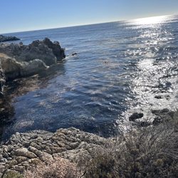
    Adj: beautiful, breathtaking natural reserve…read more Always a nice place to visit and "hike" (really just trail walking). I love coming here. It's so serene, scenic, natural, cool, and both the botanical plantlife as well as the animals (air, land, and ocean wildlife) you can find and view here are just so amazing. Being it's in the Monterey Bay, it's almost always cool when it's hot in the valley, so it's another great place to escape to. It's just a very nice and unique point in the bay and although you can spend the whole day here, or even several days, a couple of hours will also be very rewarding for a change of scenery for those of us who are urban dwellers who want to reconnect with God's natural wonders once in awhile. Overall, Point Lobos is an authentic, breathtaking, and calming place for those who enjoy seeing the ocean and taking in all the native plants, vegetations, and all the air, land, and sea creatures one can encounter or at least observe here.

    Photos
    Point Lobos State Natural Reserve
    Point Lobos State Natural Reserve
    Point Lobos State Natural Reserve
    Point Lobos State Natural Reserve
    Point Lobos State Natural Reserve

    See all

    Point Lobos State Natural Reserve
    China Cove

    China Cove

    5.0
    (10 reviews)
    64.1 mi

    Magnificent views and short hikes…read more I had a very pleasant short hike along some of the trails. Outstanding views of the sea and cliffs where the water carved out scenic scenes. Keep an eye out for seat otters in the water and seals on the sand in secluded coves. Parking can be a bit challenging on more popular days. I suggest driving to the end where China Cove is and keep an eye out for parking spots along the way. Be ready to backtrack to those open spots.

    Absolutely breathtaking views. This gorgeous cove is hidden away deep in Point Lobos State Natural…read moreReserve. The parking lots fills up fast so you may have to park outside the park. We got there fairly late in the day, so we were able to go into the entrance with our car ($10 fee per car, it's free to park on the street outside). We were able to park all the way down in the last parking lot, then walked on the Bird Island Trail to get to China Cove - it's barely 5 minutes into the trail. The seals are so fun to watch down there and the view is like a postcard! I also highly recommend continuing to walk along Bird Island Trail to see Pelican Point and more gorgeous beach views. It's a fairly easy trail with a stunning view throughout. This is a must see!! Last entrance to the park is 6:30 pm and everyone has to be out by 7 pm. This wasn't confirmed anywhere online so we called them to get correct info on their current hours.

    Photos
    Hiking - August 3rd, 2023
    Hiking - August 3rd, 2023
    August 3rd, 2023
    August 3rd, 2023
    Only seals on this beach. There are other beaches for humans.

    See all

    Only seals on this beach. There are other beaches for humans.

    Tumey Hills - hiking - Updated July 2026

    Loading...
    Loading...
    Loading...