Almaden-Quiksilver Trail Photos


You might also consider


More like Almaden-Quiksilver Trail
Recommended Reviews - Almaden-Quiksilver Trail
Start your review...


Reviews With Photos
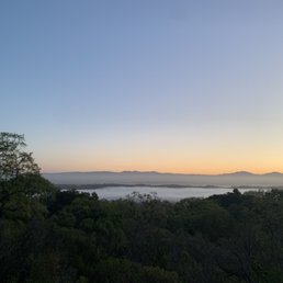

This is a fantastic trail with options for a short hike or multi-hour hike as well. There is a lot of history in the area if you want to take the time to read the signs or can google it as well. I was here for an early morning hike and was glad I remembered my flashlight. You have amazing views of the valley along the way. I saw some turkey and a beautiful coyote as well.
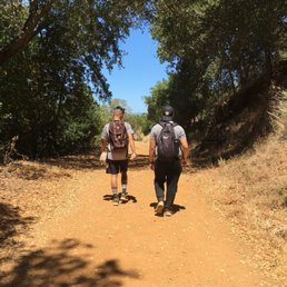

This is a very beautiful trail. There is a helpful map and guide for you to take along the trail which details certain routes and their distance. I would definitely recommend starting at the Mine Hill Trail making your way into the New Almaden Trail and then reaching the Guadalupe Trail. The Guadalupe Trail gives you such a beautiful view of the Guadalupe Reservoir that you definitely do NOT want to miss. This initial route I took was not even half of the actual Almaden-Quicksilver Trail, but was definitely perfect to get that activity of hiking and trailing. There are horse trailing alongside you, you'll see animals such as turkeys, does/bucks and even newts. If you starting from the Mine Hill Trail and making your way through the Senador Mine Trail, you'll be able to walk through a past history of some of the 1800s mining that went on; some of the landmarks are still there as well! I would definitely recommend this trail for easy to moderate hikers. I enjoyed every second.


This place has quickly become one of my favorite hiking spots. They have a 2 mile, 5 mile and 9 mile loop. It is not a hard hike at all and it's quite enjoyable with tons of greenery. It's located in a really great neighborhood and area where I totally feel safe leaving my car. Everyone who goes is super nice and it's usually an older crowd which I prefer.


Hot and long in the summer Cool and green in the winter! Great trails to run and you will see a lot of local known runners here ! The only downside is the spotty phone reception and the once in 476 times you may see a Coyote or mountain lion! But it's California dry air at its best witch keeps you dry and view in spots around the water is great! Take the 8 mile round tripper from Leighland Park drive for an hour calorie burn!
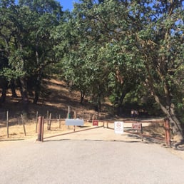

Easy to get to the trailhead on McAbee Road, just off of Hwy 85 and Camden. We did a loop that was about 5 miles that included some good climbing and took us past the Guadalupe Reservoir. Best to start early in the summer because although there is some shade, it gets hot. The views are stunning with oaks, vistas of the distant hills and the reservoir along the way. When we have more time, there are many longer options that I'd love to explore. Even though there were lots of parked cars at this trailhead, the trail wasn't crowded and no bikes are allowed, so it was mostly quiet and that's what hiking is all about!


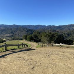
One of my all time favorite parks. Plenty of wide trails with great views of the Santa Cruz Mountains and the city of San Jose. Porta potties are a little nasty, so make sure you go before you leave from home. All sorts of neat little books and crannies all over the park. Trails all different lengths and difficulty levels, but all are at least a little hilly.
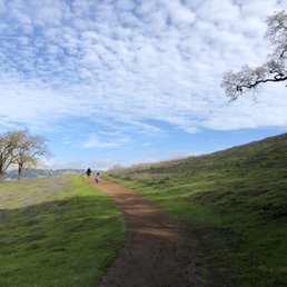

I really LOVE hiking this trail! It's beautiful and peaceful. The views changes in different seasons and it's nice to be able to get away from all the traffic noise of the Bay Area. The landscape changes from lush green to more fall colors as the season changes. There are benches dispersed throughout the trail for resting. Each with a different scenic option. Some are views of the cities, others the reservoir, and one is under a ginormous tree with diverging paths. There's also a quaint bridge where our whole family has taken photos. It's nice to get a way for a few hours and decompress here. There are many entrances to choose from. I've done 2. The Mockingbird one is more difficult than the McAbee Creek. Lots of beautifully native flowers and wildlife. We've spotted a bobcat, bunnies, deers, snakes and a little creek with a log to sit and have lunch. Come see what Almaden Quicksilver Trail has to offer.
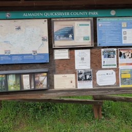

I really love this place! Different trails with beautiful views :) dog friendly which is always a plus!!


I love these trails. There's a good variety here and great scenery. I like the trail to Guadalupe reservoir. It's about 6 miles round trip with a few intermediate climbs. Its nice and peaceful when you get to the creek. Lots of wildlife and nice wild flowers. There are also some shorter routes if you feel like a nice run or just taking the dog for a 30-45 minute walk . The McCabe Rd. entrance is where I usually go. Street parking only but there's another entrance with longer trails all the way up Almaden Rd near the reservoir in new Almaden . Tons of parking available there, as well as a very well kept public rest room.


2 years ago
We parked at mocking bird lane at 10 am. Parking was full, took maybe 5 minutes to wait for someone to leave. Weather wasn't bad, warm. The trail: the map they give you is not easy to read plus the signs on the trail are not right. We meant to do 2 miles and ended up almost at 5 because we took a wrong turn. There is A LOT of uphill walking throughout the entire trail. I wouldn't say the trail is beginner friendly, but if you have a lot of time to finish 5 miles then these trails are great. Be aware there are a lot of snakes on the trail. Bring a change of clothes or extra clothes to cover yourself and extra water in case your trail takes longer than expected. Be safe! read more


This is a fantastic trail with options for a short hike or multi-hour hike as well. There is a lot of history in the area if you want to take the time to read the signs or can google it as well. I was here for an early morning hike and was glad I remembered my flashlight. You have amazing views of the valley along the way. I saw some turkey and a beautiful coyote as well. read more
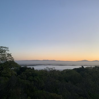


This is a very beautiful trail. There is a helpful map and guide for you to take along the trail which details certain routes and their distance. I would definitely recommend starting at the Mine Hill Trail making your way into the New Almaden Trail and then reaching the Guadalupe Trail. The Guadalupe Trail gives you such a beautiful view of the Guadalupe Reservoir that you definitely do NOT want to miss. This initial route I took was not even half of the actual Almaden-Quicksilver Trail, but was definitely perfect to get that activity of hiking and trailing. There are horse trailing alongside you, you'll see animals such as turkeys, does/bucks and even newts. If you starting from the Mine Hill Trail and making your way through the Senador Mine Trail, you'll be able to walk through a past history of some of the 1800s mining that went on; some of the landmarks are still there as well! I would definitely recommend this trail for easy to moderate hikers. I enjoyed every second. read more
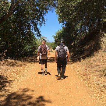

This place has quickly become one of my favorite hiking spots. They have a 2 mile, 5 mile and 9 mile loop. It is not a hard hike at all and it's quite enjoyable with tons of greenery. It's located in a really great neighborhood and area where I totally feel safe leaving my car. Everyone who goes is super nice and it's usually an older crowd which I prefer. read more


Hot and long in the summer Cool and green in the winter! Great trails to run and you will see a lot of local known runners here ! The only downside is the spotty phone reception and the once in 476 times you may see a Coyote or mountain lion! But it's California dry air at its best witch keeps you dry and view in spots around the water is great! Take the 8 mile round tripper from Leighland Park drive for an hour calorie burn! read more


8 years ago


6 years ago

Easy to get to the trailhead on McAbee Road, just off of Hwy 85 and Camden. We did a loop that was about 5 miles that included some good climbing and took us past the Guadalupe Reservoir. Best to start early in the summer because although there is some shade, it gets hot. The views are stunning with oaks, vistas of the distant hills and the reservoir along the way. When we have more time, there are many longer options that I'd love to explore. Even though there were lots of parked cars at this trailhead, the trail wasn't crowded and no bikes are allowed, so it was mostly quiet and that's what hiking is all about! read more
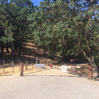


6 years ago
One of my all time favorite parks. Plenty of wide trails with great views of the Santa Cruz Mountains and the city of San Jose. Porta potties are a little nasty, so make sure you go before you leave from home. All sorts of neat little books and crannies all over the park. Trails all different lengths and difficulty levels, but all are at least a little hilly. read more


7 years ago
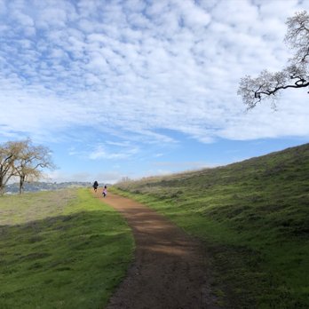
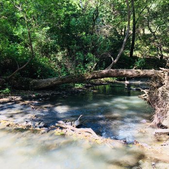
I really LOVE hiking this trail! It's beautiful and peaceful. The views changes in different seasons and it's nice to be able to get away from all the traffic noise of the Bay Area. The landscape changes from lush green to more fall colors as the season changes. There are benches dispersed throughout the trail for resting. Each with a different scenic option. Some are views of the cities, others the reservoir, and one is under a ginormous tree with diverging paths. There's also a quaint bridge where our whole family has taken photos. It's nice to get a way for a few hours and decompress here. There are many entrances to choose from. I've done 2. The Mockingbird one is more difficult than the McAbee Creek. Lots of beautifully native flowers and wildlife. We've spotted a bobcat, bunnies, deers, snakes and a little creek with a log to sit and have lunch. Come see what Almaden Quicksilver Trail has to offer. read more



7 years ago
I really love this place! Different trails with beautiful views :) dog friendly which is always a plus!! read more


12 years ago


10 years ago
I love these trails. There's a good variety here and great scenery. I like the trail to Guadalupe reservoir. It's about 6 miles round trip with a few intermediate climbs. Its nice and peaceful when you get to the creek. Lots of wildlife and nice wild flowers. There are also some shorter routes if you feel like a nice run or just taking the dog for a 30-45 minute walk . The McCabe Rd. entrance is where I usually go. Street parking only but there's another entrance with longer trails all the way up Almaden Rd near the reservoir in new Almaden . Tons of parking available there, as well as a very well kept public rest room. read more


7 years ago

8 years ago
Beautiful, quiet paradise...the nature all around gives a sense of peace and awe for how much more we as humans can do to preserve it plus its nice for a friendly or couple walk. read more


8 years ago

11 years ago
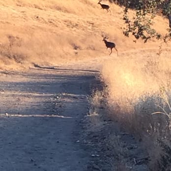
A beautiful park that brings nature up close. Some people don't know that you need to keep to the right when hiking, and some play music loudly for all to hear. All too often you find people on bikes who know the Rangers are stretched thin, or toss their water bottles aside. Early mornings are best, it's quiet, serene and you see the occasional Bobcat, sometimes hear the mating call of a cougar, and the occasional glimpses of a curious coyote or other species who call this park home. When the reservoir is full, it's a great place to bring your dogs for a swim if the water isn't fouled with bacteria & the excretions of invasive fowl. Any Ranger who happens by is normally understanding of this, knowing they have bigger worries to contend with. Fishermen need to make sure they pick up their lines & bait too. Smokers need to forgo their cravings while on the trails & be mindful of the dry conditions. I'm always amazed how some parents bring their children up here & then let them wander several 100 yards away. Prime targets for the occasional carnivore. Love- starved tarantulas & beautiful bucks search for a mate. Wild turkeys & quail talk softly as the occasional rattle snake leaves a trail for us to see in the soil. Look closely at the tales these trails hold & see who left their prints or scat. It's a dynamic system, home to fragmented populations. Respect it, love it & enjoy it. read more




8 years ago
10 years ago
More info about Almaden-Quiksilver Trail
San Jose, CA 95120
Almaden Valley
Directions
Hours
Outdoor Amenities
Ask the Community - Almaden-Quiksilver Trail
Review Highlights - Almaden-Quiksilver Trail
You might also consider












Why does Yelp recommend reviews?
1 review that is not currently recommended
The reviews below are not factored into the business's overall star rating.

3 years ago
Almaden-Quiksilver Trail - hiking - Updated September 2026
Best of San Jose
People found Almaden-Quiksilver Trail by searching for…
Running Trails in San Jose, CA
Walking Groups in San Jose, CA
Walking Trails in San Jose, CA
Dog Friendly Hiking Trails in San Jose, CA
Great View Points for Sunset in San Jose, CA
Beautiful Views in San Jose, CA
Waterfall Hike in San Jose, CA
Fun Things to Do in San Jose, CA
Trending Searches in San Jose, CA
Apple Orchards near Almaden-Quiksilver Trail
Apple Picking near Almaden-Quiksilver Trail
Archery near Almaden-Quiksilver Trail
Barbershop near Almaden-Quiksilver Trail
Blow Dry Bar near Almaden-Quiksilver Trail
Cliff Jumping near Almaden-Quiksilver Trail
Consignment Shops near Almaden-Quiksilver Trail
Corn Maze near Almaden-Quiksilver Trail
Dog Friendly Things To Do near Almaden-Quiksilver Trail
Dog Swimming near Almaden-Quiksilver Trail
Eyelash Extensions near Almaden-Quiksilver Trail
Formal Wear near Almaden-Quiksilver Trail
Hiking Trails near Almaden-Quiksilver Trail
Kids Birthday Party near Almaden-Quiksilver Trail
Makeup Artists near Almaden-Quiksilver Trail
Mens Suits near Almaden-Quiksilver Trail
Off Road Trails near Almaden-Quiksilver Trail
Parks near Almaden-Quiksilver Trail
Photo Spots near Almaden-Quiksilver Trail
Picnic Areas near Almaden-Quiksilver Trail
Places To Take Pictures near Almaden-Quiksilver Trail
Private Schools near Almaden-Quiksilver Trail
Public Shower near Almaden-Quiksilver Trail
Pumpkin Patches near Almaden-Quiksilver Trail
Rock Quarry near Almaden-Quiksilver Trail
Scenic Night View near Almaden-Quiksilver Trail
Scenic Overlook near Almaden-Quiksilver Trail
Browse Articles
Browse Nearby
BEST of San Jose, California Coffee near Almaden-Quiksilver Trail
BEST of San Jose, California Restaurants near Almaden-Quiksilver Trail
BEST of San Jose, California Things to Do near Almaden-Quiksilver Trail
BEST of San Jose, California Walking Trails near Almaden-Quiksilver Trail
BEST of San Jose, California Parks near Almaden-Quiksilver Trail
BEST of San Jose, California Breakfast near Almaden-Quiksilver Trail
BEST of San Jose, California Campgrounds near Almaden-Quiksilver Trail
BEST of San Jose, California Taxis near Almaden-Quiksilver Trail
Browse Brands
Related Searches in San Jose, CA
Affordable Kayak Rental Services in San Jose, California
Best Dog Hiking Trails Around San Jose, California
Best Fishing Locations and Guides in San Jose, California
Best Nature Trails for Hiking in San Jose, California
Best Places for Horseback Riding in San Jose, California
Check Out Off Road Trails in San Jose, California
Discover Dog Friendly Trails to Explore in San Jose, California
Discover Easy Hiking Trails Near San Jose, California
Discover Kid Friendly Hiking Trails in San Jose, California
Discover Popular Bike Trails in San Jose, California
Discover Scenic Mountain Bike Trails Near San Jose, California
Discover Walking Parks in San Jose, California Near You
Discover a Hiking Trail in San Jose, California
Discover the Best Night Hike Trails in San Jose, California
Dog-Friendly Hikes With Dogs in San Jose, California
Enjoy Camping Adventures Around San Jose, California
Enjoy Kayaking Adventures in San Jose, California
Enjoy Off Leash Dog Hikes in San Jose, California
Enjoy Scenic Places to Walk in San Jose, California
Enjoy Tent Camping Spots Around San Jose, California
Enjoy a Beautiful Waterfall Hike in San Jose, California
Enjoy the Best Walking Path in San Jose, California
Enjoy the Best Walking Trails in San Jose, California
Explore Beautiful Parks and Green Spaces in San Jose, California
Explore Easy Hikes Perfect for All in San Jose, California
Explore Fun Activities to Do in San Jose, California
Explore Popular Campgrounds Near San Jose, California
Explore Popular Dog Walking Trails in San Jose, California
Explore Top Dog Parks in San Jose, California Near You
Explore the Best Beach Spots in San Jose, California
Family Friendly Hiking With Kids in San Jose, California
Find Parks and Recreation Activities in San Jose, California
Find Top Dog Friendly Parks to Visit in San Jose, California
Find Top-Rated Waterfalls in San Jose, California Now
Find the Best Parks for Picnics in San Jose, California
Hiking Trails With Waterfalls in San Jose, California
Off Leash Dog Hiking Trails in San Jose, California
Popular Outdoor Activities to Try in San Jose, California
Popular Picnic Spots to Visit in San Jose, California
Popular Waterfall Hiking Trails in San Jose, California
Safe River Swimming Areas in San Jose, California
Safe and Fun Parks for Kids in San Jose, California
Top Hiking Trails to Explore in San Jose, California
Top Playgrounds for Kids to Enjoy in San Jose, California
Top Running Trails to Explore in San Jose, California
Top Swimming Lakes to Enjoy in San Jose, California
Top Swimming Spots and Pools in San Jose, California
Top-Rated Camping Sites in San Jose, California


