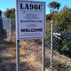
LA96C-Former NIKE Missile Control Site Photos


You might also consider


More like LA96C-Former NIKE Missile Control Site
Recommended Reviews - LA96C-Former NIKE Missile Control Site
Start your review...


Reviews With Photos


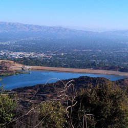
A really easy hike with extraordinary views of Los Angeles and the Valley complete with some history added in as well. There are many former Nike Missile Launch sites but this one is at the top of San Vicente Mountain south of the Encino reservoir. You can park your car just past where the road ends at the start of the Canyonback Trail or you can actually drive up to the actual entrance of the missile site but the road up is bumpy and .8 miles from the Canyonback parking area. At the top you have a great view of the valley as well as DTLA. We went early on Saturday and there was only one other person at the site when we were there. There are many biking and hiking trails crisscrossing behind and in front of it so you can add this onto a longer hike or take a short trip up to the site itself. I highly recommend if you're a fan of views and sunshine.


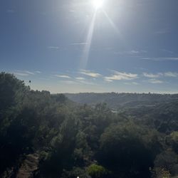
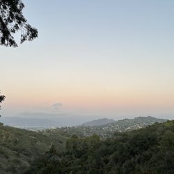
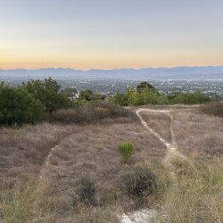
I passed this place for years on drives down Mulholland before one day I thought wait, where does this dirt road I've never seen before go, and alas I found the Nike Missile site at San Vicente Mountain Park. The site from Mulholland is about a 1-mile drive along a dusty and rocky road, I'd be careful to drive here unless my tires were in great condition. What I love is the view is so vast! This is definitely a place for people that love views! You can see downtown LA, Venice, The Valley, the San Gabriel Mountains, the most comprehensive view of LA in all of it's glory. I'd say the best time to come is when it's not too hot and not too cold. There is no shade so it can be a bit much on a hot day, also in the summer there can be a lot of bugs and you constantly have to swat yourself. There are a couple of ways to hike up here. I've parked at the end of Reseda Boulevard and walked in which is about 3 miles one way. That way is mostly pretty level and there are great views of the San Fernando valley but after 3 miles it gets a bit boring so I think that way might be better to bike it. There's also hiking in from the Westridge Trail which starts in the Brentwood hills. This hike seems more on the strenuous side since it's uphill the whole way and long (7.5 miles round trip) without a lot of shade so might not be as great of an option in the middle of summertime.


It's a scenic place to visit just outside of the bustling metropolis down below, and it offers a piece of Cold War history to reflect on. The numerous trails branching off from this location offers plenty of hiking options. Bring your dogs or mountain bikes. The bathroom is clean and there is a drinking fountain for the canine companions too.
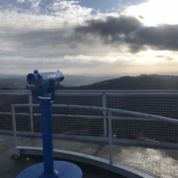

An all purpose trail good for mountain biking, trail running, and hiking. There are a few locations that lead to this site, I got here from the Mulholland Gateway Park at the top of Reseda Blvd. From there to the Nike Site is almost 3.5 miles one way. From the Nike Site you'll get some great views of the San Fernando valley, and on the other side (depending on the weather and time of day) you can also see down town LA in the distance. While the trail is on the top of the hill it's a moderate trail for hiking, no major incline so if you're a beginner hiker you can cover some good mileage without fear of getting too tired due to the terrain. For trail running and mountain biking the trail has lots of room for two way traffic so there really aren't any areas where you'll have trouble passing others on the trail if you need too.


Stumble upon this nice piece of history on my hike this morning pretty cool place and history. Pretty dope view when you climb to the top
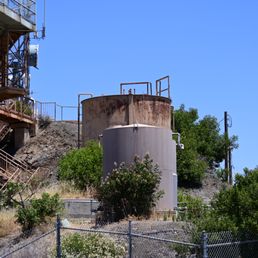

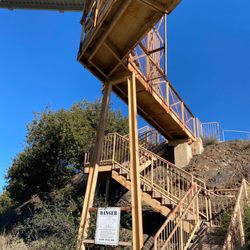
tried to hike that .8 miles to the missile site, but couldn't do it.. had to go back to my car and drive up instead. the views are nice, but i couldn't get more closer because they locked the gate due to covid 19. I was excited to climb up those stairs..


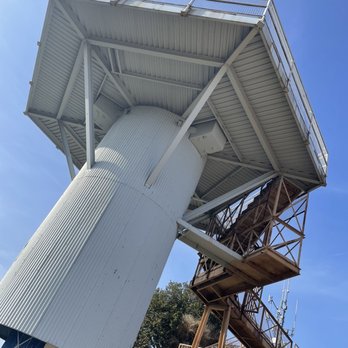
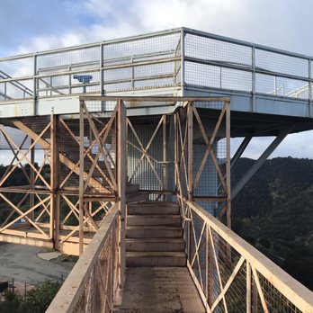
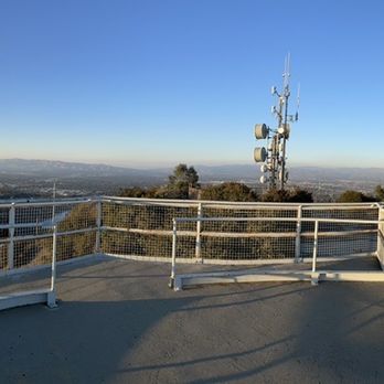
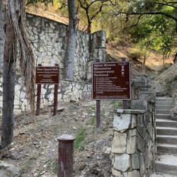
Nike missiles- named, like the athletic shoe, after the Greek goddess of victory. San Vicente was an ideal location for NIKE missile radar. On a peak 1,950 feet above the Pacific Ocean, between the San Fernando Valley and Brentwood, was the last line of defense to protect Los Angeles and its teeming aerospace factories from Soviet bombers. Tower has about 50 steps and is worth the climb. Electrifying views!!! After climbing to the top of the observation deck you can take in Valley views and can see the Encino Reservouir along with the Santa Monica and Los Angeles Basins. Then consider reading all of the signs that explain how the site was used during the Cold War. This is one of my favourite sites to hike which I stumbled upon by accidents few years ago. Great bicycle paths and walking trails. Wonderful location to watch a Western sunset as well. What was once the officer's quarters is converted to a washroom for men & women to use. Concrete pads on which the radar rested is an observation deck flanked with picnic tables. Make sure to pack some snacks and refreshments next time you go...it's nice up there. This site can be reach by climbing north from Sullivan, Rustic or Mandeville canyons, or by driving west on unpaved Mulholland Drive from Encino Hills Drive in Encino, or by driving east from Canoga Avenue in Woodland Hills. Who would have thought a fitness fanatic and a Cold War/Soviet History buff would go hand in hand...!?! "Without new experiences, something inside of us sleeps. The sleeper must awaken." --Frank Herbert


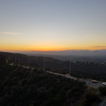
I came here with some friends to watch sunset. Follow your fellow yelper's directions to get there because it's definitely off-road and not your typical paved road. I parked on the dirt at the end, walked up and climbed up to the tower. There were a few hikers nearby but it definitely wasn't crowded. We were able to see the sunset over the mountains and it was magnificent. What a gem of a place to know about!
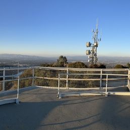

This is an awesome hike! You get wonderful views of SFV, Los Angeles, and even the ocean on clear days. Great for short hikes (just to the silo) or long hikes going deep into the "big wild". And I've seen many mountain bikers really enjoying trekking the trails.


This spot is amazing. Hard to believe more people don't know about it! Once you hike up the side of the mountain you can climb to the spot of where they use to launch rockets and it's a 360 of LA. Incredible! Worth the trip! Side note: there are tons of those weird gnat bugs that follow you all the way up the trail, bring bug repellent!


While it is a bit of a hike it is an amazing piece of history that needs to be remembered by those who lived through the 50s and 60s. And it must be taught to those who were not there then. Wonderful and descriptive signage that provides a basic explanation of this site. I gave 5 stars solely because it was such a startling surprise to discover this
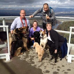

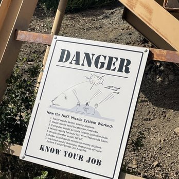
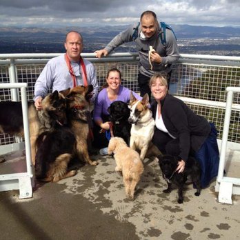
Great 8 to 9 mile loop hiking the Santa Monica Mountains to the tower. Located at the top of Hayvenhurst at Dirt Mulholland. This is a good workout due to the distance and has some steady inclines in various places along the route. We start off on a trail heading East which loops around to the Nike tower, but you can go straight up to the tower from the parking lot. Map of the trail http://www.lamountains.com/maps/sanVicente.pdf At one point the trail ends in a residential neighborhood but reconnects just up the street across the road. The neighbors have water bowls out for the many dogs that hike the trails. You must climb the tower your first visit. Stunning Views of the Valley and Westside from the top of the Nike Watch Tour. Worth the hike to enjoy the views. It over looks the Encino reservoir as well. The tower provides a glimpse into US military history. Several displays explain how from 1956-1968, San Vicente Mountain was one of sixteen Los Angeles area Nike-Ajax supersonic anti-aircraft missile launch sites. Nike sites were located in defensive rings surrounding key urban and industrial areas throughout the US. This site contained ground-based radar and computer systems designed to detect and track hostile aircraft, and to guide the anti-aircraft missiles that would be launched from nearby Sepulveda Basin to their targets. Definitely interesting to read and visit this site. The park has fresh water fountains and restrooms near the Nike Watch Tour. Hikers, runners and mountain bikers on these trails. Wide fire roads for the trails. Higher hiking traffic on the weekends, its best to arrive early. Dog friendly hiking here, our dogs love this hike. Parking in Park spaces or on the street.


This is about an 8 mile round trip hike up and back. I will not comment on the history, as it has been described quite well by other reviews. The trail starts at Mandeville Canyon fire road and is wide and smooth, without loose rocks under foot. The entire hike is not shaded and can get windy. The inclines are fairly tame and the trail ascends and descends. About 4 miles into the hike, you will arrive at the former NIKE Mission Control Site, which consists of a tower/overlook and a flat area with 2 restrooms. There are panoramic views of the mountains, ocean, and LA in the distance. If you continue on beyond the tower and left , you can reach Sullivan Canyon in a few more miles. Otherwise, this hike is up and back. parking - free, tiny lot or free residential street parking on Westridge Rd.


9 months ago

10 months ago

5 years ago
I've been coming hiking here for years, my sons cross country team use to do a ton of training up here and I believe that's how I was introduced to this trail system. I've hiked it from several entry points and out every which direction but lately I've been visiting a couple times a week and doing the quick out and back from the top of Reseda entry point to the NIKE site. It's the perfect little weekday/weekend hike when you just want to get out and get some fresh air. I do this hike with friends, my son, his girlfriend, and often solo. There isn't much elevation gain at all but you still get the sense that you are sort of hiking, since you're on a dirt path :) If you venture in on other trails towards the ocean, you lose the city views and get the sense of really being in nature. There isn't much coverage on the trail, so I would suggest sunscreen and a bottle of water. It typically takes a couple of hours tops, and I believe it's around 7miles round trip. If you aren't so big on snakes, I will say watch your step on warm days and stay near the center of the trail because I often spot many out here. This is the sort of hike you can bring just anyone on, since it's very easy. We love it! read more




A really easy hike with extraordinary views of Los Angeles and the Valley complete with some history added in as well. There are many former Nike Missile Launch sites but this one is at the top of San Vicente Mountain south of the Encino reservoir. You can park your car just past where the road ends at the start of the Canyonback Trail or you can actually drive up to the actual entrance of the missile site but the road up is bumpy and .8 miles from the Canyonback parking area. At the top you have a great view of the valley as well as DTLA. We went early on Saturday and there was only one other person at the site when we were there. There are many biking and hiking trails crisscrossing behind and in front of it so you can add this onto a longer hike or take a short trip up to the site itself. I highly recommend if you're a fan of views and sunshine. read more


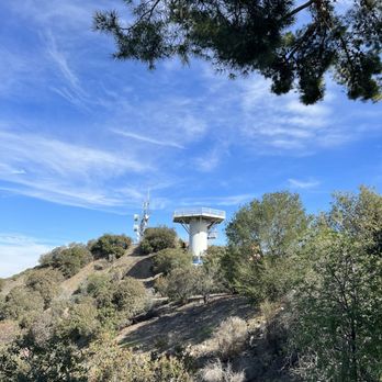


I passed this place for years on drives down Mulholland before one day I thought wait, where does this dirt road I've never seen before go, and alas I found the Nike Missile site at San Vicente Mountain Park. The site from Mulholland is about a 1-mile drive along a dusty and rocky road, I'd be careful to drive here unless my tires were in great condition. What I love is the view is so vast! This is definitely a place for people that love views! You can see downtown LA, Venice, The Valley, the San Gabriel Mountains, the most comprehensive view of LA in all of it's glory. I'd say the best time to come is when it's not too hot and not too cold. There is no shade so it can be a bit much on a hot day, also in the summer there can be a lot of bugs and you constantly have to swat yourself. There are a couple of ways to hike up here. I've parked at the end of Reseda Boulevard and walked in which is about 3 miles one way. That way is mostly pretty level and there are great views of the San Fernando valley but after 3 miles it gets a bit boring so I think that way might be better to bike it. There's also hiking in from the Westridge Trail which starts in the Brentwood hills. This hike seems more on the strenuous side since it's uphill the whole way and long (7.5 miles round trip) without a lot of shade so might not be as great of an option in the middle of summertime. read more


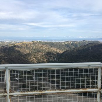

It's a scenic place to visit just outside of the bustling metropolis down below, and it offers a piece of Cold War history to reflect on. The numerous trails branching off from this location offers plenty of hiking options. Bring your dogs or mountain bikes. The bathroom is clean and there is a drinking fountain for the canine companions too. read more




An all purpose trail good for mountain biking, trail running, and hiking. There are a few locations that lead to this site, I got here from the Mulholland Gateway Park at the top of Reseda Blvd. From there to the Nike Site is almost 3.5 miles one way. From the Nike Site you'll get some great views of the San Fernando valley, and on the other side (depending on the weather and time of day) you can also see down town LA in the distance. While the trail is on the top of the hill it's a moderate trail for hiking, no major incline so if you're a beginner hiker you can cover some good mileage without fear of getting too tired due to the terrain. For trail running and mountain biking the trail has lots of room for two way traffic so there really aren't any areas where you'll have trouble passing others on the trail if you need too. read more



4 years ago
Stumble upon this nice piece of history on my hike this morning pretty cool place and history. Pretty dope view when you climb to the top read more

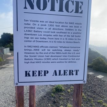
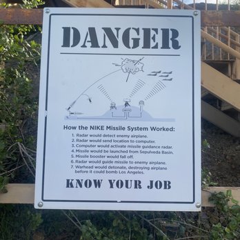


tried to hike that .8 miles to the missile site, but couldn't do it.. had to go back to my car and drive up instead. the views are nice, but i couldn't get more closer because they locked the gate due to covid 19. I was excited to climb up those stairs.. read more
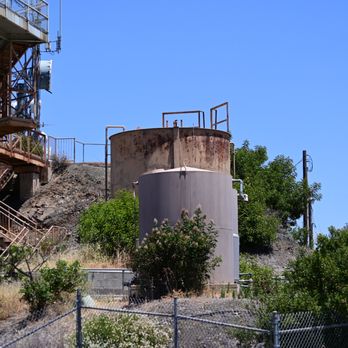
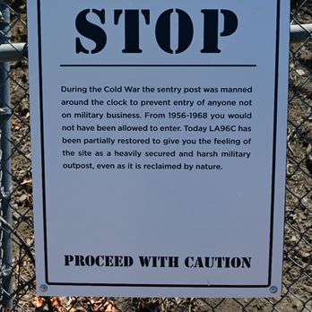


Nike missiles- named, like the athletic shoe, after the Greek goddess of victory. San Vicente was an ideal location for NIKE missile radar. On a peak 1,950 feet above the Pacific Ocean, between the San Fernando Valley and Brentwood, was the last line of defense to protect Los Angeles and its teeming aerospace factories from Soviet bombers. Tower has about 50 steps and is worth the climb. Electrifying views!!! After climbing to the top of the observation deck you can take in Valley views and can see the Encino Reservouir along with the Santa Monica and Los Angeles Basins. Then consider reading all of the signs that explain how the site was used during the Cold War. This is one of my favourite sites to hike which I stumbled upon by accidents few years ago. Great bicycle paths and walking trails. Wonderful location to watch a Western sunset as well. What was once the officer's quarters is converted to a washroom for men & women to use. Concrete pads on which the radar rested is an observation deck flanked with picnic tables. Make sure to pack some snacks and refreshments next time you go...it's nice up there. This site can be reach by climbing north from Sullivan, Rustic or Mandeville canyons, or by driving west on unpaved Mulholland Drive from Encino Hills Drive in Encino, or by driving east from Canoga Avenue in Woodland Hills. Who would have thought a fitness fanatic and a Cold War/Soviet History buff would go hand in hand...!?! "Without new experiences, something inside of us sleeps. The sleeper must awaken." --Frank Herbert read more


I came here with some friends to watch sunset. Follow your fellow yelper's directions to get there because it's definitely off-road and not your typical paved road. I parked on the dirt at the end, walked up and climbed up to the tower. There were a few hikers nearby but it definitely wasn't crowded. We were able to see the sunset over the mountains and it was magnificent. What a gem of a place to know about! read more



5 years ago
This is an awesome hike! You get wonderful views of SFV, Los Angeles, and even the ocean on clear days. Great for short hikes (just to the silo) or long hikes going deep into the "big wild". And I've seen many mountain bikers really enjoying trekking the trails. read more


8 years ago
This spot is amazing. Hard to believe more people don't know about it! Once you hike up the side of the mountain you can climb to the spot of where they use to launch rockets and it's a 360 of LA. Incredible! Worth the trip! Side note: there are tons of those weird gnat bugs that follow you all the way up the trail, bring bug repellent! read more


4 years ago

9 years ago
While it is a bit of a hike it is an amazing piece of history that needs to be remembered by those who lived through the 50s and 60s. And it must be taught to those who were not there then. Wonderful and descriptive signage that provides a basic explanation of this site. I gave 5 stars solely because it was such a startling surprise to discover this read more


Great 8 to 9 mile loop hiking the Santa Monica Mountains to the tower. Located at the top of Hayvenhurst at Dirt Mulholland. This is a good workout due to the distance and has some steady inclines in various places along the route. We start off on a trail heading East which loops around to the Nike tower, but you can go straight up to the tower from the parking lot. Map of the trail http://www.lamountains.com/maps/sanVicente.pdf At one point the trail ends in a residential neighborhood but reconnects just up the street across the road. The neighbors have water bowls out for the many dogs that hike the trails. You must climb the tower your first visit. Stunning Views of the Valley and Westside from the top of the Nike Watch Tour. Worth the hike to enjoy the views. It over looks the Encino reservoir as well. The tower provides a glimpse into US military history. Several displays explain how from 1956-1968, San Vicente Mountain was one of sixteen Los Angeles area Nike-Ajax supersonic anti-aircraft missile launch sites. Nike sites were located in defensive rings surrounding key urban and industrial areas throughout the US. This site contained ground-based radar and computer systems designed to detect and track hostile aircraft, and to guide the anti-aircraft missiles that would be launched from nearby Sepulveda Basin to their targets. Definitely interesting to read and visit this site. The park has fresh water fountains and restrooms near the Nike Watch Tour. Hikers, runners and mountain bikers on these trails. Wide fire roads for the trails. Higher hiking traffic on the weekends, its best to arrive early. Dog friendly hiking here, our dogs love this hike. Parking in Park spaces or on the street. read more

12 years ago
This is about an 8 mile round trip hike up and back. I will not comment on the history, as it has been described quite well by other reviews. The trail starts at Mandeville Canyon fire road and is wide and smooth, without loose rocks under foot. The entire hike is not shaded and can get windy. The inclines are fairly tame and the trail ascends and descends. About 4 miles into the hike, you will arrive at the former NIKE Mission Control Site, which consists of a tower/overlook and a flat area with 2 restrooms. There are panoramic views of the mountains, ocean, and LA in the distance. If you continue on beyond the tower and left , you can reach Sullivan Canyon in a few more miles. Otherwise, this hike is up and back. parking - free, tiny lot or free residential street parking on Westridge Rd. read more


Almost 20 years before the first Nike tennis shoe was invented, there was project Nike. Named after the goddess of victory, project Nike produced the Nike Ajax and Nike Hercules. Nike Ajax was the first US surface to air missile system. Nike Hercules, developed a little later, was equipped with a nuclear warhead. Between 1956 and 1974 Los Angeles had 16 total launch sites collectively formed a "Ring of Steel." The purpose of the launch sites was to shoot down enemy bombers that would enter LA airspace during the height of the Cold War. This particular site, located in San Vicente Mountain Park, contained the ground-based radar and computer systems that were used to detect and track enemy aircraft and guide the anti-aircraft missiles that would be launched from nearby Sepulveda Basin to their targets. There are a few ways to get to the site. I chose to start from the Westridge Trailhead located in Brentwood. From there it's a 4 mile trek to the Nike site. Along the way you will encounter a number of other hikers, mountain bikers and friendly unleashed dogs. The path is wide and mainly sun exposed. It has a nice consistent incline most of the way there. At the Nike site there are some clean bathrooms and shaded picnic benches. Here's the address to the Westridge Trailhead if you want to plug it into your smart phone map app: 2652 Westridge Rd, Los Angeles, CA 90049 read more


10 years ago
This is a great place for a hike and amazing for views. From the top of the base you can see the valley, Burbank, downtown the ocean and on clear days Catalina! There are easy to hike, walk or bike fire trails and a bit more moderate off shooting trails. I've seen rattlesnakes and even a tarantula! There's a restroom in the park and water for you and your pooch. If you bring your pet, please pick up their poop and remember if you bring it in, take it out. read more


8 years ago
This was a nice and easy short hike to a wonderful view of the city. Perfect for a laid back chill hike. One thing to note though, bring bug repellent if you're going there in the evening. read more


9 years ago
Stubbled onto this little gem by accident, I was looking for the San Vicente mountain trail and this spot was right next to it. Pretty cool self guided tour with signs everywhere giving little tidbits of history, worth checking out. Parked along side the dirt road with no issues and handicap parking is located through the gate all the way at the top. Happy Trails! read more


9 years ago
Cool place to hike to. Not a lot to see but still very cool. There are tables there to have lunch at. I came from reseda point, if you walk its about 3 hours round trip with lunch included. read more


7 years ago


Love hiking this area. Secluded enough where you can be alone on the trail for a long while unlike Runyon Canyon. From Encino entrance up Hayvenhurst to Encino Hills Dr., you can choose one path along the 405 or to the right to Topanga State Park or to Brentwood via Mandeville Canyon from Nike watch tower where can stop for clean restrooms and water fountain. Walk up the tower for 360 view of Los Angeles. read more


10 years ago


9 years ago

10 years ago

12 years ago

11 years ago
More info about LA96C-Former NIKE Missile Control Site
17500 Mulholland Dr
Encino, CA 91416
Brentwood
Directions
Hours
Outdoor Amenities
Ask the Community - LA96C-Former NIKE Missile Control Site
Is the gate to the observation deck still locked? :(
It's open early in the morning, before 7 am.
Review Highlights - LA96C-Former NIKE Missile Control Site
You might also consider


















Why does Yelp recommend reviews?
1 review that is not currently recommended
The reviews below are not factored into the business's overall star rating.

3 years ago
LA96C-Former NIKE Missile Control Site - hiking - Updated August 2026
Best of Encino
People found LA96C-Former NIKE Missile Control Site by searching for…
Browse Nearby
BEST of Encino, California Coffee near LA96C-Former NIKE Missile Control Site
BEST of Encino, California Restaurants near LA96C-Former NIKE Missile Control Site
BEST of Encino, California Things to Do near LA96C-Former NIKE Missile Control Site
BEST of Encino, California Parks near LA96C-Former NIKE Missile Control Site
BEST of Encino, California Beaches near LA96C-Former NIKE Missile Control Site
BEST of Encino, California Breakfast near LA96C-Former NIKE Missile Control Site
BEST of Encino, California Motel near LA96C-Former NIKE Missile Control Site
Browse Brands
Browse Articles
People who viewed LA96C-Former NIKE Missile Control Site also viewed

Mount Lukens Via Stone Canyon Trail
8 reviews

Stunt High Trail
2 reviews

West Trail and Turner Trail To Captains Roost
2 reviews
Griffith Park

Knoll Park
3 reviews

Murphy Ranch Trail
319 reviews
Pacific Palisades

Mt. Hollywood Trail
92 reviews
Griffith Park

Micheltorena Stairs
65 reviews
Silver Lake

Beachwood Canyon & Hollywoodland Stairs
52 reviews
Hollywood Hills

Lang Station Open Space
1 review

Fern Dell Nature Preserve
1 review
Hollywood Hills