Deervale-Stone Canyon Park Photos


You might also consider


More like Deervale-Stone Canyon Park
Recommended Reviews - Deervale-Stone Canyon Park
Start your review...


Reviews With Photos


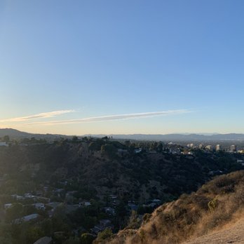
Are you looking for a quick hike paired with an incline and spectacular view during sunset? Well, here's the spot if you decide to start at the top or bottom of the trail. Please note, this is not a hike that's miles and miles long. If you're looking to just get out and get your sweat on check this hidden gem out!


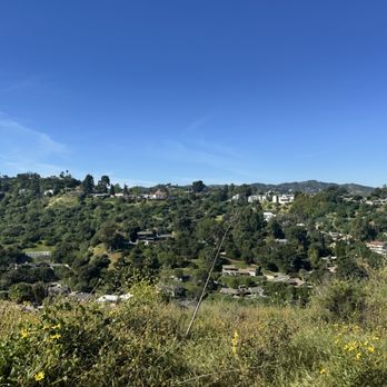
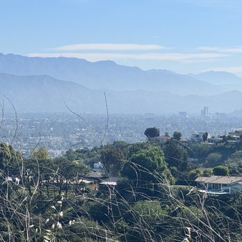
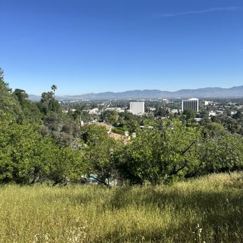
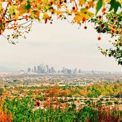
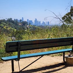
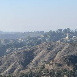
Great neighborhood hike. Cleared path. A couple fairly steep areas but a determined novice could walk those parts slowly. Notice the little details like the flowering shrubs, tiny birds, animal dens. Really pretty while the hills are green. Bird's eye view of Sherman Oaks & Encino valley floors. Sunset is pretty but would not encourage hiking much into dusk currently. There have been two recent mt. lion sitings (one on Cody, one on Mountaingate) over the last two months.


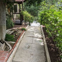
It was very hard to find information about this park on the internet. It appeared that there was an entrance off of Valley Vista but when I tried this I noticed a big fence around which was very disappointing so I drove up Beverly Glen and entered on Deervale Place. This is a hike that not many people know about, I only saw two other hikers while there. It kinda feels like you are trespassing in someone's extended backyard. The trail goes down for about 30 minutes or so and then basically you go back up the way you came. I think it has a decent incline and length so it can be good for people who live in the Valley and don't want to drive over the hill to go to Runyan or don't want to hike somewhere with many others around. I wasn't too impressed with the scenery though. The trees were extremely dry and the bushes were mostly dead. Even in the daytime I felt I had stepped into some dark Tim Burton movie land. I would like to come back at dusk around Halloween. When I reached the bottom I saw the irritating fence but I also discovered another exit to some side street. From the street the entrance wasn't marked or obvious and you'd never find it unless you had been there before, it was very clandestine and I think most people that hike here are locals that don't want it to become too popular. It might be nicer during other parts of the year but I'd skip it in the summer. I went at 9am and it was already really hot.


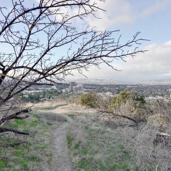
This was a nice little hike for those located in the valley. It doesn't have the cache of a Fryman or Runyon Canyon, but it's also less crowded and that's important in the time COVID where social distancing is an issue. It's not an easy trail to find if you start from the bottom of the hill. To the untrained eye, the trail head on Crisp Canyon road looks like you're walking into private property, but once you get past the initial awkwardness, it opens up into a nice incline that takes you above the valley floor offering some nice views of Sherman Oaks and Encino. The trail is not difficult, but if you have any type of knee problems, I would definitely recommend you taking your time as some parts of the incline and decline were steep. The trail is a little over a mile long and ends on Deervale Road. If you don't want to do the loop, my suggestion would be park one car at the end and drive back down as Deervale exits until Beverly Glen so walking back is not recommended.
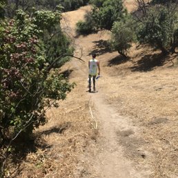
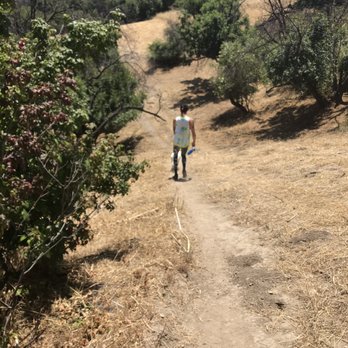
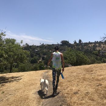
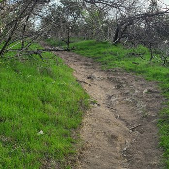
I love this hike because it is super hidden, a great workout (about 400 calories to be exact lol), and I never see any people on it. My dog loves it and it's a quiet quick hike to get away from the city. It's definitely not a glamorous hike and the trail is very thin. During spring the plants and flowers grow so tall they almost cover the trail completely, but I love it and it's beautiful to me. You will definitely see bugs and lizards so don't come here if that's not your thing!
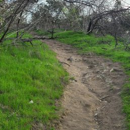
Great short hike! It looks like you're going between 2 yards/houses, but that's the trail head. Pretty steep and narrow at parts. Goes up about 700 feet total. Plenty of places to catch your breath if you need to. Great views all the way up of the San Fernando Valley looking toward Sherman Oaks and further east. A little less than 2 miles one way, so it is easy to finish in the late afternoon as well. It's great when you live in Sherman Oaks because you can walk there. I don't know what parking is like, but it's all a residencial neighborhood, so I'd be careful. Can get dusty. DO NOT follow Google maps if you're on foot for directions there. It will take you to a completely wrong area. Use the "driving" setting, even if you're walking or biking there.


5 months ago
I walked from Magnolia and Supulveda to the trail. Trail was only 2.2 miles away from my current location, so I walked. The beginning there's a steep incline where it feels like you're constantly crouching. But don't let that scare you. It's easy. Over all id rate the intensity of the hike 4/10 read more




1 year ago
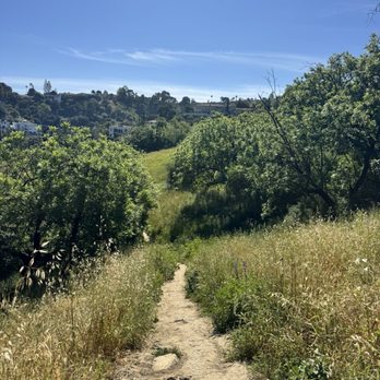
It's a not a long trail Very fast on the way down But it really kicks my a** on the way back up Very good workout read more


Are you looking for a quick hike paired with an incline and spectacular view during sunset? Well, here's the spot if you decide to start at the top or bottom of the trail. Please note, this is not a hike that's miles and miles long. If you're looking to just get out and get your sweat on check this hidden gem out! read more


5 years ago

7 years ago
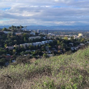
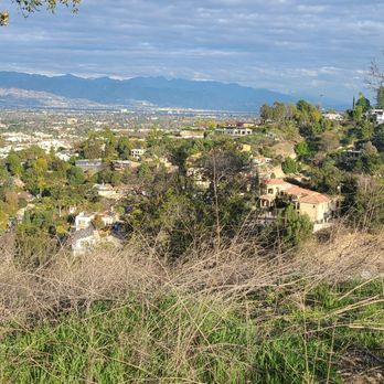
Great neighborhood hike. Cleared path. A couple fairly steep areas but a determined novice could walk those parts slowly. Notice the little details like the flowering shrubs, tiny birds, animal dens. Really pretty while the hills are green. Bird's eye view of Sherman Oaks & Encino valley floors. Sunset is pretty but would not encourage hiking much into dusk currently. There have been two recent mt. lion sitings (one on Cody, one on Mountaingate) over the last two months. read more


It was very hard to find information about this park on the internet. It appeared that there was an entrance off of Valley Vista but when I tried this I noticed a big fence around which was very disappointing so I drove up Beverly Glen and entered on Deervale Place. This is a hike that not many people know about, I only saw two other hikers while there. It kinda feels like you are trespassing in someone's extended backyard. The trail goes down for about 30 minutes or so and then basically you go back up the way you came. I think it has a decent incline and length so it can be good for people who live in the Valley and don't want to drive over the hill to go to Runyan or don't want to hike somewhere with many others around. I wasn't too impressed with the scenery though. The trees were extremely dry and the bushes were mostly dead. Even in the daytime I felt I had stepped into some dark Tim Burton movie land. I would like to come back at dusk around Halloween. When I reached the bottom I saw the irritating fence but I also discovered another exit to some side street. From the street the entrance wasn't marked or obvious and you'd never find it unless you had been there before, it was very clandestine and I think most people that hike here are locals that don't want it to become too popular. It might be nicer during other parts of the year but I'd skip it in the summer. I went at 9am and it was already really hot. read more


6 years ago
This was a nice little hike for those located in the valley. It doesn't have the cache of a Fryman or Runyon Canyon, but it's also less crowded and that's important in the time COVID where social distancing is an issue. It's not an easy trail to find if you start from the bottom of the hill. To the untrained eye, the trail head on Crisp Canyon road looks like you're walking into private property, but once you get past the initial awkwardness, it opens up into a nice incline that takes you above the valley floor offering some nice views of Sherman Oaks and Encino. The trail is not difficult, but if you have any type of knee problems, I would definitely recommend you taking your time as some parts of the incline and decline were steep. The trail is a little over a mile long and ends on Deervale Road. If you don't want to do the loop, my suggestion would be park one car at the end and drive back down as Deervale exits until Beverly Glen so walking back is not recommended. read more



7 years ago
I love this hike because it is super hidden, a great workout (about 400 calories to be exact lol), and I never see any people on it. My dog loves it and it's a quiet quick hike to get away from the city. It's definitely not a glamorous hike and the trail is very thin. During spring the plants and flowers grow so tall they almost cover the trail completely, but I love it and it's beautiful to me. You will definitely see bugs and lizards so don't come here if that's not your thing! read more
5 years ago
Great short hike! It looks like you're going between 2 yards/houses, but that's the trail head. Pretty steep and narrow at parts. Goes up about 700 feet total. Plenty of places to catch your breath if you need to. Great views all the way up of the San Fernando Valley looking toward Sherman Oaks and further east. A little less than 2 miles one way, so it is easy to finish in the late afternoon as well. It's great when you live in Sherman Oaks because you can walk there. I don't know what parking is like, but it's all a residencial neighborhood, so I'd be careful. Can get dusty. DO NOT follow Google maps if you're on foot for directions there. It will take you to a completely wrong area. Use the "driving" setting, even if you're walking or biking there. read more



4 years ago
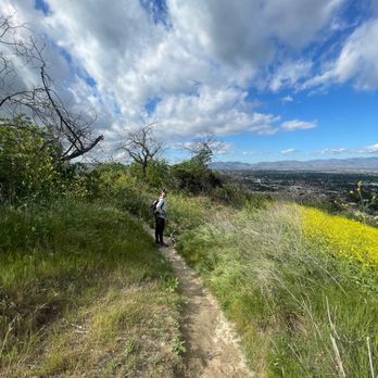
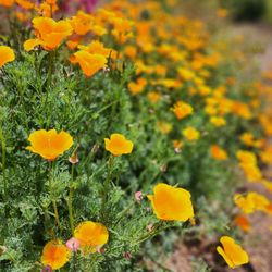
Great quick hike with beautiful wildflowers and view of Sherman oaks. Not much parking but it doesn't get very packed. read more



9 years ago

11 years ago
7 years ago
12 years ago

11 years ago
More info about Deervale-Stone Canyon Park
14700 Deervale Pl
Los Angeles, CA 91403
Sherman Oaks
Directions
(818) 788-5691
Call Now
Hours
Outdoor Amenities
Ask the Community - Deervale-Stone Canyon Park
Review Highlights - Deervale-Stone Canyon Park
You might also consider
























Why does Yelp recommend reviews?
1 review that is not currently recommended
The reviews below are not factored into the business's overall star rating.
7 years ago
Deervale-Stone Canyon Park - hiking - Updated August 2026
Best of Los Angeles
People found Deervale-Stone Canyon Park by searching for…
Hiking Trails in Los Angeles, CA
Beautiful Views in Los Angeles, CA
Secluded Spots in Los Angeles, CA
Running Trails in Los Angeles, CA
Walking Trails in Los Angeles, CA
Secret Spots in Los Angeles, CA
Watch Sunset in Los Angeles, CA
Places to Walk in Los Angeles, CA
Lookout Points in Los Angeles, CA
Scenic Overlook in Los Angeles, CA
Cheap Fun Things to Do in Los Angeles, CA
Sunset View in Los Angeles, CA
Scenic View in Los Angeles, CA
Free Things to Do in Los Angeles, CA
View Points in Los Angeles, CA
Parks for Kids in Los Angeles, CA
Stairs Workout in Los Angeles, CA
Fall Foliage in Los Angeles, CA
Off Road Trails in Los Angeles, CA
Trending Searches in Los Angeles, CA
Antiques near Deervale-Stone Canyon Park
Barbershop For Men near Deervale-Stone Canyon Park
Bike Shop near Deervale-Stone Canyon Park
Cliff Jumping near Deervale-Stone Canyon Park
Consignment Shops near Deervale-Stone Canyon Park
Cruising Spots near Deervale-Stone Canyon Park
Dog Friendly Things To Do near Deervale-Stone Canyon Park
Ear Piercing near Deervale-Stone Canyon Park
Eyebrow Threading near Deervale-Stone Canyon Park
Flower Fields near Deervale-Stone Canyon Park
Hair Braiding near Deervale-Stone Canyon Park
Kids Haircut near Deervale-Stone Canyon Park
Lakes near Deervale-Stone Canyon Park
Mini Golf near Deervale-Stone Canyon Park
Parks near Deervale-Stone Canyon Park
Pedicure near Deervale-Stone Canyon Park
Permanent Makeup near Deervale-Stone Canyon Park
Picnic Areas near Deervale-Stone Canyon Park
Public Golf Courses near Deervale-Stone Canyon Park
Public Pools near Deervale-Stone Canyon Park
Rock Quarry near Deervale-Stone Canyon Park
Running Trails near Deervale-Stone Canyon Park
Scenic Night View near Deervale-Stone Canyon Park
Scenic Overlook near Deervale-Stone Canyon Park
Sunrise View near Deervale-Stone Canyon Park
Swimming Holes near Deervale-Stone Canyon Park
Trading Card Shops near Deervale-Stone Canyon Park
Used Furniture Stores near Deervale-Stone Canyon Park
Browse Articles
Browse Nearby
BEST of Los Angeles, California Coffee near Deervale-Stone Canyon Park
BEST of Los Angeles, California Restaurants near Deervale-Stone Canyon Park
BEST of Los Angeles, California Things to Do near Deervale-Stone Canyon Park
BEST of Los Angeles, California Breakfast near Deervale-Stone Canyon Park
BEST of Los Angeles, California Walking Trails near Deervale-Stone Canyon Park
BEST of Los Angeles, California Parks near Deervale-Stone Canyon Park
BEST of Los Angeles, California Campgrounds near Deervale-Stone Canyon Park
BEST of Los Angeles, California Motel near Deervale-Stone Canyon Park
BEST of Los Angeles, California Taxis near Deervale-Stone Canyon Park
Browse Brands
Related Searches in Los Angeles, CA
Best Dog Hiking Trails Around Los Angeles, California
Best Fishing Locations and Guides in Los Angeles, California
Best Nature Trails for Hiking in Los Angeles, California
Best Places for Horseback Riding in Los Angeles, California
Check Out Off Road Trails in Los Angeles, California
Discover Dog Friendly Trails to Explore in Los Angeles, California
Discover Easy Hiking Trails Near Los Angeles, California
Discover Kid Friendly Hiking Trails in Los Angeles, California
Discover Popular Bike Trails in Los Angeles, California
Discover Scenic Mountain Bike Trails Near Los Angeles, California
Discover Walking Parks in Los Angeles, California Near You
Discover a Hiking Trail in Los Angeles, California
Discover the Best Night Hike Trails in Los Angeles, California
Dog-Friendly Hikes With Dogs in Los Angeles, California
Enjoy Camping Adventures Around Los Angeles, California
Enjoy Kayaking Adventures in Los Angeles, California
Enjoy Off Leash Dog Hikes in Los Angeles, California
Enjoy Scenic Places to Walk in Los Angeles, California
Enjoy Tent Camping Spots Around Los Angeles, California
Enjoy a Beautiful Waterfall Hike in Los Angeles, California
Enjoy the Best Walking Path in Los Angeles, California
Enjoy the Best Walking Trails in Los Angeles, California
Explore Beautiful Parks and Green Spaces in Los Angeles, California
Explore Easy Hikes Perfect for All in Los Angeles, California
Explore Fun Activities to Do in Los Angeles, California
Explore Popular Campgrounds Near Los Angeles, California
Explore Popular Dog Walking Trails in Los Angeles, California
Explore Top Dog Parks in Los Angeles, California Near You
Explore the Best Beach Spots in Los Angeles, California
Family Friendly Hiking With Kids in Los Angeles, California
Find Parks and Recreation Activities in Los Angeles, California
Find Top Dog Friendly Parks to Visit in Los Angeles, California
Find Top-Rated Waterfalls in Los Angeles, California Now
Find the Best Parks for Picnics in Los Angeles, California
Hiking Trails With Waterfalls in Los Angeles, California
Off Leash Dog Hiking Trails in Los Angeles, California
Popular Outdoor Activities to Try in Los Angeles, California
Popular Picnic Spots to Visit in Los Angeles, California
Popular Waterfall Hiking Trails in Los Angeles, California
Safe River Swimming Areas in Los Angeles, California
Safe and Fun Parks for Kids in Los Angeles, California
Top Hiking Trails to Explore in Los Angeles, California
Top Playgrounds for Kids to Enjoy in Los Angeles, California
Top Running Trails to Explore in Los Angeles, California
Top Swimming Lakes to Enjoy in Los Angeles, California
Top Swimming Spots and Pools in Los Angeles, California
Top-Rated Camping Sites in Los Angeles, California
Walk Dog Friendly Hiking Trails in Los Angeles, California
Walk the Best Paved Walking Trails in Los Angeles, California


