Famosa Slough Photos


You might also consider


More like Famosa Slough
Recommended Reviews - Famosa Slough
Start your review...


Reviews With Photos
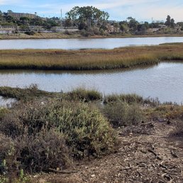


Here is another update on the goings-on at Famosa Slough. I know there's been lots of activity recently with the City of San Diego digging up the streets around the Slough. Workers are currently replacing old underground pipes that have decayed and broken down over the years. The number of sewage leaks that have occurred has increased and of course-the outfall ends up in the Slough wetlands. Monitoring of water quality in the area showed the high bacteria to be sewage contamination and the culprit was traced back to leaking city sewer pipes. Even though the street closures and re-routing of traffic has been noisy and a big hassle-it is a necessary evil in order to stop the pollution at Famosa Slough. The filtering reed plants that were planted off Valeta Street have done a great job at cleaning up the water visibility and keeping down the algae levels during the summer. As a result, the large bird populations are back-wintering in the waterways and drawing lots of "birders" with their binoculars and camera's. In fact now there are "birding tours" that pay a call here to photograph and gawk at the variety of wildlife at the Slough. I have seen large numbers of pintail ducks and the sand-pipers are numerous. Occasionally, some pelicans will show up and then there are always the "winged rats"--pigeons and sea gulls. But this vibrant display of winter birds is proof that Famosa is a healthy and vital marine wetland that can support a large variety and amount of fine-feathered friends. That is the entire purpose of all the hard-work and sweat of the brow that goes into keeping this little slice of nature something to be proud of.


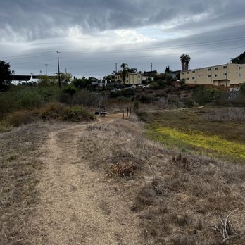
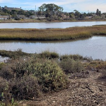
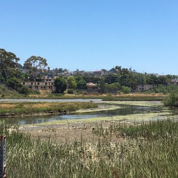
A 37-acre wetland and wildlife preserve tucked in between condos and the freeway. A unique place to take a walk and enjoy the birds, wildlife, flowers and trees. Over 190 species of birds have been observed here. Dogs on leashes are allowed. Although 37 acres seems large, the historic wetland was huge, and once covered a lot of the surrounding area, including what is now Mission Bay Park. Some reviews have mentioned Mosquitos, but we always come early in the morning when it's cooler, and have never had a problem. NOTE: there are 2 parts to the slough, the part on the south side of W. Point Loma has more walking trails, and less road noise, but both are nice.


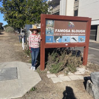
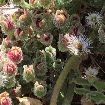
I took a Nature and Bird Walks here today and had a good time. They are held on the 3rd Saturday of each month at 1 pm. Meet at the kiosk by the corner of Famosa Blvd. and W. Pt. Loma Blvd. The guide's name was Barbara and she was really nice, helpful and knowledgeable. She had binoculars for everyone to borrow, which really helped. She told us about the history of the Slough as well as recent developments. She took us on a 2 hour walk, pointed out various birds and flowers/plants/foliage along the way. She answered all our questions and told us about the Friends of Famosa Slough organization which is always looking for volunteers! The Slough itself is pretty big, but there are only a few walking paths / trails, so its not exactly a place to hike. Just a nice place to take a stroll, bird watch, see some unique plants (the ice flower/cactus were so cool and attracted a ton of bees), relax on one of the several benches and just enjoy nature. Its conveniently located in Point Loma Heights. There are three different "kiosk" entry points which have a map of the area to help you. The one on Famosa and W Point Loma Heights is the most central (and has street parking which is pretty easy to find) and the one on Famosa and Valeta has a dirt parking lot. It seems to be a place the locals like to hang out, not sure its worth going on a regular basis if its out of your way, but I would recommend checking it out if you're into birds, nature or just want a nice new place for a walk. Especially if you can make one of the hosted walks. Point Loma Heights is a nice neighbourhood with lots of shops and restaurants to check out while you're there. I'm going to have to go back throughout the year to see how the bird life changes with the seasons.


What a beautiful day for a walk along the path at the slough. It's a great place to stop when you're driving between Ocean Beach and the Midway District. There are so many birds right now migrating through SAN DIEGO that you are guaranteed to see them enjoying the water. Make sure that you walk on both sides of the road so that you see the entire slough!! read more





15 years ago
The slough is cool, not a whole lot to it besides the trail and some wildlife. Its a good spot to kick back and think for a while in peace though, and i support the efforts to keep it a part of OB. The "roadwork" is STILL going on all around the surrounding streets. No wonder the city claims its broke and the school system is in shambles, the people doing the roadwork are obvious products of a school system in shambles because they cant seem to get anything sensible done. In the rare instance a road does appear to be repaired, eh, they come back and dig it up in a few months and start over again; which leads me to believe that the "foremen" actually running the construction show, are probably not products of a school system in shambles, but rather, very smart individuals who have figured out how to continuosly milk the blind taxpaying people of SD for their $45 an hour paychecks while they create infinite potholes and pollution! Another example of our societal imbalances. The people volunteering (key word volunteer) actually care about the environment and the living creatures within the environment and whose work is priceless(and appreciated by far too few). All the while ya have the destroyers of our environment working the system over and over again getting their fat paychecks chuckling as they watch the birds drop dead and your car rims get bent. But hey, who cares, you can go watch American Idol tonight and forget all about it. Awaken my fellow humans, the signs of the demise are all around you, but it doesnt have to be this way. Seven, over and out. read more


A jewel in the middle of town! Egrets, mallards, pipers, herons, and more! Even though there is traffic noise, this place silences it all as the senses take in a peaceful beauty! Thank you San Diego for protecting this tiny bit of wonderful!!! read more


17 years ago
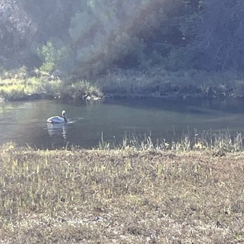
Here is another update on the goings-on at Famosa Slough. I know there's been lots of activity recently with the City of San Diego digging up the streets around the Slough. Workers are currently replacing old underground pipes that have decayed and broken down over the years. The number of sewage leaks that have occurred has increased and of course-the outfall ends up in the Slough wetlands. Monitoring of water quality in the area showed the high bacteria to be sewage contamination and the culprit was traced back to leaking city sewer pipes. Even though the street closures and re-routing of traffic has been noisy and a big hassle-it is a necessary evil in order to stop the pollution at Famosa Slough. The filtering reed plants that were planted off Valeta Street have done a great job at cleaning up the water visibility and keeping down the algae levels during the summer. As a result, the large bird populations are back-wintering in the waterways and drawing lots of "birders" with their binoculars and camera's. In fact now there are "birding tours" that pay a call here to photograph and gawk at the variety of wildlife at the Slough. I have seen large numbers of pintail ducks and the sand-pipers are numerous. Occasionally, some pelicans will show up and then there are always the "winged rats"--pigeons and sea gulls. But this vibrant display of winter birds is proof that Famosa is a healthy and vital marine wetland that can support a large variety and amount of fine-feathered friends. That is the entire purpose of all the hard-work and sweat of the brow that goes into keeping this little slice of nature something to be proud of. read more


A 37-acre wetland and wildlife preserve tucked in between condos and the freeway. A unique place to take a walk and enjoy the birds, wildlife, flowers and trees. Over 190 species of birds have been observed here. Dogs on leashes are allowed. Although 37 acres seems large, the historic wetland was huge, and once covered a lot of the surrounding area, including what is now Mission Bay Park. Some reviews have mentioned Mosquitos, but we always come early in the morning when it's cooler, and have never had a problem. NOTE: there are 2 parts to the slough, the part on the south side of W. Point Loma has more walking trails, and less road noise, but both are nice. read more


I took a Nature and Bird Walks here today and had a good time. They are held on the 3rd Saturday of each month at 1 pm. Meet at the kiosk by the corner of Famosa Blvd. and W. Pt. Loma Blvd. The guide's name was Barbara and she was really nice, helpful and knowledgeable. She had binoculars for everyone to borrow, which really helped. She told us about the history of the Slough as well as recent developments. She took us on a 2 hour walk, pointed out various birds and flowers/plants/foliage along the way. She answered all our questions and told us about the Friends of Famosa Slough organization which is always looking for volunteers! The Slough itself is pretty big, but there are only a few walking paths / trails, so its not exactly a place to hike. Just a nice place to take a stroll, bird watch, see some unique plants (the ice flower/cactus were so cool and attracted a ton of bees), relax on one of the several benches and just enjoy nature. Its conveniently located in Point Loma Heights. There are three different "kiosk" entry points which have a map of the area to help you. The one on Famosa and W Point Loma Heights is the most central (and has street parking which is pretty easy to find) and the one on Famosa and Valeta has a dirt parking lot. It seems to be a place the locals like to hang out, not sure its worth going on a regular basis if its out of your way, but I would recommend checking it out if you're into birds, nature or just want a nice new place for a walk. Especially if you can make one of the hosted walks. Point Loma Heights is a nice neighbourhood with lots of shops and restaurants to check out while you're there. I'm going to have to go back throughout the year to see how the bird life changes with the seasons. read more



8 years ago


13 years ago

12 years ago
This may be one of my favorite local spots to take a nice afternoon walk. I usually spend at least one hour a day biking, hiking, swimming or walking around and this right here is one of my number one spots for that walking! It's right off W. Point Loma which is a fairly busy road but, once you get into the Slough all that will disappear. You can walk for a good 20-30 mins around the water and back and you feel like you have transported to a nature oasis. There's lots of life and plants through out the Slough and I've even been told you can catch Halibut there. It's right down the street from my house and if a quick little walk is all I have time for this is the perfect solution for that! There are multiple locations to enter the Slough and I have used them all at one time or another. read more


17 years ago
More info about Famosa Slough
Ask the Community - Famosa Slough
Review Highlights - Famosa Slough
You might also consider



























Why does Yelp recommend reviews?
1 review that is not currently recommended
The reviews below are not factored into the business's overall star rating.

2 years ago
Famosa Slough - hiking - Updated August 2026
Best of San Diego
People found Famosa Slough by searching for…
River Swimming in San Diego, CA
Hiking Trails in San Diego, CA
Running Trails in San Diego, CA
Walking Paths in San Diego, CA
Parks for Kids in San Diego, CA
Walking Trails in San Diego, CA
Off Road Trails in San Diego, CA
Bird Watching in San Diego, CA
Waterfall Hike in San Diego, CA
Dog Friendly Trails in San Diego, CA
Bird Sanctuary in San Diego, CA
Scenic Night Views in San Diego, CA
Kid Friendly Hiking Trails in San Diego, CA
Tourist Attractions in San Diego, CA
Trending Searches in San Diego, CA
Blueberry Picking near Famosa Slough
Cliff Jumping near Famosa Slough
Cruising Spots near Famosa Slough
Dog Friendly Things To Do near Famosa Slough
Flower Fields near Famosa Slough
Jet Ski Rental near Famosa Slough
Kayak Rental near Famosa Slough
Kids Activities Indoor near Famosa Slough
Outdoor Activities near Famosa Slough
Peach Picking near Famosa Slough
Picnic Areas near Famosa Slough
Places To Walk At Night near Famosa Slough
Rainy Day Activities near Famosa Slough
River Swimming near Famosa Slough
Scenic Overlook near Famosa Slough
Shopping Malls near Famosa Slough
Sports Card Shops near Famosa Slough
Sunrise View near Famosa Slough
Things To Do On A Rainy Day near Famosa Slough
Browse Articles
Browse Nearby
BEST of San Diego, California Coffee near Famosa Slough
BEST of San Diego, California Restaurants near Famosa Slough
BEST of San Diego, California Things to Do near Famosa Slough
BEST of San Diego, California Breakfast near Famosa Slough
BEST of San Diego, California Walking Trails near Famosa Slough
BEST of San Diego, California Parks near Famosa Slough
BEST of San Diego, California Campgrounds near Famosa Slough
BEST of San Diego, California Sightseeing near Famosa Slough
BEST of San Diego, California Boat Cruise near Famosa Slough
Browse Brands
Related Searches in San Diego, CA
Affordable Kayak Rental Services in San Diego, California
Best Dog Hiking Trails Around San Diego, California
Best Fishing Locations and Guides in San Diego, California
Best Nature Trails for Hiking in San Diego, California
Best Places for Horseback Riding in San Diego, California
Best Sightseeing Experiences Available in San Diego, California
Check Out Off Road Trails in San Diego, California
Discover Dog Friendly Trails to Explore in San Diego, California
Discover Easy Hiking Trails Near San Diego, California
Discover Kid Friendly Hiking Trails in San Diego, California
Discover Popular Bike Trails in San Diego, California
Discover Scenic Mountain Bike Trails Near San Diego, California
Discover Walking Parks in San Diego, California Near You
Discover a Hiking Trail in San Diego, California
Discover the Best Night Hike Trails in San Diego, California
Dog-Friendly Hikes With Dogs in San Diego, California
Enjoy Camping Adventures Around San Diego, California
Enjoy Kayaking Adventures in San Diego, California
Enjoy Off Leash Dog Hikes in San Diego, California
Enjoy Scenic Places to Walk in San Diego, California
Enjoy Tent Camping Spots Around San Diego, California
Enjoy a Beautiful Waterfall Hike in San Diego, California
Enjoy the Best Walking Path in San Diego, California
Enjoy the Best Walking Trails in San Diego, California
Explore Beautiful Parks and Green Spaces in San Diego, California
Explore Easy Hikes Perfect for All in San Diego, California
Explore Fun Activities to Do in San Diego, California
Explore Picnic Parks Near San Diego, California
Explore Popular Campgrounds Near San Diego, California
Explore Top Dog Parks in San Diego, California Near You
Explore the Best Beach Spots in San Diego, California
Family Friendly Hiking With Kids in San Diego, California
Find Top Dog Friendly Parks to Visit in San Diego, California
Find the Best Parks for Picnics in San Diego, California
Hiking Trails With Waterfalls in San Diego, California
Off Leash Dog Hiking Trails in San Diego, California
Popular Outdoor Activities to Try in San Diego, California
Popular Picnic Spots to Visit in San Diego, California
Popular Waterfall Hiking Trails in San Diego, California
Safe River Swimming Areas in San Diego, California
Safe and Fun Parks for Kids in San Diego, California
Top Hiking Trails to Explore in San Diego, California
Top Playgrounds for Kids to Enjoy in San Diego, California
Top Running Trails to Explore in San Diego, California
Top Swimming Lakes to Enjoy in San Diego, California
Top Swimming Spots and Pools in San Diego, California
Top-Rated Camping Sites in San Diego, California


