Iron Mountain Via Heaton Flats Photos


You might also consider


More like Iron Mountain Via Heaton Flats
Recommended Reviews - Iron Mountain Via Heaton Flats
Start your review...


Reviews With Photos


To climb Iron Mountain, the individual must suffer from these three qualities: 1. Amnesia 2. Stockholm Syndrome 3. Masochism I vaguely remember first climbing Iron Mountain as a way to prepare for the Tough Mudder. The hike expert "El Puma" sold it to me like this: "after you do this hike, you'll be able to do anything else". And since I was having frequent panic attacks leading up to the Tough Mudder, i thought, why the hell not. famous last words. first time around--- first sign of concern: start time 7am? carpool area, arrive at 6am. Get up at 4:45 am. what? second time around (climbed this past sunday) start time: 6 am, carpool arrival: 4:45am, Get up: 3:45am so. obviously- first signs of AMNESIA. Depending on where you're coming from, it would be wise to carpool. Because you will be spent after. No. Spent is not the word. Devastated, broken. Yes. The mountain will break your spirit. And you will like it. Masochist. You have to be a masochist. Because though I remembered the hike to be about 8 hours- in reality it takes about 13-15 hours. Most definitely in the double digits unless you're training with mr steroid-- the trek takes a bit. The whole trip is and out and back. And deceptively short - 14 miles. But what happens during those 14 miles is the problem. Climbing up inclines at about 60 degrees, and constant scrambling up loose terrain will wear on you. To make matters worse, one of the steepest is towards the end. You will encounter a false summit and start weeping when you realize just how really much further you are. Not to mention the yuccas, nature's way of saying "Fuck you, you furless, exposed mammals". Take care not to stumble into them, they are Venus human traps, and they yearn for the sacrificial nectar of blood from us. If you're in a jam and just too close to one, carefully take the sharp tip and curl it away-- it's the only way. Bring at least 4 liters of water and 3-4 sandwiches, along with snacks and various other goodies that will get you by. Sunscreen and hats are a must. Dress in layers, since you will be starting out when still dark, and it might be chilly. The mountains are unpredictable. Also, flashlights are necessary, for the trek back in the dark is NOT fun. The terrain is very slippery coming down, so leave your ego at the trail head, you will be crab walking a lot. Plus side- you'll have some new guns to show your significant other. That is -- after you've recovered from the bashing of iron mountain. The first time I climbed it, it took me two full days to walk straight. My knees wouldn't stop buckling under my own weight. So you have been warned. Have at least one day to recover. There will be moments on the way back, where you will curse the Gods and yourself. Why did you do this! Why is this still going on! Is this really the hike that never endsssss it just goes on and on my friendssss. And yes. You will break into song, and there will be random bursts of anger followed by absolute silence. Yet, when you finally get into your vehicle- and you're driving away, you'll feel like you've lost a limb (cuz you probably have). But you realize. Godammit. I miss that mountain and yea. Cursing. There will be much cursing to be had. But the pay off of having accomplished such a feat is extraordinary. It puts life in perspective and after 6 month, amnesia will set in, and you'll be planning another bashing of your physical form again. Make sure at the summit to sign your name on the little book, and maybe, we'll see each other there. Beaten, beleaguered, hallucinating, but happy as hell to be at the top of the world.


An alternative perspective. 6 liters of water -- really? I took 3.75 and drank 2 on a cool day in April. 14 miles -- My hiking partner's Ipod which counts her steps, read 19.3 miles. Probably less, but still.... 14? smh (that means I'm shaking my head) Bears and mountain lions? I wouldn't worry too much. But if you're that worried, don't hike alone and make sure you're a burly 200 pound dude trained in Muy Thai and carrying a shotgun. You will be cursing the Gods? Dude, watch it now. You don't want to be struck by lightning when you're on a 8000 foot peak do you? Going down is brutal. Really? I made it down in about 3 hours no problems. Of course, my hiking partner fell 8 times, got stabbed by a yucca, tore her other palm up, and almost stepped on a snake. 12-13 hours? It took us 8 1/2 total hiking time plus a half hour break on top. 3-4 sandwiches? Are you planning on entering an eating contest? I ate half a turkey sandwich, half a cup of pasta, chocolate milk, a pepperoni stick, a Balance Bar and 6 Fig Newtons. This was way less hard than I expected, but I'm a conditioned hiker. And here's the point-- If you're not a conditioned hiker, what the heck are you doing hiking up Iron Mountain? You'll probably freak out, get lost, become dehydrated, hallucinate and then write a hysterical review on Yelp. And then get eaten by a bear. Be warned!!
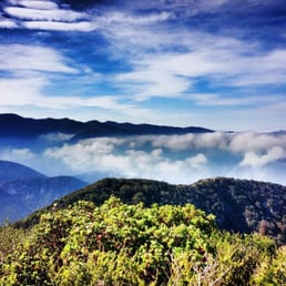

Iron Mountain or "Big Iron" is one of those hikes most people avoid because they have heard of all the difficult or grueling experiences of others. For me, that was my motivation to go and experience it for myself. The hike is a long a grueling journey along the San Gabriel Mountains in which most of the hike is an uphill battle. I recommend trekking poles to help as they helped me out both on the way up and way down. There are areas in which the incline is nearly 60 to 70 degree grade. I also recommend pants as you will run into many yuccas with sharp sword like leaves along the trail which will make you bleed. Even though the distance is a little under 7 miles to the summit, it really takes a lot of work and time. My time to the summit was 6 hours and nearly 5 hours to get back down. I slipped on the loose rocks three times coming down but fortunately was not injured. Overall I have to say this hike was epic with a beautiful 360 degree view at the summit. I have to say it was tough and I've hiked Mt. Whitney three times. I recommend it to anyone wanting a real challenge. Make sure to sign the notebook at the peak. Enjoy the trek and pain!


John Robinson, author of "Trails of the Angeles", claims this to be the hardest hike in the San Gabriels. 15 miles 7000 ft elevation gain 10/10 I will return with more info if I actually return this weekend from this hike! In the mean time, I leave you with lolcat: http://icanhascheezburger.files.wordpress.com/2008/03/funny-pictures-proceed-cat.jpg This was easily the hardest hike I've done, and it lived up to its reputation in local hiking books. Hiking member "Rachelle" and I set out at about 9:20 and walked on fire road for about a half mile until we met up with the Heaton Flat trail. This part of the trail is in very good shape and well used. However, this trail made me realize that yucca plants are the devil as they come close up on the trail at a few occasions. If you do this hike it is important to wear long sleeves to avoid any annoying brush that you may encounter in some spots. The first 4 miles follows this trail up eastward then northeast. You occasionally get views of West Baldy and the destination, Iron Mountain. This trail ends up at a saddle at about 4500 ft (you start at 2000 ft), but there is some roller coaster action so you probably have gotten 3000 ft so far. Now the fun starts. You follow the ridge straight ahead of you, and you will basically take this about 3 miles and 3500 ft of elevation gain. I would equate this to the steepness of hiking from Brand Park in the Verdugos, but just much longer! As you ascend you'll notice the vegetation changes and clears out a bit more. With about a mile left it becomes really steep with no flat portions for breaks. With about a half mile left we found a little bit of snow at 2 or 3 locations on the trail, but they were not a hindrance. We made it to the peak at about 1:10 which was pretty good time. We had very nice views as you could see Rattlesnake Peak, Mt Baden-Powell and Old Baldy (when it wasn't misty). We relaxed up there and ate lunch until about 2. Coming down may be more annoying. Some of the trail along the ridge has loose dirt and rock, so you have to take your time coming down, and it is energetically taxing on the legs, and you've probably already spent a bunch of energy coming up! Hiking poles would be a nice help for this one. We got down at 5, which was pretty good time overall. I was sore the next 2 days in my quadriceps, which never happens. So this is a tough, strenuous hike. If you want a physical challenge for hiking, this is it. Next time we'll ascend Iron Mountain the same way, then take the ridge across to Old Baldy. More on that in the next few months...


Starting point: 34.237040,-117.765370 Just finished "Iron Mountain" last week, so wanted to give you a quick heads-up if you decide to attack this beast. Iron Mountain or "Big Iron" as it's affectionately called, is described as the most strenuous one-summit hike in the entire San Gabriel range. Here are some stats: Elevation gain: 6,900 ft Total distance: 14.4 miles Time: 5 hours for ascent, 3 hours for descent Trail itself is very rough with bushes but easily followed. I recommend to start at the trail very early, around 5am (or even earlier at 4:30am) to beat traffic and heat as the trail is very exposed. Bring 6 liters of water (and stash 2 liters at the Saddle, which is a point on the trail about 4 miles in). That way you have water for your return trip. Bring bug repellent as there are tons of little gnats flying around. The last 3 miles are very steep so just take plenty of small breaks and you'll make it to the summit with no problems. Going down is very tough on your knees because it's so steep with loose gravel on the ground, so take your time to make sure you don't fall and use poles to anchor yourself. All in all, this is a tough hike, but much easier than C2C. Go into your #BeastMode and you've got it. Best of luck!


Want to get away from it all, get out in nature, see the sights, experience a spectacular sunrise, while getting full body workout, w/o the price of a gym membership, all in one day? Or would you simply like to know if you have lost your mind, w/o paying for a therapist? Keep calm and read on: What you will need for this journey: Backpack, lug sole boots, layered clothing, hat, sunglasses, hiking poles, camera, emergency supplies. More importantly: a minimum of 5 liters (in winter) of water, some form of electrolytes, snacks. Most importantly: a smile, a positive, upbeat, can do attitude, at minimum good health, leave your sound mind in a safe place at home there is no place for it on this journey. This hike is not for the faint of heart. Stats: Distance: 13 miles, Total Accumulated Gain: 7200 feet, Time: 9-11 hours, Best Start time: 5 a.m. hour, Parking: San Gabriel River-East Fork (34.236977,-117.765230). Rangers will advise an Adventure Pass, but it is not necessary...http://www.sangabrielmountains.org/forest_service_adventure_pass General Information: Iron Mountain is known in the hiking community as, 'The mother of all hikes in the San Gabriel's'. Iron Mountain stands at 8,007 feet and is considered to be the least accessible mountain in the range. There are no trails to the summit. You can reach the summit from West Baldy via a treacherous hike across San Antonio Ridge or from the East Fork Ranger Station. 3:15 a.m. Saturday morning, day after Valentine's Friday, my alarm goes off, earliest I've ever had to roll out of bed for a hike. As I enjoy my morning shower (MY morning cup of coffee), I contemplate how an addiction to hiking could have gotten me to this point...hiking a trail that I know only the best of the best hikers call this a beast of hike, followed by many four letter words. Getting my gear together, again, I ask myself why? What's the point? You're not a trail hiker, you're not a fan of the San Gab's. Then it hits me, I'm doing this because a friend of mine, who couldn't make this hike, wants to do an even more challenging trail hike, wants me to go with, and this is a great training ground. UGH!!! 4:00 a.m. car is packed with everything listed above and off I go to meet fellow crazy hiker friends. 5:20 a.m. we are in the BTN parking lot at coordinates provided above. We got the last parking spot and don't use a parking pass. Information on this also provided above. 5:32 head off in the direction of BTN. We make a quick pit-stop at the, typically cleaner of the two outhouses at this trail head. Then off we go to the trail on the right, heading toward Allison Mine. We start up the Heaton Flat Trail for the first four miles and 2,500 of gain, layered in clothing, packs filled with food, water, and other essentials, and poles in overdrive. The elevation sudden gain and warm air have many of us shedding layers of clothing within the first 20 minutes. It's going to be a warm day. Quick break at Allison Saddle before continuing onward and upward. What goes up must come down. A section of this hike is like riding a roller coaster... up...down ...up....down. Only here, you're not yelling and screaming WooHoo!! When you muster enough energy to lift your head, you say, 'oh no, another hill to climb, are we there yet?!' The last mile and a half of this trail is on a ridge through a narrow brush lined trail. At the end of the trail we reach a saddle that drops us about 200 feet and brings us up on the other side to the beginning of our climb. From here we will proceed the last 3 1/2 miles up a scratch trail through thick chaparral and forest for the last 3,500 feet of gain to the summit. This portion of the trail is basically 1000 feet of gain per mile. Many areas we are all on hands and feet scrambling up the loose dirt and rock. Talk about a cardio workout, gyms could never prepare you for this.
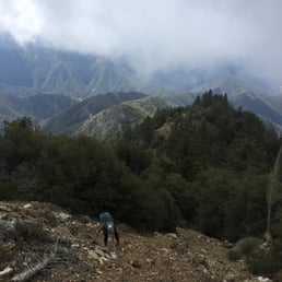

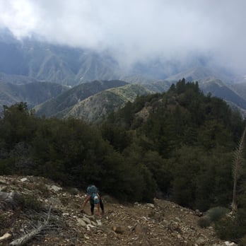
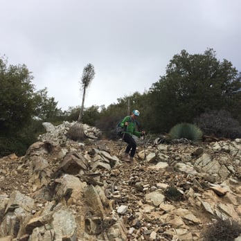
IF YOU ARE PLANNING ON DOING THIS HIKE FOR THE FIRST TIME, READ THIS! The first most important thing to note is that the Yelp map for this hike will NOT get you to the trailhead. I had read just about everything available online for this hike and did not get accurate information on how to locate the trailhead. The Yelp map will get you to E Fork Road. From there, you will drive to the very end of the road (about six miles), onto a street labeled "not a through street", over a white bridge and then eventually you will end up in the paved parking lot. From there, you will walk past the gates toward the river and you will reach the trailhead for Heaton Flats. Thanks to inadequate information on the Internet, the third (male) hiker in our group never found us, so it was two women doing this on our own (more on this in a moment). There is no cell service up in those mountains so plan for that. Our goal was to start the trail at 6 am yesterday. We were in the general area at 5:50 am and drove around for nearly an hour and a half trying to find the trailhead. The poor guy who was supposed to meet us there (the only thing I did was send him the Yelp map) did the same thing and eventually gave up and drove home. Once we finally found the trailhead, I was excited that the lot was nearly full. However, we eventually found out that everyone there was either panning for gold or bungee jumping. At the self permit stand, we met two guys who were going to the summit but on some other trail I had never heard of. We never saw them. We did encounter three other people but their destination was the saddle, so after the first three or four miles (forgot the distance to the saddle), we were the only ones on the mountain and never encountered another human being after that point. We started at 7:30 am and finished at 6:30 pm. We were excruciatingly slow coming down. I was initially nervous about this hike because of all the information out there about the trail to the summit being very difficult to find, etc. This was not our experience. From the saddle, there was an obvious trail that took us up and over a few mountains and then eventually to the summit. At no point were we wondering if we were going the right way. I'm sure there are other trail options to the summit, but I did not see any options besides the obvious! You will know you have reached the saddle when you come to a clearing point that has a couple of reflectors on some rocks. The first part of the hike to the saddle was easy. Fair incline, tight trail, not a problem. We did expect the second half to be brutal. As you'll read in other reviews, scrambling, scree, etc. Yes, this was our experience. However, with trekking poles, we were never on all fours. Poles are imperative on this hike, regardless of your age, unless you want to be crawling up the steep inclines. The inclines were fine for us. We felt good all the way to the top. We are NOT experienced mountaineers, climbers, etc. We have done a few big hikes and hike occasionally. What made the hike difficult was the FEAR we were experiencing as the only ones up there. We did encounter large feces on the trail. And we did read about mountain lion and bear tracks other people have seen. Totally spooked - do not do this hike solo - go with a big group. The trails are really tight in some areas. I felt claustrophobic as well as easy prey for any hungry animal out there. A gold panner we encountered near the trailhead warned us of "critters" and recommended we do not stop to sit and eat. Great. So we battled fear as well as trying to get down. This hike is a knee buster, big time. Often times coming down the very steep parts, we were sliding in the loose dirt/rubble and falling. This absolutely killed our knees and once we got to the easy part of the hike, even the slight decline in the trail was extremely painful. We hobbled down like two old ladies. The other reviews are accurate on the needed supplies. 4.5 liters of water was adequate for each of us. Had it been hot out, we would have been absolutely miserable. It was a perfect 72 degrees, cloudy and even super cold near the summit. Encountered a small patch of snow near the top. You will know you are approaching the summit when you reach some blue/grey/white granite looking rocks. We were not tracking our miles nor did we have an altimeter. So we had no idea how close or far we were from the summit. If you have done Cactus to Clouds, I would say the second part of this hike is comparable to the C2C climbs. And the entire time I was climbing C2C, I was thinking how happy I was that I wouldn't have to climb down. Well, you have to climb down this one and the elevation gain for the last portion of the hike is comparable to C2C. Bottom line, it's steep. Wear your knee bands, etc., unless you're 20 years old!
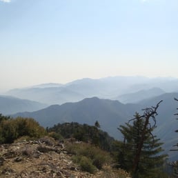

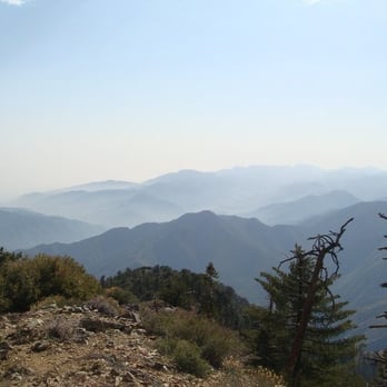
5 stars for kicking my ass. By far the hardest hike I've done in the San Gabriels. There are no sources of water during this hike, so bring plenty. I went on a warm, sunny day and ended up drinking all 6 liters by mile 13. I started late, about 10am. I don't recommend this unless you are in great shape and know that you can complete the hike before it gets dark. I'm not in great shape yet, so I had to finish the hike in the dark using a headlamp. Finished at 9pm. Also, if you start late you will be doing the most strenuous part of the hike during the hottest part of the day. I used trekking poles for this hike and found them very helpful during the steep portions of the climb. Saw a couple small rattlesnakes.


4 years ago
Gorgeous Trail, but EXTREMELY exhausting!!! I would have loved, to have loved this trail...Mentally and physically challenging! More mentally...flase summits, grueling 60-70% gradient ascents, and sun exposure through-out the trail. The trail is located in the San Bernardino County. Trail is an out & back, approx 14+ miles, elevation gain of 7000k. You will also require a parking premit, you can use your "America the beautiful" annual pass. Make sure its visable. Must, MUST start early (5:30/6am)! We started later than we wanted to and ended up having to turn back before we reached the summit. Take your time, but also know when to stop and head back. Please do your research before heading out on trail. Believe what you read! Bring lots of water. I brought a total of 4 liters and only had 1/2 liter left when I reached the bottom of the trailhead. I had a water bottle, with "liquid IV" electrolyte mix. I drank that on the way up, which seemed to help on the descent. Trekking poles are highly recommended, if you have micro-spikes bring those too...will help on the descent (save your knees). If you don't have micro-spikes, not to worry, you'll still be alright, just don't lock your knees and take your time. Good luck! read more


8 years ago
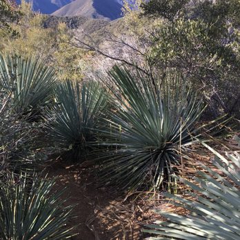
This hike will test your stamina. It is not for beginners and will take you several hours to complete. It took me 10 1/2 hrs. There are many steep parts; however, it was well worth the effort. After reading 2-3 books, each indicated the trail was difficult to locate in areas and advised to go with another person. Thankfully, I found the entire trail easy to navigate. Unless you love hot weather, do this hike on a cool day and bring plenty of water. I drank more water on the descent than on the ascent. Probably the first time that ever happened. I recommend AT LEAST 6 liters for the average hiker. Also, use caution because there are several stabbing yucca plants along the entire way (especially on the descent)! After reading several local hiking books, it is well documented that this is the most difficult hike in the Angeles National Forest! I share their opinion....so far. I will most likely do this hike again as it was very challenging. Good luck, take care, & enjoy life to the fullest! read more




9 years ago
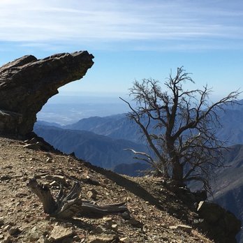
Iron Mountain (AKA Big Iron) has been touted as the most strenuous one-summit hike in the entire San Gabriel range. It is an out and back hike of about 13.5 miles with 6,600' elevation to the summit and 600' on the return. Is it a tough hike? In one word, yes. However, it was not as tough as I was expecting, especially since I was told that it would be the hardest hike that I have ever done. To me, Cactus to Clouds and Rattlesnake Peak are still more difficult. The ascent is pretty steady, with a few ups and downs along the way. The trail is single file and mostly unshaded. The first 4.5 miles to Allison Saddle are not difficult. At the Saddle, it is recommended to stash some water/fluids if you want to continue on with less weight, as the last 3+ miles are the most difficult. The incline can get quite steep, especially the last mile or so. It reminded me a lot of Mt Baldy's Register Ridge trail. Views at the summit are 360 degrees. What makes this hike so difficult is the descent. As the last 3+ miles were steep going up, inevitably you will have to go down the same way. There are lots of rocks, loose sand, and scree to deal with. Hiking poles are a must. Even for experienced hikers, your quads will not be happy the following day. parking - adventure pass required in the lot tip - the ideal time to hike this trail is during cool weather. I can't even imagine going during the summer. You will require less water as well. read more


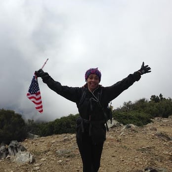
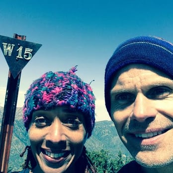
To climb Iron Mountain, the individual must suffer from these three qualities: 1. Amnesia 2. Stockholm Syndrome 3. Masochism I vaguely remember first climbing Iron Mountain as a way to prepare for the Tough Mudder. The hike expert "El Puma" sold it to me like this: "after you do this hike, you'll be able to do anything else". And since I was having frequent panic attacks leading up to the Tough Mudder, i thought, why the hell not. famous last words. first time around--- first sign of concern: start time 7am? carpool area, arrive at 6am. Get up at 4:45 am. what? second time around (climbed this past sunday) start time: 6 am, carpool arrival: 4:45am, Get up: 3:45am so. obviously- first signs of AMNESIA. Depending on where you're coming from, it would be wise to carpool. Because you will be spent after. No. Spent is not the word. Devastated, broken. Yes. The mountain will break your spirit. And you will like it. Masochist. You have to be a masochist. Because though I remembered the hike to be about 8 hours- in reality it takes about 13-15 hours. Most definitely in the double digits unless you're training with mr steroid-- the trek takes a bit. The whole trip is and out and back. And deceptively short - 14 miles. But what happens during those 14 miles is the problem. Climbing up inclines at about 60 degrees, and constant scrambling up loose terrain will wear on you. To make matters worse, one of the steepest is towards the end. You will encounter a false summit and start weeping when you realize just how really much further you are. Not to mention the yuccas, nature's way of saying "Fuck you, you furless, exposed mammals". Take care not to stumble into them, they are Venus human traps, and they yearn for the sacrificial nectar of blood from us. If you're in a jam and just too close to one, carefully take the sharp tip and curl it away-- it's the only way. Bring at least 4 liters of water and 3-4 sandwiches, along with snacks and various other goodies that will get you by. Sunscreen and hats are a must. Dress in layers, since you will be starting out when still dark, and it might be chilly. The mountains are unpredictable. Also, flashlights are necessary, for the trek back in the dark is NOT fun. The terrain is very slippery coming down, so leave your ego at the trail head, you will be crab walking a lot. Plus side- you'll have some new guns to show your significant other. That is -- after you've recovered from the bashing of iron mountain. The first time I climbed it, it took me two full days to walk straight. My knees wouldn't stop buckling under my own weight. So you have been warned. Have at least one day to recover. There will be moments on the way back, where you will curse the Gods and yourself. Why did you do this! Why is this still going on! Is this really the hike that never endsssss it just goes on and on my friendssss. And yes. You will break into song, and there will be random bursts of anger followed by absolute silence. Yet, when you finally get into your vehicle- and you're driving away, you'll feel like you've lost a limb (cuz you probably have). But you realize. Godammit. I miss that mountain and yea. Cursing. There will be much cursing to be had. But the pay off of having accomplished such a feat is extraordinary. It puts life in perspective and after 6 month, amnesia will set in, and you'll be planning another bashing of your physical form again. Make sure at the summit to sign your name on the little book, and maybe, we'll see each other there. Beaten, beleaguered, hallucinating, but happy as hell to be at the top of the world. read more


11 years ago
An alternative perspective. 6 liters of water -- really? I took 3.75 and drank 2 on a cool day in April. 14 miles -- My hiking partner's Ipod which counts her steps, read 19.3 miles. Probably less, but still.... 14? smh (that means I'm shaking my head) Bears and mountain lions? I wouldn't worry too much. But if you're that worried, don't hike alone and make sure you're a burly 200 pound dude trained in Muy Thai and carrying a shotgun. You will be cursing the Gods? Dude, watch it now. You don't want to be struck by lightning when you're on a 8000 foot peak do you? Going down is brutal. Really? I made it down in about 3 hours no problems. Of course, my hiking partner fell 8 times, got stabbed by a yucca, tore her other palm up, and almost stepped on a snake. 12-13 hours? It took us 8 1/2 total hiking time plus a half hour break on top. 3-4 sandwiches? Are you planning on entering an eating contest? I ate half a turkey sandwich, half a cup of pasta, chocolate milk, a pepperoni stick, a Balance Bar and 6 Fig Newtons. This was way less hard than I expected, but I'm a conditioned hiker. And here's the point-- If you're not a conditioned hiker, what the heck are you doing hiking up Iron Mountain? You'll probably freak out, get lost, become dehydrated, hallucinate and then write a hysterical review on Yelp. And then get eaten by a bear. Be warned!! read more





12 years ago
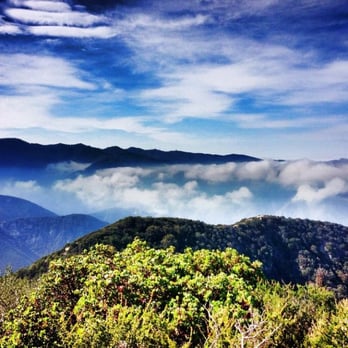
Iron Mountain or "Big Iron" is one of those hikes most people avoid because they have heard of all the difficult or grueling experiences of others. For me, that was my motivation to go and experience it for myself. The hike is a long a grueling journey along the San Gabriel Mountains in which most of the hike is an uphill battle. I recommend trekking poles to help as they helped me out both on the way up and way down. There are areas in which the incline is nearly 60 to 70 degree grade. I also recommend pants as you will run into many yuccas with sharp sword like leaves along the trail which will make you bleed. Even though the distance is a little under 7 miles to the summit, it really takes a lot of work and time. My time to the summit was 6 hours and nearly 5 hours to get back down. I slipped on the loose rocks three times coming down but fortunately was not injured. Overall I have to say this hike was epic with a beautiful 360 degree view at the summit. I have to say it was tough and I've hiked Mt. Whitney three times. I recommend it to anyone wanting a real challenge. Make sure to sign the notebook at the peak. Enjoy the trek and pain! read more


18 years ago
John Robinson, author of "Trails of the Angeles", claims this to be the hardest hike in the San Gabriels. 15 miles 7000 ft elevation gain 10/10 I will return with more info if I actually return this weekend from this hike! In the mean time, I leave you with lolcat: http://icanhascheezburger.files.wordpress.com/2008/03/funny-pictures-proceed-cat.jpg This was easily the hardest hike I've done, and it lived up to its reputation in local hiking books. Hiking member "Rachelle" and I set out at about 9:20 and walked on fire road for about a half mile until we met up with the Heaton Flat trail. This part of the trail is in very good shape and well used. However, this trail made me realize that yucca plants are the devil as they come close up on the trail at a few occasions. If you do this hike it is important to wear long sleeves to avoid any annoying brush that you may encounter in some spots. The first 4 miles follows this trail up eastward then northeast. You occasionally get views of West Baldy and the destination, Iron Mountain. This trail ends up at a saddle at about 4500 ft (you start at 2000 ft), but there is some roller coaster action so you probably have gotten 3000 ft so far. Now the fun starts. You follow the ridge straight ahead of you, and you will basically take this about 3 miles and 3500 ft of elevation gain. I would equate this to the steepness of hiking from Brand Park in the Verdugos, but just much longer! As you ascend you'll notice the vegetation changes and clears out a bit more. With about a mile left it becomes really steep with no flat portions for breaks. With about a half mile left we found a little bit of snow at 2 or 3 locations on the trail, but they were not a hindrance. We made it to the peak at about 1:10 which was pretty good time. We had very nice views as you could see Rattlesnake Peak, Mt Baden-Powell and Old Baldy (when it wasn't misty). We relaxed up there and ate lunch until about 2. Coming down may be more annoying. Some of the trail along the ridge has loose dirt and rock, so you have to take your time coming down, and it is energetically taxing on the legs, and you've probably already spent a bunch of energy coming up! Hiking poles would be a nice help for this one. We got down at 5, which was pretty good time overall. I was sore the next 2 days in my quadriceps, which never happens. So this is a tough, strenuous hike. If you want a physical challenge for hiking, this is it. Next time we'll ascend Iron Mountain the same way, then take the ridge across to Old Baldy. More on that in the next few months... read more


10 years ago
Starting point: 34.237040,-117.765370 Just finished "Iron Mountain" last week, so wanted to give you a quick heads-up if you decide to attack this beast. Iron Mountain or "Big Iron" as it's affectionately called, is described as the most strenuous one-summit hike in the entire San Gabriel range. Here are some stats: Elevation gain: 6,900 ft Total distance: 14.4 miles Time: 5 hours for ascent, 3 hours for descent Trail itself is very rough with bushes but easily followed. I recommend to start at the trail very early, around 5am (or even earlier at 4:30am) to beat traffic and heat as the trail is very exposed. Bring 6 liters of water (and stash 2 liters at the Saddle, which is a point on the trail about 4 miles in). That way you have water for your return trip. Bring bug repellent as there are tons of little gnats flying around. The last 3 miles are very steep so just take plenty of small breaks and you'll make it to the summit with no problems. Going down is very tough on your knees because it's so steep with loose gravel on the ground, so take your time to make sure you don't fall and use poles to anchor yourself. All in all, this is a tough hike, but much easier than C2C. Go into your #BeastMode and you've got it. Best of luck! read more

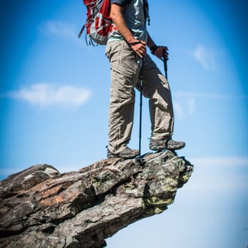

12 years ago
Want to get away from it all, get out in nature, see the sights, experience a spectacular sunrise, while getting full body workout, w/o the price of a gym membership, all in one day? Or would you simply like to know if you have lost your mind, w/o paying for a therapist? Keep calm and read on: What you will need for this journey: Backpack, lug sole boots, layered clothing, hat, sunglasses, hiking poles, camera, emergency supplies. More importantly: a minimum of 5 liters (in winter) of water, some form of electrolytes, snacks. Most importantly: a smile, a positive, upbeat, can do attitude, at minimum good health, leave your sound mind in a safe place at home there is no place for it on this journey. This hike is not for the faint of heart. Stats: Distance: 13 miles, Total Accumulated Gain: 7200 feet, Time: 9-11 hours, Best Start time: 5 a.m. hour, Parking: San Gabriel River-East Fork (34.236977,-117.765230). Rangers will advise an Adventure Pass, but it is not necessary...http://www.sangabrielmountains.org/forest_service_adventure_pass General Information: Iron Mountain is known in the hiking community as, 'The mother of all hikes in the San Gabriel's'. Iron Mountain stands at 8,007 feet and is considered to be the least accessible mountain in the range. There are no trails to the summit. You can reach the summit from West Baldy via a treacherous hike across San Antonio Ridge or from the East Fork Ranger Station. 3:15 a.m. Saturday morning, day after Valentine's Friday, my alarm goes off, earliest I've ever had to roll out of bed for a hike. As I enjoy my morning shower (MY morning cup of coffee), I contemplate how an addiction to hiking could have gotten me to this point...hiking a trail that I know only the best of the best hikers call this a beast of hike, followed by many four letter words. Getting my gear together, again, I ask myself why? What's the point? You're not a trail hiker, you're not a fan of the San Gab's. Then it hits me, I'm doing this because a friend of mine, who couldn't make this hike, wants to do an even more challenging trail hike, wants me to go with, and this is a great training ground. UGH!!! 4:00 a.m. car is packed with everything listed above and off I go to meet fellow crazy hiker friends. 5:20 a.m. we are in the BTN parking lot at coordinates provided above. We got the last parking spot and don't use a parking pass. Information on this also provided above. 5:32 head off in the direction of BTN. We make a quick pit-stop at the, typically cleaner of the two outhouses at this trail head. Then off we go to the trail on the right, heading toward Allison Mine. We start up the Heaton Flat Trail for the first four miles and 2,500 of gain, layered in clothing, packs filled with food, water, and other essentials, and poles in overdrive. The elevation sudden gain and warm air have many of us shedding layers of clothing within the first 20 minutes. It's going to be a warm day. Quick break at Allison Saddle before continuing onward and upward. What goes up must come down. A section of this hike is like riding a roller coaster... up...down ...up....down. Only here, you're not yelling and screaming WooHoo!! When you muster enough energy to lift your head, you say, 'oh no, another hill to climb, are we there yet?!' The last mile and a half of this trail is on a ridge through a narrow brush lined trail. At the end of the trail we reach a saddle that drops us about 200 feet and brings us up on the other side to the beginning of our climb. From here we will proceed the last 3 1/2 miles up a scratch trail through thick chaparral and forest for the last 3,500 feet of gain to the summit. This portion of the trail is basically 1000 feet of gain per mile. Many areas we are all on hands and feet scrambling up the loose dirt and rock. Talk about a cardio workout, gyms could never prepare you for this. read more


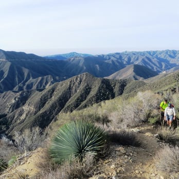


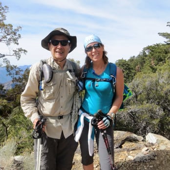
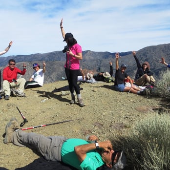


14 years ago

8 years ago

12 years ago
IF YOU ARE PLANNING ON DOING THIS HIKE FOR THE FIRST TIME, READ THIS! The first most important thing to note is that the Yelp map for this hike will NOT get you to the trailhead. I had read just about everything available online for this hike and did not get accurate information on how to locate the trailhead. The Yelp map will get you to E Fork Road. From there, you will drive to the very end of the road (about six miles), onto a street labeled "not a through street", over a white bridge and then eventually you will end up in the paved parking lot. From there, you will walk past the gates toward the river and you will reach the trailhead for Heaton Flats. Thanks to inadequate information on the Internet, the third (male) hiker in our group never found us, so it was two women doing this on our own (more on this in a moment). There is no cell service up in those mountains so plan for that. Our goal was to start the trail at 6 am yesterday. We were in the general area at 5:50 am and drove around for nearly an hour and a half trying to find the trailhead. The poor guy who was supposed to meet us there (the only thing I did was send him the Yelp map) did the same thing and eventually gave up and drove home. Once we finally found the trailhead, I was excited that the lot was nearly full. However, we eventually found out that everyone there was either panning for gold or bungee jumping. At the self permit stand, we met two guys who were going to the summit but on some other trail I had never heard of. We never saw them. We did encounter three other people but their destination was the saddle, so after the first three or four miles (forgot the distance to the saddle), we were the only ones on the mountain and never encountered another human being after that point. We started at 7:30 am and finished at 6:30 pm. We were excruciatingly slow coming down. I was initially nervous about this hike because of all the information out there about the trail to the summit being very difficult to find, etc. This was not our experience. From the saddle, there was an obvious trail that took us up and over a few mountains and then eventually to the summit. At no point were we wondering if we were going the right way. I'm sure there are other trail options to the summit, but I did not see any options besides the obvious! You will know you have reached the saddle when you come to a clearing point that has a couple of reflectors on some rocks. The first part of the hike to the saddle was easy. Fair incline, tight trail, not a problem. We did expect the second half to be brutal. As you'll read in other reviews, scrambling, scree, etc. Yes, this was our experience. However, with trekking poles, we were never on all fours. Poles are imperative on this hike, regardless of your age, unless you want to be crawling up the steep inclines. The inclines were fine for us. We felt good all the way to the top. We are NOT experienced mountaineers, climbers, etc. We have done a few big hikes and hike occasionally. What made the hike difficult was the FEAR we were experiencing as the only ones up there. We did encounter large feces on the trail. And we did read about mountain lion and bear tracks other people have seen. Totally spooked - do not do this hike solo - go with a big group. The trails are really tight in some areas. I felt claustrophobic as well as easy prey for any hungry animal out there. A gold panner we encountered near the trailhead warned us of "critters" and recommended we do not stop to sit and eat. Great. So we battled fear as well as trying to get down. This hike is a knee buster, big time. Often times coming down the very steep parts, we were sliding in the loose dirt/rubble and falling. This absolutely killed our knees and once we got to the easy part of the hike, even the slight decline in the trail was extremely painful. We hobbled down like two old ladies. The other reviews are accurate on the needed supplies. 4.5 liters of water was adequate for each of us. Had it been hot out, we would have been absolutely miserable. It was a perfect 72 degrees, cloudy and even super cold near the summit. Encountered a small patch of snow near the top. You will know you are approaching the summit when you reach some blue/grey/white granite looking rocks. We were not tracking our miles nor did we have an altimeter. So we had no idea how close or far we were from the summit. If you have done Cactus to Clouds, I would say the second part of this hike is comparable to the C2C climbs. And the entire time I was climbing C2C, I was thinking how happy I was that I wouldn't have to climb down. Well, you have to climb down this one and the elevation gain for the last portion of the hike is comparable to C2C. Bottom line, it's steep. Wear your knee bands, etc., unless you're 20 years old! read more



11 years ago

17 years ago
5 stars for kicking my ass. By far the hardest hike I've done in the San Gabriels. There are no sources of water during this hike, so bring plenty. I went on a warm, sunny day and ended up drinking all 6 liters by mile 13. I started late, about 10am. I don't recommend this unless you are in great shape and know that you can complete the hike before it gets dark. I'm not in great shape yet, so I had to finish the hike in the dark using a headlamp. Finished at 9pm. Also, if you start late you will be doing the most strenuous part of the hike during the hottest part of the day. I used trekking poles for this hike and found them very helpful during the steep portions of the climb. Saw a couple small rattlesnakes. read more


11 years ago

17 years ago
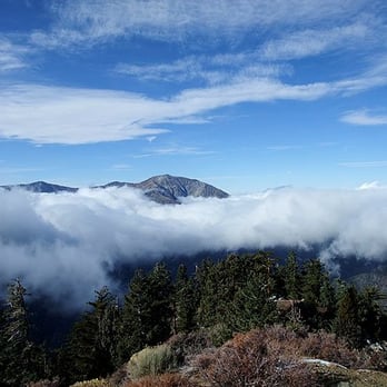
Not quite as scenic as Cactus to Clouds, but an extra star for proximity to Glendale and extra punishing grades. Fortunately, the NOAA wind predictions didn't hold up because the ambient air temp was cold enough without windchill. We were treated to interesting ice crystal formations on the pine trees and a pocket of blue skies at the summit. On the way down we saw a huge great horned own perched at the top of a dead yucca. Took us 7:20, and like C2C the descent takes longer than you think it should. read more


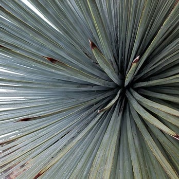


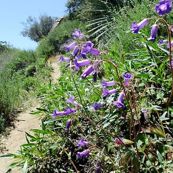

15 years ago

12 years ago

16 years ago

15 years ago

14 years ago

15 years ago

7 years ago
14 years ago
More info about Iron Mountain Via Heaton Flats
E East Fork Rd
Azusa, CA 91702
Directions
Hours
Outdoor Amenities
Ask the Community - Iron Mountain Via Heaton Flats
Review Highlights - Iron Mountain Via Heaton Flats
You might also consider



























Why does Yelp recommend reviews?
2 reviews that are not currently recommended
The reviews below are not factored into the business's overall star rating.

15 years ago

14 years ago
Iron Mountain Via Heaton Flats - hiking - Updated August 2026
Best of Azusa
People found Iron Mountain Via Heaton Flats by searching for…
Trending Searches in Azusa, CA
Bird Sanctuary near Iron Mountain Via Heaton Flats
Blueberry Picking near Iron Mountain Via Heaton Flats
Cinema near Iron Mountain Via Heaton Flats
Cliff Jumping near Iron Mountain Via Heaton Flats
Cruising Spots near Iron Mountain Via Heaton Flats
Day Trips near Iron Mountain Via Heaton Flats
Dog Friendly Things To Do near Iron Mountain Via Heaton Flats
Flower Fields near Iron Mountain Via Heaton Flats
Kids Activities Indoor near Iron Mountain Via Heaton Flats
Kids Haircut near Iron Mountain Via Heaton Flats
Lakes near Iron Mountain Via Heaton Flats
Outdoor Activities near Iron Mountain Via Heaton Flats
Parks near Iron Mountain Via Heaton Flats
Peach Picking near Iron Mountain Via Heaton Flats
Picnic Areas near Iron Mountain Via Heaton Flats
Rainy Day Activities near Iron Mountain Via Heaton Flats
River Swimming near Iron Mountain Via Heaton Flats
Rock Quarry near Iron Mountain Via Heaton Flats
Scenic Night View near Iron Mountain Via Heaton Flats
Shopping Malls near Iron Mountain Via Heaton Flats
Sports Card Shops near Iron Mountain Via Heaton Flats
Sunrise View near Iron Mountain Via Heaton Flats
Things To Do On A Rainy Day near Iron Mountain Via Heaton Flats
Trading Card Shops near Iron Mountain Via Heaton Flats
Uniforms near Iron Mountain Via Heaton Flats
Used Book Stores near Iron Mountain Via Heaton Flats
Watch Sunset near Iron Mountain Via Heaton Flats
Waterfalls And Swimming Holes near Iron Mountain Via Heaton Flats
Browse Brands
Related Searches in Azusa, CA
Best Dog Hiking Trails Around Azusa, California
Best Fishing Locations and Guides in Azusa, California
Best Gymnastics for Kids Activities in Azusa, California
Best Indoor Climbing Spots Available in Azusa, California
Best Kids Climbing Gym Options in Azusa, California
Best Nature Trails for Hiking in Azusa, California
Best Places for Calisthenics Workouts in Azusa, California
Best Places for Horseback Riding in Azusa, California
Best Rock Climbing Gyms to Try in Azusa, California
Best Rock Wall Climbing Spots in Azusa, California
Challenge Yourself With an Obstacle Course in Azusa, California
Check Out Off Road Trails in Azusa, California
Discover Dog Friendly Trails to Explore in Azusa, California
Discover Easy Hiking Trails Near Azusa, California
Discover Kid Friendly Hiking Trails in Azusa, California
Discover Outdoor Gym Facilities in Azusa, California
Discover Popular Bike Trails in Azusa, California
Discover Popular Ropes Course Options in Azusa, California
Discover Rock Climbing Walls in Azusa, California
Discover Scenic Mountain Bike Trails Near Azusa, California
Discover Walking Parks in Azusa, California Near You
Discover a Hiking Trail in Azusa, California
Discover the Best Night Hike Trails in Azusa, California
Discover the Best Parkour Gyms in Azusa, California
Dog-Friendly Hikes With Dogs in Azusa, California
Enjoy Camping Adventures Around Azusa, California
Enjoy Hiking Adventures in Azusa, California
Enjoy Kayaking Adventures in Azusa, California
Enjoy Off Leash Dog Hikes in Azusa, California
Enjoy Safe and Fun Bungee Jumping in Azusa, California
Enjoy Scenic Places to Walk in Azusa, California
Enjoy Tent Camping Spots Around Azusa, California
Enjoy a Beautiful Waterfall Hike in Azusa, California
Enjoy the Best Bouldering Experiences in Azusa, California
Enjoy the Best Walking Path in Azusa, California
Enjoy the Best Walking Trails in Azusa, California
Experience Aerial Yoga Sessions in Azusa, California
Explore Beautiful Parks and Green Spaces in Azusa, California
Explore Climbing Gyms in Azusa, California Near You
Explore Easy Hikes Perfect for All in Azusa, California
Explore Fun Activities to Do in Azusa, California
Explore Popular Campgrounds Near Azusa, California
Explore Popular Dog Walking Trails in Azusa, California
Explore Top Dog Parks in Azusa, California Near You
Explore Top Parkour Spots and Activities in Azusa, California
Explore Top Trampoline Parks in Azusa, California
Explore the Best Rock Climbing Areas in Azusa, California


