La Madre Springs Photos
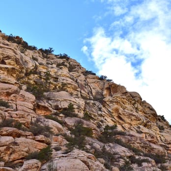


You might also consider


More like La Madre Springs
Recommended Reviews - La Madre Springs
Start your review...


Reviews With Photos


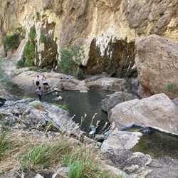
This is a moderate, 3 mile round trip hike in the Conservation Area. You get to the trailhead by driving the Scenic Drive about halfway. Between Mile 7 and 8 on the drive, there's a side road that turns off to the right. There is a sign saying Willow Springs Picnic Area and Lost Creek Children's Discovery Trail a couple of hundred feet before the road. Turn right onto this road and go to the end where the fencing is at the picnic area. From here, start hiking west on a dirt road that goes by an Indian roasting pit, down into a wash, and back up. On the other side of the wash, Rocky Gap Road (a 4x4 road that's very bad) goes off to your left. For La Madre Springs, turn right and follow the signs to the Springs. The trail is a busy one at Red Rock so you most likely won't be hiking alone. There is an elevation gain, and you may need to stop and catch your breath. Also, the trail is not smooth. For a fair amount of the trail, you're walking on some good size gravel and rocks, so take care as you hike along. After a while, you'll come to a side trail, the White Rock Loop Trail, that goes off to your right. DON'T take this trail. That's for another day. Keep going straight ahead. You'll come to some concrete pads. This was once used by an archery club. Eventually you come to a small concrete dam that is La Madre Springs. The dam was built by an owner of the property years ago to store water for animals. This is technically the end of the hike. To make it more interesting, you can walk along the creek that runs into the dam and follow a well used trail that leads to some small waterfalls. The trail continues beyond here into the mountains, but I don't recommend this unless you're with someone who has done this trail. It can be a bit muddy in a couple of places, you have to cross the creek a couple of times, and the footing gets poor. It's best to explore just past the dam and then re-trace your steps to the parking area. If you bring a cooler, the Willow Springs Picnic Area is a great place to have a sandwich and drink before driving back to Las Vegas. Happy hiking!
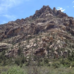

Nice moderate hike which begins from the Willow Springs picnic area in Red Rock Canyon National Conservation Area (RRCNCA) There are restrooms, maps, instructions and picnic tables at the trailhead. Most Red Rock hikes (except for aptly named IceBox Canyon) are best left to early starts or cooler weather. The heat and elevation gains can cause issues even if you are prepared. There is NO CELL PHONE RECEPTION (AT&T did not pop up again till Visitor's Center) Spent a few hours exploring this beautiful trail with my hiking buddy, Daniel S. He has such an appreciation for geology, wildlife and nature that we have excellent adventures together. We saw families and several dogs along the journey, just make sure to bring FRESH water for your furry family members: one AssHat was letting their dog drink from the green, algae filled Springs. Ummm, no! Anywho, starts with an elevation climb on a mildly rocky terrain. The only time we had to use our hands for position was at the Springs to sit and take in the beauty of the scenery, plant life and surrounding mountains while listening to the music of the running water. There a several trees you take shade under, relax, grab a snack and rehydrate before going back downhill. This day there were no burros or bighorn sheep in sight, though they are known to frequent the area. We did see a blue bird, an elusive yellow bird and tiny Florida sized newt like lizards. The colors and shapes of the rock formations are stunning. Daniel really liked a Piggy Bank rock atop a mountain; and we spent a bit debating which order the Beatles would be in on a spot we declared perfect for a "Fab Four Mt Rushmore." There were some desert wildflowers and cactus in bloom and a variety of trees, grass and shrubs to peruse. The hike downhill is pretty quick and not at all steep. We are truly lucky to have RRCNCA in our backyard and La Madre Springs is a nice hike to get away from the grind and let your mind relax. Especially as it is warmer now, just make sure to bring fluids (I went through a gallon: 3L w electrolytes & added a Renu to one of my 2L of Smart Water) sunscreen & a hat are a must and there are ample spots to grab shade or take in your surroundings. Definitely good times. Looking forward to our next adventure :)) Yelp 100 Challenge


It was a beautiful sunny day today for the hike. To get here, park your car at the Willow Springs picnic area near the old Rocky Gap road. We saw an off-road vehicle drive another half-mile or so up to the trailhead. As we walked up the rocky terrain, we saw a huge Agave Roasting Pit located on the south side of the road. From the trailhead you'll be hiking up. You are totally surrounded by mountains. The limestone La Madre range is right behind you; North Peak and Bridge Mountain are to the West and directly in front is the White Rock. If you continue up the trail toward the La Madre Spring, you'll see two old concrete pads. These are the remnants of the Las Vegas Archery Club that closed in 1975 when the BLM acquired this land for an expansion of Red Rock Canyon NCA. From here it's a short walk up the road to the springs. A little dam was built here in 1968 creating a nice pond. The pond marks the end of the trail. We walked and scrambled up to explore some more. Overall, this trail is a good aerobic workout with a lot of interesting cultural resources to see.


This is one of my favorite hikes in Red Rock Conservation Area. I'll spare you the description of the turn off, parking lot, etc., which is all available in the free map the gatekeeper provides. As many have noted, the hike to the springs themselves is rather boring (at least for me). Walking a couple miles down a dirt road is not really hiking to me, but as some have said, it does provide more opportunity to take in the beautiful mountains that surround you. The springs should be renamed the La Madre Slimy Little Pond, and wasn't too remarkable otherwise. The REAL fun begins beyond the springs up the mountain. The trail narrows and proceeds through the trees, following the stream up the mountain. About, I would estimate, a half mile up beyond the springs is a cool little mining fort. If you continue straight back behind the fort, the climb increases in difficulty both because of the incline and loose rocks, but the trail is clearly marked and will take you up to the old mine. My friends and I have been up past the mine twice, and there is another summit above and beyond the one we reached. My altimeter showed we reached about 6,585' elevation (McCarran Airport is about 2,200'). It's a nice feeling of accomplishment, but I think the view's better from the mine. It takes about 4.5 hours to go up & down at a strong, steady pace. Great hike though, I highly recommend it. Just make sure you have plenty of water and weather's not too extreme. There's not too much shade anywhere along the way.


Went on Free day to try this new trail to see what the fuss was about. This spot has a lil of everything it's nice and wide open for lots of folks to hike together. It's a pretty straight forward hike until you start going on up. Beware of 4x4's on this trail! Wish my truck was 4X4 to see what the top of the trial looked like. Some SUV's and trucks will haul ass down the trail .. so if you are there with the fam,kids,older folks be on the lookout. I was expecting to see some springs but no such luck. It's an ok trail system , My favorite is still pine creek,


La Madre Spring Hiking Trail - Sun, 11/04/12 This beautiful, tranquil La Madre Springs Trail (3.5mi RT from Willow Spring Picnic Area) is a popular one for locals and visitors alike, especially during autumn and cooler winter/spring months. - The hike can also be extended to 6+miles via the White Rock Loop, whose upper trailhead is near the top part of La Madre. I love La Madre Spring trail for its tranquility and the magnificent, wide open wilderness! Its moderate climb is good for body and soul! During autumn and winter, La Madre Spring is my favorite trail to hike on! Now, you can skip reading the following, just GO TAKE A HIKE(!) on this nice, quiet trail, and/or the White Rock Loop. You'll like it, too, I'm sure! YELPY DETAILS: - La Madre Springs is very popular but never crowded; short in distance but could be a bit strenuous, for its constant climb of 700+ ft elevation gain over a short distance of ~1.7mi. Its base trailhead is conviently located at the beautiful Willow Spring Picnic Area off the "13mi Scenic Drive" [- Follow the Willow Spring sign, turn RIGHT into the 2-way drive]. - The trail is a 1.75 mi long [1-way], moderately pitched, wide-open, gravel/dirt "road" (covered mostly by egg-sized rocks), with spectacular views of the La Madre Mountain Range and valleys it towers over below! At the "end" of the trail is the famous La Madre Spring, where you'll find a beautiful, SMALL "Pond" covered by a layer of green water plants. This pond is formed by the flowing spring, which is not very visible, but you can hear its soothing musical sound! This is really NOT the end of the trail! From here, one can hike further on a VERY NARROW PATH (at times muddy), along the mostly hidden spring, crisscrossing over it a few times, to small water falls. Holwever, over the years hiking, I myself have never hiked far enough to see the water falls. Yesterday, I had a wonderful time hiking on this trail, happily soaking up the sun and taking in the gorgeous views of the mountains and valleys! I parked at the beautiful Willow Springs Picnic area, and walked 0.25mi up the Rocky Gap Road to the upper trailhead. From there, it was only 1.5+mi to the spring. The last 0.5mi was a series of climbs on moderately pitched slopes covered with small rocks. It could be a bit strenuous due to the pitch and higher altitude, but it was absolutely worth the climb, especially after you reached the SMALL pond formed by the hidden spring! Although the tiny spring itself was mostly hidden, the SOUND of its FLOWING stream was audible and soothingly therapeutical! A young couple told me that some kids told them they had spotted a tarantula around the pond earlier! Well, that tarantula was too smart to stay around for me - it was long gone when I got there! It was such a gorgeous afternoon by the pond, I took extra time to relax over my trail mix and water before moving on. I walked along the narrow path along the spring for a short distance, but it was too challenging for my tired old legs! I'd have to come back another day to explore further up, where I knew there were a couple of small waterfalls. Going back down was easy, but those small rocks could make the path a bit slippery at spots. Do be careful! So, GO TAKE A HIKE on this trail and/or the White Rock Loop. You will see hikers of all ages there, many with pets, and some older ones with walking canes! I am sure you'll enjoy the hike, too! NOTE: - BTW, hiking up yesterday, I saw several pink-colored "super jeeps" (from Pink Jeep Tours) climbing up Rocky Gap Road heading up to the summit! It looked like fun! I myself have not taken one in Vegas, although my wife and I did have a thrilling pink jeep ride on Sedona's steep rocky boulders! For those interested, here is their weblink and some reviews on them: http://pinkjeeptours.com/ https://www.google.com/search?q=pink+jeep+tours+las+vegas&ie=UTF-8&oe=UTF-8&hl=en&client=safari#mldd=0 Peterskis, Nov 2012 ---


Yelp 100 Challenge 15' * 9/100 La Madre looked absolutely stunning after the brief storm system finally moved away from the Valley. My mother and I hiked up this moderate beautiful trail the past two Thursdays in hopes of reaching the springs as well as catching some snow remnants and we were not disappointed. The trail system can be accessed either from White Rock Loop or from the Picnic Area, the latter of which would require you to go through nearly a couple of miles of dirt road to get here. Be careful if you decide to take the dirt path route. Cars drive in and out of that bumpy road and some of them are not very slow. You will only begin to feel the incline once you reach the La Madre Trail head. Bring lots of water and know how to pace yourselves. Take in the majestic views every once in a while and rest on some of the rocks for a snack. About 200 yards from the spring, you'll find the remains of what we ascertain to be a house. Its floor tiles are still pretty intact and there's a pipe coming down straight from the spring. Maybe it was more useful back then. Today, the spring is nothing more than a running stream with dense algae, and I could only say that after the ice caps melted. Who knows how it looks during the 110 degree months. This, of course, makes for a perfect spring hike. It takes some stamina to get up there so bump up the calories during breakfast and snack on some granola bars. You'll need energy to overcome a 900 elevation gain over a 2-ish mile one way trip. If you intend to complete the White Rock Trail, hike about 1.3 miles till you see a fork. Turn right and enjoy some 5 miles of flatter land. That'll be a good option for a longer day hike.


This is a pleasant and easy hike without major elevation gain. The trail is well traveled and fairly busy - no risk of getting lost whatsoever! We ventured past the well known destination and up the spring. The trail keeps running along the spring, is pretty narrow and slippery at times. We were on a hunt for the La Madre cabin, but not sure if the foundation stones visible in the picture are actually that cabin.


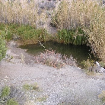
This trail starts starts at the Willow Springs Picnic Area. You have to walk a little bit up a dirt path to actually see where the trail starts. The scenery is beautiful of course!!! Cliffs, different rock formations, trees and bushes...all beautiful. The path is pretty easy, meaning no huge boulders to climb over like at Ice Box Canyon. There were a lot of older people on the trail so that should show how easy it is. There are smaller trails that break off from the main trail that look a little more steep and difficult. It's about an hour and a half walk round trip. The bf and I enjoyed the scenery, the awesome weather and got some exercise. My favorite part was listening to the wind. Sounds kind of lame, but it was. When we reached the end of the trail, we were a but disappointed. It wasn't a spring that you picture in your head that's all nice and pristine. Instead, it's like a little swampy pond help up by a cement wall. I enjoyed the actual hike more than I did the spring. I think next time the bf and I will venture off into the smaller, more difficult trails.


unfavorable grade up hill. when we finally reached the springs was disappointed to see a bunch old marsh. strange blue plastic tubing to preserve the reeds. if youre looking for water i recommend first creek. was very disappointed reaching the end of this trail :(


Moderate is a perfect way to describe this roughly 3 mile hike. The first half is a gradual climb up about 600 feet of elevation over some loose gravel. Throughout most of it there is either dirt or small rocks that can be loose so watch out to not roll your ankle. It's one of my favorite trails in Red Rock since it has the variety of some trees to change up the environment a little bit. At the top it's not really a peak, but still a nice view with the sound of water running through the creek nearby. It's a bit thick so I wouldn't recommend it as a water stop to go down and sit by, but the sound is nice. read more



8 years ago
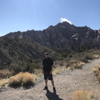
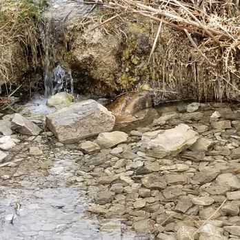
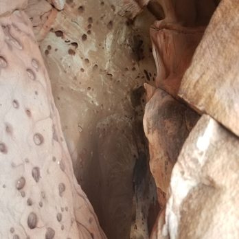
This is a easy hike in red rock in the white rock area. Interesting boulders near the beginning of the trail, which then leads up through a forest brush area. The end of the la madre hike is somewhat underwhelming with a small spring at the end. Nevertheless, the hike itself is enjoyable. Good for when you aren't trying to exert yourself too much. read more






8 years ago
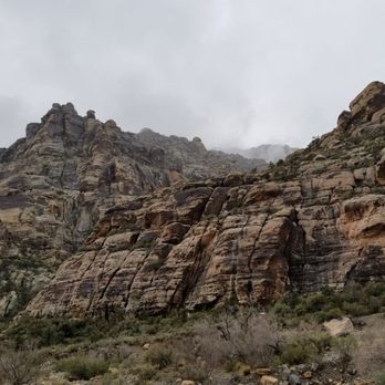
Short, easy hike with a gradual incline. Amazing view on every side. There's a small spring when you get to the end. It offers a great time to relax and reflect with the sound of the flowing water along with gorgeous views. Though the trail is only 1.5 round trip, it's about half a mile to get to the trailhead. Trail is great for children and dogs. read more


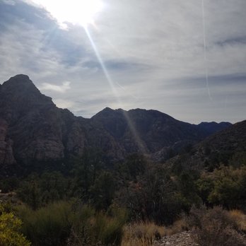


This is a moderate, 3 mile round trip hike in the Conservation Area. You get to the trailhead by driving the Scenic Drive about halfway. Between Mile 7 and 8 on the drive, there's a side road that turns off to the right. There is a sign saying Willow Springs Picnic Area and Lost Creek Children's Discovery Trail a couple of hundred feet before the road. Turn right onto this road and go to the end where the fencing is at the picnic area. From here, start hiking west on a dirt road that goes by an Indian roasting pit, down into a wash, and back up. On the other side of the wash, Rocky Gap Road (a 4x4 road that's very bad) goes off to your left. For La Madre Springs, turn right and follow the signs to the Springs. The trail is a busy one at Red Rock so you most likely won't be hiking alone. There is an elevation gain, and you may need to stop and catch your breath. Also, the trail is not smooth. For a fair amount of the trail, you're walking on some good size gravel and rocks, so take care as you hike along. After a while, you'll come to a side trail, the White Rock Loop Trail, that goes off to your right. DON'T take this trail. That's for another day. Keep going straight ahead. You'll come to some concrete pads. This was once used by an archery club. Eventually you come to a small concrete dam that is La Madre Springs. The dam was built by an owner of the property years ago to store water for animals. This is technically the end of the hike. To make it more interesting, you can walk along the creek that runs into the dam and follow a well used trail that leads to some small waterfalls. The trail continues beyond here into the mountains, but I don't recommend this unless you're with someone who has done this trail. It can be a bit muddy in a couple of places, you have to cross the creek a couple of times, and the footing gets poor. It's best to explore just past the dam and then re-trace your steps to the parking area. If you bring a cooler, the Willow Springs Picnic Area is a great place to have a sandwich and drink before driving back to Las Vegas. Happy hiking! read more




13 years ago
Nice moderate hike which begins from the Willow Springs picnic area in Red Rock Canyon National Conservation Area (RRCNCA) There are restrooms, maps, instructions and picnic tables at the trailhead. Most Red Rock hikes (except for aptly named IceBox Canyon) are best left to early starts or cooler weather. The heat and elevation gains can cause issues even if you are prepared. There is NO CELL PHONE RECEPTION (AT&T did not pop up again till Visitor's Center) Spent a few hours exploring this beautiful trail with my hiking buddy, Daniel S. He has such an appreciation for geology, wildlife and nature that we have excellent adventures together. We saw families and several dogs along the journey, just make sure to bring FRESH water for your furry family members: one AssHat was letting their dog drink from the green, algae filled Springs. Ummm, no! Anywho, starts with an elevation climb on a mildly rocky terrain. The only time we had to use our hands for position was at the Springs to sit and take in the beauty of the scenery, plant life and surrounding mountains while listening to the music of the running water. There a several trees you take shade under, relax, grab a snack and rehydrate before going back downhill. This day there were no burros or bighorn sheep in sight, though they are known to frequent the area. We did see a blue bird, an elusive yellow bird and tiny Florida sized newt like lizards. The colors and shapes of the rock formations are stunning. Daniel really liked a Piggy Bank rock atop a mountain; and we spent a bit debating which order the Beatles would be in on a spot we declared perfect for a "Fab Four Mt Rushmore." There were some desert wildflowers and cactus in bloom and a variety of trees, grass and shrubs to peruse. The hike downhill is pretty quick and not at all steep. We are truly lucky to have RRCNCA in our backyard and La Madre Springs is a nice hike to get away from the grind and let your mind relax. Especially as it is warmer now, just make sure to bring fluids (I went through a gallon: 3L w electrolytes & added a Renu to one of my 2L of Smart Water) sunscreen & a hat are a must and there are ample spots to grab shade or take in your surroundings. Definitely good times. Looking forward to our next adventure :)) Yelp 100 Challenge read more
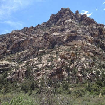


It was a beautiful sunny day today for the hike. To get here, park your car at the Willow Springs picnic area near the old Rocky Gap road. We saw an off-road vehicle drive another half-mile or so up to the trailhead. As we walked up the rocky terrain, we saw a huge Agave Roasting Pit located on the south side of the road. From the trailhead you'll be hiking up. You are totally surrounded by mountains. The limestone La Madre range is right behind you; North Peak and Bridge Mountain are to the West and directly in front is the White Rock. If you continue up the trail toward the La Madre Spring, you'll see two old concrete pads. These are the remnants of the Las Vegas Archery Club that closed in 1975 when the BLM acquired this land for an expansion of Red Rock Canyon NCA. From here it's a short walk up the road to the springs. A little dam was built here in 1968 creating a nice pond. The pond marks the end of the trail. We walked and scrambled up to explore some more. Overall, this trail is a good aerobic workout with a lot of interesting cultural resources to see. read more




12 years ago
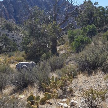
This is one of my favorite hikes in Red Rock Conservation Area. I'll spare you the description of the turn off, parking lot, etc., which is all available in the free map the gatekeeper provides. As many have noted, the hike to the springs themselves is rather boring (at least for me). Walking a couple miles down a dirt road is not really hiking to me, but as some have said, it does provide more opportunity to take in the beautiful mountains that surround you. The springs should be renamed the La Madre Slimy Little Pond, and wasn't too remarkable otherwise. The REAL fun begins beyond the springs up the mountain. The trail narrows and proceeds through the trees, following the stream up the mountain. About, I would estimate, a half mile up beyond the springs is a cool little mining fort. If you continue straight back behind the fort, the climb increases in difficulty both because of the incline and loose rocks, but the trail is clearly marked and will take you up to the old mine. My friends and I have been up past the mine twice, and there is another summit above and beyond the one we reached. My altimeter showed we reached about 6,585' elevation (McCarran Airport is about 2,200'). It's a nice feeling of accomplishment, but I think the view's better from the mine. It takes about 4.5 hours to go up & down at a strong, steady pace. Great hike though, I highly recommend it. Just make sure you have plenty of water and weather's not too extreme. There's not too much shade anywhere along the way. read more


Went on Free day to try this new trail to see what the fuss was about. This spot has a lil of everything it's nice and wide open for lots of folks to hike together. It's a pretty straight forward hike until you start going on up. Beware of 4x4's on this trail! Wish my truck was 4X4 to see what the top of the trial looked like. Some SUV's and trucks will haul ass down the trail .. so if you are there with the fam,kids,older folks be on the lookout. I was expecting to see some springs but no such luck. It's an ok trail system , My favorite is still pine creek, read more


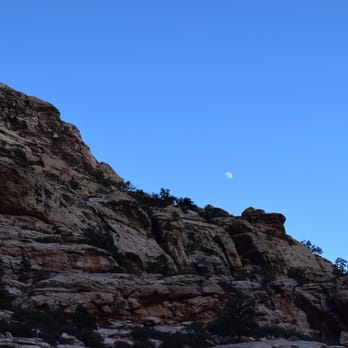

La Madre Spring Hiking Trail - Sun, 11/04/12 This beautiful, tranquil La Madre Springs Trail (3.5mi RT from Willow Spring Picnic Area) is a popular one for locals and visitors alike, especially during autumn and cooler winter/spring months. - The hike can also be extended to 6+miles via the White Rock Loop, whose upper trailhead is near the top part of La Madre. I love La Madre Spring trail for its tranquility and the magnificent, wide open wilderness! Its moderate climb is good for body and soul! During autumn and winter, La Madre Spring is my favorite trail to hike on! Now, you can skip reading the following, just GO TAKE A HIKE(!) on this nice, quiet trail, and/or the White Rock Loop. You'll like it, too, I'm sure! YELPY DETAILS: - La Madre Springs is very popular but never crowded; short in distance but could be a bit strenuous, for its constant climb of 700+ ft elevation gain over a short distance of ~1.7mi. Its base trailhead is conviently located at the beautiful Willow Spring Picnic Area off the "13mi Scenic Drive" [- Follow the Willow Spring sign, turn RIGHT into the 2-way drive]. - The trail is a 1.75 mi long [1-way], moderately pitched, wide-open, gravel/dirt "road" (covered mostly by egg-sized rocks), with spectacular views of the La Madre Mountain Range and valleys it towers over below! At the "end" of the trail is the famous La Madre Spring, where you'll find a beautiful, SMALL "Pond" covered by a layer of green water plants. This pond is formed by the flowing spring, which is not very visible, but you can hear its soothing musical sound! This is really NOT the end of the trail! From here, one can hike further on a VERY NARROW PATH (at times muddy), along the mostly hidden spring, crisscrossing over it a few times, to small water falls. Holwever, over the years hiking, I myself have never hiked far enough to see the water falls. Yesterday, I had a wonderful time hiking on this trail, happily soaking up the sun and taking in the gorgeous views of the mountains and valleys! I parked at the beautiful Willow Springs Picnic area, and walked 0.25mi up the Rocky Gap Road to the upper trailhead. From there, it was only 1.5+mi to the spring. The last 0.5mi was a series of climbs on moderately pitched slopes covered with small rocks. It could be a bit strenuous due to the pitch and higher altitude, but it was absolutely worth the climb, especially after you reached the SMALL pond formed by the hidden spring! Although the tiny spring itself was mostly hidden, the SOUND of its FLOWING stream was audible and soothingly therapeutical! A young couple told me that some kids told them they had spotted a tarantula around the pond earlier! Well, that tarantula was too smart to stay around for me - it was long gone when I got there! It was such a gorgeous afternoon by the pond, I took extra time to relax over my trail mix and water before moving on. I walked along the narrow path along the spring for a short distance, but it was too challenging for my tired old legs! I'd have to come back another day to explore further up, where I knew there were a couple of small waterfalls. Going back down was easy, but those small rocks could make the path a bit slippery at spots. Do be careful! So, GO TAKE A HIKE on this trail and/or the White Rock Loop. You will see hikers of all ages there, many with pets, and some older ones with walking canes! I am sure you'll enjoy the hike, too! NOTE: - BTW, hiking up yesterday, I saw several pink-colored "super jeeps" (from Pink Jeep Tours) climbing up Rocky Gap Road heading up to the summit! It looked like fun! I myself have not taken one in Vegas, although my wife and I did have a thrilling pink jeep ride on Sedona's steep rocky boulders! For those interested, here is their weblink and some reviews on them: http://pinkjeeptours.com/ https://www.google.com/search?q=pink+jeep+tours+las+vegas&ie=UTF-8&oe=UTF-8&hl=en&client=safari#mldd=0 Peterskis, Nov 2012 --- read more


12 years ago
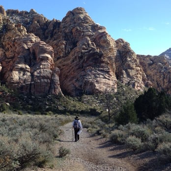
Yelp 100 Challenge 15' * 9/100 La Madre looked absolutely stunning after the brief storm system finally moved away from the Valley. My mother and I hiked up this moderate beautiful trail the past two Thursdays in hopes of reaching the springs as well as catching some snow remnants and we were not disappointed. The trail system can be accessed either from White Rock Loop or from the Picnic Area, the latter of which would require you to go through nearly a couple of miles of dirt road to get here. Be careful if you decide to take the dirt path route. Cars drive in and out of that bumpy road and some of them are not very slow. You will only begin to feel the incline once you reach the La Madre Trail head. Bring lots of water and know how to pace yourselves. Take in the majestic views every once in a while and rest on some of the rocks for a snack. About 200 yards from the spring, you'll find the remains of what we ascertain to be a house. Its floor tiles are still pretty intact and there's a pipe coming down straight from the spring. Maybe it was more useful back then. Today, the spring is nothing more than a running stream with dense algae, and I could only say that after the ice caps melted. Who knows how it looks during the 110 degree months. This, of course, makes for a perfect spring hike. It takes some stamina to get up there so bump up the calories during breakfast and snack on some granola bars. You'll need energy to overcome a 900 elevation gain over a 2-ish mile one way trip. If you intend to complete the White Rock Trail, hike about 1.3 miles till you see a fork. Turn right and enjoy some 5 miles of flatter land. That'll be a good option for a longer day hike. read more



9 years ago
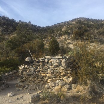
This is a pleasant and easy hike without major elevation gain. The trail is well traveled and fairly busy - no risk of getting lost whatsoever! We ventured past the well known destination and up the spring. The trail keeps running along the spring, is pretty narrow and slippery at times. We were on a hunt for the La Madre cabin, but not sure if the foundation stones visible in the picture are actually that cabin. read more



This trail starts starts at the Willow Springs Picnic Area. You have to walk a little bit up a dirt path to actually see where the trail starts. The scenery is beautiful of course!!! Cliffs, different rock formations, trees and bushes...all beautiful. The path is pretty easy, meaning no huge boulders to climb over like at Ice Box Canyon. There were a lot of older people on the trail so that should show how easy it is. There are smaller trails that break off from the main trail that look a little more steep and difficult. It's about an hour and a half walk round trip. The bf and I enjoyed the scenery, the awesome weather and got some exercise. My favorite part was listening to the wind. Sounds kind of lame, but it was. When we reached the end of the trail, we were a but disappointed. It wasn't a spring that you picture in your head that's all nice and pristine. Instead, it's like a little swampy pond help up by a cement wall. I enjoyed the actual hike more than I did the spring. I think next time the bf and I will venture off into the smaller, more difficult trails. read more


12 years ago

11 years ago
unfavorable grade up hill. when we finally reached the springs was disappointed to see a bunch old marsh. strange blue plastic tubing to preserve the reeds. if youre looking for water i recommend first creek. was very disappointed reaching the end of this trail :( read more


10 years ago
hey, this was a good hike, if you actually keep going after the small spring you actually have a much better hike up ahead with some great nature scenes and views of the stream read more


More info about La Madre Springs
Ask the Community - La Madre Springs
Review Highlights - La Madre Springs


















La Madre Springs - hiking - Updated September 2026
Best of Las Vegas
People found La Madre Springs by searching for…
Hiking Trails With Waterfalls in Las Vegas, NV
Lookout Points in Las Vegas, NV
Waterfalls and Swimming Holes in Las Vegas, NV
Visitor Centers in Las Vegas, NV
Off Road Trails in Las Vegas, NV
Natural Hot Springs in Las Vegas, NV
Dog Friendly Trails in Las Vegas, NV
Lakes & Ponds in Las Vegas, NV
Fishing Spots in Las Vegas, NV
Trending Searches in Las Vegas, NV
Barbershop near La Madre Springs
Bike Shop near La Madre Springs
Cliff Jumping near La Madre Springs
Consignment Shops near La Madre Springs
Cruising Spots near La Madre Springs
Dog Friendly Things To Do near La Madre Springs
Estheticians near La Madre Springs
Eyelash Extensions near La Madre Springs
Hiking Trails With Waterfalls near La Madre Springs
Kids Birthday Party near La Madre Springs
Lakes & Ponds near La Madre Springs
Makeup Artists near La Madre Springs
Middle Schools & High Schools near La Madre Springs
Musical Instruments & Teachers near La Madre Springs
Off Road Trails near La Madre Springs
Picnic Areas near La Madre Springs
Places To Take Pictures near La Madre Springs
Private Schools near La Madre Springs
Public Shower near La Madre Springs
Rock Quarry near La Madre Springs
Scenic Night View near La Madre Springs
Scenic Overlook near La Madre Springs
Sunrise View near La Madre Springs
Swimming Holes near La Madre Springs
Teeth Whitening near La Madre Springs
Browse Nearby
Browse Brands
Related Searches in Las Vegas, NV
Best Dog Hiking Trails Around Las Vegas, Nevada
Best Fishing Locations and Guides in Las Vegas, Nevada
Best Places for Horseback Riding in Las Vegas, Nevada
Best Sightseeing Experiences Available in Las Vegas, Nevada
Check Out Off Road Trails in Las Vegas, Nevada
Discover Dog Friendly Trails to Explore in Las Vegas, Nevada
Discover Popular Bike Trails in Las Vegas, Nevada
Discover Scenic Mountain Bike Trails Near Las Vegas, Nevada
Discover Walking Parks in Las Vegas, Nevada Near You
Discover a Hiking Trail in Las Vegas, Nevada
Discover the Best Night Hike Trails in Las Vegas, Nevada
Dog-Friendly Hikes With Dogs in Las Vegas, Nevada
Enjoy Camping Adventures Around Las Vegas, Nevada
Enjoy Exciting Mountain Biking Adventures in Las Vegas, Nevada
Enjoy Kayaking Adventures in Las Vegas, Nevada
Enjoy Off Leash Dog Hikes in Las Vegas, Nevada
Enjoy Scenic Places to Walk in Las Vegas, Nevada
Enjoy Tent Camping Spots Around Las Vegas, Nevada
Enjoy a Beautiful Waterfall Hike in Las Vegas, Nevada
Enjoy the Best Walking Path in Las Vegas, Nevada
Enjoy the Best Walking Trails in Las Vegas, Nevada
Explore Beautiful Parks and Green Spaces in Las Vegas, Nevada
Explore Easy Hikes Perfect for All in Las Vegas, Nevada
Explore Fun Activities to Do in Las Vegas, Nevada
Explore Popular Campgrounds Near Las Vegas, Nevada
Explore Popular Dog Walking Trails in Las Vegas, Nevada
Explore Top Dog Parks in Las Vegas, Nevada Near You
Explore Top Water Parks in Las Vegas, Nevada Today
Family Friendly Hiking With Kids in Las Vegas, Nevada
Find Parks and Recreation Activities in Las Vegas, Nevada
Find Popular Ziplining Spots Around Las Vegas, Nevada
Find the Best Parks for Picnics in Las Vegas, Nevada
Hiking Trails With Waterfalls in Las Vegas, Nevada
Off Leash Dog Hiking Trails in Las Vegas, Nevada
Perfect Spots to Watch Sunset in Las Vegas, Nevada
Picnic Areas With BBQ Pits Available in Las Vegas, Nevada
Plan a Scenic Drive Route Near Las Vegas, Nevada
Play at a Splash Pad Park in Las Vegas, Nevada
Popular Outdoor Activities to Try in Las Vegas, Nevada
Popular Picnic Spots to Visit in Las Vegas, Nevada
Safe and Fun Parks for Kids in Las Vegas, Nevada
Top Hiking Trails to Explore in Las Vegas, Nevada
Top Playgrounds for Kids to Enjoy in Las Vegas, Nevada
Top Running Trails to Explore in Las Vegas, Nevada
Top Swimming Lakes to Enjoy in Las Vegas, Nevada
Top Swimming Spots and Pools in Las Vegas, Nevada
Top Things to Do With Kids in Las Vegas, Nevada
Top-Rated Camping Sites in Las Vegas, Nevada


