Quick Silver Almaden Webb Canyon Access Photos


You might also consider
More like Quick Silver Almaden Webb Canyon Access
Recommended Reviews - Quick Silver Almaden Webb Canyon Access
Start your review...

Reviews With Photos

Came here to get out of the house and enjoy a simple hike. The trails were well maintained and lots of different directions you can go. Even better is that it is dog friendly. Parking was easy too. We did not get to see any deer as others have mentioned but we did get to see a bunch of wild turkey which was pretty cool!

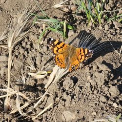
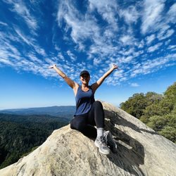
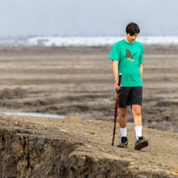
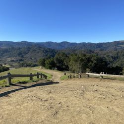
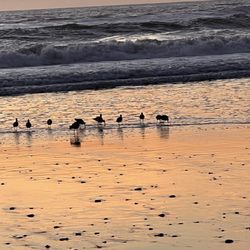
The closer one gets to the top, the more one finds there is no "top." ~Nancy Barcus The pouty, British dish of a cupcake Emmalouise B. keeps trying to one up me on review count. Looks like we need to add a quickie here to maintain that edge. The access for this part of Almaden Quicksilver is off of Webb Canyon Road and Echo Valley. A great place to access because there is ample free street parking. And an embedded neighborhood basketball hoop if you need to practice your "J" ;) (I'm looking at you Nicole D!) Deer and bucks are ample out here as are the wild turkeys (see my award winning photo). Views are very nice at sunset and with the free street parking this is a nice spot to bend the closed at sunset rule. I bring a flashlight now every evening. There is a strenuous 6 mile loop that I hike in about a buck thirty or so. You go on the New Almaden trail, Mine Hill and others. You can add more mileage by accessing all of the other trails and their are nice views of the reservoir on the randol and guadalupe trails. Highly recommended for an outdoor workout!

My family and I came here to hike on the first Saturday of the year around 11AM. It rained the day before and it wasn't as wet/mushy as we were expecting it to be. My sister is an avid hiker and led the way via her AllTrails app. This is a solid hike in the Almaden Valley with just the right amount of incline and hills. My Apple Watch logged 4.71 miles and 785ft of elevation gain. We took our time with this hike and it only took us 1 hour 45 minutes to complete the hike. A great way to kick start the first weekend of 2025. We followed suit of other hikers and parked in the residential area at the start of the trailhead. Be courteous to the residents and don't block their driveway. read more


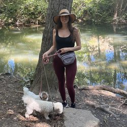
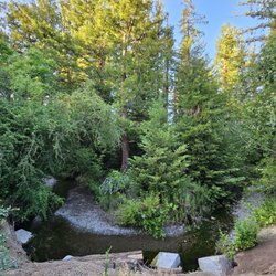
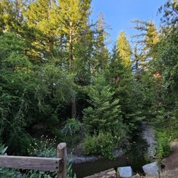
We had a wonderful hike here. The trail offers you different options as you go up and we got to explore a little bit. We were here early and it was very peaceful to be on the trail and have these wonderful views and not run into anyone. The entrance that I took was through a residential neighborhood and parking was a little challenging. I suppose there are entry ways to the trail with parking. read more
one of my favorite trails This trail actually tested my strength, haha. Had to take a couple deep breathes throughout the 6 miles up and down hill. Overall, it was not packed at all (which is great!) Super great way to reconnect with mother nature herself. Great views and the environment is so calming. Tip: - Bring a backpack with goodies such as water! read more


4 years ago
Came here to get out of the house and enjoy a simple hike. The trails were well maintained and lots of different directions you can go. Even better is that it is dog friendly. Parking was easy too. We did not get to see any deer as others have mentioned but we did get to see a bunch of wild turkey which was pretty cool! read more


The closer one gets to the top, the more one finds there is no "top." ~Nancy Barcus The pouty, British dish of a cupcake Emmalouise B. keeps trying to one up me on review count. Looks like we need to add a quickie here to maintain that edge. The access for this part of Almaden Quicksilver is off of Webb Canyon Road and Echo Valley. A great place to access because there is ample free street parking. And an embedded neighborhood basketball hoop if you need to practice your "J" ;) (I'm looking at you Nicole D!) Deer and bucks are ample out here as are the wild turkeys (see my award winning photo). Views are very nice at sunset and with the free street parking this is a nice spot to bend the closed at sunset rule. I bring a flashlight now every evening. There is a strenuous 6 mile loop that I hike in about a buck thirty or so. You go on the New Almaden trail, Mine Hill and others. You can add more mileage by accessing all of the other trails and their are nice views of the reservoir on the randol and guadalupe trails. Highly recommended for an outdoor workout! read more


10 years ago
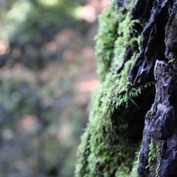
The trail, I believe, is beautiful. As soon as I walked thru the entrance there were deer walking up on the hills. Birds chirping. Just beautiful. However, I didn't make it more than 50 yards. I occasionally get vertigo, odd angles usually set it off. The entrance to this trail is at an incline for as far as I could see and after just a few moments my vertigo was attacking me hard. Wish I could have made it! read more


13 years ago
More info about Quick Silver Almaden Webb Canyon Access
7062 Webb Canyon Dr
San Jose, CA 95120
Almaden Valley
Directions
Hours
Outdoor Amenities
Ask the Community - Quick Silver Almaden Webb Canyon Access
You might also consider


Quick Silver Almaden Webb Canyon Access - hiking - Updated June 2026
Best of San Jose
People found Quick Silver Almaden Webb Canyon Access by searching for…
Great View Points for Sunset in San Jose, California
Hiking Trails in San Jose, California
Sunset View in San Jose, California
Shaded Hike in San Jose, California
Calisthenics Park in San Jose, California
Lakes & Ponds in San Jose, California
Beautiful Views in San Jose, California
Fishing Spots in San Jose, California
Watch Sunset in San Jose, California
Off Road Trails in San Jose, California
Dog Friendly Hiking Trails in San Jose, California
Basketball Courts in San Jose, California
Hiking Groups in San Jose, California
Easy Hikes in San Jose, California
Canyoneering in San Jose, California
Walking Trails in San Jose, California
Hikes With Dogs in San Jose, California
Free Parking in San Jose, California
Walking Groups in San Jose, California
Running Trails in San Jose, California
Trending Searches in San Jose, CA
Beaches near Quick Silver Almaden Webb Canyon Access
Black Owned Nail Salons near Quick Silver Almaden Webb Canyon Access
Boat Rental near Quick Silver Almaden Webb Canyon Access
Cliff Jumping near Quick Silver Almaden Webb Canyon Access
Creeks near Quick Silver Almaden Webb Canyon Access
Day Trips near Quick Silver Almaden Webb Canyon Access
Dog Friendly Trails near Quick Silver Almaden Webb Canyon Access
Fishing Spots near Quick Silver Almaden Webb Canyon Access
Free Kids Activities near Quick Silver Almaden Webb Canyon Access
Jet Ski Rental near Quick Silver Almaden Webb Canyon Access
Lakes & Ponds near Quick Silver Almaden Webb Canyon Access
Off Road Trails near Quick Silver Almaden Webb Canyon Access
Outdoor Activities near Quick Silver Almaden Webb Canyon Access
Pick Your Own Farms near Quick Silver Almaden Webb Canyon Access
Public Shower near Quick Silver Almaden Webb Canyon Access
Rock Quarry near Quick Silver Almaden Webb Canyon Access
Scenic Drive near Quick Silver Almaden Webb Canyon Access
Scenic Night View near Quick Silver Almaden Webb Canyon Access
Secluded Spots near Quick Silver Almaden Webb Canyon Access
Soccer Store near Quick Silver Almaden Webb Canyon Access
Splash Pad near Quick Silver Almaden Webb Canyon Access
Strawberry Picking near Quick Silver Almaden Webb Canyon Access
Sunrise View near Quick Silver Almaden Webb Canyon Access
Swimming Holes near Quick Silver Almaden Webb Canyon Access
Swimming Lakes near Quick Silver Almaden Webb Canyon Access
Swimming Pools near Quick Silver Almaden Webb Canyon Access
Watch Sunset near Quick Silver Almaden Webb Canyon Access
Browse Articles
Browse Nearby
BEST of San Jose, California Coffee near Quick Silver Almaden Webb Canyon Access
BEST of San Jose, California Restaurants near Quick Silver Almaden Webb Canyon Access
BEST of San Jose, California Things to Do near Quick Silver Almaden Webb Canyon Access
BEST of San Jose, California Walking Trails near Quick Silver Almaden Webb Canyon Access
BEST of San Jose, California Parks near Quick Silver Almaden Webb Canyon Access
BEST of San Jose, California Breakfast near Quick Silver Almaden Webb Canyon Access
BEST of San Jose, California Campgrounds near Quick Silver Almaden Webb Canyon Access
BEST of San Jose, California Taxis near Quick Silver Almaden Webb Canyon Access
Browse Brands
Related Searches in San Jose, CA
Affordable Kayak Rental Services in San Jose, California
Best Fishing Locations and Guides in San Jose, California
Best Nature Trails for Hiking in San Jose, California
Best Places for Horseback Riding in San Jose, California
Check Out Off Road Trails in San Jose, California
Discover Dog Friendly Trails to Explore in San Jose, California
Discover Kid Friendly Hiking Trails in San Jose, California
Discover Scenic Hiking Trails in San Jose, California
Discover Scenic Mountain Bike Trails Near San Jose, California
Discover Scenic Waterfall Spots in San Jose, California
Discover Walking Parks in San Jose, California Near You
Discover a Hiking Trail in San Jose, California
Discover the Best Night Hike Trails in San Jose, California
Dog-Friendly Hikes With Dogs in San Jose, California
Enjoy Camping Adventures Around San Jose, California
Enjoy Exciting Mountain Biking Adventures in San Jose, California
Enjoy Kayaking Adventures in San Jose, California
Enjoy Tent Camping Spots Around San Jose, California
Enjoy a Beautiful Waterfall Hike in San Jose, California
Enjoy a Peaceful Nature Walk in San Jose, California
Enjoy the Best Walking Path in San Jose, California
Enjoy the Best Walking Trails in San Jose, California
Exciting Cliff Jumping Spots in San Jose, California
Experience Thrilling White Water Rafting in San Jose, California
Explore Beautiful Parks and Green Spaces in San Jose, California
Explore Easy Hikes Perfect for All in San Jose, California
Explore Fun Activities to Do in San Jose, California
Explore Popular Campgrounds Near San Jose, California
Explore the Best Beach Spots in San Jose, California
Explore the Best Boating Spots in San Jose, California
Explore the Best Trail Options in San Jose, California
Family Friendly Hiking With Kids in San Jose, California
Find Popular Ziplining Spots Around San Jose, California
Find the Best Parks for Picnics in San Jose, California
Find the Best Scenic View Locations in San Jose, California
Great Places to Walk in San Jose, California
Hike the Popular Waterfall Trail in San Jose, California
Hiking Trails With Waterfalls in San Jose, California
Off Leash Dog Hiking Trails in San Jose, California
Plan a Scenic Drive Route Near San Jose, California
Popular Outdoor Activities to Try in San Jose, California
Popular Picnic Spots to Visit in San Jose, California
Safe River Swimming Areas in San Jose, California
Safe and Fun Parks for Kids in San Jose, California
Top Climbing Spots and Gyms in San Jose, California
Top Paddleboarding Activities in San Jose, California
Top Running Trails to Explore in San Jose, California
Top Swimming Spots and Pools in San Jose, California
People who viewed Quick Silver Almaden Webb Canyon Access also viewed
Foothill Park
3 reviews
Blossom Valley
Santa Teresa County Park
98 reviews
Los Alamitos Creek Trail
44 reviews
Sierra Azul Open Space Preserve
38 reviews
Almaden Quicksilver County Park
296 reviews
Farnsworth Regional Trail - Access
2 reviews
Evergreen
Flat Frog Trail
2 reviews
Montgomery Hill Park
37 reviews
Evergreen
Guadalupe Creek Trail
4 reviews
Almaden Valley
Knibb's Knob Hike To Summit Rd At Uvas Canyon County Park
4 reviews