Fremont Older Open Space Preserve Photos


You might also consider


More like Fremont Older Open Space Preserve
Recommended Reviews - Fremont Older Open Space Preserve
Start your review...


Reviews With Photos


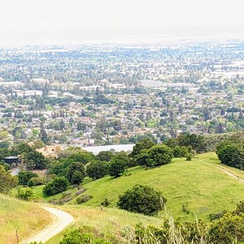
My go to trial for an easy short hike. There's the short easy hike to Hunter's Point which is the overlook area where you can see Cupertino. If you look to the right you can spot the Apple Spaceship building. Then there's the Maisie 's peak that has a higher elevation gain and steady uphill climb. Love seeing the rolling greens all around. Trails are more rocky. Downside is the small parking lot so get there before 9am to find parking especially on the weekends.


My friend and I decided to hike the trails to Maisie's Peak, starting from the Prospect Parking Area. There were barely any people on a Wednesday afternoon, which made it an even better experience. Very peaceful out there. Lizards, birds and butterflies, even swarms of bees along the trails (though they didn't bother us). The views were lovely, lots of green out there, trees, flowers, and hills in the background. I love how there are so many trails to choose from. It gives me a reason to come back and explore other routes. I had no internet access in the area, but it was unnecessary.


A very green and well kept open space preserve. Fremont Older Open Space features a plethora of wide dirt trails that are popular with both hikers and mountain bikers. Not much shade on these trails, but it's a great place to hike during the cooler months as the vegetation is super lush and green. I hiked the 6.5 mile Stephens Canyon Trail loops which splits itself between Fremont Older and Stevens Creek County Park. This trail loop begins on the laved Tony Look Trail and then begins a gradual ascent up Coyote Ridge. It's a nice mix of hills and flats and the inclines present a wonderful workout. The city and hillside views are really pretty here. Aside from the inclines and the locality aspect, I feel like people come here for the scenic city vistas. This seems to be a popular trail but not overwhelmingly so. It wasn't crowded and there was still plenty of parking spots available on a Saturday morning around 10 am which is a very late start for me. But, it ended up being a really nice hike. This open space is also dog friendly and there are plenty of flat paved paths for walkers and people with strollers. There are is also recreation space near the entrance with a few picnic tables in tow. If the parking lot does happen to her full, there is plenty of street parking off of Stevens Creek Blvd. This preserve is also easily connectable to Stevens Creek County Park and there are several intersecting trails between the parks. I don't usually make it to this area too often, but I'd gladly come back to check out some different trails in this park.


I've been hiking a lot on my days off now that the weather is much warmer. There are plenty of trails here which is perfect for all ages, bikers, horseback riders, and those that want to bring their dogs. The scenery varies and I much prefer it over locations that have a steep cliff and require you to pay for entry - not to say that there aren't any narrow roads but ,they are much more tame than other locations I've been to. There are several parking locations. I ended up parking on a residential street and just hiked up.


Parking on Regnart Road entrance was sparse and tight against the shoulder of the road. Animal sightings include cute deer and bunnies. Thankfully no mountain lion encounters, though they do live there according to signs. Also didn't come across any horses, but they were definitely there and left some fresh tracks (poop). Hiking was a great mix of rolling ups and downs, giving you a good workout, but interspersed with some reprieve. Trails were very wide and adequate for pandemic distancing without any issues. It wasn't too crowded on a Saturday morning.


Great hike! I've only done the hike to hunters point which is short and sweet (~30 mins roundtrip). Great views from the top. I come here a lot with my dog, and there are many dogs on this trail which my dog loves. Parking is a pain. I've witnessed arguments, honking, yelling, and all kinds of drama in this parking lot. It's small and often times a queue forms by the entrance while people wait for people to finish their hikes and leave. If you're coming during peak hours, I recommend parking by the road before the entrance.
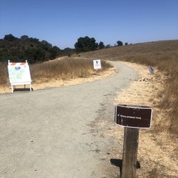

I intended to do the Maisie Peak hike but I had no clue where I was going so I just went with the flow. I ended up doing the Seven Trails Loop which was about 3.2 miles round trip from the parking lot. It was an easy trail run. There were very narrow parts of the trail (which of course was when I needed to pass people) and the sloping of the trails made it difficult to pass other trail-users who were not cognizant of how hard it is to run on a slope when one foot is hitting the ground at a lower point than the other.... but it was only for a short stretch so it wasn't too bad. I almost rolled my ankles but whatever. (Not bitter about it lol.) I would say about 50/50 shade VS unshaded on the trail. Wear sunscreen and bring a hat because it gets hot out there. The views were okay. Smoggy in the early afternoon. The trail was pretty dusty and footing was rocky as well so be careful. I liked that some of the trails were marked "ONE WAY" so everyone was going the same direction. PARKING: The lot is pretty small but a decent number of cars can fit in it. I like that it's limited because that means there are fewer people on the trails but it's sucks if you get here when it's full and have to wait or hunt for a spot. Overall, I didn't love the terrain (rocky, packed dusty dirt for most of it) and how the sun was so direct on the trail. The run was easy so I would come again on a cold/cloudy day.


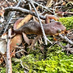
This is a fine place to hike and obtain views of the valley below. It is just a short drive on Prospect Road from S. DeAnza Blvd. Most of the trails are out in the open, but there is a creek trail that is shady. On this visit, we saw several lizards out and about. It was a hot day, so we did not go as far as I would have wanted to go otherwise.
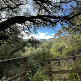

Awesome selection of trails (including kid friendly ones) and great views, but there is a serious lack of parking here. Also would not recommend for the summer as there is zero shade once you make it past the initial ascent. Perfect for a winter hike though.


Came here on a Saturday around 4pm-ish. Hiked Tony Look Trail to Stevens Creek Reservoir. Trail is quite narrow, which might be more of an issue if you go during a busier time. But, wasn't bad when we went. Only had to pass a handful of people. It was a pretty easy trail with lots of rolling hills, but nothing too steep. Was also shady for most of the trail. Dogs are allowed, but must be on leash. No horses or bikes on this trail. Parking is limited but we didn't have any issues finding one when we were there.
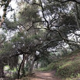

I only hike because of my dog, and this is the closest dog-friendly hiking trail for me. The narrow road to get here is not only confusing, but pretty dangerous. Last time, I had to back up along a super narrow winding road so two trucks could pass each other. It was definitely not a safe situation for anybody. I felt like I was in a third world country on one of those mountain roads that weren't measured correctly. The parking lot is a clusterfuck. There's a severe shortage of spots even in the middle of a weekday and everyone parks haphazardly. You have to watch out for trees, people, dogs, and bikes weaving through the tiny lot. The trail is extremely narrow in the beginning and then only slightly less narrow afterwards. Horse turds EVERYWHERE. I hate HATE the many bikes that ride through because there's not enough room for them to pass and I'm always worried they're going to run over my dog. Then there's the ranger parked at the top of the trail with a set of binoculars just waiting for you to do something wrong. Overall hiking here just isn't a relaxing situation for me so I'm actively looking for something better and preferably with an off-leash policy.


This is a popular spot evidenced by the fact that the parking spots were all taken by the time we got there at 7.30. Once we got a spot and went on the hike, it was great. Beautiful views including some deer sightings.


I never knew this trail was here and am glad we found it since it's dog friendly!! The trails are really lovely- most of it is fairly lush and shaded. There are portions that are out in the open (so bring a hat!), but the prairie landscape and the views of the bay are are so peaceful. Lots of different trail options. The smallest loop in the beginning is just 0.7 miles. Mountain bikes are allowed on many of the trails, which can make it a little bit crowded. PARKING: I have never seen such a tiny parking lot at a park before! It fits perhaps less than 20 cars, so the only way to guarantee a parking spot is to arrive before 7:15 am. We came at 8am, and luckily a couple early birds were just leaving so we only had to wait 5 minutes but there really is barely a place to even wait. A lot of people park at the bottom of the road which has a sign that says "1/4 mile" to the park. The problem is the road up is narrow and windy, so you have little to no visibility of oncoming cars. There was no way I was walking up that with our baby and dog.


2 months ago
Cane here on 4th of July for a family hike. Found parking inside when we arrived around 9. Took about 45m roundtrip to hike the Maisie's peak. We ran into a lot of friendly people. Keep in mind it gets hot with minimal shade. Overall would do again for a nearby hike. read more


2 months ago
I always love coming here for a hike. There is multiple trails available and a lot of nice views. Biking is allowed on the trails too, just stay clear of the people biking. The only downside is if you come in through the prospect road entrance there isn't a lot of parking spots, so it's all about luck and timing. Also, please don't double park because then people can't get out, I saw it first hand happen to someone read more


Flower Me With Your Love 739-acre open space preserve that, despite the name, is actually located in the City of Cupertino and not the City of Fremont. We arrived hoping for some wildflower viewing after seeing some reports on AllTrails, and we were not disappointed. While hardly a "super bloom," it was still pretty nice and I imagine will get nicer in the coming weeks. The Good: *Port-o-potty available in the parking lot *All trails are LEASHED dog-friendly *Biking & Horses ok on designated trails *Superlative views *Trails were all in pretty good shape for the most part, and this was even after some rain. *Loop trails: Coral Older Trail-Seven Springs Trail-Hayfield Trail-Cora Older Trail-Creekside Trail will get you ±3.5miles with very minimal overlap. The Meh: *No e-bikes *Didn't see any picnic tables The Ugly: *Parking here is a real shit-show and *extremely* limited. If you don't get here early, then you'll have to sit and stalk an open spot kinda like the old days of Rancho San Antonio (IYKYK). Conclusion: Great park with amazing trails, but god-awful parking. read more


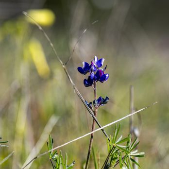

My go to trial for an easy short hike. There's the short easy hike to Hunter's Point which is the overlook area where you can see Cupertino. If you look to the right you can spot the Apple Spaceship building. Then there's the Maisie 's peak that has a higher elevation gain and steady uphill climb. Love seeing the rolling greens all around. Trails are more rocky. Downside is the small parking lot so get there before 9am to find parking especially on the weekends. read more





1 year ago
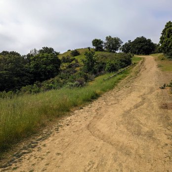
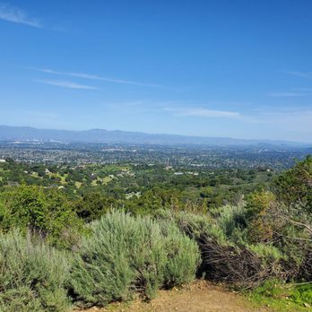
My friend and I decided to hike the trails to Maisie's Peak, starting from the Prospect Parking Area. There were barely any people on a Wednesday afternoon, which made it an even better experience. Very peaceful out there. Lizards, birds and butterflies, even swarms of bees along the trails (though they didn't bother us). The views were lovely, lots of green out there, trees, flowers, and hills in the background. I love how there are so many trails to choose from. It gives me a reason to come back and explore other routes. I had no internet access in the area, but it was unnecessary. read more



5 months ago

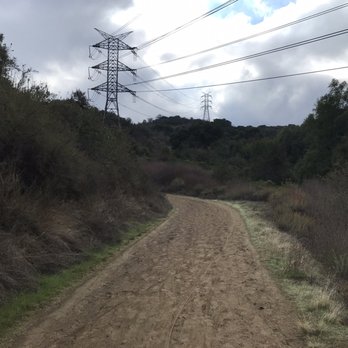
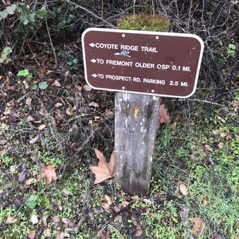
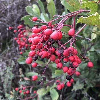
A very green and well kept open space preserve. Fremont Older Open Space features a plethora of wide dirt trails that are popular with both hikers and mountain bikers. Not much shade on these trails, but it's a great place to hike during the cooler months as the vegetation is super lush and green. I hiked the 6.5 mile Stephens Canyon Trail loops which splits itself between Fremont Older and Stevens Creek County Park. This trail loop begins on the laved Tony Look Trail and then begins a gradual ascent up Coyote Ridge. It's a nice mix of hills and flats and the inclines present a wonderful workout. The city and hillside views are really pretty here. Aside from the inclines and the locality aspect, I feel like people come here for the scenic city vistas. This seems to be a popular trail but not overwhelmingly so. It wasn't crowded and there was still plenty of parking spots available on a Saturday morning around 10 am which is a very late start for me. But, it ended up being a really nice hike. This open space is also dog friendly and there are plenty of flat paved paths for walkers and people with strollers. There are is also recreation space near the entrance with a few picnic tables in tow. If the parking lot does happen to her full, there is plenty of street parking off of Stevens Creek Blvd. This preserve is also easily connectable to Stevens Creek County Park and there are several intersecting trails between the parks. I don't usually make it to this area too often, but I'd gladly come back to check out some different trails in this park. read more





1 year ago

1 year ago

5 years ago
I've been hiking a lot on my days off now that the weather is much warmer. There are plenty of trails here which is perfect for all ages, bikers, horseback riders, and those that want to bring their dogs. The scenery varies and I much prefer it over locations that have a steep cliff and require you to pay for entry - not to say that there aren't any narrow roads but ,they are much more tame than other locations I've been to. There are several parking locations. I ended up parking on a residential street and just hiked up. read more

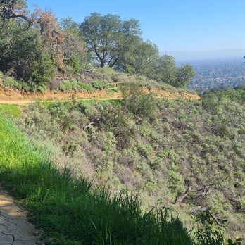

Parking on Regnart Road entrance was sparse and tight against the shoulder of the road. Animal sightings include cute deer and bunnies. Thankfully no mountain lion encounters, though they do live there according to signs. Also didn't come across any horses, but they were definitely there and left some fresh tracks (poop). Hiking was a great mix of rolling ups and downs, giving you a good workout, but interspersed with some reprieve. Trails were very wide and adequate for pandemic distancing without any issues. It wasn't too crowded on a Saturday morning. read more


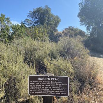
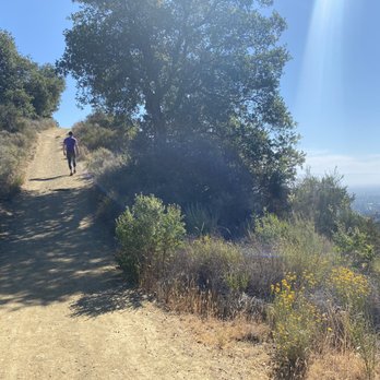


Great hike! I've only done the hike to hunters point which is short and sweet (~30 mins roundtrip). Great views from the top. I come here a lot with my dog, and there are many dogs on this trail which my dog loves. Parking is a pain. I've witnessed arguments, honking, yelling, and all kinds of drama in this parking lot. It's small and often times a queue forms by the entrance while people wait for people to finish their hikes and leave. If you're coming during peak hours, I recommend parking by the road before the entrance. read more


I intended to do the Maisie Peak hike but I had no clue where I was going so I just went with the flow. I ended up doing the Seven Trails Loop which was about 3.2 miles round trip from the parking lot. It was an easy trail run. There were very narrow parts of the trail (which of course was when I needed to pass people) and the sloping of the trails made it difficult to pass other trail-users who were not cognizant of how hard it is to run on a slope when one foot is hitting the ground at a lower point than the other.... but it was only for a short stretch so it wasn't too bad. I almost rolled my ankles but whatever. (Not bitter about it lol.) I would say about 50/50 shade VS unshaded on the trail. Wear sunscreen and bring a hat because it gets hot out there. The views were okay. Smoggy in the early afternoon. The trail was pretty dusty and footing was rocky as well so be careful. I liked that some of the trails were marked "ONE WAY" so everyone was going the same direction. PARKING: The lot is pretty small but a decent number of cars can fit in it. I like that it's limited because that means there are fewer people on the trails but it's sucks if you get here when it's full and have to wait or hunt for a spot. Overall, I didn't love the terrain (rocky, packed dusty dirt for most of it) and how the sun was so direct on the trail. The run was easy so I would come again on a cold/cloudy day. read more
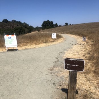


This is a fine place to hike and obtain views of the valley below. It is just a short drive on Prospect Road from S. DeAnza Blvd. Most of the trails are out in the open, but there is a creek trail that is shady. On this visit, we saw several lizards out and about. It was a hot day, so we did not go as far as I would have wanted to go otherwise. read more


Awesome selection of trails (including kid friendly ones) and great views, but there is a serious lack of parking here. Also would not recommend for the summer as there is zero shade once you make it past the initial ascent. Perfect for a winter hike though. read more
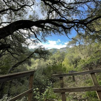


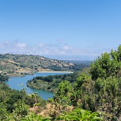
Came here on a Saturday around 4pm-ish. Hiked Tony Look Trail to Stevens Creek Reservoir. Trail is quite narrow, which might be more of an issue if you go during a busier time. But, wasn't bad when we went. Only had to pass a handful of people. It was a pretty easy trail with lots of rolling hills, but nothing too steep. Was also shady for most of the trail. Dogs are allowed, but must be on leash. No horses or bikes on this trail. Parking is limited but we didn't have any issues finding one when we were there. read more



6 years ago
I only hike because of my dog, and this is the closest dog-friendly hiking trail for me. The narrow road to get here is not only confusing, but pretty dangerous. Last time, I had to back up along a super narrow winding road so two trucks could pass each other. It was definitely not a safe situation for anybody. I felt like I was in a third world country on one of those mountain roads that weren't measured correctly. The parking lot is a clusterfuck. There's a severe shortage of spots even in the middle of a weekday and everyone parks haphazardly. You have to watch out for trees, people, dogs, and bikes weaving through the tiny lot. The trail is extremely narrow in the beginning and then only slightly less narrow afterwards. Horse turds EVERYWHERE. I hate HATE the many bikes that ride through because there's not enough room for them to pass and I'm always worried they're going to run over my dog. Then there's the ranger parked at the top of the trail with a set of binoculars just waiting for you to do something wrong. Overall hiking here just isn't a relaxing situation for me so I'm actively looking for something better and preferably with an off-leash policy. read more
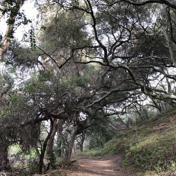


This is a popular spot evidenced by the fact that the parking spots were all taken by the time we got there at 7.30. Once we got a spot and went on the hike, it was great. Beautiful views including some deer sightings. read more


I never knew this trail was here and am glad we found it since it's dog friendly!! The trails are really lovely- most of it is fairly lush and shaded. There are portions that are out in the open (so bring a hat!), but the prairie landscape and the views of the bay are are so peaceful. Lots of different trail options. The smallest loop in the beginning is just 0.7 miles. Mountain bikes are allowed on many of the trails, which can make it a little bit crowded. PARKING: I have never seen such a tiny parking lot at a park before! It fits perhaps less than 20 cars, so the only way to guarantee a parking spot is to arrive before 7:15 am. We came at 8am, and luckily a couple early birds were just leaving so we only had to wait 5 minutes but there really is barely a place to even wait. A lot of people park at the bottom of the road which has a sign that says "1/4 mile" to the park. The problem is the road up is narrow and windy, so you have little to no visibility of oncoming cars. There was no way I was walking up that with our baby and dog. read more


Wonderful and popular park for hiking, mountain biking and even horseback riding (from the Garrod Stables). Trails are mixed use and accessed from a busy parking lot at the end of Prospect Road or Regnart Road with street parking. Some trails are marked one direction now during Covid. Trails are mostly exposed and sunny, but the Seven Springs trail drops into a little valley and is shady. We go often for a nice getaway to nature. read more


Lots of trails to choose from and I really enjoyed this place! Families, dogs, horses - mixed use trails which kept it interesting. Parking is tough - I parked near Madrone picnic area off Stevens Canyon Road. Do not bother with the main parking lot that is a tiny, maybe 20 car lot, with at least 10 cars circling and waiting for someone to leave. Too much stress please avoid. Views of SF bay! Enjoy! read more


Creekside Trail starts off completely in the shade... but then suddenly you are in the trails exposed to searing heat. And no more shade. It's like when your girlfriend gives you special attention when you are first dating but then once you're committed, there's no more shade. Except maybe on your birthday. So, don't get used to that shade. Anyway, tight parking, lack of trash bins, and no water aside, it's a great trail. Unlike Jones Trail (another fave in Los Gatos), these wide trails have no loose gravel, there's no mountain lion warnings, you get trail maps, and you can't hear the freeway. Though this trail has some really persistent flies that seem to want to enter you via your ear. I was flapping my hands and cussing- I'm sure the couple behind me thought I had Tourette's or something. read more


5 years ago
I love Fremont Older. It's a great hiking spot that I've been going to for several years now. Lots of different trails to take so you won't get bored. There's plenty of shady spots and great views of the Bay Area. They also have a nice parking lot with plenty of spaces. Very populated so it feels very safe. It's also great for dogs. read more


Love this place except the parking is very limited less than 12 cars. You can park a little further and walk to the hiking trails. There are many hiking trails and points. Some with shades some without and very open space and pretty. DOGS are allowed and on leash. There are many people come and hike here. There are biker and certain area have horse riding as well. Be prepared there is restroom in the front or in the middle of the hike. Not to hard for beginners. Enjoy and stay healthy. read more


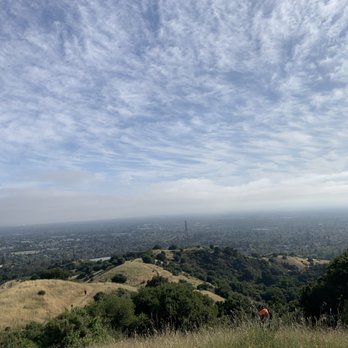
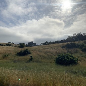


6 years ago
I had originally planned to go to San Antonio Preserve to mountain bike, but realized upon arrival that San Antonio was more catered to hiking rather than mountain biking. While not my first choice, I don't regret having gone to Fremont Preserve at all. Probably because it was a weekday, but the parking lot still had plenty of spaces when i got there. That was an accurate indicator of how empty the park was (which is just how i like it). As for the trails and parks itself, I admit that i'm a novice at mountain biking, but for what it's worth i thought that the trails were exceptional. Almost every trail was accessible to both mountain bikers and hikers, as well as being wide enough that I didn't have to worry about navigating around hikers. The trails were in good condition (the only gripe i would say is having to avoid horse poop on some of the trails haha). Wide trails, amazing views, and not that many people, overall it gets a reccomend from me. read more


Been eating too many yumburgers lately? Don't worry, Fremont Older Open Space Preserve has you covered. The inclines here are only moderately steep, but there are so many of them that a good workout is practically guaranteed. Parking: The small parking lot on Prospect Road accommodates around 20 cars. It fills up in the early morning but starts clearing out from 10am onward. The last quarter mile of road leading up to the parking lot is very narrow. It's possible for two cars to squeeze by each other carefully. You can pick up a free map at the trailhead, which is probably a good idea since this map is more accurate than Google Maps (refer to comments below about specific Google Map inaccuracies). According to the map, the only restroom in the park is in this parking lot. I didn't see it, but it's probably a porta-potty behind a tree somewhere. 5 miles to the reservoir and back: You might as well hike to the Stevens Creek Reservoir since it's only 2.5 miles to get there. From the Prospect Road parking lot, take the Cora Older Trail, turn right onto the Seven Springs Loop Trail, left towards the Hayfield Trail, and then left onto the Hayfield Trail. Stay on the Hayfield Trail until you turn right onto Coyote Ridge Trail. At the fork where the Coyote Ridge Trail splits into two, keep left. Turn left onto the Tony Look Trail (Google mistakenly calls this the Loop Trail), follow it a short distance and tada! Reservoir. The reservoir is actually in the adjacent Stevens Creek County Park. You're allowed to bike most of this route but unfortunately bikes are not allowed on the Tony Look Trail. If biking, you can follow the Coyote Ridge Trail to its end, which will bring you to the north end of Stevens Creek County Park and some parking lots. 7 mile roundtrip to the reservoir and back: Once you're at the reservoir, instead of going back the same way you came, you can follow the Tony Look Trail south and circle around the park. This will add 2 miles and more moderate inclines to your hike. The Tony Look Trail will run through Stevens Creek County Park until it ends at Stevens Canyon Road. There, you'll find a marker (http://www.yelp.com/biz_photos/dnuz7enB2-aMoSsVF4N2Ow?select=WPsKiNuCvbvMQzV5PjRv6Q#9q6IVNVklEDSEBLeJHnvHA) indicating the start of the Lookout Trail (Google mistakenly still thinks this is the Tony Look Trail). Following the Lookout Trail will take you past the Madrone Group Area (http://www.yelp.com/biz/madrone-group-area-cupertino) where there is a water fountain. Continue up the Lookout Trail, up a set of switchbacks which brings you back into Fremont Older. Continue past the intersection with the Wedding Trail, then turn right onto Vista Look Trail, and left onto Coyote Ridge Trail. You'll pass by a short trail leading up to Maisie's Peak (http://www.yelp.com/biz/maisies-peak-saratoga), the highest point in the park with a decent view of Silicon Valley. Have a look, then continue on Coyote Ridge Trail till you make a right onto the Hayfield Trail. From here, the rest of the way back is the way you originally came. Verdict: A scenic place to hike with moderate inclines to give you a good leg workout. Minus one star for the less than ideal restroom and the limited parking. read more
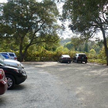


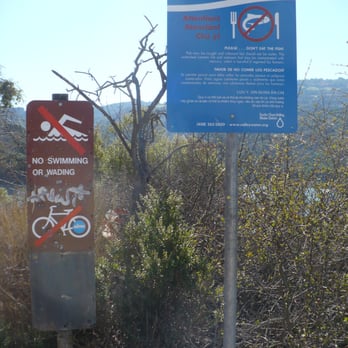


Took an out of town friend here to hike with her dogs during wintertime. It wasn't to cold, and I brought a sunhat just in case. No need! There was plenty of clouds and shaded area on the ascent to the viewpoint! Speaking of ascent, there's basically none. It's very flat for a hike, so bikers and runners might find this pretty fun (albeit slightly bumpy) with vibrant green and blue beautiful snapshots of the Bay Area. Easy-going, sweatless, dog-friendly, full panoramic South Bay hike. Those are the major pros. Here are some cons: NO trashbins (bring doggy doodoo bags if you have a fluffy friend), parking is TIGHT (only 20-25 cars can fit easily), and no water fountains. Although, this hike is more of a friendly trail, I still like coming here from time to time for a chill relaxing walk. read more


11 years ago
Parking: problematic. Only room for about 15 cars or so. We lucked out. Hike: we did the Hunter's Point trail which was an easy .8 mile hike to the top where there's a bench to sit on and enjoy the view. We brought binoculars and could spot Moffett field, Shoreline amphitheater and Apple's new campus being built in Cupertino. This was our first ever hike and was a good beginner level for ourselves and our 7 year old. The path was dirt and had flat areas and inclined areas. Lots of beautiful greenery and views to admire and even a few mansions. There were other trails that veered off from the Hunter's Point path which I think we'll try next time. read more


Fremont Older Open Space Preserve is a wonderful place to go hiking, running, biking, or even horse back riding! This is me and my mom's go to spot for a run/hike whenever Rancho San Antonio, which is a few miles down the road, is too crowded. There are several entrances into this park. I have never parked at the parking lot on Prospect Road that so many people have mentioned in previous reviews. I recommend parking on Stevens Canyon Road. Foothill Blvd turns into Stevens Canyon Road and there is a little lot on the side of the road right at the trail head for the Rim Trail. Rim Trail is actually part of Steven's Creek County Park, but Steven's Creek County Park connects to Fremont Older at the Coyote Ridge Trail, which isn't too far from the trail head. The Coyote Ridge Trail is the only trail I have experience with so I can't really comment on other parts of the park. Once on the Coyote Ridge Trail, there are an assortment of inclines and peaks, which make the trail challenging at times. Maisie's Peak, Nob Hill, and Hunter's Point are the main peaks on the Coyote Ridge Trail. All these peaks provide amazing views of the bay, so have your camera ready. This trail doesn't provide that much shade, so sunscreen and hats are recommended. Make sure you watch out for bikers, this park is very popular with bikers who are often speeding down the trails. This park even has a winery and a farm connected to it. It was bizarre because I wasn't expecting it, but then I saw a sign that said tasting room hours on it. And I was like what a winery here?? It turns out it is Garrod Farms and Vineyard. I have never been, but it is something I am curious to discover on future visits to Fremont Older. Happy Hiking! read more
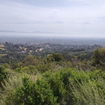


Sometimes, the best adventures in life are the ones closest to home. For me, that was hiking at Fremont Older Open Space Preserve. Recently, my friend and I were hoping to catch up during an early morning hike. Thanks to Yelp, we came across the Fremont Preserve, which was actually only 20 minutes from each of us. A few miles of hiking later and we both agreed that the Fremont Preserve was such a beautiful place to hike, train, and bask in the glory of the South Bay Area. Fremont Older Open Space Preserve is located on Prospect Road in Saratoga, California (Yes, it's not actually in Fremont despite the name). What I really like about this spot is that the public space is SO ACCESSIBLE. Specifically, the Fremont Preserve is only 10 or so minutes AT MOST from the 85 Freeway; you just take Prospect Road all the way down. It's really nice that the Fremont Preserve is far enough away from reality, yet close enough to drive there without trouble (no traffic usually). If you decide to come here, I HIGHLY SUGGEST arriving early (like 7am early) because the small parking lot FILLS UP FAST - probably because it's not that far from the city. We came by around 730 am and literally took up the last few spots. One big reason why the Fremont Preserve is so popular across all groups is because it can offer different kinds of adventures for people from all levels of hiking experience. Looking for an easy walk with plenty of views? Check out the Seven Springs Loop Trail; it's relatively flat during most parts and it will eventually get you to Hunter's Point (a.k.a. THE VIEW!). Want a cardio challenge? Explore the Bay View or Hayfield Trails that get take you to Maisie's Peak! It's a short, but pretty steep climb for even the experienced. If you are looking for the FULL ADVENTURE and want to explore everything that the Fremont Preserve has to offer, I have the perfect guide to send you to nirvana: 1. From the parking lot, head right onto Cora Older Trail and continue to Seven Springs Loop Trail. So far, so good... 2. Follow Seven Springs Loop Trail until Woodhills Loop Trail; this will get you to Hunter's Point. Make sure you stick around because the panoramic view is AMAZING! THERE'S SO MUCH TO SEE. Like, there's even a bench for you to sit down and relax. 3. Want to see more? Head down onto Hayfield Trail and continue until Coyote Ridge Trail. NOTE: This is when it gets tough, but stick at it because the reward is worth. Follow Coyote Ridge until the beautiful Maisie's Peak. Scratch your head in bewilderment for not knowing that such a beautiful hiking spot existed SO CLOSE TO YOU! 4. Head back on Coyote Ridge Trail the way you came and continue onto Hayfield Trail again. Once you see Cora Older Trail, you are nearly back! When you finally reach the parking lot, relax and soak in that delicious sweat you've accumulated. Look at your watch and realize that the hike was only like 2 hours! But you worked hard for 5 or so miles!!! Time to redo? Would I say Fremont Older Open Space Preserve is the best hiking spot in the South Bay Area/Peninsula region? Definitely not! But I just love the fact that the Fremont Preserve is so close to me. This is like the PERFECT place to both train AND enjoy the scenery. I will for sure be back for a longer run. Because Fremont Preserve is truly worth an "omg, I'd travel 2 hours for this" rating. Just watch out for horse poop! Have fun and prosper, read more

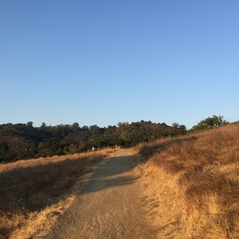


Wonderful place to head out for a family hike. A few different trail options, but we took a 3 mile route (you can see Apple's gigantic spaceship campus!): Cora Older Trail - (right) Hunter's Point - (right) Seven Springs Trail - Woodhills Loop Trail (to Hunter's Point) - retrace steps to junction and follow directions back to Prospect Road Parking Lot Fortunately lucked out finding a spot in the small parking lot, otherwise would have added on another 1/2 mile to get from street parking to the trailhead. read more

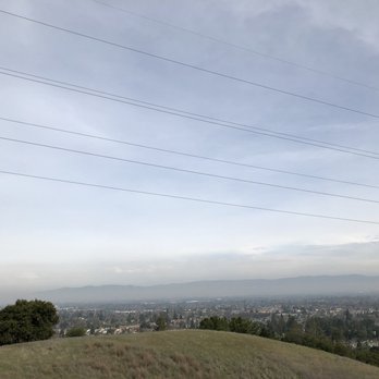


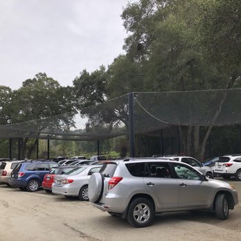


6 years ago

10 years ago
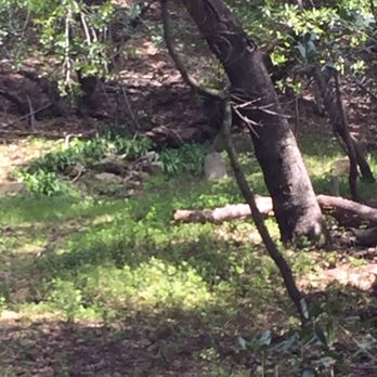
The Fremont Older Preserve is a beautiful spot to hike at, but it's not as much of a challenge. I've been able to hike most of it's trails fairly easy. My most recent visit was a couple days ago with my best friend. We began out hike towards Hunters Point Lookout via the Coral Older Trail. We then took the Creekside Trail to get back to the Prospect Rd. parking area afterward. It was on the Creekside Trail where things got a little spooky. My bestie and I had went off the trail and found a secluded spot right beside the Calabazas Creek. She looked across the creek from where we were at and noticed a single gravestone (pictured below). A minute later we suddenly found an old used and rusty knife with residue on it near us on our side of the creek. We ran like hell back to our car shortly after that. Wonder if I might have stumbled upon something that happened there at one point in the park's history. read more

15 years ago
Pros: - Dog friendly! - Picturesque verdant vista (at least in spring time). - Lots of trails to choose from (mostly easy). - Good mix of sun and shade. Cons: - Limited parking spaces. - Watch out for horse poo! - No trash cans at park entrance. read more

Page 1 of 5
More info about Fremont Older Open Space Preserve
22898 Prospect Rd
Saratoga, CA 95070
Directions
(650) 691-1200
Call Now
Visit Website
https://www.openspace.org
Hours
Indoor Amenities
Outdoor Amenities
Ask the Community - Fremont Older Open Space Preserve
Has anyone seen mountain lions here recently or at all?
No, but a Mountain Lion is certainly a possibility. Stay sharp.
Review Highlights - Fremont Older Open Space Preserve
You might also consider














Why does Yelp recommend reviews?
4 reviews that are not currently recommended
The reviews below are not factored into the business's overall star rating.
12 years ago

6 years ago
12 years ago
12 years ago
Fremont Older Open Space Preserve - parks - Updated September 2026
Best of Saratoga
People found Fremont Older Open Space Preserve by searching for…
Trending Searches in Saratoga, CA
Apple Orchards near Fremont Older Open Space Preserve
Apple Picking near Fremont Older Open Space Preserve
Archery near Fremont Older Open Space Preserve
Barbershop near Fremont Older Open Space Preserve
Baseball Fields near Fremont Older Open Space Preserve
Beautiful Views near Fremont Older Open Space Preserve
Bird Sanctuary near Fremont Older Open Space Preserve
Blow Dry Bar near Fremont Older Open Space Preserve
Corn Maze near Fremont Older Open Space Preserve
Dog Friendly Things To Do near Fremont Older Open Space Preserve
Dog Parks near Fremont Older Open Space Preserve
Dog Swimming near Fremont Older Open Space Preserve
Eyelash Extensions near Fremont Older Open Space Preserve
Fishing Pier near Fremont Older Open Space Preserve
Hiking near Fremont Older Open Space Preserve
Hiking Trails near Fremont Older Open Space Preserve
Kids Birthday Party near Fremont Older Open Space Preserve
Makeup Artists near Fremont Older Open Space Preserve
Mens Suits near Fremont Older Open Space Preserve
Off Road Trails near Fremont Older Open Space Preserve
Parks near Fremont Older Open Space Preserve
Photo Spots near Fremont Older Open Space Preserve
Picnic Areas near Fremont Older Open Space Preserve
Places To Take Pictures near Fremont Older Open Space Preserve
Playgrounds near Fremont Older Open Space Preserve
Private Schools near Fremont Older Open Space Preserve
Public Running Track near Fremont Older Open Space Preserve
Public Shower near Fremont Older Open Space Preserve
Pumpkin Patches near Fremont Older Open Space Preserve
Rock Quarry near Fremont Older Open Space Preserve
Scenic Night View near Fremont Older Open Space Preserve
Scenic Overlook near Fremont Older Open Space Preserve
Swimming Holes near Fremont Older Open Space Preserve
Browse Nearby
BEST of Saratoga, California Coffee near Fremont Older Open Space Preserve
BEST of Saratoga, California Playgrounds near Fremont Older Open Space Preserve
BEST of Saratoga, California Restaurants near Fremont Older Open Space Preserve
BEST of Saratoga, California Things to Do near Fremont Older Open Space Preserve
BEST of Saratoga, California Breakfast near Fremont Older Open Space Preserve
BEST of Saratoga, California Picnic Areas near Fremont Older Open Space Preserve
BEST of Saratoga, California Star Gazing near Fremont Older Open Space Preserve
BEST of Saratoga, California Campgrounds near Fremont Older Open Space Preserve
Browse Brands
Related Searches in Saratoga, CA
Affordable Kayak Rental Services in Saratoga, California
Best Dog Hiking Trails Around Saratoga, California
Best Fishing Locations and Guides in Saratoga, California
Best Nature Trails for Hiking in Saratoga, California
Best Off Leash Dog Parks in Saratoga, California
Best Parks for Parties and Events in Saratoga, California
Best Places for Horseback Riding in Saratoga, California
Best Sightseeing Experiences Available in Saratoga, California
Best Water Parks for Kids in Saratoga, California
Check Out Great Playgrounds in Saratoga, California
Check Out Off Road Trails in Saratoga, California
Discover Baseball Fields Around Saratoga, California
Discover Dog Friendly Trails to Explore in Saratoga, California
Discover Easy Hiking Trails Near Saratoga, California
Discover Fun Toddler Parks in Saratoga, California for Your Little One
Discover Kid Friendly Hiking Trails in Saratoga, California
Discover Popular Bike Trails in Saratoga, California
Discover Popular Photo Spots in Saratoga, California
Discover Soccer Fields in Saratoga, California Near You
Discover Top Nature Parks to Visit in Saratoga, California
Discover Top State Parks to Visit in Saratoga, California
Discover Walking Parks in Saratoga, California Near You
Discover a Hiking Trail in Saratoga, California
Discover the Best Beaches in Saratoga, California
Discover the Best Kids Park Spots in Saratoga, California
Discover the Best Night Hike Trails in Saratoga, California
Dog-Friendly Hikes With Dogs in Saratoga, California
Enjoy Camping Adventures Around Saratoga, California
Enjoy Kayaking Adventures in Saratoga, California
Enjoy Off Leash Dog Hikes in Saratoga, California
Enjoy Scenic Places to Walk in Saratoga, California
Enjoy Tent Camping Spots Around Saratoga, California
Enjoy a Beautiful Waterfall Hike in Saratoga, California
Enjoy the Best Picnic Spots and Ideas in Saratoga, California
Enjoy the Best Walking Path in Saratoga, California
Enjoy the Best Walking Trails in Saratoga, California
Explore Beautiful Parks and Green Spaces in Saratoga, California
Explore Easy Hikes Perfect for All in Saratoga, California
Explore Free Picnic Areas Around Saratoga, California
Explore Fun Activities to Do in Saratoga, California
Explore Parks With Pull Up Bars in Saratoga, California
Explore Picnic Parks Near Saratoga, California
Explore Popular Campgrounds Near Saratoga, California
Explore Popular Dog Walking Trails in Saratoga, California
Explore Popular Kids Parks Throughout Saratoga, California
Explore Popular Picnic Areas Around Saratoga, California
Explore Popular RV Parks Around Saratoga, California
Explore Scenic Lakes to Visit in Saratoga, California


