Uvas Canyon County Park Photos


You might also consider


More like Uvas Canyon County Park
Recommended Reviews - Uvas Canyon County Park
Start your review...


Reviews With Photos


Long overdue review, but this is from 2019 trip, loved hiking there, checked out a few waterfalls, and the area is absolutely gorgeous. You do lose signals so it was hard to tell which trail you are on and can easily get lost, so plan ahead. Overall a gorgeous spot


It was my first nature hike & I absolutely loved it! We could water running the entire time. It was so peaceful & calming. Their campground is really nice. I could definitely spend a weekend there. There are multiple trails to choose from, from easy to hard. There's something for everyone. It's kid friendly and pets on a leash are welcome. It's all incline but not too difficult at all. On to the next one!
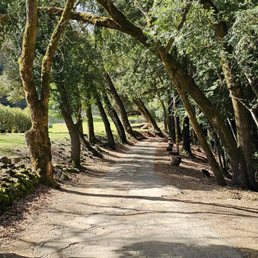

We were looking for a scenic hike with waterfalls and to get a little exercise and man we got all of that! As a matter of fact my calves are still feeling this hike, but was so worth it. We kept forgetting we needed to book in advance online as weekend parking reservations fill up quickly so we decided we would park on the road and walk in. It only added an extra 0.7 miles at most and was a beautiful walk with cute cottages along the river we enjoyed so I recommend it. When you enter the park will see the waterfall loop trail, which is what we chose and you don't have to walk far before seeing some beautiful smaller waterfalls. We soon started to climb, and I swear AllTrails is lying with only showing a 630 ft elevation gain, since my legs and eyes told me otherwise. I honestly thought we would never stop going up..lol My guy's smart watch showed over 1k elevation gain. Anyways, the views at the top are really nice and totally worth it. Much of the hike is alongside the water and shaded which is relaxing. We ended up with between 4 to 5 miles total, after adding the walk from the road in. I highly recommend, especially if you're looking for a booty and leg blaster workout!


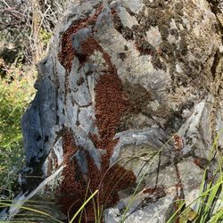
Great retreat in the South Bay for shady trails, waterfalls, and LADYBUGS!! Omg I didn't know ladybugs lived in colonies and this was the first time I'd witnessed so many of them in bunches -- super cool! The park has a good variety of trails at different lengths so you can choose depending on your mood. There's also a great campsite in the heart of the park that has some of the cleanest and nicest facilities I've seen at a campsite (automatic flushing, always clean, free pads/tampons, and warm water in the sink!). Day use parking is $10.


Made reservation online for parking which only cost $6. It was easy and we arrived 30 minutes earlier than our time slot. Love the hike to the waterfalls. Easy to moderate hike. Went last weekend and the weather was perfect.


This park is a favorite place to hike! With all the rain this spring it is full of flowers, waterfalls and happy growing groves of trees. We really enjoyed the wild flowers and grand vistas (hikes can be steep). There are steep gravely (slippery) trails and flatter trails. Wear hiking shoes or sturdy shoes with tread. We went on Monday and saw a couple other groups- weekdays are a great peaceful time to come. Families enjoy hiking up to see the closest water falls. Bathroom facilities are available in parking lot. Note: there are ticks in the grass and poison oak too- stay on the trail. (Do a tick check when you return to the parking lot after hiking) Get a free map of the park & trails at the trail head. Downside: A lot of time spent trying to pay online for parking/reservations before we came and needed to print the $6 parking pass to put it on the dashboard. Then, when we arrived, there were only a couple cars in the large lot. Sigh. Not much cell service en-route or at the parking lot. Come prepared with a map to the park, water, snacks, hat.


The campsite was nicer than I thought, but it is not very "wilderness" since the neighboring campsites are so close. Animals we saw: Slug, snake, blue jay Amenities: 2 parking spots per campsite, 1 tap water fountain for every 3 campsites or so, 1 wooden picnic table & fire pit & storage area per campsite, free shower area, restrooms, free tampons & pads in restrooms. This park is a cute area to have a small camping trip with your kids, but know that all the campsites are pretty close to one another. Luckily, my friends and I booked 4 campsites (1 name can book 2 sites) so we had plenty of private space. However, you can still see the tents and cars of neighboring sites so it did not feel the most immersive with nature. Hiking: 3/5 - 7 mile hike available but we did the 1 mile hike - One trail closed due to tree fall - Waterfalls are suuper small (thanks California drought) and the areas to stand near it is too small for larger groups (10) - But, there are areas to swim in which is very cool - One waterfall has a watering hole on top which was very cooling and nice - Watering hole downside: fits 3-4 people comfortably and a bit unsafe to get to - Saw a large snake swimming in the river, so be careful when swimming! Showers: 3/5 - Free - About 4 shower rooms available - Lukewarm is the warmest setting - Lights can be finicky - Grateful overall


A great place for beautiful hike so bring a good camera. It can be a little steep if you are not a regular hiker but otherwise it's pretty easy.


Checked this place out with a couple of friends in hopes of seeing ladybug clusters and waterfalls as seen on here/Google Maps. We had to get a vehicle reservation pass for parking which can be found on the park's website. Just make sure you print out your parking pass and keep it on your car dash once you park. There's timed entries by the hour once the park opens probably to stagger entries. We entered the park during 8AM-9AM window and once we were done, the lots were full so I would recommend visiting either once they open or nearing closing hours. Despite all the cars there, we only encountered two or three groups. We did the waterfall loop (yes it is full of beautiful waterfalls) which is completely shaded and has scenic views throughout. It is also not a difficult trail and starts uphill, ends downhill and the map is easy to follow.


Amazing ! The views and the water falls are all amazing ! We got to see ladybug clusters and the hike up was worth it. Did have to get parking reservations but easy. Clean bathrooms as well. Would recommend!


Beautiful beautiful Uvas Canyon! What a wonderful park to do some "forest bathing" and get some negative ions. We went on a very scenic hike and saw several waterfalls which were spectacular and very relaxing. I wish it was closer and I could go every weekend. It was not crowded and parking was a piece of cake but remember to book a spot online before you go.


I've visited Uvas Canyon 4 times now and have loved it every time. I loved showing this beautiful gem of a park off to my family and friends who have never been here before and I get the same reaction every time. "I had no idea this was out here. It's beautiful" Almost the entire trail is shaded. So although I came on an extremely hot day (over 90 degrees), it was bearable. There's a beautiful stream, small waterfalls, and the loop trails are easy to follow. Remember to reserve a parking pass before coming


5 months ago
This review is specifically for the Waterfall Loop Nature Trail within Uvas Canyon Park, one of the Bay Area's many "hidden gems." Nothing like a relaxing hike along a pristine nature trail to clear the mind and nourish the soul. I noticed that one recent review calls this hike "easy" but as we were climbing the stairs from the parking lot, we encountered two young women who looked to be in their 20s who were going in the opposite direction, returning to the parking lot. "It's beautiful," one of them volunteered to us, "but it's really HARD!" And indeed, on the trail we encountered young people who were visibly panting, even though the Waterfall Loop trail is shorter and easier than others in the park. So you might want to take that into account, FWIW, as the expression goes. It might also be helpful to mention the following: * The rules of this park call for purchasing an entry pass/parking permit online BEFORE you arrive. The reason is the limited number of spaces. Your permit is good for entry during a ONE-HOUR WINDOW for which you make your reservation. The person in the car ahead of us hadn't purchased a permit in advance and was able to use a credit card to purchase it at the entry gate but that might only be done when ample space in the lot is available. * To access the park, you must drive through a private 110-acre resort (Sveadal, meaning Swedish Valley), owned and operated by the Swedish American Patriotic League since 1926. It's a SINGLE-LANE road that is NOT LEVEL (quite rocky). You will want to make sure that your vehicle is in reasonably good shape for this drive. The only really scary part of this road for us was that at a couple of points, the incline is steep enough that you can't see ahead of you on this single-lane road. So you have to trust that no other vehicle is going faster than it should be coming toward you, in the opposite direction. * One more point ("muy importante"/very important): If you're coming for the waterfalls, use your preferred AI platform to check to make sure that the water will be flowing at the time of your visit. That's because the falls are generally seasonal and dependent on the amount of rain during preceding months. The falls are not large and thundering but they are nonetheless quite beautiful and soothing. PS: For those who don't know Spanish but may be interested: The Park is named after the Spanish word for grapes (uvas), referring to the abundance of wild grapes (Vitis californica) that early settlers found growing along the creek and throughout the canyon. read more

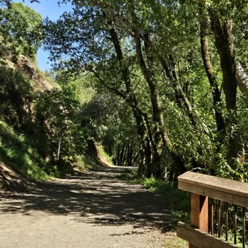
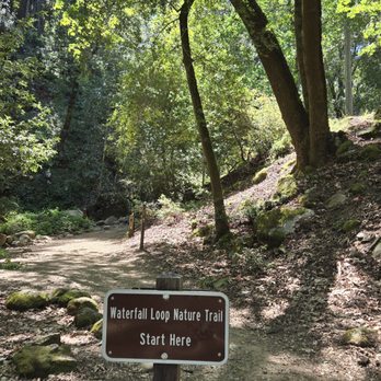
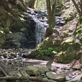


The best hike I've ever been on! Great views with multiple waterfalls throughout the trail and a huge plus that the park is completely dog-friendly. Easy parking but you have to reserve a spot ($6) ahead of time. We only booked a day before and there were still a lot of availabilities. The reserved hour is only a time frame of when you have to arrive to the park but you can stay for as long as you would like. My printer ended up not working the day of so I called the park and they were so nice in offering that I just write my reservation number on paper and place it on my dash. The weather was so nice when we went (mid March) and almost all of the trail was beautifully shaded. We did the Waterfall Loop trail which was about 3 miles and lasted about 1 hr & 40 min. Moderately challenging and such a fun workout with absolutely amazing views. I loved everything about this park! read more


I had been wanting to go to Uvas Canyon for over a year now and I finally made it on a Sunday in March! I recommend going after heavy rain so that the waterfalls are stronger. You have to buy a parking permit for $6 at least 24 hours in advance and bring a printed copy with you. We arrived around 10:30am and thanks to the timed entry system, it was not too crowded. We did the Upper, Basin, and Black Rock Falls via Contour and Waterfall Loop and used All Trails for directions. Hiking shoes not required but there were a few points where we had to cross a stream so could be useful for those portions. Took about 90 minutes for us to complete, so would say the trail is easy-moderate. Overall, the views were simple but the mossy forest and the waterfalls were very pretty. Trail was well maintained and the bathrooms at the trailhead were clean. Nice, calming hiking spot - I would come back next year after the rain! read more


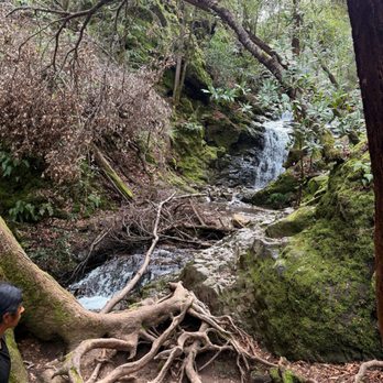


Long overdue review, but this is from 2019 trip, loved hiking there, checked out a few waterfalls, and the area is absolutely gorgeous. You do lose signals so it was hard to tell which trail you are on and can easily get lost, so plan ahead. Overall a gorgeous spot read more


4 months ago

1 year ago
It was my first nature hike & I absolutely loved it! We could water running the entire time. It was so peaceful & calming. Their campground is really nice. I could definitely spend a weekend there. There are multiple trails to choose from, from easy to hard. There's something for everyone. It's kid friendly and pets on a leash are welcome. It's all incline but not too difficult at all. On to the next one! read more


7 months ago

2 months ago

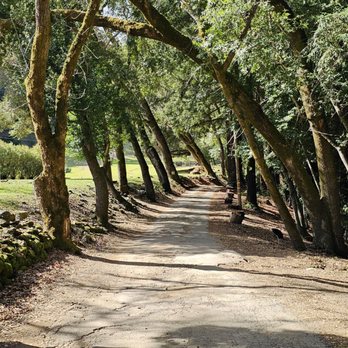
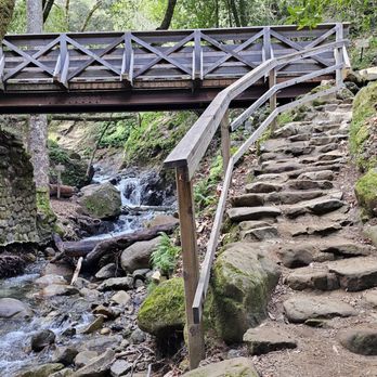
We were looking for a scenic hike with waterfalls and to get a little exercise and man we got all of that! As a matter of fact my calves are still feeling this hike, but was so worth it. We kept forgetting we needed to book in advance online as weekend parking reservations fill up quickly so we decided we would park on the road and walk in. It only added an extra 0.7 miles at most and was a beautiful walk with cute cottages along the river we enjoyed so I recommend it. When you enter the park will see the waterfall loop trail, which is what we chose and you don't have to walk far before seeing some beautiful smaller waterfalls. We soon started to climb, and I swear AllTrails is lying with only showing a 630 ft elevation gain, since my legs and eyes told me otherwise. I honestly thought we would never stop going up..lol My guy's smart watch showed over 1k elevation gain. Anyways, the views at the top are really nice and totally worth it. Much of the hike is alongside the water and shaded which is relaxing. We ended up with between 4 to 5 miles total, after adding the walk from the road in. I highly recommend, especially if you're looking for a booty and leg blaster workout! read more




2 years ago
Great retreat in the South Bay for shady trails, waterfalls, and LADYBUGS!! Omg I didn't know ladybugs lived in colonies and this was the first time I'd witnessed so many of them in bunches -- super cool! The park has a good variety of trails at different lengths so you can choose depending on your mood. There's also a great campsite in the heart of the park that has some of the cleanest and nicest facilities I've seen at a campsite (automatic flushing, always clean, free pads/tampons, and warm water in the sink!). Day use parking is $10. read more


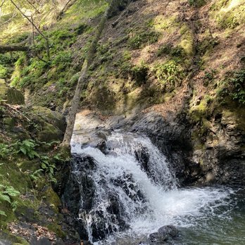
Made reservation online for parking which only cost $6. It was easy and we arrived 30 minutes earlier than our time slot. Love the hike to the waterfalls. Easy to moderate hike. Went last weekend and the weather was perfect. read more


4 months ago

3 years ago
This park is a favorite place to hike! With all the rain this spring it is full of flowers, waterfalls and happy growing groves of trees. We really enjoyed the wild flowers and grand vistas (hikes can be steep). There are steep gravely (slippery) trails and flatter trails. Wear hiking shoes or sturdy shoes with tread. We went on Monday and saw a couple other groups- weekdays are a great peaceful time to come. Families enjoy hiking up to see the closest water falls. Bathroom facilities are available in parking lot. Note: there are ticks in the grass and poison oak too- stay on the trail. (Do a tick check when you return to the parking lot after hiking) Get a free map of the park & trails at the trail head. Downside: A lot of time spent trying to pay online for parking/reservations before we came and needed to print the $6 parking pass to put it on the dashboard. Then, when we arrived, there were only a couple cars in the large lot. Sigh. Not much cell service en-route or at the parking lot. Come prepared with a map to the park, water, snacks, hat. read more


5 months ago

3 years ago
The campsite was nicer than I thought, but it is not very "wilderness" since the neighboring campsites are so close. Animals we saw: Slug, snake, blue jay Amenities: 2 parking spots per campsite, 1 tap water fountain for every 3 campsites or so, 1 wooden picnic table & fire pit & storage area per campsite, free shower area, restrooms, free tampons & pads in restrooms. This park is a cute area to have a small camping trip with your kids, but know that all the campsites are pretty close to one another. Luckily, my friends and I booked 4 campsites (1 name can book 2 sites) so we had plenty of private space. However, you can still see the tents and cars of neighboring sites so it did not feel the most immersive with nature. Hiking: 3/5 - 7 mile hike available but we did the 1 mile hike - One trail closed due to tree fall - Waterfalls are suuper small (thanks California drought) and the areas to stand near it is too small for larger groups (10) - But, there are areas to swim in which is very cool - One waterfall has a watering hole on top which was very cooling and nice - Watering hole downside: fits 3-4 people comfortably and a bit unsafe to get to - Saw a large snake swimming in the river, so be careful when swimming! Showers: 3/5 - Free - About 4 shower rooms available - Lukewarm is the warmest setting - Lights can be finicky - Grateful overall read more

2 years ago
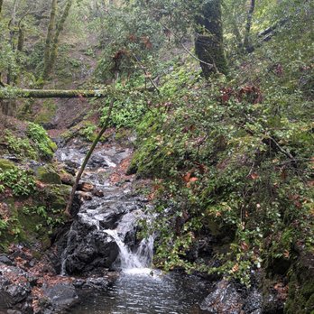
A great place for beautiful hike so bring a good camera. It can be a little steep if you are not a regular hiker but otherwise it's pretty easy. read more


1 year ago
Absolutely beautiful campground! Bathrooms are spotless and campground is perfectly maintained! Trails are beautiful along the creek with waterfalls. Even if the water is low it is beautiful. After the rain it is amazing. Dogs welcome on leash. Make a reservation at gooutsideandplay.org read more


3 years ago
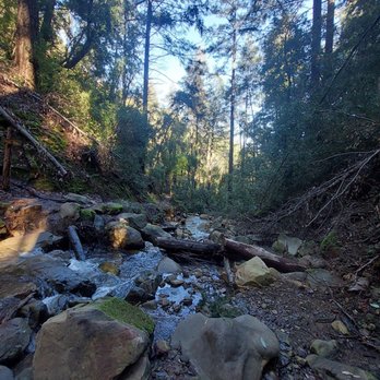
Checked this place out with a couple of friends in hopes of seeing ladybug clusters and waterfalls as seen on here/Google Maps. We had to get a vehicle reservation pass for parking which can be found on the park's website. Just make sure you print out your parking pass and keep it on your car dash once you park. There's timed entries by the hour once the park opens probably to stagger entries. We entered the park during 8AM-9AM window and once we were done, the lots were full so I would recommend visiting either once they open or nearing closing hours. Despite all the cars there, we only encountered two or three groups. We did the waterfall loop (yes it is full of beautiful waterfalls) which is completely shaded and has scenic views throughout. It is also not a difficult trail and starts uphill, ends downhill and the map is easy to follow. read more




2 years ago
Amazing ! The views and the water falls are all amazing ! We got to see ladybug clusters and the hike up was worth it. Did have to get parking reservations but easy. Clean bathrooms as well. Would recommend! read more


Beautiful beautiful Uvas Canyon! What a wonderful park to do some "forest bathing" and get some negative ions. We went on a very scenic hike and saw several waterfalls which were spectacular and very relaxing. I wish it was closer and I could go every weekend. It was not crowded and parking was a piece of cake but remember to book a spot online before you go. read more


I've visited Uvas Canyon 4 times now and have loved it every time. I loved showing this beautiful gem of a park off to my family and friends who have never been here before and I get the same reaction every time. "I had no idea this was out here. It's beautiful" Almost the entire trail is shaded. So although I came on an extremely hot day (over 90 degrees), it was bearable. There's a beautiful stream, small waterfalls, and the loop trails are easy to follow. Remember to reserve a parking pass before coming read more




1 year ago
4 of us were camping spread out in 25 sites on a Wednesday night in April. Of course, all 25 sites plus the group sites are booked solid for the weekend, so visit during the week. What a hidden gem. I wanted an escape from Silicon Valley. This place is minutes away, still in Santa Clara County, but wow!, what absolute wilderness. Clean bathrooms (running water, flush toilets, even hot showers!). Clean campsite. Well marked trails. Up & down the Waterfall Trail is easy & beautiful. I also did the Contour Trail. You think you're 3-4 days into a 7 day hike in a National Forest. Absolute wilderness. But you're in a County Park, less than 2 square miles, in Santa Clara county. Book 2 nights, & you can hike every trail. There's no cell reception for 5+ miles before you get here, so print out your reservation beforehand, but I did get cell reception once I got to the campsite, and everywhere on the trails where you get a view, you get reception. The 3-4 deer in the campsite looked at me & kept eating their breakfast. This place is nature. Very therapeutic. read more



This is a very nice little hidden gem not too far from home from the South Bay. This campground is small, but family oriented and clean. Most importantly (for me) there's running water, clean restrooms and showers with warm water! We've been here twice. This time in June and last time in August. In June, I've noticed more mosquitoes and flyer versus yellow jackets flying around during meal times in August. Highly recommended to bring inset and mosquito repellents if you have young kids. Also citronella candles. FYI, the camp ranger informed us, when temperature over 95F, no open fire is allowed to prevent wild fire; but charcoals were allowed. Plan you trips and check out their website before leaving. This time, we happened to be here during the hottest days in June! It was 97F! So no open fire was allowed on one of the night. It was nearly 100F outdoors, I thought I would be melting. Thanks to the shades and the little creek nearby the campsite, it made it much easier for us. Most campsites are well shaded by huge pine trees. There were quite a few hiking trails to hike. However, due to the drought, the falls were very dry with barely any water dribbling. There's also a volunteer camp host that stays in the campground, and the park rangers come around very frequently to empty out the garbage cans. Restrooms were cleaned twice a day! In addition, fire woods were only $13/box cheaper than some of the places and don't have to bring it into the campground. One box would last a night. But they are not always available, you may want to check before leaving. In summary, highly recommended campground for people like me who glamps once a year =) read more
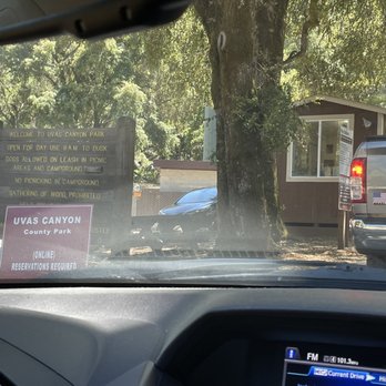


2 years ago
Dog Friendly!! (Just Make Sure to Pick up After your Dog) I RSVP'd the Morning of my Hiking Day with No Problem Beautiful lil Swedish Community you Drive thru Towards the Parks Entrance Keep an Eye out and Try to Spot Wild Deer as they are Eating along the Grass and Meadows along the Way Plenty of Designated Parking with Clean Restrooms and PicnicTables Over all a Great Park all Around read more


6 years ago
I almost didn't want to write a review for this place because I don't want it to get too crowded / discovered ! This was a beautiful enchanting and easy hike with abundant waterfalls and streams along the way ! During covid they require a reservation in advance ( can do this online ) and this helps ensure that the park is not over crowded. We did the small waterfall loop hike and it was a hit with our 3 year old. There are are no/low signals inside the park, and there are good clean bathrooms next to the parking lot. There is a variety of hikes with varying levels of difficulty. I hope to go back to try some of the longer hikes after the rains have filled out the waterfalls. I think this hike would also be great in the summer as its very shaded. read more


Great park to venture to, and not sure if it's always this way, but there's a limit of parking spot reservations each hour. This way, it was really great to be socially distant from others, unlike other hiking trails. The mini waterfalls and creek was very refreshing, though the trail is quite more difficult than expected. Nice and cool with all the trees and shade. Plenty of picnic benches to have lunch, and restrooms in the parking lot are clean. Would definitely go back. read more


6 years ago
Camped here for two nights over the weekend and probably hiked about 90% of all the trails in the park. Good option for a camping trip without traveling too far away from the bay. Bathrooms are very clean with running hot water. Each campsite has the basic storage locker and fire pit (some sites have the fire rings whereas some have brick pits). The rangers come by at least twice a day to take out the garbage and sanitize the water fountain areas from what I witnessed, so everything is pretty well managed. I was able to reserve our site about a month before but all the good sites were, not surprisingly, taken already. Although the park doesn't contain many trails, it does offer trails ranging from easy to almost difficult. The waterfall loop is great for families who want to hang out near the creek and the falls. I assume this is where most people were because when we hiked the Contour/Alec Canyon/Knibbs Knob Trails, we rarely saw anyone on our hike. The Uvas Creek Trail is a quick, fun hike that we also did when we first got there late in the day and we had the trail all to ourselves the entire time. For the Knibbs Knob Trail, I suggest going early in the morning or late in the day. Although a fairly short hike in distance, the trail does get a little steep and is mostly uncovered as you head further up. (I had to take small breathers whenever there was some shade lol). The views up top aren't that amazing but it was a great workout. Remember to make reservations on their website, even for day use! I saw some cars having to turn around when they got to the park entrance booth, likely because they didn't have a reservation. read more


7 years ago
ABSOLUTELY LOVE, LOVE, LOVE!!! This is the closest and easiest hike to see a waterfall in the Bay Area. I've been here a few times and I love it every time. This trail is pretty easy. There might be some inclines, but majority of the trail is doable! I haven't really been too active, but decided to hike again and I chose Uvas to kickstart my journey to a healthier lifestyle. For someone who hasn't been working out for soooo long, I didn't die! Also, there are so many great falls to see along the loop! I would definitely recommend Uvas Canyon County Park to any beginner hikers who would love to see a waterfall. I can't really remember how long it took my boyfriend and I to hike this trail, only because we kept stopping to take pictures. But, I'm pretty sure you can hike the loop within 2 hours or even less. read more


My last hike here was with my girlfriend and her family. I used to frequent Uvas with my childhood friend -- he loves this park. The drive from San Jose (depending which part you reside in) can be a bit of a stretch. We drove from my friend's house which was in North San Jose and it was about a 45 minute drive. It's an easy one though so just plan accordingly. Before planning your trip, make sure to go on the website to purchase a day pass as they do not sell them at the gate. As of now, tickets are at $6 per day but they get sold out fast (crowd control) so book ahead of time. When you arrive, a ranger will verify your ticket before allowing you into the park. Once you're in, there is a huge lot that could probably fill 50 cars easily. Right outside the lot, there are restrooms and picnic tables -- it's a very well kept park. Super clean and well maintained. The trails are easy and nicely marked. It's almost impossible to get lost. The nature you get to explore along the way includes waterfalls, beautiful plants, and different types of trees which creates an exceptional platform for nature therapy. Pack a sandwich, put on some sunscreen, and visit Uvas for a therapeutic nature getaway. Highly recommended. read more
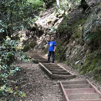
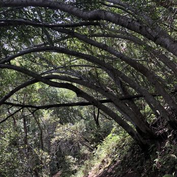

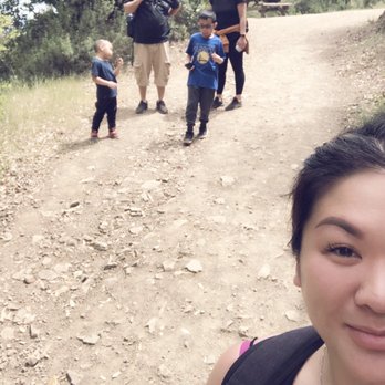


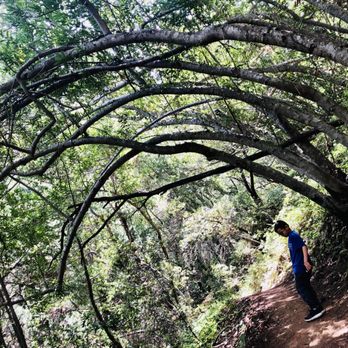

This is my favorite place in Santa Clara County. I absolutely love it here. Im almost scared to leave a review and have more people go here. It would break my heart to go here again and find that all the fairies had to move on to another place because of too much foot traffic or litter. Its absolutely STUNNING. And the waterfall loop is kid friendly and new hiker friendly. They also have hikes that are longer and have great views. I CANT recommend it enough. It is a truly magical place. But only those who look for the magic will find it. You also have to believe, so start there if your feeling like you need a recharge in nature, a forest bath if you will. Please just be respectful and leave no trace other than joy in the air. read more

3 years ago

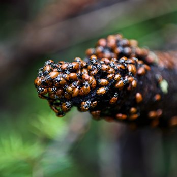
The undisputed crown jewel of the Santa Clara County Parks system, Uvas Canyon continues to be one of my favorite spots to visit―esp during the winter. The coolest thing here are their multiple waterfalls that are located throughout the park, and the best part is they offer a tremendous pay-off for very little work. The entire Waterfall Loop Trail is less than two miles and features some of the best waterfalls the area has to offer. There are some steep hills involved, but the trails themselves are fairly well-kept and easy to navigate with well-placed signage. This is also a great place to bring kids, as the hiking should be easy enough for most young children; I brought my son here when he was around 4-years-old and he had no issues. As if that wasn't cool enough, how awesome was it to find a virtual blanket of ladybugs aggregating on the forest floor during their "hibernation" (technically called a diapause) on my last trip here. I'll admit it was a bit creepy seeing that may ladybugs in one spot moving like a living carpet, but totally awesome nonetheless. Only bad thing about Uvas is the lack of parking spaces on the weekends. In order to visit on the weekends (or holidays), one needs to make a reservation thru the County website and pay the $6 vehicle entrance fee ahead of time to secure a parking spot within a certain time frame. Go to: http://gooutsideandplay.org/reservations/product.asp or call 408.355.2201 during weekday business hours to make a reservation. Also, make sure to print your ticket at home or just grab a screenshot of the reservation email, as there is zero of the Internets™ once you get to the entrance. Follow these simple steps and it should make for a great family-fun filled day. Happy hikes! read more




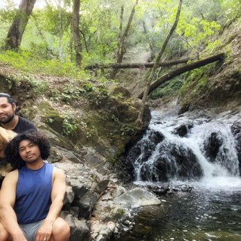
February 14, 2021 Uvas Canyon was once the tribal territory of the Mutsun Ohlone tribe . I'd like to thanks the Mutsun Ohlone tribal community for letting us hike on your sacred land. As of now , advanced reservations are required 7days a week to visit Uvas Canyon County Park. You can make your reservation at reservations@prk.sscgov.org or call (408)355-2201 it's $6 to reserve a parking spot. Croy Road to get there is narrow and winding , to reach the park entrance , drive through Sveadal a private resort belonging to the Swedish American patriotic League . It's an interesting place. Once we arrived , we grabbed the park map since it was our first time being there and we wanted to hike the waterfall loop . The trailhead is just behind the restrooms ( very clean ) behind the parking lot. There was a big herd of wild turkeys drinking water from water puddles in the parking lot. They seem friendly not afraid of humans. There were also a couple of deer near the parking lot. We made our reservation for 8am-9 am slot and that was good because we pretty much had the park all to ourselves, very quiet and got to see wildlife. Saw a Coyote , a group of quails and black tailed deer ( at least a dozen ) on the way to the park. I like this county park because it's very green with lots of water flowing in the creeks and waterfalls reminded me of an island where I'm from. The trails are well maintained and there are plenty signages. We got to see Black Rock Falls , Basin Falls and Upper Falls within two mile hike. This place is definitely one of my favorite hikes. It's only about half an hour drive from Morgan Hill . Dark-eyed junco wanted to ride with us back to Morgan Hill. He was holding on to the door by the window of my bf's car for good 5 minutes or so. (See videos) those birds are territorial and can chase you like the geese. Again , thank you Mutsun Ohlone tribal community for letting me hike on your sacred ground. Please stay safe tribal communities. read more


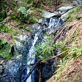


Shady park with lots of water area for kids to discover nature's miracles. During COVID, must reserve parking online before heading to the park. Also, the entrance to the park will pass by a private community, there is a few spots with one lane only, make sure to drive slow and pay attention to surroundings as there might be deers and turkeys sharing the road. read more


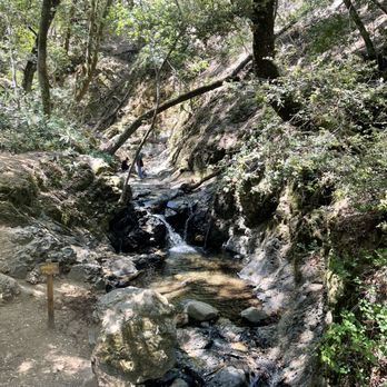
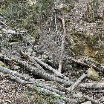

5 years ago
Long overdue review for this gem of a park in the South Bay. Reservations are required and parking is limited but that just made the whole experience so much more enjoyable. Trails weren't crowded and you could actually get shots of the waterfalls without other hikers in view. Make sure to plan in advance when you want to venture down here during peak waterfall season-It was about 3 weeks out from when I made my reservation to being able to find availability on a weekend. Once you've checked in with the ranger at the kiosk, you'll find clean restrooms near the lot, a well maintained picnic area and great signage for the trails along with maps. I've been twice and did the waterfall trail and then looped up to contour trail which gives you about 4-5 miles. For a shorter hike you can stick to just the waterfalls. Although we've had little rain this winter and spring, I lucked out by coming a few days after the biggest storm of the season and found some nicely flowing falls. Along the falls loop you will find side trails for Black Rock and Basin Falls-both very short but worthwhile detours. My favorite of the falls though was Lower Falls-when you're heading from the lot to the waterfall loop, there's a sign to the right for the short trail along Swanson Creek down to the Lower Falls. Definitely do not miss that one! The waterfall loop is pretty easy but the initial climb up to Contour trail is a bit steep and rocky. That only lasts less than 1/2 a mile and afterwards that trail levels out. I would only recommend Contour Trail if you're looking to add some additional miles to your hike. Since I drove quite a bit to get here, I figured I might as well. It's a nice winding path through the woods. The falls, and Swanson Creek with it's footbridges and ferns are the main attraction. Come for those, especially during the rainy season and you won't be disappointed. Review #19 of 100 review goal in 2020 read more


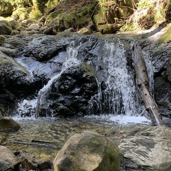


2 years ago

I loved loved this park for camping They have over 20 sites available. reservations are made online or over the phone There are showers but they are close during covid which makes no sense.. I would think they would encourage cleanliness.. i think the park district does not typically clean the showers daily as they do the bathrooms which is why they were closed but I am not sure.. I did see staff coming about twice a days to clean the bathrooms and 3x a day to spray down common areas such as the trash cans and water faucets .. all of the staff I interacted with were extremely friendly and provided good instructions. There are several trails to hike none are really long i think we did all of them in about 1.5 hour.. unfortunately some of the waterfalls were dry . I recommend this place for families simply because they did have a family restroom equipped with a changing table and a chair for your little ones. The bathrooms also had hot water which I appreciated since the showers weren't running.. every two campsites are close to each other . Ie. 10&11 were close but 9 and 12 were spread apart .. they also have a group campsite but it was closed during the 2020 SIP. There is a 2 car limit per campsite 8 person limit. Typically there is over flow parking avaliable but during covid there is not.. overall I enjoyed my self and look forward to camping here again. They also have wifi service avaliable with limited capabilities.. Tmobile & AT&T did not have service but Verizon did. There were also out let's for air mattress or other electronic necessities and every two campsites has a running water faucet. read more


Page 1 of 8
More info about Uvas Canyon County Park
8515 Croy Rd
Morgan Hill, CA 95037
Directions
(408) 779-9232
Call Now
Visit Website
https://www.sccgov.org/sites/parks/parkfinder/Pages/UvasCanyon.aspx
Hours
Indoor Amenities
Outdoor Amenities
Other Amenities
Ask the Community - Uvas Canyon County Park
Hi, does anyone know which trail have the waterfalls. My sister wants to do a beautiful hike for her 40? I've heard this one is very nice. Thank you
There is a trail not far from the lot called the Waterfall loop trail. Easy to follow, although the full loop is closed right now for repairs. It's an out and back, currently. Trails are well signed to point out side trails to other falls and…
Hi, is the trail safe/toddler friendly (I have a 2yr old) enough to where I won't need to put them in a carrier?
How I am just wondering which phone services did or did not have service? Ie. Version y/n T-mobile etc.
Hi there. We had cell service in the parking lot. Our carrier is AT&T. As we got deeper into park for our hike, we had very little to no cell service at all.
I have a parking reservation for 2 cars on this Saturday at slot 9am-10am and I can't go due to some urgent things. I want to share it for those who want to go. Do you know where I can share the info or reach me if you want?
I know its late but there are two California camping groups on facebook where folks regular share canceled reservations.. one is northern California camping
I came without researching & I need to purchase a vehicle pass. Am I guaranteed the slot for the time I purchase? I can't go over that time? Also I lost reception after making a right on Cory rd then I got lost. What's the best way to drive up here?
You should be able to get in during the time slot you purchased. If you arrive past your entry time slot, there is no guarantee that the park rangers will still let you in, but it's still worth asking them. It's at their discretion if you happen…
To make a two person hiking reservation on the website, do I just make a reservation under the vehicle day pass? I'm having a hard time navigating the website.
Yes-just order the vehicle day pass. That will cover the two of for entry to the park.
Is it an open very sunny hot hike? Or are there lots of shady areas?
Tons of shade along the waterfall trail. In fact I'd say it's 80-90% shaded
Do we need reservation to visit Uvas Canyon and why?
Reservations will be required for day use parking on 7 days a week (and holidays) through July 5, 2020. Please visit http://gooutsideandplay.org/ or call 408-355-2201 to make your reservation.
Are the trails stroller and/or kids (4-6yo) friendly?
Yes the trail to the left is steep but can be walked up. There are trails to the right inside the parking lot and towards the campground that are not as wide but still accessible for kids.
Is the hike stroller friendly?
You can bring a stroller, I see many parents do it, but you have to be willing to push up the left trail which elevates really fast. The left portion of the trail has less stairs and is wider than the right side which has more scenery and mini falls.
Is uvas canyon open yet?
Yes . Now you have to make reservations and pay 6$ per person.
How long does the 4.1 mile hike take for someone who is moderately active?
I visited yesterday 08/08/2017 and still close to public road maintenance still need to get done.
Is Uvas Canyon open again? Both the website and the voicemail say that they are closed indefinitely, but it looks like people have been this 2017 spring. Any answers? Thanks!
Still closed as of today 5/14/17
Review Highlights - Uvas Canyon County Park
You might also consider


















Why does Yelp recommend reviews?
11 reviews that are not currently recommended
The reviews below are not factored into the business's overall star rating.


4 years ago

8 years ago

8 years ago

6 years ago
2 years ago

10 years ago

3 years ago
11 years ago

14 years ago

15 years ago


