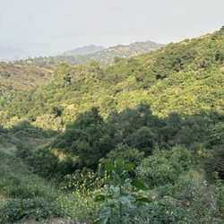
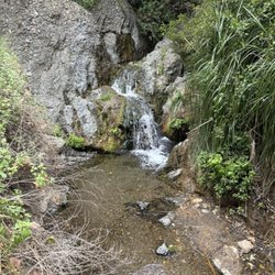
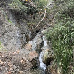
Westridge-Canyonback Wilderness Park Photos


You might also consider


More like Westridge-Canyonback Wilderness Park
Recommended Reviews - Westridge-Canyonback Wilderness Park
Start your review...


Reviews With Photos


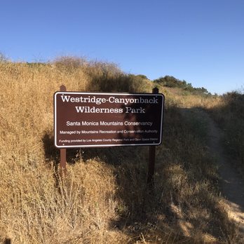
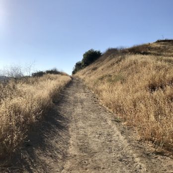
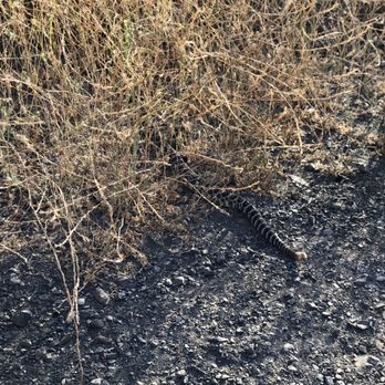
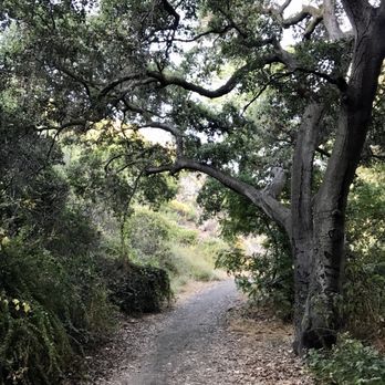
Came to Westridge Cynback for the very first time on 4th of July. I have been helping a friend with conditioning himself and it was suggested by him that we check out a different place. He did mention this trail is easier than the ones he was conditioning on back at Griffith but I wanted to give him a chance to show me something new. From the get go, the start of the hiking trail is at an elevated height. You can see a good view of the San Fernando Valley and catch the sun rise early in the hike. The trail is about 1.5 miles long with the main trail being the easy route. There are several hills running parallel to the main trail for additional challenge. The hills were fairly easy but take your time if you are not used to inclines. Since it is the Summer the view isn't all pretty surrounded by greenery, but of dried up bushes and other plants. As you complete the trail it leaves you into a neighborhood. From there we did a 180 and started heading back to the car. For most of the trail we took the main trail until we noticed we missed the first hill. We decided to take that hill back to the car and it was the most challenging out of all the hills on the trail. There were a lot of loose rocks which made it difficult to keep a steady pace but it was completely doable with very little problems. The only thing I didn't like about the trail is the condition of the road. There were some uneven pavement. If you are driving at a moderate speed you may bottom out your car. So please take it easy when arriving. Parking: there are several spots near the start of the trail. I do see people parking parallel to the main road where available. 6:30am there wasn't many cars and parking was easy. 1hr later the parking area was full and parallel parking started to form. VERDICT: Rinse and repeat
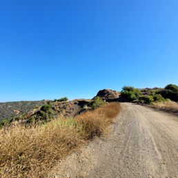

In A Nutshell: -The Westridge-Canyonback Trail is pretty secluded. -You will run into some people, but not a lot. -Mostly people hiking or mountain biking. -I like the firebreaks aka trails b/c they are very wide to give space. -There isn't a lot of shade, but the scenery of the open wilderness is serene. -You can see San Fernando Valley, the Topanga State Park & the rest of Santa Monica Mountains. -I love the fact you can bring your dog along. -The signs say make sure you dog is leashed, but since you rarely run into people you can let your dog off-leash as long as they obey your vocal commands. -There are plenty of trails to divert from which is great. -Cell phone signal was pretty strong, which is good just in case you need it. Overall, make sure you bring water for you & your dog(s).
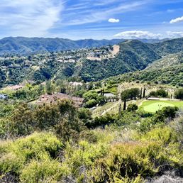

Westridge Canyonback is one of the better local hikes that you can take that offers a good variety of surfaces and incline declines. It's split between Upper Canyonback and Lower Canyonback with the Mountaingate Community and golf club in between. You enter Upper Canyonback from Mulholland Drive, via the route up to the Nike Missile site. The northern entrance starts with a slight incline and then descends into the park with side trails offering some good variety. The southern entrance is at the end of Kenter Ave, on the Kenter Fire Road. The southern entrance is a steeper incline from the get go and keeps climbing until you get to the Mountaingate community. Depends on what you're looking for, both are good workouts. For offroad biking, you can do the entire trail easily with a good variety of surfaces. On foot, it is a longer haul and I would say starting from Lower Canyonback would be the better option as you get the immediate incline out of the way and on the way back it's a lot easier to handle the descend than an ascend. Both trails offer a nice variety of views and both are dog friendly, but be advise that there are snakes and bugs and I've even seen goats on the trail. Parking can be an issue on both sides so use your best judgement.
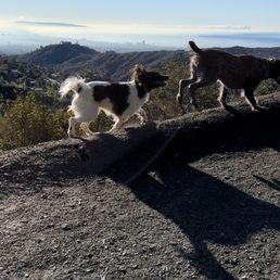

This is one of the only "off leash" optional trails. Most other trails want dogs on a leash. I take dogs on hikes for their owners while they're away and this is the best place. Not only is it breathtakingly gorgeous, it's a great trail with a gradual incline, nothing too crazy. It gets you out in Nature and that is the biggest benefit of all. The dogs get to be free and have fun and being witness to that is a thrill. I'm so grateful for all the trails but this one is the best for people with dogs!


A 6 mile gravel trail that has scenic views. Right now Spring is just starting to show with yellow and pink wildflowers already sprouting. We went a few days after the rain and there were small areas of mud and a rather strong water current flowing on a neighborhood roadside. The road up to parking is a bit rocky with large potholes


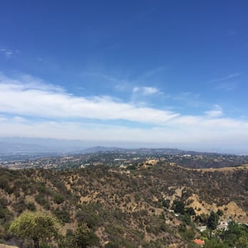
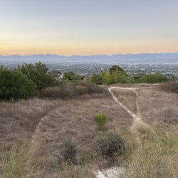
Do you like looking down on people? How about looking down on the entire San Fernando Valley? If so, this is your spot! Starting from neighboring San Vicente Mountain Park, Mulholland Drive turns into a dirt multi-use trail/access road with a sweeping view of the San Fernando Valley to the north, close enough to make out details but far enough away to not hear any traffic noise. Another sight to the north is the Encino Reservoir. And as you head west along Mulholland, you'll catch a glimpse of the ocean and Santa Monica to the south. Westridge has over 1,500 acres of open space, and there are a lot of branching trails with no signage posted. Best to bring your navigational aid of choice. The park also borders and connects to Mandeville Canyon Park and Sullivan Canyon Park. If you hike far enough south, you'll end up at Pacific Palisades close to the ocean. Northern access to Westridge is through San Vicente (https://www.yelp.com/biz/san-vicente-mountain-park-encino), so follow the instructions there for getting to the park (it can be a little tricky).
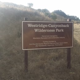

Came here for a morning hike and it was a nice change from my usual Griffith Park hike. A lot less people so it was a more relaxing and peaceful hike. Everyone that we ran into had dogs off leash and the pups were all friendly. Also, lots of mountain bikers riding the trails. The hike is not difficult at all. It goes up and down throughout the trail so you never get too tired. Lots of shade also during the morning time!
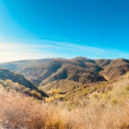

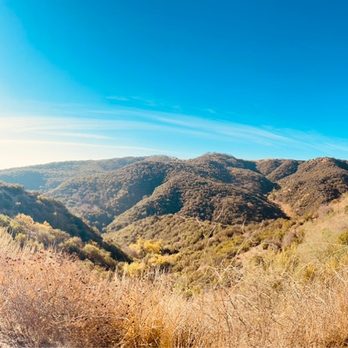
Excellent place to go for a hike with your dog and or other individuals. Easy trails and excellent views. Highly recommend.


BRIDGES, BASINS, AND PLANES!!! (Review 1 in a series of 2) BACKGROUND: Deep in the eastern Santa Monica Mountains in the City of Los Angeles, Westridge-Canyonback Park provides more than 1,500 acres of open space bordered by upper Mandeville Canyon, Sullivan Canyon, Mission Canyon, and San Vicente Mountain Park. The Sepulveda Dam area provides space for many activities, such as tennis, cricket, soccer, boating, fishing, biking and walking. There are three golf courses, a remote control aircraft area, a lake, a pond and a wilderness area. After the flood of 1938, residents asked for protection from the floodwaters. The Sepulveda dam and the 51 miles of engineered waterways is the result of that request. At a cost of more than 6.5 million dollars, the dam was completed in 1941. Its purpose is to hold back flood waters from heavy rains. Controlled release of the water will protect land downstream. In 1969, 1988, 1994 and 2005 the system was tested by heavy rainfall. STATS: Distance: 8ish miles total of 2 in the series Elevation gain: very minimal (our route) Watch for the Rattlers Tick checks following the hike Free Parking ESSENTIALS: At least 2 liters of water Comfy walking shoes Layered Clothing High protein food/snacks Electrolytes Camera Hat (optional) Sunblock OUR ROUTE: Me and The Crew started our Urbanish Adventure at Lake Balboa, which is in the Westridge-Canyonback Wilderness Park. From the parking area, we headed towards the Sepulveda Basin. The winding trail leads us along the drainage area, across a bridge, along river and finally to one of the biggest in the country remote control aircraft flying area. Although it was a bit on the windy side, several gents put on a short air show for us. There were ooooh's and ahhhhh's as the planes climbed dipped and dove. Quite a talent to pilot the airplanes. At one point one of them looked like a full sized passenger plane in the distance. Ever in the valley and itchin' to get out and stretch your legs, put on those sneaks, grab your ipod, a friend, or your favorite fur and head to this park. It is clean, safe and a great place to get the blood flowin'. Runners run, walkers walk, and canines on leashes with their caretakers roam these parts. #whattodoinSFV #runningtrail #walkingpath #parks #18


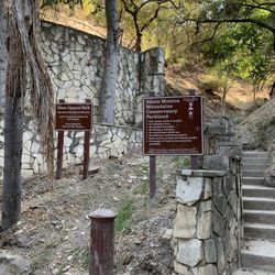
Hmm, as hikes go this isn't really a fave. This isn't a park for hikers/bikers but an off-leash park for dogs and their moneyed Encino Hills humans, and you can tell that by the horrid amount of dried poop and random plastic poop bags thrown everywhere. I get that we all need a place to hike regardless of what companion animals we might have but the mess here caused by dogs and their owners is pretty gross. Also, as someone who regularly hikes with a person who was bitten by a dog**, it's really annoys me that the MRCA (Mountains Recreation and Conservation Authority) is trying to make their long list of "rules for dog owners" at the park entrance give you the impression that this is anything other than an off-leash dog park. It's not in the slightest: you can let your dog roam freely here so long as he's under your immediate control, but MRCA's definition of "immediate control" is that you just have to be able to see your dog at all times and have a leash in your hand. (I have a feeling the park used be be on-leash, as the park's website lists on-leash as a "park feature" but there's a new line of text above the features saying that the park is off-leash with immediate control.) This means your dog can be fifty feet away chasing animals it shouldn't, crapping where it shouldn't, or perhaps most importantly putting itself in danger by running up to a coyote or rattlesnake, so long as you can see him. I've seen both more than once in this area, and believe me, you'll want more than "immediate control" if your dog runs into one of them. Regardless of whether or not Debbie Downers like me think it's stupid to have dogs off-leash in a park where you have a decent chance of seeing coyote and snakes, the park should be clearly marked as off-leash. There is too much gray area with "immediate control." (The West Mandeville Fire Trail that heads south out of San Vicente Mountain Park next door is actually a part of Westridge-Canyonback and NOT San Vicente, and that hiking area tends to have less dogs roaming around, probably because it takes a little more effort to get to there (with a fifteen-minute walk uphill on dirt Mulholland) than it does to the main entrance of Westridge. Head there if you have issues with off-leash areas.) Since this park is so close to the northern entrance of Topanga I usually go to Topanga to hike instead: dogs aren't allowed there, so worrying about whether or not an owner is ~in control~ or whatever isn't an issue, and the trails are much, much cleaner. There are some excellent views of downtown LA and the ocean from Westridge-Canyonback, but you can get that from San Vicente or Topanga as well. If there weren't so many other walking/hiking/nature viewing options right by this park I'd give it three stars, but since there are, this one gets a two. I totally feel the dog owners' complaints about fast bikers careening down the slopes though (another reason why the off-leash nature of this park is totally asking for trouble). Unfortunately they're hard to avoid completely, whether you're here, at San Vicente, Marvin Braude, or Topanga. Most of the cyclist dudebros are awesome as hell (and most have hot bods as well!) but the few who aren't, whoo boy. ** No, it wasn't a pitbull; no, it wasn't a poorly trained dog; and no, the dog wasn't out of the owner's "immediate control." But yes, this person ended up with horrible puncture wounds and as they had no healthcare at the time they had a hell of a time getting treatment. Yes, this issue is a pet peeve (pun!) of mine. :)
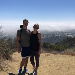

I hiked this trail a few months back with a friend from out of town, it was the perfect length! Not too long of a hike but not too short either, there were a few places to stop on the way up to take pictures and rest. The view is beautiful! This trail wasn't too crowded either, everyone we did see was very polite & kind! I love this area!


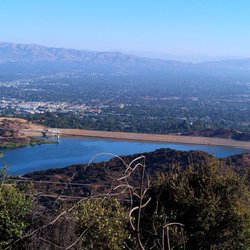
I had never heard of this trail loop until my Canis Nature dog 3 training class met here today! Coming up Mulholland be careful because I initially missed the dirt road and there's almost nowhere safe to turn around and I ended up on a ridiculous detour to get back to the dirt road. Once there though I drove up until I saw the parking area and I found a spot. Our group walked up for about 30 minutes and it's a nice wide trail, pretty dusty but really well maintaimed. Since it's the heat of summer there's nothing lush and green right now but I can only imagine how it looks when things are growing! Watch out for bicyclists, we noticed they were not even ringing bells and it's hard to hear them coming so one second you're la dee dah enjoying the walk and next second some bikes are going past and I don't think they realize we can't hear them coming. After about 30 min our group stopped and we took some nice photos of the dogs with the reservoir/dam (?) below before making our way back down. I really enjoyed this trail and would love to come back and walk further! Bring a hat, water, sunglasses, sunscreen, because there wasn't much shade. read more
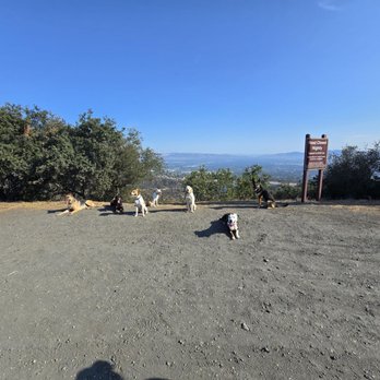
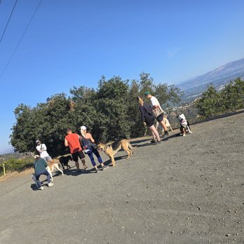


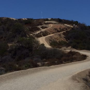
This trail is my happy place. I absolutely love the views of DTLA and the Ocean! While there are a couple inclines in the beginning, it feels a lot more like a nature walk. If you want a little bit of a challenge, there are some smaller paths that run parallel to the main one that have a lot more hills to climb. Path can be rocky at times, so I recommend good shoes for sure! At a somewhat leisurely pace, it takes me about an hour to go out and back from the entrance to the opposite side of the trail where it meets the neighborhood. Very dog friendly, all dogs are usually off leash. Be sure to bring water and take any trash out with you because there are no amenities whatsoever. After a rain, it's completely gorgeous. Lots of wildflowers! I have seen a snake or two here in the warmer months, so keep your eyes peeled. On the weekends it can get crowded, but I never have a hard time finding parking. Great for families too! read more


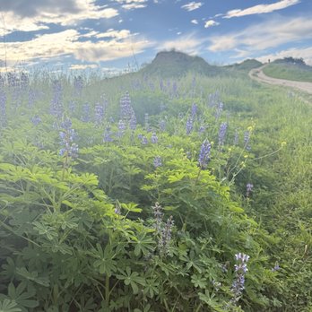


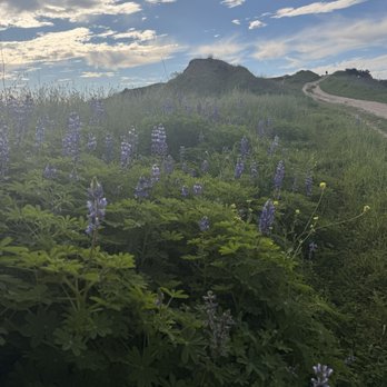


It's been so long since I was last at this trail. I usually start at the top off of mullholand from the valley and work my way. This was a first starting from the bottom area in the palisades. Theres a small lot at the base of the hike but majority of the parking is in the residential area. It's all street parking so be courteous as you are parking in-front of people's home and respect their properties. Entrance is about a mile or two from sunset off of Mandeville. Just continue all the way to the top where it ends and that's the start of the hike. There's also a little board area where it's also a lost and found spot. There was a set of cars keys, gloves and so on. Sunday morning which was quite busy. Everyone working off all the food they've consumed during thanksgiving long weekend. I honestly didn't know it was the same hike as it was a first time starting from this side. With the rain last week, the trail and the mountain area was so beautiful with all the new growth and greenery. Trail was dry which was nice. It was pretty busy obviously at the start but halfway through it did start to quiet up. Seemed like most people either turned back around or did it somewhat halfway. The whole trail if you stay on the main path is about 7 miles roundtrip. There's also the trail in the middle while is more up and down with the hill. Depending on which one you do, it's still quite nice. Main trails quite wide. You have runners, mountain bikers and people just leisurely taking their time as well as loads of dogs. Both trail have amazing views of the canyons but if you're doing the higher trail, you'll get both view of either sides as well as the city in the background. Just approaching a year now from the palisades fire. Im not quite sure if a lot of the canyons in this area was affected but there's loads of old charred trees remaining. But new growth has sprouted out from the base which looked very promising. It was quite nice to see loads of greenery along the trail. The much needed rain was a major help. Regardless of what side you start, it's still very beautiful to come out and enjoy nature. Pathway is wide so there's plenty of room for everyone. It an amazing trail with beautiful views. read more






Came to Westridge Cynback for the very first time on 4th of July. I have been helping a friend with conditioning himself and it was suggested by him that we check out a different place. He did mention this trail is easier than the ones he was conditioning on back at Griffith but I wanted to give him a chance to show me something new. From the get go, the start of the hiking trail is at an elevated height. You can see a good view of the San Fernando Valley and catch the sun rise early in the hike. The trail is about 1.5 miles long with the main trail being the easy route. There are several hills running parallel to the main trail for additional challenge. The hills were fairly easy but take your time if you are not used to inclines. Since it is the Summer the view isn't all pretty surrounded by greenery, but of dried up bushes and other plants. As you complete the trail it leaves you into a neighborhood. From there we did a 180 and started heading back to the car. For most of the trail we took the main trail until we noticed we missed the first hill. We decided to take that hill back to the car and it was the most challenging out of all the hills on the trail. There were a lot of loose rocks which made it difficult to keep a steady pace but it was completely doable with very little problems. The only thing I didn't like about the trail is the condition of the road. There were some uneven pavement. If you are driving at a moderate speed you may bottom out your car. So please take it easy when arriving. Parking: there are several spots near the start of the trail. I do see people parking parallel to the main road where available. 6:30am there wasn't many cars and parking was easy. 1hr later the parking area was full and parallel parking started to form. VERDICT: Rinse and repeat read more


3 years ago
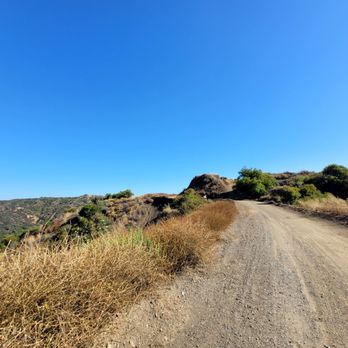
In A Nutshell: -The Westridge-Canyonback Trail is pretty secluded. -You will run into some people, but not a lot. -Mostly people hiking or mountain biking. -I like the firebreaks aka trails b/c they are very wide to give space. -There isn't a lot of shade, but the scenery of the open wilderness is serene. -You can see San Fernando Valley, the Topanga State Park & the rest of Santa Monica Mountains. -I love the fact you can bring your dog along. -The signs say make sure you dog is leashed, but since you rarely run into people you can let your dog off-leash as long as they obey your vocal commands. -There are plenty of trails to divert from which is great. -Cell phone signal was pretty strong, which is good just in case you need it. Overall, make sure you bring water for you & your dog(s). read more


3 years ago
Westridge Canyonback is one of the better local hikes that you can take that offers a good variety of surfaces and incline declines. It's split between Upper Canyonback and Lower Canyonback with the Mountaingate Community and golf club in between. You enter Upper Canyonback from Mulholland Drive, via the route up to the Nike Missile site. The northern entrance starts with a slight incline and then descends into the park with side trails offering some good variety. The southern entrance is at the end of Kenter Ave, on the Kenter Fire Road. The southern entrance is a steeper incline from the get go and keeps climbing until you get to the Mountaingate community. Depends on what you're looking for, both are good workouts. For offroad biking, you can do the entire trail easily with a good variety of surfaces. On foot, it is a longer haul and I would say starting from Lower Canyonback would be the better option as you get the immediate incline out of the way and on the way back it's a lot easier to handle the descend than an ascend. Both trails offer a nice variety of views and both are dog friendly, but be advise that there are snakes and bugs and I've even seen goats on the trail. Parking can be an issue on both sides so use your best judgement. read more

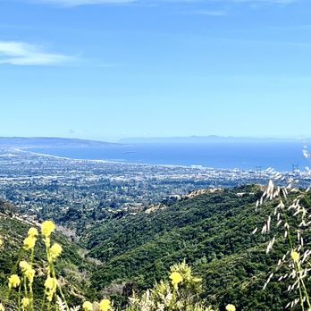


This is one of the only "off leash" optional trails. Most other trails want dogs on a leash. I take dogs on hikes for their owners while they're away and this is the best place. Not only is it breathtakingly gorgeous, it's a great trail with a gradual incline, nothing too crazy. It gets you out in Nature and that is the biggest benefit of all. The dogs get to be free and have fun and being witness to that is a thrill. I'm so grateful for all the trails but this one is the best for people with dogs! read more

3 years ago
A 6 mile gravel trail that has scenic views. Right now Spring is just starting to show with yellow and pink wildflowers already sprouting. We went a few days after the rain and there were small areas of mud and a rather strong water current flowing on a neighborhood roadside. The road up to parking is a bit rocky with large potholes read more

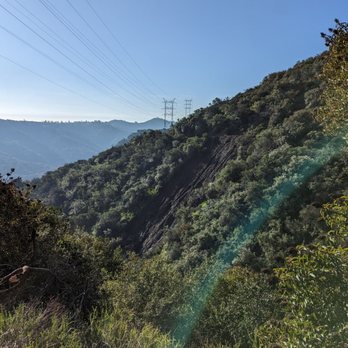
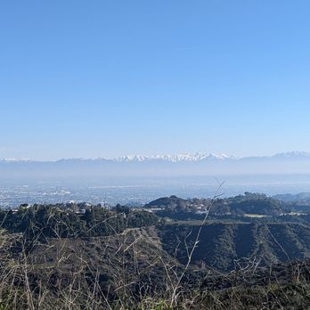

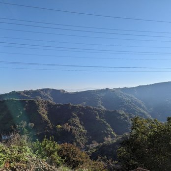


Do you like looking down on people? How about looking down on the entire San Fernando Valley? If so, this is your spot! Starting from neighboring San Vicente Mountain Park, Mulholland Drive turns into a dirt multi-use trail/access road with a sweeping view of the San Fernando Valley to the north, close enough to make out details but far enough away to not hear any traffic noise. Another sight to the north is the Encino Reservoir. And as you head west along Mulholland, you'll catch a glimpse of the ocean and Santa Monica to the south. Westridge has over 1,500 acres of open space, and there are a lot of branching trails with no signage posted. Best to bring your navigational aid of choice. The park also borders and connects to Mandeville Canyon Park and Sullivan Canyon Park. If you hike far enough south, you'll end up at Pacific Palisades close to the ocean. Northern access to Westridge is through San Vicente (https://www.yelp.com/biz/san-vicente-mountain-park-encino), so follow the instructions there for getting to the park (it can be a little tricky). read more


Came here for a morning hike and it was a nice change from my usual Griffith Park hike. A lot less people so it was a more relaxing and peaceful hike. Everyone that we ran into had dogs off leash and the pups were all friendly. Also, lots of mountain bikers riding the trails. The hike is not difficult at all. It goes up and down throughout the trail so you never get too tired. Lots of shade also during the morning time! read more


6 years ago
Excellent place to go for a hike with your dog and or other individuals. Easy trails and excellent views. Highly recommend. read more


7 years ago

7 years ago

12 years ago
BRIDGES, BASINS, AND PLANES!!! (Review 1 in a series of 2) BACKGROUND: Deep in the eastern Santa Monica Mountains in the City of Los Angeles, Westridge-Canyonback Park provides more than 1,500 acres of open space bordered by upper Mandeville Canyon, Sullivan Canyon, Mission Canyon, and San Vicente Mountain Park. The Sepulveda Dam area provides space for many activities, such as tennis, cricket, soccer, boating, fishing, biking and walking. There are three golf courses, a remote control aircraft area, a lake, a pond and a wilderness area. After the flood of 1938, residents asked for protection from the floodwaters. The Sepulveda dam and the 51 miles of engineered waterways is the result of that request. At a cost of more than 6.5 million dollars, the dam was completed in 1941. Its purpose is to hold back flood waters from heavy rains. Controlled release of the water will protect land downstream. In 1969, 1988, 1994 and 2005 the system was tested by heavy rainfall. STATS: Distance: 8ish miles total of 2 in the series Elevation gain: very minimal (our route) Watch for the Rattlers Tick checks following the hike Free Parking ESSENTIALS: At least 2 liters of water Comfy walking shoes Layered Clothing High protein food/snacks Electrolytes Camera Hat (optional) Sunblock OUR ROUTE: Me and The Crew started our Urbanish Adventure at Lake Balboa, which is in the Westridge-Canyonback Wilderness Park. From the parking area, we headed towards the Sepulveda Basin. The winding trail leads us along the drainage area, across a bridge, along river and finally to one of the biggest in the country remote control aircraft flying area. Although it was a bit on the windy side, several gents put on a short air show for us. There were ooooh's and ahhhhh's as the planes climbed dipped and dove. Quite a talent to pilot the airplanes. At one point one of them looked like a full sized passenger plane in the distance. Ever in the valley and itchin' to get out and stretch your legs, put on those sneaks, grab your ipod, a friend, or your favorite fur and head to this park. It is clean, safe and a great place to get the blood flowin'. Runners run, walkers walk, and canines on leashes with their caretakers roam these parts. #whattodoinSFV #runningtrail #walkingpath #parks #18 read more

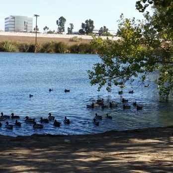


Hmm, as hikes go this isn't really a fave. This isn't a park for hikers/bikers but an off-leash park for dogs and their moneyed Encino Hills humans, and you can tell that by the horrid amount of dried poop and random plastic poop bags thrown everywhere. I get that we all need a place to hike regardless of what companion animals we might have but the mess here caused by dogs and their owners is pretty gross. Also, as someone who regularly hikes with a person who was bitten by a dog**, it's really annoys me that the MRCA (Mountains Recreation and Conservation Authority) is trying to make their long list of "rules for dog owners" at the park entrance give you the impression that this is anything other than an off-leash dog park. It's not in the slightest: you can let your dog roam freely here so long as he's under your immediate control, but MRCA's definition of "immediate control" is that you just have to be able to see your dog at all times and have a leash in your hand. (I have a feeling the park used be be on-leash, as the park's website lists on-leash as a "park feature" but there's a new line of text above the features saying that the park is off-leash with immediate control.) This means your dog can be fifty feet away chasing animals it shouldn't, crapping where it shouldn't, or perhaps most importantly putting itself in danger by running up to a coyote or rattlesnake, so long as you can see him. I've seen both more than once in this area, and believe me, you'll want more than "immediate control" if your dog runs into one of them. Regardless of whether or not Debbie Downers like me think it's stupid to have dogs off-leash in a park where you have a decent chance of seeing coyote and snakes, the park should be clearly marked as off-leash. There is too much gray area with "immediate control." (The West Mandeville Fire Trail that heads south out of San Vicente Mountain Park next door is actually a part of Westridge-Canyonback and NOT San Vicente, and that hiking area tends to have less dogs roaming around, probably because it takes a little more effort to get to there (with a fifteen-minute walk uphill on dirt Mulholland) than it does to the main entrance of Westridge. Head there if you have issues with off-leash areas.) Since this park is so close to the northern entrance of Topanga I usually go to Topanga to hike instead: dogs aren't allowed there, so worrying about whether or not an owner is ~in control~ or whatever isn't an issue, and the trails are much, much cleaner. There are some excellent views of downtown LA and the ocean from Westridge-Canyonback, but you can get that from San Vicente or Topanga as well. If there weren't so many other walking/hiking/nature viewing options right by this park I'd give it three stars, but since there are, this one gets a two. I totally feel the dog owners' complaints about fast bikers careening down the slopes though (another reason why the off-leash nature of this park is totally asking for trouble). Unfortunately they're hard to avoid completely, whether you're here, at San Vicente, Marvin Braude, or Topanga. Most of the cyclist dudebros are awesome as hell (and most have hot bods as well!) but the few who aren't, whoo boy. ** No, it wasn't a pitbull; no, it wasn't a poorly trained dog; and no, the dog wasn't out of the owner's "immediate control." But yes, this person ended up with horrible puncture wounds and as they had no healthcare at the time they had a hell of a time getting treatment. Yes, this issue is a pet peeve (pun!) of mine. :) read more


13 years ago


8 years ago
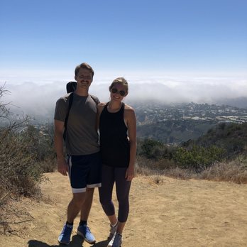
I hiked this trail a few months back with a friend from out of town, it was the perfect length! Not too long of a hike but not too short either, there were a few places to stop on the way up to take pictures and rest. The view is beautiful! This trail wasn't too crowded either, everyone we did see was very polite & kind! I love this area! read more

7 years ago
This was such a nice hike, great for the dogs, great views and not a tough journey! We parked before the entrance to walk up to the park which was not a bad walk because it might be rough on some cars! read more


6 years ago


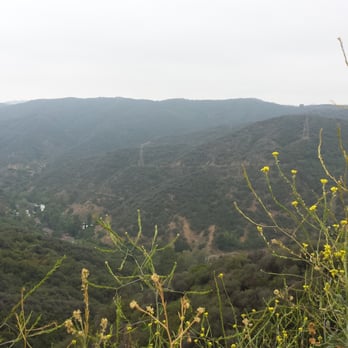
Westridge-Canyonback is one of my favorite spots to walk with my dogs. I am so grateful that they are allowed off their leashes! Our dogs are pretty well-behaved, so it's not an issue to keep them close by. I especially love coming here after a rainy period (not since last year), because flowers are in bloom and make for incredibly beautiful scenery. Even dry and crispy, the views are still gorgeous. I try and come here when the weather's a little cooler, or overcast, because both me and my dogs can last longer. read more



13 years ago

15 years ago

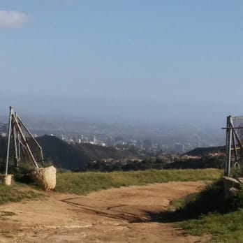
First of all, there are two parts to this hike and there are two places to park and hike along one road halfway between the Westside and the Valley. Canyonback Road, Los Angeles, is off of Mountain Gate Road off of Sepulveda - and here on this road are where there are two trail heads. Both trails offer little shade (so bring a sun hat and sunscreen!) and both are fire roads with tons of mountain bikers (all very tame and considerate). Bring your camera and lots of water (at least 2-3 bottles or a Camelbak). If you go down the Lower/East Canyonback Trail, you will travel about 4 miles RT, with at least two good butt burner hills along the way, on a fire road. The views of the Pacific Coast are exceptional, especially on a clear day. There is a small sofa/love seat along the way and some water towers, although nothing truly unique scenery-wise -but who cares? Views in the distance are lovely and the workout is a good one, especially if you decide to trail run it! And there are a couple of options of uphill, off-shoot trails (that end up connecting with the main trail) to choose to explore and up your calorie burn (if that's your reason for going). I felt safe hiking here alone and saw a lot of solo men/women out. I'd never suggest hitting a trail with earphones listening to music and unable to hear around you, this one included, but I don't see a threat here, other than no shade! (Regardless, always hike with a buddy whenever possible.) If you head out on the Upper/West Canyonback route, you end up hiking a far more exposed trail (also a fire road). I LOVE this route because it truly is exposed so that you never feel vulnerable hiking alone during most mornings/afternoons. Lots of folks with their dogs out, beautiful views of the valley (no ocean views, though) and lots of ways to add additional miles. So, for trail-runners or hikers out to get a fast, but good, hike/jaunt/exercise in, this is the spot to do it. Seriously beautiful here, just lacking shade. Trust me - it's worth it! Plus, you end up at Dirt Mulholland. You can continue the hike over to the Nike Missile Site or turn back. Either way, it's a workout with views - and one doable by most fitness levels. No worries here about having your car broken into given security patrolling. With that said, still use common sense - nothing valuable in sight in your car, follow all parking laws, take water (especially on a hot day - you will want to take a LOT) and your cell phone with you, and stay alert. Perfect place for hikers, trail runners and mountain bikers! read more



16 years ago
9 years ago
5 years ago

11 years ago
Did the 7.2 mile hike today with my family, including 4 teens/young adults. Great views of the valleys, water and the city. We were fortunate to go on a day that had a breeze. We parked on the Brentwood side (the trailhead on the Westridge Road Side). There's a lot for about 10 cars, but you can park in the adjacent neighborhood. About 3.5 miles to get to the halfway point at the Nike Missile Tower site. We hiked the first 1/2 of the entire hike on the mountain bike trails (all hills... Strenuous!). Took the flatter trail on the way back! People and doggies all friendly on the trail. I recommend to bring a full liter water bottle; then refill it once you reach the halfway point at the old Nike Missile Tower (water spicket, restrooms and benches there), good "resting area." Highly recommend this hike! read more





16 years ago

16 years ago
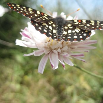
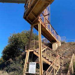
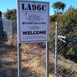
This hike was really enjoyable. The terrain was mild but I still felt sore the next day - in a good way. There were pretty flowers, nice hills, rocks, bugs, and a few big birds to see. It was a really quite hike, which was great to clear my mind. I probably saw less than ten people the whole day! The entrance of the place has an old missile launching site from the Cold War Era. Pretty neat...you can even climb up the structure. I walked south for about two hours and as I got high atop a hill I could see the beach, downtown, and everywhere in between (although hazy from that delicious smog). I will definitely go back to this spot again. I think it might have gone all the way to the beach, but I headed back before then. :0) Finding this place is a bit tricky. Take mulholland drive headed west from 405. After about 5, (10 minutes at the most) you'll see a dirt driveway on the left. It says something like "Mulholland scenic outlook" or something like that. You can park down at the bottom.. but i recommend driving up that driveway (i found out the hard way) instead of walking up... save that uphill trekking for the real trail. If you are driving down Mulholland and enter into nice residential housing, you've gone too far. Turn around, it's right before then. Happy hiking. read more




8 years ago

15 years ago


14 years ago
Page 1 of 2
More info about Westridge-Canyonback Wilderness Park
17500 Mulholland Dr
Encino, CA 91436
Brentwood
Directions
Hours
Indoor Amenities
Outdoor Amenities
Ask the Community - Westridge-Canyonback Wilderness Park
Does anyone have the exact address for the parking lot?
What is the best address to plug in for parking?
Put in the Nike missell site, that is at the top of the park.
Review Highlights - Westridge-Canyonback Wilderness Park
You might also consider












Why does Yelp recommend reviews?


Westridge-Canyonback Wilderness Park - hiking - Updated August 2026
Best of Encino
People found Westridge-Canyonback Wilderness Park by searching for…
Browse Nearby
BEST of Encino, California Coffee near Westridge-Canyonback Wilderness Park
BEST of Encino, California Restaurants near Westridge-Canyonback Wilderness Park
BEST of Encino, California Things to Do near Westridge-Canyonback Wilderness Park
BEST of Encino, California Parks near Westridge-Canyonback Wilderness Park
BEST of Encino, California Beaches near Westridge-Canyonback Wilderness Park
BEST of Encino, California Breakfast near Westridge-Canyonback Wilderness Park
BEST of Encino, California Motel near Westridge-Canyonback Wilderness Park
Browse Brands
Browse Articles
People who viewed Westridge-Canyonback Wilderness Park also viewed

Deervale-Stone Canyon Park
16 reviews
Sherman Oaks

Marvin Braude Mulholland Gateway Park
49 reviews
Tarzana

Dixie Canyon Park
47 reviews
Sherman Oaks

Stone Canyon Overlook
16 reviews
Beverly Crest

Sepulveda Dam Bike Path
11 reviews
Sepulveda Basin

Libbit Park
54 reviews
Encino

Nancy Hoover Pohl Overlook
31 reviews
Studio City

El Scorpion Canyon Park
14 reviews

Tuna Canyon Park
77 reviews

Charmlee Wilderness Park
57 reviews