1. Woodland Acres Campground

1. Woodland Acres Campground

0

Brownfield, ME

Cancel

Open app

Search

Woodland Acres Campground

3.8 (14 reviews)
Closed 8:00 am - 6:00 pm

Woodland Acres Campground Photos

You might also consider

More like Woodland Acres Campground

Recommended Reviews - Woodland Acres Campground

Your trust is our priority, so businesses can't pay to alter or remove their reviews. Learn more about reviews.
Yelp app icon
Browse more easily on the app
Review Feed Illustration

Reviews With Photos

Rene C.

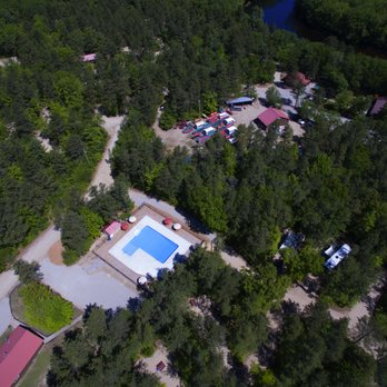
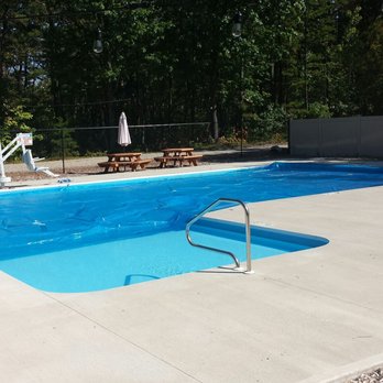
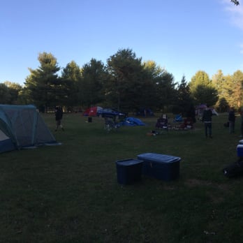
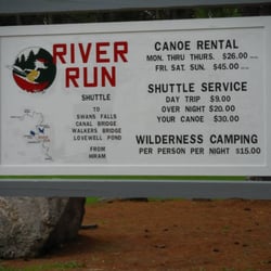
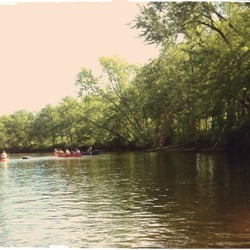
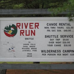
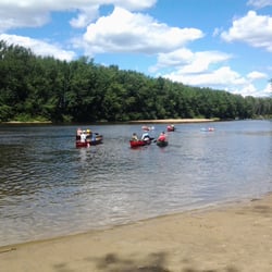
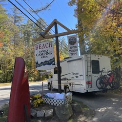
Decided to take one last weekend before the official end of summer and go camping at Woodland Acres Campground in Brownfield Maine. The weather was amazing and spectacular as the temperatures were in the 80s with not a drop of rain. Woodland Acres offers large campsites with beautiful views is the Saco River. One of the main features of this campground is the variety of canoe, kayak and floating trips down the river. They provide the boats and transportation up the river to the launching areas, so all you have to do is paddle, relax and let the current take you back to the campground where you make your way to the shore and disembark. The "crew" takes care of the rest. My party elected not to do the water ride this weekend, but plan on coming back next season to take the river ride. Unfortunately, there were some things that kept my rating low. The biggest issue was the cleanliness of the bathrooms, particularly the women's. The toilets had brown stains and it appeared that they were not cleaned daily. They also, along with your campsite fee, have extra fees like you pets and the use your personal canoe or kayak. These small fees just seem like a bit to much for me. There also didnt seem that there wasn't any swimming area. They had a sign warning campers that there wasn't a lifeguard on duty and to be aware of the posibility strong currents. Oh yeah, they also said that the beach across the river was off limits. Along with those there are a few more positives. The check out is 2pm which gives you, lots of extra time on your last day. They also have a heated pool which definitely is a plus.

View of the dock and raft on the Saco.

See all

3 months ago

Good campground, clean and fairly priced. Would definitely recommend to anyone that wants a nice getaway spot

Helpful 0
Thanks 0
Love this 0
Oh no 0

2 years ago

Helpful 0
Thanks 0
Love this 0
Oh no 1

2 years ago

Helpful 0
Thanks 0
Love this 0
Oh no 0

7 years ago

Helpful 0
Thanks 0
Love this 0
Oh no 1
Photo of Kevin S.
31
17
15

6 years ago

Helpful 0
Thanks 0
Love this 1
Oh no 0
Photo of Rene C.
311
483
1619

9 years ago

Helpful 3
Thanks 0
Love this 4
Oh no 0
Photo of John A.
12
47
0

9 years ago

Helpful 1
Thanks 0
Love this 0
Oh no 1

8 years ago

Helpful 1
Thanks 0
Love this 0
Oh no 0
Photo of Dee S.
0
58
35

8 years ago

Helpful 0
Thanks 0
Love this 0
Oh no 0
Photo of K P.
0
4
0

16 years ago

Helpful 3
Thanks 0
Love this 0
Oh no 0

12 years ago

Helpful 2
Thanks 0
Love this 0
Oh no 0

10 years ago

Helpful 0
Thanks 0
Love this 0
Oh no 0

9 years ago

Helpful 0
Thanks 0
Love this 0
Oh no 0
Photo of K R.
0
3
0

14 years ago

Helpful 0
Thanks 0
Love this 0
Oh no 0

Ask the Community - Woodland Acres Campground

Verify this business for free

People searched for Campgrounds 828 times last month within 15 miles of this business.

Verify this business

Burnt Meadow Mountain

Burnt Meadow Mountain

5.0(1 review)
2.6 mi

I feel the need to preface all of my nature reviews with this: being 90% forested and having around…read more3,500 miles of coastline, Maine has a tremendous amount of spaces, walkways, paths, and trails of all kinds and of all levels. There's something for everyone. What I'm reviewing is how a spot compares to similar outdoor spots in my personal opinion. Being in nature - and remembering to carry in, carry out - is always five stars! :) Parking? Yes. Loop trail? Yes. Well marked signs? NO*. Element of surprise? Yes. WOW (say it like Owen Wilson a dozen times, please). What an absolutely incredible trail! Burnt Meadow Trail/North Peak Trail, 1.25 miles and blue blaze, "leaves a parking area along ME Route 160 and ascend the shoulders and south facing ledges of the broad eastern spur of the North Peak weaving in and out of forests and ledges onto the summit after a short scramble up the uppermost ledges to the summit (elevation 1,575 ft)." Read: this has strenuous uphill hiking, rock scrambling, aggressive climbing, and absolutely breathtaking views. From here DO NOT DOUBLE BACK, instead carry on to... Twin Brook Trail, 2 miles and yellow blaze, "leaves from North Peak Trail, mostly following the main brook and ravine..." (the kiosk goes on and on to talk about the various peaks this travels through). Read: this barely has any blazes, so there's A LOT of guesswork about where you're going (which I was annoyed at in the moment because I didn't realize it was twice as long and sooooooooo very full of switchbacks, but retrospectively added to the charm of this overall experience). We had to cross streams, pass by a wall of giant boulders where a me-sized porcupine was eating, and goes windy, windy, windy through the forest until we were dumped back onto the Burnt Meadow Trail. DO NOT go up this trail and "down" North Peak because... that'd be just dangerous. The views here are some of the best in this part of Maine. Honestly, this might become an annual autumnal pilgrimage for me. Despite it being a complete workout, the summit is just such a rewarding treat. It should be noted that during the summer (at least the past two) there's an overwhelming amount of hornets right at the most difficult part of the climb, so you may want to come in spring or fall.

Photos
Burnt Meadow Mountain

See all

Peary Mountain

Peary Mountain

2.0(1 review)
3.0 mi

I feel the need to preface all of my nature reviews with this: being 90% forested and having around…read more3,500 miles of coastline, Maine has a tremendous amount of spaces, walkways, paths, and trails of all kinds and of all levels. There's something for everyone. What I'm reviewing is how a spot compares to similar outdoor spots in my personal opinion. Being in nature - and remembering to carry in, carry out - is always five stars! :) Parking? Yes. Loop trail? No. Well marked signs? No. Element of surprise? Kind of. Peary Mountain (929 to 958 feet [varying websites say varying things]) - named after Arctic explorer Admiral Robert E Peary - is a 3ish mile out and back trail that's maybe a bit moderate, especially towards the top as it gets a little steeper; the first part is on an ATV or snowmobile trail. I didn't visit in the summer specifically because I had seen across all sorts of hiking websites that the grass grows so tall here that a) it's nearly impossible to find the trail, and b) the ticks, mosquitos, and brown tail moths are overwhelming. I came in early autumn, and the trail was relatively easy to follow, though almost entirely unmarked. (If they're still there) look for the small cairns near the top to direct yourself to the summit. There's a stone bench at the top where you can look out; we were able to watch planes take off from the nearby airfield. A short spur allows you to see the Presidential and Whites from a distance. Overall, the views aren't as impressive as other nearby trails, but if you're short on time and want something just a little bit challenging... this might be for you! Finally, this is clearly a popular spot for the locals. As we made our way to the top, a family of about twenty adults and kids were coming down. We explored the summit alone for maybe five minutes before four sixty-somethings came up, took over the stone bench area, and had a party (literally: there was a speaker, drinks, smoking, and extremely ill-behaved dogs off leash that tried to attack us [and again, I mean that literally]). We left and passed maybe a dozen more folks bringing up chairs and coolers. I don't know if it's always like that on a Saturday mid-morning/early-afternoon (side note: it wasn't even a particularly nice day out), but it's not the vibe we're looking for when hiking. Again - maybe it's yours!

Photos
Peary Mountain
Peary Mountain
Peary Mountain

See all

Black Cap Trail

Black Cap Trail

5.0(6 reviews)
12.8 mi

The elevation gain is less than 600 feet, but if feels like a nice, steady workout. I'm not in…read morethe greatest shape and I thought it was pretty easy and quick. I was to the top in about 35-40 min. The trail is actually pleasant even without the views. At the top, the reward is huge, really nice views in an alpine area. Plenty of space to spread out up top, so you can space out. Lots of kids and dogs, but people that day were all respectful and pleasant. There is still cell phone coverage at the top (I use AT&T.)

Black Cap Trail is a relatively easy hike with a huge reward at the end. The views from the top…read moreare just spectacular. Take Hurricane Mountain Road off of Route 16 near the Intervale Scenic Vista. The Parking lot will be on the right near the summit of the road. Warning - this road is steep and winding! The trail is well marked and is approximately one mile in each direction. It is a slow, gradual climb with a lot of tree roots in the beginning that eventually give way to scattered rocks and then to all rock on the summit. If you are not an experienced hiker or do not have the proper gear (I fall into both of these categories) I would not attempt this when the ground is wet as it can be slippery on a good day. It's a good hike Spring through Fall, but hiking it in the Fall is by far my favorite. The view of the changing colors from the top is amazing.

Photos
Black Cap Trail - Trail down from Black Cap

Trail down from Black Cap

Black Cap Trail - It starts out fairly flat....

It starts out fairly flat....

Black Cap Trail

See all

Mt Cutler

Mt Cutler

4.3(3 reviews)
6.1 mi

I feel the need to preface all of my nature reviews with this: being 90% forested and having around…read more3500 miles of coastline, Maine has a tremendous amount of spaces, walkways, paths, and trails of all kinds and of all levels. There's something for everyone. What I'm reviewing is how a spot compares to similar outdoor spots in my personal opinion. Being in nature - and remembering to carry in, carry out - is always five stars! :) Parking? Yes. Loop trail? Kind of. Well marked signs? Kind of. Element of surprise? Yes. Mt Cutler feels like a work in progress. What I read about it online didn't entirely match what we found in real life; and those changes felt recent. Like the town of Hiram realized what a popular place this has become and they're trying to improve it to make it more accessible. That being said, here's what I would do if I were you: from the parking lot on Hiram Hill Rd (please DO NOT park on the road, there's plenty of space in the lot and if there's not... then have a Plan B) enter the woods near the Information Kiosk. Take the blue blazes (North Trail) to white blazes (White Flag Trail) to the yellow blazes (Boulder Trail). This will bring you to the Front Ledges on Mt Cutler, an overlook of a glacial moraine. Parts of this are a steeper climb, but the view is spectacular and an amazing spot to have lunch at. I would then doubleback and go home. AVOID THE RED TRAIL. Apparently this was the original trail and parts of it are basically just rock climbing while other parts are completely eroded (even the information kiosk reminds hikers of this hazard). You can also skip diverging left to the white and yellow blazes, and just keep following the blue trail for a while. It's a pretty steep climb and the views are almost as satisfying as Front Ledge (though there's more tree coverage and less space to enjoy yourself)... so it's A LOT more work for substantially less reward. I'm glad I did this; sitting on the Front Ledges looking at the foliage was special, but I'm not sure this is a trail I would need to repeat.

Great views, good hiking trails and not crowded. A hidden gem. Easy access and plenty of parking…read more Plus you may see a deer.

Photos
Mt Cutler
Mt Cutler
Mt Cutler

See all

Jockey Cap Trail - A random tree has grown out of the rocks!

Jockey Cap Trail

4.5(2 reviews)
5.9 mi

To me, a perfect trail is one that: not a lot of people know about, is hidden in plain sight, has…read moresome challenging parts (it's good to feel the heart pumping! ... but my legs don't need to quiver in fatigue with every step; does that make sense?), and offers an impressive reward by way of view at the top. Jockey Cap Trail is all of that. A former ski hill in the 30's (it boasts of having had the first rope tow in Maine), Jockey Cap is now a trail system (unfortunately, many of the off-branches of the two main routes up lead to dead-ends). Tucked right behind a country store off Route 302 in Fryeburg, you'll find a dirt trail that first leads into the woods to Molly Locket's cave. Here's your Robert Frost moment: from here, the trail splits to the left and right. The former offers a gradual climb, the latter is much more steep. Regardless of which you choose, both are only about a quarter mile long. At the top are breathtaking views of forest, lakes, valleys, and mountain ranges. There's also a bronze silhouette allowing climbers to line up which mountain is which. It's a short climb, but if you're in the area, it's worth it - especially in spring and autumn when the colors are on opposite ends of the spectrum of impressive and the tourists are at a minimum. I would say it's kid-friendly if your kids are active and love the outdoors; as a side note, while brief in length, I would still say this leads more towards "hike" then "nature walk".

Fun short hike with nice views at the top. Not enough parking. Trail not well marked but you can…read morefigure it out. Use all trails.

Photos
Jockey Cap Trail - The cave at Jockey Cap Trail!

The cave at Jockey Cap Trail!

Jockey Cap Trail
Jockey Cap Trail - From the top of Jockey Cap Trail.

See all

From the top of Jockey Cap Trail.

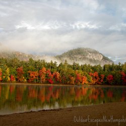
Outdoor Escapes New Hampshire - Autumn colors in NH on a custom photo tour.

Outdoor Escapes New Hampshire

3.7(3 reviews)
14.2 mi

I do not recommend any "Moose Tours" with Lucie. We drove 3 hours to meet her and she was an hour…read morelate to the meeting point(no cell service to contact her), completely unprepared for us as she "pulled the wrong file" "what did I tell you we were doing" We basically drove up and down route 26 for 6 hours looking for moose on the side of the highway. She stopped to asked the locals where to find moose and spoke endlessly about the types of trees in NH. No moose were spotted at all even after a desperate mosquito infested walk through the woods (yes, we had bug spray but it didn't make a difference). We were told "plan B" was to drive up and down the same highway at midnight to see if the moose were out. This was a surprise for my husbands birthday, It was a surprise for both of us! This was a complete waste of time and money.

What a great experience we had and most of all a beautiful day with a great guide! I booked a one…read moreday trip kayaking for Lisa and I and it couldn't have went any better. Lucy met us in the morning and we went straight to the river. It was such a gorgeous and enjoyable ride and she was so pleasant and relaxed the whole way through. She gave us some simple tips on kayaking and also some nice information on some of the wildlife and history of the area. When we reached Lake Ossipee the wind was very strong which made the lake very choppy and her lead was so assuring in the challenge that lay ahead of us - she was awesome and we made it to the other side of the lake without any issues whatsoever. I would highly recommend Lucy if you want to experience a great day outdoors in the White Mountains

Photos
Outdoor Escapes New Hampshire - Custom hikes for all abilities...learn about local history and nature.

Custom hikes for all abilities...learn about local history and nature.

Outdoor Escapes New Hampshire - Family hiking tour.

Family hiking tour.

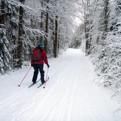
Outdoor Escapes New Hampshire - Private cross-country ski lessons/tours on groomed and backcountry trails.

See all

Private cross-country ski lessons/tours on groomed and backcountry trails.

Douglas Mountain

Douglas Mountain

3.7(3 reviews)
10.8 mi

I feel the need to preface all of my nature reviews with this: being 90% forested and having around…read more3500 miles of coastline, Maine has a tremendous amount of spaces, walkways, paths, and trails of all kinds and of all levels. There's something for everyone. What I'm reviewing is how a spot compares to similar outdoor spots in my personal opinion. Being in nature - and remembering to carry in, carry out - is always five stars! :) Parking? Yes. Loop trail? Kind of. Well marked signs? Kind of. Element of surprise? No. When I think about hikes in Maine I need to do again, want to do again, would suggest others do... Douglas Mountain is unfortunately not one of them. For a few reasons: 1. There's no real view at the summit; there's a large stone observation tower that's pretty cool that you can climb up to see maybe a 160° view of the Maine Lakes Region (mountains, bodies of water, etc.). However, unless you're at the top of the tower (which always has a large number of wasps, by the way), you can't see anything at all because of the tree coverage. 2. If you take Eagle Scout (orange) from the parking lot, the first part is a really lovely walk in the woods. It then becomes a much more strenuous uphill hike. You need to stick on this trail to reach the top of the mountain, but it becomes confusing near Nature Loop Trail --- there's a misleading path, that's not part of the trail system, that it seems people have made overtime in search of a shortcut. We watched about ten people follow each other into the woods on one of these, then doubleback when they realized they weren't on Eagle Scout anymore. After you get to the top you can go down Woods or Ledges trail... but they both end on a dead end road with private homes. It's underwhelming. 3. We didn't see anyone pay the $3 suggested donation (to help maintain the trails). So that's a bummer; on the flipside, people were very respectful and patient about taking turns going up the stone tower so there wasn't overcrowding there. 4. If I wanted something similar, honestly I think Bradbury or Mt. Agamenticus are much better choices. Here's what I can say about Douglas Mountain: have you ever seen a man take his chickens hiking before? Because I have.

it's a pretty view but not the best i've ever seen. you can see mount washington from the top of…read morethe stone tower. the stone tower had a lot of wasps/hornets. it said the hike was a mile up and a mile down but my apple watch said the total (up AND down) was only 0.8 miles. nice hike though.

Photos
Douglas Mountain
Douglas Mountain
Douglas Mountain

See all

Woodland Acres Campground - campgrounds - Updated July 2026

Loading...
Loading...
Loading...