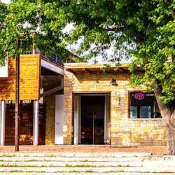
1. Honey Creek State Natural Area

1. Honey Creek State Natural Area

0

Spring Branch, TX

Cancel

Open app

Search

Honey Creek State Natural Area

4.5 (2 reviews)

Honey Creek State Natural Area Photos

You might also consider

More like Honey Creek State Natural Area

Recommended Reviews - Honey Creek State Natural Area

Your trust is our priority, so businesses can't pay to alter or remove their reviews. Learn more about reviews.
Yelp app icon
Browse more easily on the app
Review Feed Illustration
Photo of Brent L.
451
1520
5905

8 years ago

Helpful 10
Thanks 0
Love this 7
Oh no 0
Photo of Jake H.
303
1062
4041

6 years ago

Helpful 4
Thanks 0
Love this 0
Oh no 0

You might also consider
Verify this business for free

People searched for Parks 466 times last month within 15 miles of this business.

Verify this business

Guadalupe River State Park

Guadalupe River State Park

4.2
(125 reviews)
1.2 mi

We arrived early this morning for our first hike of the year. The rangers were very efficient; our…read morereservation was checked and our permit was brought out. We drove out to the water and decided to walk those trails. The trails are all very easy to navigate. The more challenging trails may not have actually been trails at all, but got us down to the river bank for some lovely photos. The grounds and trails are very clean and well maintained. The camp sites look really nice and the bathrooms (I'm told) were Buccees level clean. There's a Discovery center that seemed to be interesting for the littles. I really enjoyed the solitude and the zen. I suspect it probably gets pretty packed though.

Lovely park! Make sure to prepay entrance fee online and discount was offered with military park…read morepass. We parked near the end of the road where you'll find a parking lot with bathrooms and changing facilities. We met our hiking group and trekked off walking along the Guadalupe River. Make sure to bring water shoes with grip cuz you'll cross the river to get to more hiking trails. The water was cool and the flow perfect...depending on the time of the year, it can get quite powerful. The weather was gorgeous - fall vibes of overcast and cooler temps. We hiked a mix of many shaded forest areas and open fields . Captured many pics of the fall changes - leaves turning shades of yellow and orange. And I gotta kick seeing live armadillos scurrying amongst the long grasses. So cute!!! With the great weather and scenery, we hiked a steady pace and clocked in approximately 8.5 miles ! Loved hiking through the river : ) Clean bathrooms and changing rooms were a plus!

Photos
Dog friendly paths
Dog friendly paths
Guadalupe River State Park
Trails

See all

Trails
Nichols Landing

Nichols Landing

4.7
(3 reviews)
3.7 mi

If you like to kayak and are near the Canyon Lake, Spring Branch, or Bandera areas, you're going to…read morewant to know about Nichol's Landing (also called Specht's Crossing) on the beautiful upper Guadalupe River before it flows into Canyon Lake. From this spot, you can end your short paddle trip from Guadalupe State Park, or start a longer 3-6 hour trip down to FM 311 or Rebecca Creek Crossing. This small day-use park under an overpass off Old Spring Branch Road has just 20 parking spaces, so depending on when you go, you may need to arrange a drop-off or pickup via friend or river outfitter that doesn't leave a vehicle. There is a dumpster for trash and a couple of porto-johns if you really need to answer nature's call. The signage at the entrance is a bit confusing on when and how you need to pay a fee, the proceeds of which are used to maintain the park. The clear facts are that it's free when there is no attendant on duty. Otherwise (generally weekends & holidays from Memorial Day to Labor Day, basically summer months from end of May through early September), you pay a fee upon entry based as follows: If parking... $4 per person over age 12 $2 per person age 12 and under If not parking... $1 per person drop-off (any age) Open 9am to sunset, year-round (gates locked at 8:30pm) If you are putting in or taking out, there is a cul de sac where you can park briefly to deal with loading and unloading your 'yaks. The water is less than 50 yards down a couple of pebbly paths. On our recent sunny January Sunday visit, there were very few other vessels on the river and less than 10 people in the park. So peaceful. The Water Oriented Recreation District (WORD) of Comal County manages the park and their website is a great source of information on current river conditions, river laws, and any special events that could impact your day on the river. The Texas Parks & Wildlife "Texas Paddling Trail" page also has great info about Nichol's Landing and what you'll see on the river. For the upper part of the Guadalupe and the lower outside of New Braunfels city limits, the rules (enforced with fines up to $500) are: Wear a life vest or other PFD Don't trespass on private property Pets on leash at all times No firearms No fireworks No campfires No camping No glass No styrofoam No plastic containers under 5oz No littering No jumping from bridges, dams, trees, or cliffs

What a nice, clean place to go swimming! This place is…read morelocated near the bottom of a bridge that crosses the Guadalupe River. This spot charges for access to the river, I paid $4 to get in. They seem to have various other charges that can apply if you're just launching a kayak or a tube. The river was clean here! There wasn't trash floating around, and the place was picked up. The water wasn't very deep here, the deepest spots being chest deep, but most of it was about knee deep. Someone has come through here and made lots of little wading pools out of rocks and set up stone dams so your tube doesn't go floating away very easily. There's also lots of shade through here, with many large cypress trees lining the far side of the river. On the near side, there aren't many trees, so many people brought their own canopies. Since there's a charge to get in, this place wasn't so crowded, so it was easy to get a patch of river to myself. There are trash cans provided, and they also give away mesh onion bags for your garbage. There are no restrooms, or changing rooms. Parking was easy, along a paved road and spaces painted in white. The end of the parking lot doubles as a helicopter landing pad for added safety.

Photos
Nichols Landing
Even more park rules. If you park, get out by 8:30p or your vehicle may be locked inside.
What its like when it floods.

See all

What its like when it floods.
Bullis County Park

Bullis County Park

4.3
(12 reviews)
10.1 mi

Carved out a quiet hour at Bullis County Park (my favorite park at the moment) with a great book…read moreand delicious latte in hand - the kind of simple moment that feels like pur happiness.

If I had gone on a day when the temperature was in the double digits in Fahrenheit, I might have…read moregiven this park at least 4 stars, but when I visited on Father's Day, there wasn't really much to do. Scorching hot temperatures scared everyone away because none of the kids would want to play on the playground there, though I did see one family just sitting there, possibly resting during a long road trip. Otherwise, it was literally a ghost town minus the tumbleweeds. I stopped by this park to just get away from city life. Well actually, I wanted to visit the nearby Nekter Juice Bar because they a Father's Day promo going on that would only work for that day and that day only. I had already visited the other Nekter location in the Greater San Antonio area, but wanted to pay a visit to this location aloof from the urban life. Bullis County Park and Nekter are just across from one another, opposite Borgfield Dr. After leaving Nekter with smoothie in hand, I drove up Old Blanco and parked in the parking lot right in front of the playground. As I mentioned, nobody was playing in the playground. I did see a pavilion, which allowed me to rest in the shade and take more photos of the park while sipping on my smoothie. The park wasn't the greatest, I can say. Let's just say the grass is greener on the other side lol. I was, however, fascinated by some rock and log formation near the pavilion. There are a handful of picnic tables in the pavilion that you could throw a party at. However, you'll need to reserve the space beforehand; call in advance to do so! On the south side of the park, there is a softball field, which surprise surprise, nobody was there during my visit. However, I was fascinated by the number of dandelions I saw in the outfield. Nice to see, but I'm sure outfielders will be trampling over them while trying to catch a fly ball. To the west, there is nothing but trees. The grounds immediately around the pavilion have seen better days. Grass isn't very abundant here. It almost looked like the cows have eaten most of the grass here! Not that I'm comparing this park to Brackenridge Park, which I had visited the weekend before, but it was kind of a boring visit overall to Bullis County Park. Then again, if school were in session, I'm sure it would have been loads better with kids enjoying the playground and possibly frolicking through the flowers. I say this because it's real close to Timberwood Park Elementary School, and it would make for a nice place to unwind and relax after school, if the weather were nicer, that is. 3 stars for now. I still recommend stopping by if you want to stretch your legs, but don't expect anything memorable here. The only thing memorable about my visit to this park was sipping on my cold smoothie, which allowed me to stay at the park for a while without burning in the hot sun.

Photos
Playground
Playground
Bullis Park
Bullis Park
Park hours

See all

Park hours
Canyon Park

Canyon Park

2.9
(23 reviews)
17.1 mi

Now that it's almost Summer 2022 - yay! - and there are lots of changes this season in WORD-leased…read moreparks, it's time for an update to my review from last year. Please check out that comprehensive narrative if you want to learn about what "WORD" is and why the rules and fees here are different from other parts of Canyon Lake, which is managed by the U.S. Army Corps of Engineers. Before you head to this park on the North side of Canyon Lake near Brookshire Brothers off 306, be sure to check social media (the "book of face") to see what WORD's latest updates are. That is where they will post any notices about the park being full, maintenance closures, or changes in policy. Make sure you sort Posts by Most Recent. https://www.facebook.com/Canyon-Park-on-Canyon-Lake-112315650954797 The biggest change for 2022 (April 1 - September 30 operating days) is a pricing increase for anyone without a vehicle registered in Comal County. If you are visiting from out of town, you will now pay $20 per carload. Locals driving their Comal County-registered vehicle (per the windshield sticker as proof) get in for $5 per carload. Gates will close when the park reaches capacity and no one is admitted after the gatehouse closes for the day at 6p. Gatehouse Hours (for Swim Beaches): Mon - Fri: 10a - 6p Sat, Sun, & Holidays: 8a - 6p Swim Beach Hours: Mon - Fri: 10a - 7:30p Sat, Sun, & Holidays: 8a - 7:30p Another major change this year is that the Madrone Trail parking area (for the free hiking, mountain biking, and trail running trail system) is closed every weekend from Memorial Day to Labor Day. This means you cannot access this trail system without paying to enter the park on the weekends, and you will be subject to park closure at capacity. For 2022, the boat ramp and day-use picnic sites at the tip of the peninsula (Park Areas 2, 3, & 4) have the same locals $5/non-locals $20 pricing structure, but you can get in as early as 8a (and should because these fill up fast each day in the summer). You must exit these areas by 7:30p, so plan accordingly to get your boat out in time at the end of the day or be banned. The WORD gatehouse staff do not mess around. More details available at https://wordcc.com/canyon-park/

The older male attendant with the beard refused to refund my $20 after our GPS took us to the wrong…read moreentrance and we had to make a U-turn before even getting to enjoy the lake. He told me, "No refunds, I'm sorry," and I replied, "You're not sorry." It was incredibly frustrating to lose $20 without seeing any part of the lake. I wish the staff had more discretion and common sense to handle situations like this, especially when the issue was caused by incorrect directions rather than us using the facilities. Couldn't even hold eye contact with me.

Photos
Lake is low but usable
Canyon Park
Wild life

See all

Wild life
Old Hancock Trail

Old Hancock Trail

3.5
(4 reviews)
16.1 mi

This review is targeting active adults who love the outdoors and like to run, hike, or cycle…read more(mountain bike) on trails with a variety of terrain: grassland, limestone rock gardens, oak groves, and lake shoreline. If that doesn't float your boat, or you are looking for a spot to have a family swim & picnic with the kids, knock the stars down to 2 and find another pretty park to explore during your visit to North Canyon Lake. Old Hancock Equestrian Trail is a free, public, day-use-only park on land managed by the U.S. Army Corps of Engineers, like all the other land in the flood plain surrounding Canyon Lake. It is designated specifically for horseback riding, so everyone else must yield to those riders. If you get there before 9a on a weekday, chances are, you'll have the whole place to yourself for a 7-mile round-trip (out and back) trip from the trailhead around the north shore of the lake to Canyon Park Road (near Brookshire Brothers and Canyon Beach). The horses are more commonly seen on the weekends but may be there at any time, along with their owners' trucks and trailers in the dirt parking area. Just off the parking area, there are a few spurs that take you through the bushes to the lakeshore. This area is often used by anglers and kayakers to access the lake during good conditions for their sport, but its main purpose is for horses and their riders to take a dip after their ride. Toward the northeast from the parking area is the main trailhead, next to the informational kiosk. Take the path in the grass that heads north/northeast and follows the shore of the lake. About half the time, you'll have a water view; other times, it will be tall grasses, trees, or cow pastures. Depending on the time of day and time of year, you'll see a variety of birds, insects, deer, cattle, and maybe a big spiny lizard, a snapping turtle, or a harmless rat snake if you're lucky. In the spring, wildflowers and butterflies are abundant, but so can be the mud. In summer, it is hotter than Hades but the lake breeze is nice with the blue water and blue skies. In the fall, a few of the trees take on a magnificent red, orange, and yellow color scheme. In winter, everything is dried out and gray. I just love watching the seasons change here. At different points along the trail, you'll find rest benches, trail markers, and spurs down to the water, where you are welcome to go for a swim (at least at the time of this writing in June 2022). It's one of the last places around Canyon Lake where you can do that without paying a fee, but you've got to want it bad enough to hike there & back, and you can only bring what you can carry on your back. The trail (more like a dual-track dirt road) is mostly flat and open with sand, grass, or caliche surfaces, but there are a few challenging sections with short inclines, yards of bumpy rocks, and a couple of wet weather creek crossings. After a rain, there's also the possibility that some local dude from the adjacent neighborhood will have gone "night muddin'" out there in a 4x4 and made the ruts deep in some areas, but this has lately not been such a problem since the Comal County Sherriff has started warning about the potential $5,000 fine for using a motorized vehicle on the trail. A few words of warning: - This park property is between private land (residences, ranches, and businesses) and the lake. Be sure to stay on the trail and don't trespass over fences or beyond posted "private property" areas. - Shade is limited and the sun can be intense at least 10 months of the year, so wear a hat and sunscreen, make sure you're hydrated, go with a buddy, and try to time your trip for hours close to sun up or sundown. It would not be easy for an emergency vehicle to reach you out there if heatstroke happened. - No restrooms, water fountains, or trash bins are available to users of this trail. Pack in and pack out everything. Leave no trace. Litterbugs, shoo, stay away!

The Old Hancock Trail is primarily a trail for horses, but it also makes a good hiking trail. If it…read moreis warm outside, beware because there is lots of sunshine on this trail and little shade. Investing in some SPF 40 might be a good idea. It is mostly a dirt trail that skirts the northern side of the lake and stretches for about 3 1/2 miles to end at Canyon Park. To find the trailhead, just find your way to FM 306 (I took FM 12 out of San Marcos and it was a scenic drive). Once you pass FM 3424 on the north side of the lake, continue for about 1.9 miles on FM 306 until you see a street sign for Hancock Road. This road passes by a small airport and then dead ends at the trailhead where there is tons of free parking. Take a picnic with you and maybe a swimsuit, because there are several places along the trail that would be a good stop for a swim and a bite to eat. I mostly felt like I was hiking on someone's ranch road that happened to be next to a nice lake. I saw several deer and birds along the way, and there were a few people on horseback also. I'm sure this trail would be full of wildflowers and butterflies in the Spring. Anyway, I hope this encourages you to check it out when you have a free day to play in the sun. I'm not sure how Yelp ended up with this in Lubbock, but don't worry, I am working with them to fix this error. Yes, it is on Canyon Lake. Google Maps must hate Canyon Lake for some reason. :-)

Photos
Kayaking from the south spur at Old Hancock Trail
A view from the trail at the halfway point
A view from the trail on a summer dusk hike, July 2022

See all

A view from the trail on a summer dusk hike, July 2022

Honey Creek State Natural Area - parks - Updated July 2026

Loading...
Loading...
Loading...