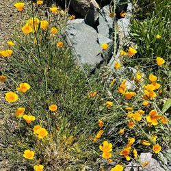
LMR Rutherford Gardens Photos


You might also consider
More like LMR Rutherford Gardens
Recommended Reviews - LMR Rutherford Gardens
Start your review...

8 years ago


17 years ago
10 years ago
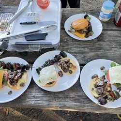
great quality food reccomended!!! make reservation b4. very nice. rib were great !! seafood salad was super!!!!!!!!!!!!!!!!! definitery go back again. love it!! read more
More info about LMR Rutherford Gardens
1796 St Helena Hwy S
St. Helena, CA 94574
Directions
Hours
Payment methods
Outdoor Amenities
You might also consider

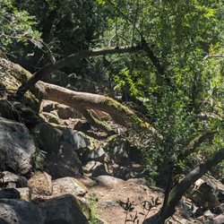


LMR Rutherford Gardens - hiking - Updated June 2026
Best of St. Helena
People found LMR Rutherford Gardens by searching for…
Market in St. Helena, California
Public Markets in St. Helena, California
Things to Do in St. Helena, California
Liquor Store in St. Helena, California
Gift Shops in St. Helena, California
Farm in St. Helena, California
Seafood Markets in St. Helena, California
Cheap Eats in St. Helena, California
Walking Trails in St. Helena, California
Farm Tours in St. Helena, California
Hiking Trails in St. Helena, California
Farm Fresh Eggs in St. Helena, California
Tours in St. Helena, California
Specialty Food in St. Helena, California
Farm Stand in St. Helena, California
Organic Restaurant in St. Helena, California
Grass Fed Beef in St. Helena, California
Running Trails in St. Helena, California
Fruit Stands in St. Helena, California
Fruit Salad in St. Helena, California
Strawberry Farm in St. Helena, California
Fresh Fruit in St. Helena, California
Trending Searches in St. Helena, CA
24 Hour Liquor Store near LMR Rutherford Gardens
Beer Distributor near LMR Rutherford Gardens
Beverage Store near LMR Rutherford Gardens
Biggest Liquor Store near LMR Rutherford Gardens
Black Owned Restaurants near LMR Rutherford Gardens
Boiled Peanuts near LMR Rutherford Gardens
Bourbon Store near LMR Rutherford Gardens
Buy Live Crab near LMR Rutherford Gardens
Ceviche near LMR Rutherford Gardens
Cliff Jumping near LMR Rutherford Gardens
Corn near LMR Rutherford Gardens
Country Store near LMR Rutherford Gardens
Creeks near LMR Rutherford Gardens
Farm Stand near LMR Rutherford Gardens
Fresh Produce near LMR Rutherford Gardens
Fresh Seafood Market near LMR Rutherford Gardens
Fruit And Vegetable Market near LMR Rutherford Gardens
Fruit Stand near LMR Rutherford Gardens
Gelato near LMR Rutherford Gardens
Grocery Delivery near LMR Rutherford Gardens
Kegs near LMR Rutherford Gardens
Lakes & Ponds near LMR Rutherford Gardens
Lavender Fields near LMR Rutherford Gardens
Liquor Stores Open Late near LMR Rutherford Gardens
Lottery Tickets near LMR Rutherford Gardens
Non Alcoholic Beer near LMR Rutherford Gardens
Off Road Trails near LMR Rutherford Gardens
Orchard near LMR Rutherford Gardens
Outdoor Activities near LMR Rutherford Gardens
Pineapple Dole Whip near LMR Rutherford Gardens
Places To Walk Around near LMR Rutherford Gardens
Public Shower near LMR Rutherford Gardens
Rock Quarry near LMR Rutherford Gardens
Rocky Mountain Oysters near LMR Rutherford Gardens
Scenic Drive near LMR Rutherford Gardens
Scenic Night View near LMR Rutherford Gardens
Secluded Spots near LMR Rutherford Gardens
Shaved Ice near LMR Rutherford Gardens
Snow Cones near LMR Rutherford Gardens
Soccer Bars near LMR Rutherford Gardens
Soju near LMR Rutherford Gardens
Strawberry Picking near LMR Rutherford Gardens
Sunrise View near LMR Rutherford Gardens
Swimming Holes near LMR Rutherford Gardens
U Pick Farms near LMR Rutherford Gardens
Watch Sunset near LMR Rutherford Gardens
Waterfalls near LMR Rutherford Gardens
Browse Nearby
BEST of St. Helena, California Coffee near LMR Rutherford Gardens
BEST of St. Helena, California Restaurants near LMR Rutherford Gardens
BEST of St. Helena, California Things to Do near LMR Rutherford Gardens
BEST of St. Helena, California Walking Trails near LMR Rutherford Gardens
BEST of St. Helena, California Breakfast near LMR Rutherford Gardens
BEST of St. Helena, California Parks near LMR Rutherford Gardens
BEST of St. Helena, California Taxis near LMR Rutherford Gardens
BEST of St. Helena, California Hot Springs near LMR Rutherford Gardens
BEST of St. Helena, California Campgrounds near LMR Rutherford Gardens
Browse Brands
Related Searches in St. Helena, CA
Affordable Kayak Rental Services in St. Helena, California
Attend Farmers Market Saturday in St. Helena, California
Best Fishing Locations and Guides in St. Helena, California
Best Places for Horseback Riding in St. Helena, California
Best Smoothie Spots and Cafes in St. Helena, California
Browse Local Meat Shops in St. Helena, California
Browse Popular Seafood Markets in St. Helena, California
Browse the Finest Cheese Shops Found in St. Helena, California
Buy Farm Fresh Eggs in St. Helena, California
Buy Fresh Produce Near St. Helena, California
Buy Fresh Raw Milk From Trusted Sources in St. Helena, California
Buy Fresh Vegetables Locally in St. Helena, California
Buy Premium Beef Jerky Treats in St. Helena, California
Buy Pure Local Honey From St. Helena, California Producers
Buy the Best Organic Produce in St. Helena, California
Check Out Off Road Trails in St. Helena, California
Delicious Ice Cream Treats in St. Helena, California
Discover Authentic Filipino Food in St. Helena, California
Discover Coffee & Tea Options in St. Helena, California
Discover Dog Friendly Trails to Explore in St. Helena, California
Discover Fun Farms for Kids in St. Helena, California
Discover Kid Friendly Hiking Trails in St. Helena, California
Discover Scenic Mountain Bike Trails Near St. Helena, California
Discover Scenic Waterfall Spots in St. Helena, California
Discover Top Japanese Market Spots in St. Helena, California
Discover Top State Parks to Visit in St. Helena, California
Discover a Hiking Trail in St. Helena, California
Discover the Best Night Hike Trails in St. Helena, California
Discover the Best Organic Farm in St. Helena, California
Discover the Best Running Track in St. Helena, California
Dog-Friendly Hikes With Dogs in St. Helena, California
Enjoy Berry Picking Experiences in St. Helena, California
Enjoy Camping Adventures Around St. Helena, California
Enjoy Cherry Picking Activities in St. Helena, California
Enjoy Exciting Mountain Biking Adventures in St. Helena, California
Enjoy Kayaking Adventures in St. Helena, California
Enjoy Tent Camping Spots Around St. Helena, California
Enjoy a Beautiful Waterfall Hike in St. Helena, California
Enjoy the Best Picnic Spots and Ideas in St. Helena, California
Enjoy the Best Walking Path in St. Helena, California
Enjoy the Best Walking Trails in St. Helena, California
Exciting Cliff Jumping Spots in St. Helena, California
Experience Thrilling White Water Rafting in St. Helena, California
Explore Beautiful Parks and Green Spaces in St. Helena, California
Explore Delicious Sandwiches in St. Helena, California
Explore Easy Hikes Perfect for All in St. Helena, California
Explore Fun Activities to Do in St. Helena, California
Explore Fun Corn Maze Attractions in St. Helena, California
Browse Articles
People who viewed LMR Rutherford Gardens also viewed
Calistoga Farmer's Market
14 reviews
$$
Sonoma Valley Certified Farmer's Market
19 reviews
$
Sonoma Valley Certified Farmers Market
13 reviews
$
Bale Grist Mill State Historic Park
63 reviews
Napa Valley Olive Oil
207 reviews
$$
Grove 45
41 reviews
The Olive Press
64 reviews
$$
The Patch
14 reviews
$
Bartholomew Park
22 reviews
AvinoDos Wines
41 reviews
$$